Safety Score: 3,5 of 5.0 based on data from 9 authorites. Meaning please reconsider your need to travel to Sierra Leone.
Travel warnings are updated daily. Source: Travel Warning Sierra Leone. Last Update: 2024-08-13 08:21:03
Delve into Ro-poti
Ro-poti in Western Area is a city located in Sierra Leone a little east of Freetown, the country's capital town.
Current time in Ro-poti is now 05:59 AM (Friday). The local timezone is named Africa / Freetown with an UTC offset of zero hours. We know of 8 airports closer to Ro-poti. The closest airport in Sierra Leone is Hastings Airport in a distance of 6 mi (or 10 km), South-East. Besides the airports, there are other travel options available (check left side).
In need of a room? We compiled a list of available hotels close to the map centre further down the page.
Since you are here already, you might want to pay a visit to some of the following locations: Freetown, Forecariah, Conakry, Makeni and Coyah. To further explore this place, just scroll down and browse the available info.
Local weather forecast
Todays Local Weather Conditions & Forecast: 29°C / 83 °F
| Morning Temperature | 26°C / 78 °F |
| Evening Temperature | 27°C / 81 °F |
| Night Temperature | 26°C / 79 °F |
| Chance of rainfall | 4% |
| Air Humidity | 72% |
| Air Pressure | 1011 hPa |
| Wind Speed | Gentle Breeze with 6 km/h (4 mph) from North-East |
| Cloud Conditions | Scattered clouds, covering 34% of sky |
| General Conditions | Light rain |
Saturday, 16th of November 2024
28°C (83 °F)
27°C (80 °F)
Light rain, gentle breeze, broken clouds.
Sunday, 17th of November 2024
29°C (85 °F)
27°C (80 °F)
Moderate rain, gentle breeze, scattered clouds.
Monday, 18th of November 2024
30°C (85 °F)
27°C (80 °F)
Light rain, gentle breeze, scattered clouds.
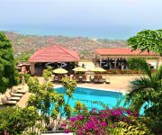
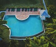
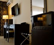
Hotels and Places to Stay
The Country Lodge Complex
Nonsuch Bay Resort All Inclusive
New Brookfields
Videos from this area
These are videos related to the place based on their proximity to this place.
The Ferry to Freetown - Sierra Leone
A clip of the ferry across the Sierra Leone River from Lungi to Freetown as it arrives in Freetown, Sierra Leone. This ferry is the main transportation link between the city and the airport...
White Powder In Freetown ;-) FPV Fun Warthox FQuad
White Powder In Freetown ;-) FPV Fun Warthox FQuad.
nightscenes of homeless disabled in freetown, part two
nightscenes of homeless disabled in freetown sierra leone!
Cap Anamur-Straßenkinderprojekt Pikin Paddy in Sierra Leone
Sierra Leone | Das Pikin Paddy ist ein Straßenkinder-Projekt von Cap Anamur und bedeutet „Freund der Kinder“. Wir sind ansässig in der Susan Bay, dem größten Brennpunkt in der Hauptstadt...
U ebul pay God
An anthem by a local composer, 'Mr. Aubrey Nat Jones', being sung by Zion Methodist Church Choir, Wilberforce Street, Freetown, Sierra Leone.
ACAT Ghana
The International Federation of Action by Christians for the Abolition of Torture, FIACAT, is an international non-governmental human rights organisation, set up in 1987, which works towards...
Videos provided by Youtube are under the copyright of their owners.
Attractions and noteworthy things
Distances are based on the centre of the city/town and sightseeing location. This list contains brief abstracts about monuments, holiday activities, national parcs, museums, organisations and more from the area as well as interesting facts about the region itself. Where available, you'll find the corresponding homepage. Otherwise the related wikipedia article.
University of Sierra Leone
The University of Sierra Leone is the name of the former unitary public university system in Sierra Leone, which, as of May 2005, was reconstituted into the individual colleges of Fourah Bay College and Njala University. It is now affiliated to many colleges in Sierra Leone.
Kissy, Sierra Leone
Kissy (formerly Waterloo refugee camp) is a poor neighborhood on the eastern end of the Sierra Leonean capital of Freetown. It is also home to numerous health services, including a United Methodist Church Health and Maternity ward as well as a mental hospital. It is also home to over 500 Liberian refugees.
Sierra Leone River
The Sierra Leone River is a river estuary on the Atlantic Ocean in Western Sierra Leone. It is formed by the Bankasoka River and Rokel River and is between 4 and 10 miles wide (6–16 km) and 25 miles (40 km) long. It holds the major ports of Queen Elizabeth II Quay and Pepel. The estuary is also important for shipping. It is the largest natural harbour in the African continent.
Queen Elizabeth II Quay
Queen Elizabeth II Quay, also known as QE II Quay and by residents as the Deep Water Quay, is a locality in Freetown, Sierra Leone. It is located on a promontory called Fourah Point (also known as Farran Point, Farren Point, and Foura Point) on the southern bank of the estuary of the Sierra Leone River between Destruction Bay and Cline Bay within the suburb of Cline Town directly to the east of central Freetown.
Sierra Leone International Mission School
The Sierra Leone International Mission School commonly called SLIMS or Mission runs a primary (grades 1-6), junior secondary (grades 7-9) and senior secondary (grades 10-12) school. The school was established by missionaries from the Atlanta International Fellowship (AIF) in October 1992 as a school for orphan children.


