Safety Score: 2,5 of 5.0 based on data from 9 authorites. Meaning we advice caution when travelling to Saint Lucia.
Travel warnings are updated daily. Source: Travel Warning Saint Lucia. Last Update: 2024-08-13 08:21:03
Explore La Point
La Point in Castries is a city in Saint Lucia a little south-west of Castries, the country's capital.
Local time in La Point is now 04:41 PM (Sunday). The local timezone is named America / St Lucia with an UTC offset of -4 hours. We know of 8 airports in the vicinity of La Point. The closest airport in Saint Lucia is George F. L. Charles Airport in a distance of 4 mi (or 6 km), North-East. Besides the airports, there are other travel options available (check left side).
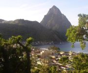
There are two Unesco world heritage sites nearby. The closest heritage site in Saint Lucia is Pitons Management Area in a distance of 14 mi (or 23 km), South-East. If you need a place to sleep, we compiled a list of available hotels close to the map centre further down the page.
Depending on your travel schedule, you might want to pay a visit to some of the following locations: Castries, Anse La Raye, Gros Islet, Soufriere and Dennery. To further explore this place, just scroll down and browse the available info.
Local weather forecast
Todays Local Weather Conditions & Forecast: 28°C / 82 °F
| Morning Temperature | 26°C / 79 °F |
| Evening Temperature | 28°C / 83 °F |
| Night Temperature | 26°C / 78 °F |
| Chance of rainfall | 13% |
| Air Humidity | 82% |
| Air Pressure | 1012 hPa |
| Wind Speed | Gentle Breeze with 6 km/h (4 mph) from West |
| Cloud Conditions | Broken clouds, covering 63% of sky |
| General Conditions | Moderate rain |
Sunday, 17th of November 2024
29°C (84 °F)
26°C (79 °F)
Moderate rain, light breeze, overcast clouds.
Monday, 18th of November 2024
29°C (85 °F)
26°C (79 °F)
Light rain, gentle breeze, overcast clouds.
Tuesday, 19th of November 2024
29°C (84 °F)
26°C (79 °F)
Light rain, gentle breeze, broken clouds.
Hotels and Places to Stay
CAPELLA MARIGOT BAY ST. LUCIA
Anse Chastanet Resort
Mago Estate Hotel
St. James's Club Morgan Bay All Inclusive
JJ's Paradise Hotel
Apartment Espoir
Golden Arrow Inn
Villa Beach Cottages
Poinsettia Villa Apartments
Marigot Palms Luxury Guesthouse
Videos from this area
These are videos related to the place based on their proximity to this place.
LIAT Landing St. Lucia (SLU)
Trip to Martinique from Barbados via St. Lucia with the St. Michael School onboard LIAT the Caribbean Airline. Dash 8 Q300 series.
St. Lucia Marigot Bay/Roseau River Kayaking
Enjoy a specialty tour kayaking Marigot Bay/Roseau River in St. Lucia. DFH Kayaking offers a number of kayaking tours to experience true nature. http://www.dfhkayaking.com.
Few scenes around St. Lucia
A few scenes from our cruise stop in St. Lucia and Rodney Bay beach. The island is gorgeous and lush and tropical and the beaches beautiful. We hired a taxi at the cruise port to drive to Rodney...
Sandals St. Lucia Resorts, Compare the three Sandals Resorts in St. Lucia
Compare all three Sandals St. Lucia resorts (http://www.sandals.com/index.cfm?referral=105188): Sandals Grande St. Lucian, Sandals Halcyon and Sandals LaToc. These three Sandals resorts are...
St Lucia Villages 2
Driving tour through a few villages on the west side of St. Lucia, south of Marigot Bay. We hired a very nice man named Fabi who drove us in a minibus down the rather treacherous road along...
Villa St. Lucia of Marigot Bay, St. Lucia, by Oasis Marigot
http://www.oasismarigot.com/villa-st-lucia.html. The Villa St. Lucia rests on a hillside overlooking the beautiful Marigot Bay. Relax by the pool or on the beach just below. Visit http://www.oasism...
Videos provided by Youtube are under the copyright of their owners.
Attractions and noteworthy things
Distances are based on the centre of the city/town and sightseeing location. This list contains brief abstracts about monuments, holiday activities, national parcs, museums, organisations and more from the area as well as interesting facts about the region itself. Where available, you'll find the corresponding homepage. Otherwise the related wikipedia article.
Windward Islands
This article is about the Caribbean island group. For the eastern islands in French Polynesia, see Windward Islands (Society Islands). For the British Colony, see British Windward Islands. The southeastern Hawaiian Islands are also occasionally referred to as the Windward Islands. Windward Islands {{#invoke:InfoboxImage|InfoboxImage|image=Windward Islands.
Marigot Bay
for the bay of Dominica see Marigot Bay (Dominica) Marigot Bay is located on the western coast of the Caribbean island of Saint Lucia, 3.75 miles southwest from Castries and a short distance from the Saint Lucian National Marine Reserve. It is surrounded on three sides by steep, forested hills. The inland portion of the bay forms a hurricane hole, used to shelter boats from hurricanes.
Cul de Sac River
The Cul De Sac River is a river in Saint Lucia. It flows north and then west from the central highlands in the south of the island, reaching the Caribbean Sea to the south of the capital. Castries. It is one the longest rivers in Saint Lucia.
Roseau River (Saint Lucia)
The Roseau River is a river in Saint Lucia. It flows north and then west from the central highlands in the south of the island, reaching the Caribbean Sea to the north of the town of Anse la Raye. The Roseau river is also the longest in ST. LUCIA.
Roseau Valley
The Roseau Valley in St. Lucia is home to the island's largest banana plantation. The Roseau River runs through the valley and enters the sea at Roseau Bay. It is the longest river in St Lucia and the Roseau Reservoir is a major source of drinking water. There are several settlements within the valley, These are Roseau, Jacmel, Bois d'Inde, Morne d'Or, Morne Ciseaux, Coolietown, Derrière Lagoon, Vanard and Millet.
Morne Fortune
Morne Fortune is a hill and residential area located south of Castries, Saint Lucia in the West Indies. Originally it was a fort constructed by the French, it was captured by the British on 24th May 1796. A memorial to the Royal Inniskilling Fusiliers still stands commemorating the battle. The original fortifications still stand on the summit and the old military buildings are in a listed historical area. The Saint Lucia National Trust operates this area.
Derek Walcott Square
Derek Walcott Square (formerly Columbus Square) is a public square and park located in central Castries, Saint Lucia. The square is bounded by Bourbon, Brazil, Laborie and Micoud Streets. The Cathedral of the Immaculate Conception and the Castries Central Library located at the square. The square was previously named Place d'Armes and Promenade Square. It was named Columbus Square in 1892. In 1993, it was named Derek Walcott Square after Nobel laureate Derek Walcott.
Victoria Hospital (Saint Lucia)
Victoria Hospital is the main public health care facility in Saint Lucia. It is located in Castries. The hospital opened in 1887. The New National Hospital is under construction. It will replace Victoria Hospital.


