Safety Score: 2,5 of 5.0 based on data from 9 authorites. Meaning we advice caution when travelling to Saint Lucia.
Travel warnings are updated daily. Source: Travel Warning Saint Lucia. Last Update: 2024-08-13 08:21:03
Delve into Belair
Belair in Bexon (Castries) is located in Saint Lucia a little south-east of Castries, the country's capital town.
Current time in Belair is now 06:37 PM (Sunday). The local timezone is named America / St Lucia with an UTC offset of -4 hours. We know of 8 airports close to Belair. The closest airport in Saint Lucia is George F. L. Charles Airport in a distance of 5 mi (or 8 km), North. Besides the airports, there are other travel options available (check left side).
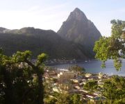
There are two Unesco world heritage sites nearby. The closest heritage site in Saint Lucia is Pitons Management Area in a distance of 10 mi (or 16 km), South. If you need a hotel, we compiled a list of available hotels close to the map centre further down the page.
While being here, you might want to pay a visit to some of the following locations: Castries, Anse La Raye, Dennery, Praslin and Soufriere. To further explore this place, just scroll down and browse the available info.
Local weather forecast
Todays Local Weather Conditions & Forecast: 28°C / 82 °F
| Morning Temperature | 26°C / 79 °F |
| Evening Temperature | 28°C / 83 °F |
| Night Temperature | 26°C / 78 °F |
| Chance of rainfall | 13% |
| Air Humidity | 82% |
| Air Pressure | 1012 hPa |
| Wind Speed | Gentle Breeze with 6 km/h (4 mph) from West |
| Cloud Conditions | Broken clouds, covering 63% of sky |
| General Conditions | Moderate rain |
Sunday, 17th of November 2024
29°C (84 °F)
26°C (79 °F)
Moderate rain, light breeze, overcast clouds.
Monday, 18th of November 2024
29°C (85 °F)
26°C (79 °F)
Light rain, gentle breeze, overcast clouds.
Tuesday, 19th of November 2024
29°C (84 °F)
26°C (79 °F)
Light rain, gentle breeze, broken clouds.
Hotels and Places to Stay
CAPELLA MARIGOT BAY ST. LUCIA
Mago Estate Hotel
Anse Chastanet Resort
Fox Grove Inn
Casa Del Vega
Aanola Villas
Poinsettia Villa Apartments
Auberge Seraphine
LA HAUT PLANTATION
Tropical Paradise View
Videos from this area
These are videos related to the place based on their proximity to this place.
Lamawaje-ARC2009
Aankomst-beelden vd kopgroep. Kijk op: http://www.worldcruising.com/arc/gallery_boat.aspx.
Silk Art Gallery
PURCHASE JEAN-BAPTISTE PRINTS: http://fineartamerica.com/profiles/daniel-jeanbaptiste.html VISIT JEAN-BAPTISTE WEB SITE: http://www.jean-baptiste.com/stluciasilk/WELCOME.html ...
St. Lucia, Gros Piton
Gros Piton descent...It was like this for 3.5 hours...Mission ,our guide dog, helped us the whole way up and down the mountain.
Ocean Cottage of Marigot Bay, St. Lucia, by Oasis Marigot
http://www.oasismarigot.com/oceancottage.html. A relaxing cottage getaway nestled on the hillside and overlooking Marigot Bay. Nothing less than paradise in its fullest. Visit http://www.oasismarig...
FSX Virgin Atlantic Landing in St.Lucia
comment if u need help Download at;http://www.fs-freeware.net/downloads/viewdownload/7-civil-airliners/1963-fsx-747-400-virgin-atlantic My email: shane_1120@hotmail.com.
St. Lucia. St. Jude hospital volunteer quarters
St. Lucia. St. Jude hospital volunteer quarters. http://RomanoTravelOnline.com Health Volunteers Overseas http://hvousa.org.
Videos provided by Youtube are under the copyright of their owners.
Attractions and noteworthy things
Distances are based on the centre of the city/town and sightseeing location. This list contains brief abstracts about monuments, holiday activities, national parcs, museums, organisations and more from the area as well as interesting facts about the region itself. Where available, you'll find the corresponding homepage. Otherwise the related wikipedia article.
Anse la Raye Quarter
Anse la Raye is a Quarter on the West coast of St. Lucia in the Caribbean Sea. In 2001, the population of the region was 6,071 people, and they are mainly fishers and agricultural workers. The main town in the area takes the same name as the Quarter and is located at {{#invoke:Coordinates|coord}}{{#coordinates:13|55|N|61|01|W||| | |name= }}, down the western coast from Castries, the capital of the country.
Cul de Sac River
The Cul De Sac River is a river in Saint Lucia. It flows north and then west from the central highlands in the south of the island, reaching the Caribbean Sea to the south of the capital. Castries. It is one the longest rivers in Saint Lucia.
Roseau River (Saint Lucia)
The Roseau River is a river in Saint Lucia. It flows north and then west from the central highlands in the south of the island, reaching the Caribbean Sea to the north of the town of Anse la Raye. The Roseau river is also the longest in ST. LUCIA.
Sarrot
Sarrot is a farming community in the Castries Quarter of the island nation of St. Lucia, in the Caribbean. It is located at {{#invoke:Coordinates|coord}}{{#coordinates:13|56|N|60|59|W||| | |name= }}, 265 feet above sea level.
Morne Fortune
Morne Fortune is a hill and residential area located south of Castries, Saint Lucia in the West Indies. Originally it was a fort constructed by the French, it was captured by the British on 24th May 1796. A memorial to the Royal Inniskilling Fusiliers still stands commemorating the battle. The original fortifications still stand on the summit and the old military buildings are in a listed historical area. The Saint Lucia National Trust operates this area.


