Safety Score: 4,4 of 5.0 based on data from 9 authorites. Meaning please reconsider your need to travel to Russia.
Travel warnings are updated daily. Source: Travel Warning Russia. Last Update: 2024-08-13 08:21:03
Discover Uliss
The district Uliss of Vladivostok in Primorskiy Kray is a subburb in Russia about 3,990 mi east of Moscow, the country's capital city.
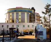
If you need a hotel, we compiled a list of available hotels close to the map centre further down the page.
While being here, you might want to pay a visit to some of the following locations: Xitumenzi, Sanchakou Chaoxianzu, Daduchuan, Laoheishan and Dongning. To further explore this place, just scroll down and browse the available info.
Local weather forecast
Todays Local Weather Conditions & Forecast: -2°C / 28 °F
| Morning Temperature | -5°C / 23 °F |
| Evening Temperature | -2°C / 28 °F |
| Night Temperature | -3°C / 26 °F |
| Chance of rainfall | 0% |
| Air Humidity | 35% |
| Air Pressure | 1018 hPa |
| Wind Speed | Strong breeze with 18 km/h (11 mph) from East |
| Cloud Conditions | Clear sky, covering 6% of sky |
| General Conditions | Sky is clear |
Wednesday, 4th of December 2024
-5°C (23 °F)
-2°C (28 °F)
Few clouds, fresh breeze.
Thursday, 5th of December 2024
-2°C (29 °F)
-1°C (30 °F)
Scattered clouds, fresh breeze.
Friday, 6th of December 2024
-5°C (23 °F)
-4°C (25 °F)
Scattered clouds, fresh breeze.
Hotels and Places to Stay
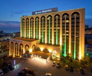
Hyundai Hotel Hyundai
Aquilon Hotel
Azimut Hotel Vladivostok
Gavan
Acfes-Seiyo Hotel
HOTEL COMPLEX VGUES
A Hotel Amur Bay
Hotel Variant
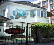
Sunrise-apartments Hotel
Acfes-Seiyo Hotel
Videos from this area
These are videos related to the place based on their proximity to this place.
Port of Vladivostok, Russia
This is a short video of our trip Vladivostok, Russia in October 2011. We are on a ferry traveling from Vladivostok to Russian Island.
Vladivostok Wikipedia travel guide video. Created by http://stupeflix.com
Create your own video on http://studio.stupeflix.com/?w=1 ! View of Vladivostok and Zolotoy Rog Bay from space. Fokin Street in the central part of Vladivostok. Vladivostok Christmas and tree...
Fashion Catch Alexey ROMANOFF Backstage Vladivostok 2013
Fashion Catch Alexey ROMANOFF Miss San Re Mo Backstage Vladivostok 2013.
Параллели - Да/Нет (Vlad Dance City 2015)
27.02.2015 - Vlad Dance City Radiohead - Everything In Its Right Place.
Владивосток. Путешествие... Vladivostok. Travelling...
Видеоролик и кадры из мультимедиа альбома "Фото Владивосток. Выпуск 3. Путешествие". Автор проекта - Илья...
V/Channel Мисс Приморье 2013 Miss Primorye Fashion Catch Vladivostok
V/Channel Мисс Приморье 2013 Miss Primorye Fashion Catch Vladivostok.
VOSTOK barge from Vladivostok to uspeniya bay
переход на барже восток из порта Владивосток в бухту Успения двигатель3 д6 груз 15 тон (строй материалы)...
Проезд на остров Русский по мосту во Владивостоке
Проезд на остров Русский по мосту "Русский" и возвращение во Владивосток по мосту "Золотой" Journey on island Russian...
Videos provided by Youtube are under the copyright of their owners.
Attractions and noteworthy things
Distances are based on the centre of the city/town and sightseeing location. This list contains brief abstracts about monuments, holiday activities, national parcs, museums, organisations and more from the area as well as interesting facts about the region itself. Where available, you'll find the corresponding homepage. Otherwise the related wikipedia article.
Far Eastern Federal University
Far Eastern Federal University (Russian: Дальневосто́чный федера́льный университе́т, Dalnevostochny federalny universitet) is an institution of higher education located in Vladivostok, Russia. Established in 1899, the university was closed in the late 1930s under Joseph Stalin, and reopened in 1956, two years after Nikita Khrushchev visited Vladivostok.
Mount Kholodilnik
Kholodilnik Mountain is the highest peak of Vladivostok, Primorsky Krai, Russia.
Dynamo Stadium (Vladivostok)
Dynamo Stadium is a multi-purpose stadium in Vladivostok, Russia. It is currently used mostly for football matches and is the home ground of FC Luch-Energia Vladivostok. The stadium is situated close to the main square and harbour and by one of beaches of Vladivostok. The pitch has been improved and floodlights have been installed as well. The stadium holds 10,200. http://www. sport-express. ru/art. shtml?130719
Zolotoy Rog
Zolotoy Rog Bay is a sheltered horn-shaped bay separated from the Peter the Great Gulf of the Sea of Japan by Shkota Peninsula on the north-west, Cape Goldobina on the east-north-east, and Cape Tigrovy on the west. The bay is seven kilometers long, with a width of about two kilometers and a depth ranging from 20 to 27 meters. The Russian port of Vladivostok lies on the hills at the head of the bay. Until the mid-19th century, the bay had been known to the Chinese as the "Gamat Bay".
Russky Island
Russky Island (Russian: о́стров Ру́сский, lit. Russian island) is an island off Vladivostok, Russia, in the Peter the Great Gulf, Sea of Japan. It is located about 9,334 kilometres east of Moscow. The Eastern Bosphorus separates the island from the Muravyov-Amursky Peninsula. Off the southern shore of Russky Island is Shkot Island; to the southwest lie Popov Island (7 km long, 4.3 km wide), Reyneke Island (3.4 km across) and Rikord Island (4.1 km long and less than 2 km wide).
Lazurnaya Bay
Lazurnaya Bay - part of the Ussuri Bay of the Sea of Japan. Shamora is a Chinese and traditional Russian name. The Chinese name translates as "sandy desert", referring to the sandy beaches that attract scores of holiday-makers from Vladivostok and other towns of the Russian Far East. Several rest homes and sanatioriums are scattered along the coastline. The hinterland is hilly and woody. Shamora is also the name of a collection of old songs by the Vladivostok band Mumiy Troll.
Diomede Bay
The Diomede Bay is a landlocked inlet of the Peter the Great Gulf in the Russian city of Vladivostok. The bay derives its name from Diomedes, the first Russian brig to cast anchor in the bay back in 1862. The coastline is dotted with run-down fisheries, fishing wharves, and depots.
Vladivostok State Medical University
Vladivóstok State Medical University (Владивосто́кский госуда́рственный медици́нский университе́т) is a university in Vladivostok in the Far East of Russia. At the beginning, since 1956 VSMU was the Medical Faculty of the Far Eastern State University, but in 2 years it became Vladivostok State Medical Institute (VSMI). Institute was reorganized into the University in 1995.
Eastern Bosphorus
Eastern Bosphorus (Russian: Босфор Восточный, Bosfor Vostochny) is a strait that separates the Muravyov-Amursky Peninsula and Russky Island, and connects Amur Bay and Ussuri Bay. The depth is up to 50 m. It is about 9 km long and only 800 m wide at its narrowest point. Completed in July 2012, Russky Bridge, a cable-stayed bridge connects Russky Island and mainland Vladivostok. As of 2013, the bridge is the longest cable-stayed bridge in the world by the virtue of its span of 1104 m.
Russky Bridge
The Russky Bridge is a bridge built across the Eastern Bosphorus strait, to serve the Asia-Pacific Economic Cooperation that took place in Vladivostok in 2012. The bridge connects the mainland part of the city (Nazimov peninsula) with Russky Island, where the main activities of the summit are to take place. The bridge was completed in July 2012 and opened by Russian Prime Minister Dmitry Medvedev. On September 3, 2012, the bridge was officially given its name.
Czechoslovak Legions Graveyard in Vladivostok
Czechoslovak Legions Graveyard in Vladivostok (Czech: Pohřebiště československých legionářů ve Vladivostoku, Russian: Кладбище чехословацких легионеров во Владивостоке) is a graveyard of the Czechoslovak Legions on the Sea Graveyard in Vladivostok, Russia. In total there are buried 163 Czechoslovak legionnaires, who fought in the Russian Far East in between 1918 and 1920. In 2005 the graveyard was reconstructed at the expense of the Czech Republic and in May 2006 it was reopened.
Skrebtsov island
Skrebtsova Island, popularly known as Kovrizhka ("honey-cake"), is an island in the Amur Bay, Sea of Japan, 2 km north-west of the coast of Vladivostok. Named in 1863 in honor of M. L. Skrebtsova who participated in hydrographic research of Peter the Great.
Shkot Island
Shkot Island is a one of five big islands of Eugénie de Montijo Archipelago. It lies due south of Russkiy Island, and falls under Vladivostok administration. The area of the island is 2.6 km². Its highest point is 146 m above the sea level. The island is uninhabited. The island was named after Nikolay Shkot, commander of the corvette America, who led a hydrographic expedition to the area in 1863.
Ushi Island
Ushi is a small uninhabited island in Amur Bay. It is a part of Eugénie de Montijo Archipelago under Vladivostok administration. Area of an island is 0.1 ha (45 m on 22 m). Its the highest point is 6 m. The island is located 160 m north-west from Russky Island. Ushi island is almost devoid of vegetation life. It consists of two rocks which connected narrow and low isthmus. There are shoals (4.8-5.2 m) near the island.


