Safety Score: 4,0 of 5.0 based on data from 9 authorites. Meaning please reconsider your need to travel to Puerto Rico.
Travel warnings are updated daily. Source: Travel Warning Puerto Rico. Last Update: 2024-08-13 08:21:03
Discover San Felipe
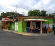
San Felipe in Aguirre Barrio (Salinas Municipio) is a city in Puerto Rico about 35 mi (or 56 km) south of San Juan, the country's capital city.
Local time in San Felipe is now 07:52 PM (Thursday). The local timezone is named America / Puerto Rico with an UTC offset of -4 hours. We know of 8 airports in the vicinity of San Felipe, of which one is a larger airport. The closest airport in Puerto Rico is Mercedita Airport in a distance of 23 mi (or 37 km), West. Besides the airports, there are other travel options available (check left side).
There is one Unesco world heritage site nearby. The closest heritage site is La Fortaleza and San Juan National Historic Site in Puerto Rico in United states at a distance of 41 mi (or 66 km). We discovered 1 points of interest in the vicinity of this place. Looking for a place to stay? we compiled a list of available hotels close to the map centre further down the page.
When in this area, you might want to pay a visit to some of the following locations: Salinas, Guayama, Cayey, Arroyo and Aibonito. To further explore this place, just scroll down and browse the available info.
Local weather forecast
Todays Local Weather Conditions & Forecast: 28°C / 83 °F
| Morning Temperature | 24°C / 75 °F |
| Evening Temperature | 27°C / 80 °F |
| Night Temperature | 26°C / 78 °F |
| Chance of rainfall | 6% |
| Air Humidity | 71% |
| Air Pressure | 1010 hPa |
| Wind Speed | Light breeze with 4 km/h (3 mph) from North |
| Cloud Conditions | Scattered clouds, covering 27% of sky |
| General Conditions | Moderate rain |
Thursday, 14th of November 2024
28°C (82 °F)
27°C (80 °F)
Overcast clouds, light breeze.
Friday, 15th of November 2024
28°C (82 °F)
26°C (78 °F)
Light rain, light breeze, broken clouds.
Saturday, 16th of November 2024
28°C (82 °F)
25°C (78 °F)
Moderate rain, light breeze, overcast clouds.
Hotels and Places to Stay
Playa Apartments
Videos from this area
These are videos related to the place based on their proximity to this place.
Evento de match entre El Fenomeno y El Problematico @ Salinas Speedway
Aqui un resumen de lo occurido el miercoles 16 de mayo de 2012. Night-Warriors.com GOR Productions.
Unidos Por La Vida SALINAS
Evento: "UNIDOS POR LA VIDA", celebrado el 24 de enero de 2013 en la Plaza Las Delicias de Salinas. Organizado por el comité: YO QUIERO UN SALINAS LIBRE DE VIOLENCIA, esta actividad ...
salinas 740i 1
salinas drag strip in the 95' 740i this was the first pass doing 16.3. Actually this was the first time I legally drag raced! So I missed the lights and the guys had to tell me to back up...
Toyota MR2 Turbo - Salinas Track Nov 20, 2011 (Road Racing)
Car: MR2 Turbo '93 Driver: Billy Torres.
Videos provided by Youtube are under the copyright of their owners.
Attractions and noteworthy things
Distances are based on the centre of the city/town and sightseeing location. This list contains brief abstracts about monuments, holiday activities, national parcs, museums, organisations and more from the area as well as interesting facts about the region itself. Where available, you'll find the corresponding homepage. Otherwise the related wikipedia article.
Jobos Bay National Estuarine Research Reserve
Jobos Bay National Estuarine Research Reserve (JBNERR, sometimes JOBNERR or JOBANERR) is a federally protected estuary in Aguirre, Puerto Rico. The bay is an intertidal tropical ecosystem dominated by seagrass beds, coral reefs, and mangroves. In an area of 1140 hectares, the reserve contains five distinct habitat types and provides sanctuary to several endangered species.
Río Seco, Puerto Rico
The Río Seco (Seco River) is a river located on the southern coastal valley region of Puerto Rico. It originates at the Barrio Pozo Hondo of the municipality of Guayama at an elevation of 984 feet (300 meters) above sea level. The river has a length of approximately 8 miles emptying into the Bay of Jobos. {{#invoke:Coordinates|coord}}{{#coordinates:17.9530227|-66.1879445|region:US-PR_type:river_source:gnis|||||| |primary |name= }}


