Safety Score: 2,8 of 5.0 based on data from 9 authorites. Meaning we advice caution when travelling to Portugal.
Travel warnings are updated daily. Source: Travel Warning Portugal. Last Update: 2024-08-13 08:21:03
Delve into Vide
Vide in Seia Municipality (Guarda) is located in Portugal about 131 mi (or 210 km) north-east of Lisbon, the country's capital town.
Current time in Vide is now 04:09 PM (Monday). The local timezone is named Europe / Lisbon with an UTC offset of zero hours. We know of 9 airports close to Vide, of which two are larger airports. The closest airport in Portugal is Covilha Airport in a distance of 16 mi (or 26 km), East. Besides the airports, there are other travel options available (check left side).
There are several Unesco world heritage sites nearby. The closest heritage site in Portugal is University of Coimbra – Alta and Sofia in a distance of 13 mi (or 20 km), South-East. If you need a hotel, we compiled a list of available hotels close to the map centre further down the page.
While being here, you might want to pay a visit to some of the following locations: Oliveira do Hospital, Seia, Nelas, Tabua and Carregal do Sal. To further explore this place, just scroll down and browse the available info.
Local weather forecast
Todays Local Weather Conditions & Forecast: 11°C / 52 °F
| Morning Temperature | 9°C / 48 °F |
| Evening Temperature | 9°C / 47 °F |
| Night Temperature | 8°C / 46 °F |
| Chance of rainfall | 31% |
| Air Humidity | 78% |
| Air Pressure | 1021 hPa |
| Wind Speed | Moderate breeze with 10 km/h (6 mph) from North-East |
| Cloud Conditions | Broken clouds, covering 59% of sky |
| General Conditions | Heavy intensity rain |
Tuesday, 26th of November 2024
12°C (53 °F)
7°C (44 °F)
Overcast clouds, calm.
Wednesday, 27th of November 2024
14°C (58 °F)
8°C (47 °F)
Scattered clouds, light breeze.
Thursday, 28th of November 2024
16°C (61 °F)
12°C (54 °F)
Overcast clouds, light breeze.
Hotels and Places to Stay
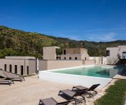
AQUA Village Health Resort & SPA
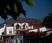
Quinta da Geia Boutique and Rural Hotel
Videos from this area
These are videos related to the place based on their proximity to this place.
Roteiro da Serra da Estrela. Circuito III.Entre o Alva e o Mondego
Roteiro do Património Natural e Cultural da Serra da Estrela. Circuito III: Entre o Alva e o Mondego. Between two rivers. Percurso recomendado: Oliveira do Hospital (EM)-Bobadela (EM)-Nogueira...
Farrapeira - (grupo Balancé da Cabeça)
Atuação em Cabeça *Aldeia Natal (Seia) no dia 29-11-2014. Esta atuação também foi transmitida pela RTP, em directo, no programa "Aqui Portugal"
My (little) First Timelapse Experience With GoPro Hero 3 Black Edition
Little Timelapse test in the beautiful Alentejo (Portugal) Filmed 100% with a Gopro 3 Black Edition using the time lapse function (5 sec intervals; 298 Photos; Protune) This can be great fun...
Videos provided by Youtube are under the copyright of their owners.
Attractions and noteworthy things
Distances are based on the centre of the city/town and sightseeing location. This list contains brief abstracts about monuments, holiday activities, national parcs, museums, organisations and more from the area as well as interesting facts about the region itself. Where available, you'll find the corresponding homepage. Otherwise the related wikipedia article.
São Gião
São Gião is a parish (freguesia in Portuguese), in the North of Portugal, on Serra da Estrela, the highest mountain range in Portugal. It belongs to the municipality of Oliveira do Hospital, and the district (distrito) of Coimbra. It is located at 40°20'11.93N, 7°47'57.43W and lies at an altitude of 704m, in the Beira region. It is an old Roman trading post. The old Roman bridge is still visible and in use to this day.
Teixeira (Seia)
Teixeira is a Portuguese parish, located in the municipality of Seia.
Vide (Seia)
Vide is a Portuguese parish, located in the municipality of Seia.


