Safety Score: 2,8 of 5.0 based on data from 9 authorites. Meaning we advice caution when travelling to Poland.
Travel warnings are updated daily. Source: Travel Warning Poland. Last Update: 2024-08-13 08:21:03
Discover Zalesie Kętrzyńskie
Zalesie Kętrzyńskie in Powiat kętrzyński (Województwo Warmińsko-Mazurskie) is a place in Poland about 124 mi (or 200 km) north of Warsaw, the country's capital city.
Current time in Zalesie Kętrzyńskie is now 05:50 AM (Friday). The local timezone is named Europe / Warsaw with an UTC offset of one hour. We know of 8 airports near Zalesie Kętrzyńskie, of which one is a larger airport. The closest is airport we know is Khrabrovo Airport in Russia in a distance of 69 mi (or 111 km). The closest airport in Poland is Białystok-Krywlany Airport in a distance of 96 mi (or 111 km), North-West. Besides the airports, there are other travel options available (check left side).
There is one Unesco world heritage site nearby. The closest heritage site is Curonian Spit in Lithuania at a distance of 89 mi (or 143 km). We encountered 1 points of interest in the vicinity of this place. If you need a hotel, we compiled a list of available hotels close to the map centre further down the page.
While being here, you might want to pay a visit to some of the following locations: Ryn, Mragowo, Mikolajki, Gizycko and Wegorzewo. To further explore this place, just scroll down and browse the available info.
Local weather forecast
Todays Local Weather Conditions & Forecast: 7°C / 45 °F
| Morning Temperature | 2°C / 35 °F |
| Evening Temperature | 5°C / 41 °F |
| Night Temperature | 5°C / 42 °F |
| Chance of rainfall | 0% |
| Air Humidity | 60% |
| Air Pressure | 1019 hPa |
| Wind Speed | Moderate breeze with 10 km/h (6 mph) from East |
| Cloud Conditions | Broken clouds, covering 76% of sky |
| General Conditions | Broken clouds |
Saturday, 16th of November 2024
10°C (51 °F)
5°C (42 °F)
Overcast clouds, moderate breeze.
Sunday, 17th of November 2024
5°C (41 °F)
5°C (41 °F)
Light rain, moderate breeze, overcast clouds.
Monday, 18th of November 2024
4°C (40 °F)
2°C (36 °F)
Light rain, fresh breeze, overcast clouds.
Hotels and Places to Stay
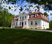
Pałac Nakomiady
Koch
Księżycowy Dworek
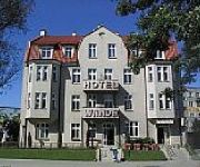
Wanda
Videos from this area
These are videos related to the place based on their proximity to this place.
Grand Prix Polski w Bilard-Słomka Ptysiowa Brześć POLTOUR - Kętrzyn 2015 FINAŁ Skowerski-Śniegocki
Grand Prix Polski w Bilard-Słomka Ptysiowa Brześć POLTOUR - Kętrzyn 2015 FINAŁ Skowerski-Śniegockihttp://bilard-sport.pl/poltour_2015/aktualnosci.php?inf_id=3.
Mazuroznawcy - odc. 1 Kętrzyn
Facebook - http://facebook.com/pokochajmazury Zapraszamy na naszą stronę internetową http://www.pokochajmazury.com.pl Odcinek wykonała firma Reshka zapewniająca marketing internetowy na...
Bramki z meczu Granica Kętrzyn - GKS Wikielec
Granica Kętrzyn - GKS Wikielec 3:0 (2:0). Kętrzyn, 10.08.2014 r.
Grand Prix Polski w Bilard-Słomka Ptysiowa Brześć POLTOUR - Kętrzyn 2015 Wiatrowski - Ejmont
http://bilard-sport.pl/poltour_2015/aktualnosci.php?inf_id=3 Grand Prix Polski w Bilard-Słomka Ptysiowa Brześć POLTOUR - Kętrzyn 2015 Wiatrowski - Ejmont.
Kętrzyn, 28.11.2009 r.
Malownicze miasto położone na Warmii i Mazurach, które prawa miejskie uzyskało w 1357 r.
Fontanna na drodze, Kętrzyn
Ciekawe zjawisko zaobserwowane na Kętrzyńskiej drodze. Nagrywane kalkulatorem Adriana.
Skrót meczu: Granica Kętrzyn - Motor Lubawa
Kętrzyn, 03.04.2015 r., Granica - Motor Lubawa 2:0 (0:0)
Videos provided by Youtube are under the copyright of their owners.
Attractions and noteworthy things
Distances are based on the centre of the city/town and sightseeing location. This list contains brief abstracts about monuments, holiday activities, national parcs, museums, organisations and more from the area as well as interesting facts about the region itself. Where available, you'll find the corresponding homepage. Otherwise the related wikipedia article.
Wolf's Lair
Wolf's Lair was Adolf Hitler's first Eastern Front military headquarters in World War II. The complex, which would become one of several Führerhauptquartiere located in various parts of occupied Europe, was built for the start of Operation Barbarossa - the invasion of the Soviet Union - in 1941. It was constructed by Organisation Todt. The top secret, high security site was in the Masurian woods about 5 miles from the small East Prussian town of Rastenburg (now Kętrzyn in Poland).
Langanki, Kętrzyn County
Langanki (German Langanken) is a village in the administrative district of Gmina Kętrzyn, within Kętrzyn County, Warmian-Masurian Voivodeship, in northern Poland. It lies approximately 12 kilometres south of Kętrzyn and 65 km east of the regional capital Olsztyn. Before 1945 the area was part of Germany.
Poganowo
Poganowo is a former village in the administrative district of Gmina Kętrzyn, within Kętrzyn County, Warmian-Masurian Voivodeship, in northern Poland. It lies approximately 7 kilometres south of Kętrzyn and 65 km north-east of the regional capital Olsztyn. Before 1945 the area was part of Germany.
Windykajmy
Windykajmy is a village in the administrative district of Gmina Kętrzyn, within Kętrzyn County, Warmian-Masurian Voivodeship, in northern Poland. Before 1945 the area was part of Germany.
Wajsznory
Wajsznory (German Weischnuren) is a village in the administrative district of Gmina Kętrzyn, within Kętrzyn County, Warmian-Masurian Voivodeship, in northern Poland. It lies approximately 4 kilometres south of Kętrzyn and 67 km north-east of the regional capital Olsztyn. Before 1945 the area was part of Germany.
Wilamowo, Kętrzyn County
Wilamowo is a village in the administrative district of Gmina Kętrzyn, within Kętrzyn County, Warmian-Masurian Voivodeship, in northern Poland. It lies approximately 5 kilometres south-east of Kętrzyn and 68 km north-east of the regional capital Olsztyn. Before 1945 the area was part of Germany. The village has a population of 10.
Zalesie Kętrzyńskie
Zalesie Kętrzyńskie (German Hinzenhof) is a village in the administrative district of Gmina Kętrzyn, within Kętrzyn County, Warmian-Masurian Voivodeship, in northern Poland. It lies approximately 8 kilometres south of Kętrzyn and 64 km north-east of the regional capital Olsztyn. Before 1945 the area was part of Germany.
Gronowo, Mrągowo County
Gronowo is a village in the administrative district of Gmina Mrągowo, within Mrągowo County, Warmian-Masurian Voivodeship, in northern Poland. It lies approximately 14 kilometres north of Mrągowo and 62 km east of the regional capital Olsztyn. Before 1945 the area was part of Germany.


