Safety Score: 2,8 of 5.0 based on data from 9 authorites. Meaning we advice caution when travelling to Poland.
Travel warnings are updated daily. Source: Travel Warning Poland. Last Update: 2024-08-13 08:21:03
Discover Hołdunów Nowy
The district Hołdunów Nowy of Lędziny in Powiat bieruńsko-lędziński (Województwo Śląskie) is a district in Poland about 165 mi south-west of Warsaw, the country's capital city.
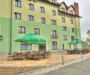
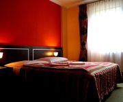
Looking for a place to stay? we compiled a list of available hotels close to the map centre further down the page.
When in this area, you might want to pay a visit to some of the following locations: Imielin, Bierun, Chelm Slaski, Bojszowy and Chelmek. To further explore this place, just scroll down and browse the available info.
Local weather forecast
Todays Local Weather Conditions & Forecast: 5°C / 40 °F
| Morning Temperature | 3°C / 37 °F |
| Evening Temperature | 4°C / 39 °F |
| Night Temperature | 3°C / 38 °F |
| Chance of rainfall | 0% |
| Air Humidity | 78% |
| Air Pressure | 1024 hPa |
| Wind Speed | Light breeze with 4 km/h (2 mph) from East |
| Cloud Conditions | Overcast clouds, covering 100% of sky |
| General Conditions | Overcast clouds |
Thursday, 5th of December 2024
3°C (38 °F)
3°C (37 °F)
Rain and snow, calm, overcast clouds.
Friday, 6th of December 2024
4°C (39 °F)
4°C (39 °F)
Rain and snow, moderate breeze, broken clouds.
Saturday, 7th of December 2024
5°C (41 °F)
5°C (40 °F)
Light rain, moderate breeze, overcast clouds.
Hotels and Places to Stay
Videos from this area
These are videos related to the place based on their proximity to this place.
2014-08-04 KWK ZIEMOWIT Kopalnia węgla kamiennego Lędziny - Hołdunów - Widok z lotu ptaka ŚLĄSK
2014-08-04 KWK ZIEMOWIT Kopalnia węgla kamiennego Lędziny - Hołdunów - Widok z lotu ptaka ŚLĄSK.
KWK Ziemowit Szyb Szewczyka widok na Lędziny i Hołdunów IMIELIN śląskie
2014-08-06 - KWK Ziemowit Szyb Szewczyka widok na Lędziny i Hołdunów IMIELIN śląskie.
Droga ekspresowa S1. (odcinek Lędziny - Tychy)
Przejazd drogą ekspresową S1 z Lędzin do Tych (wschodnia obwodnica GOP).
2014-08-19 Lędziny - KLIMONT - ŚWIĘTA GÓRA w LĘDZINACH Parafia św. Klemensa
KLIMONT - ŚWIĘTA GÓRA W LĘDZINACH Cokolwiek by wzniosłego i patetycznego nie napisać o Górce Klemensowej, zwanej popularnie Klimontem to i tak nie odda się w pełni przywiązania oraz...
MKS Lędziny- Piast Leszczyny 4:2 (gol na 4:1)
Gol Gardawskiego na 4:1 dla MKS-u w spotkaniu z Piastem Leszczyny, wygranym przez MKS 4:2; 9 VIII 2008.
7 Runda SMT 2011 Ledziny Koselski Rzeszótko Honda Civic próba 3 rally
www.salonalicja.za.pl www.tychy.pl www.noltychy.pl 1 miejsce w klasie 2 3 miejsce w klasyfikacji generalnej.
Videos provided by Youtube are under the copyright of their owners.
Attractions and noteworthy things
Distances are based on the centre of the city/town and sightseeing location. This list contains brief abstracts about monuments, holiday activities, national parcs, museums, organisations and more from the area as well as interesting facts about the region itself. Where available, you'll find the corresponding homepage. Otherwise the related wikipedia article.
Mysłowice
Mysłowice is a city in Silesia in southern Poland, near Katowice. The south district of the Upper Silesian Metropolitan Union - metropolis with a population of 2 million. It is located in the Silesian Highlands, on the Przemsza and Brynica rivers (tributaries of the Vistula). It is situated in the Silesian Voivodeship since its formation in 1999, previously in the Katowice Voivodeship, and before then, the Autonomous Silesian Voivodeship.
Chełmek
Chełmek is a town in Lesser Poland Voivodeship in southern Poland. In 1975-1998 it belonged to Bielsko-Biała Voivodeship. It has 9,073 inhabitants (data from 2006). Previously known for the Chełmek Shoe Factory, which until 1947 was part of Bata Shoes. During World War II, a subcamp of the Auschwitz concentration camp was created in 1941 by Otto P. Klein in the northern sector of the town, housing overflow from Auschwitz.
FM- and TV-mast Kosztowy
The FM- and TV-mast Katowice / Kosztowy (RTCN Katowice / Kosztowy) is a 355 metre tall guyed mast for FM and TV situated at Mysłowice - near Kosztowy, Poland .). It replaced the TVP Katowice Mast which was dismantled in the 1970s. The TVP Katowice Mast which it replaced was a 225 metre-high guyed steel framework mast with triangular cross section near Katowice, Poland. It was not the transmission site for the medium-wave frequency 1080 kHz.
Kosztowy
Kosztowy is a quarter of the city of Mysłowice in the Silesian Voivodship of Poland. The formerly independent municipality is approximately 4 km south the city centre of Mysłowice, close of the neighbouring city of Imielin. In the course of a major re-organisation of municipal borders in Upper Silesia it was incorporated into Mysłowice together with Wesoła and Dziećkowice.
Imielin
Imielin is a small town in Silesia in southern Poland, near Katowice. Borders on the Upper Silesian Metropolitan Union - metropolis with the population of 2 millions. Located in the Silesian Highlands.
Central Labour Camp Jaworzno
The Central Labour Camp in Jaworzno has a double history. Originally, it was a Nazi concentration camp called SS-Lager Dachsgrube a.k. a Arbeitslager Neu-Dachs established during World War II by the Third Reich on the territory of occupied Poland in Jaworzno, Upper Silesia. The camp operated continuously from 1943 under the German administration until the end of war.
Giszowiec
Giszowiec is an eastern district of the city of Katowice, created as a coal miners' settlement in 1907. Initially consisting of about 3,300 miners and their families, the district's population have grown over the years to over 18,000.
Murcki
Murcki is a district of Katowice.
Janów-Nikiszowiec
Janów - Nikiszowiec is a district of Katowice.
Lędziny
Lędziny is a town in Silesia in southern Poland, near Katowice. It borders the Upper Silesian Metropolitan Union - a metropolis with a population of 2 million which is located in the Silesian Highlands. It is situated in the Silesian Voivodeship since its formation in 1999, previously in Katowice Voivodeship, and before then, of the Autonomous Silesian Voivodeship.
Brynica
Brynica is a river in Silesia and Lesser Poland (Małopolska), Poland. It has a length of 55 km and is the main confluence of Czarna Przemsza. It has a source in Wymysłów, and flows through Piekary Śląskie, Wojkowice, Czeladź, Siemianowice Śląskie, Świerklaniec, Katowice, Sosnowiec and finally Mysłowice where it joins Czarna Przemsza.
Przemsza
Przemsza is a river in the south of Poland, a tributary of the Vistula. According to one theory, it originates at the confluence of the Black Przemsza and White (Biała) Przemsza, between the cities of Mysłowice and Jaworzno. For about 24 km it flows southwards to its Vistula mouth at Czarnuchowice (a district of Bierun). Another theory stipulates that it has the length of 88 kilometers, and begins at the source of the Black Przemsza. It is one of the most polluted rivers of Poland.
Fürstengrube subcamp
The Fürstengrube subcamp was organized in the summer of 1943 at the Fürstengrube hard coal mine in the town of Wesola (Wessolla) near Myslowice (Myslowitz), approximately 30 kilometers from Auschwitz concentration camp. The mine, which IG Farbenindustrie AG acquired in February 1941, was to supply hard coal for the IG Farben factory being built in Auschwitz.
Babice, Oświęcim County
Babice is a village in the administrative district of Gmina Oświęcim, within Oświęcim County, Lesser Poland Voivodeship, in southern Poland. The village has a population of 1,582.
Pławy
Pławy is a village in the administrative district of Gmina Oświęcim, within Oświęcim County, Lesser Poland Voivodeship, in southern Poland. It lies approximately 7 kilometres west of Oświęcim and 57 km west of the regional capital Kraków. The village has a population of 350.
Three Emperors' Corner
Three Emperors' Corner is a former tripoint at the confluence of the Black and White Przemsza rivers, near the town of Mysłowice in the present-day Silesian Voivodeship of Poland. From 1871 to 1918, it marked the border between the Russian Empire, Austria-Hungary and the German Empire.
Bojszowy
Bojszowy is a village in Bieruń-Lędziny County, Silesian Voivodeship, in southern Poland. It is the seat of the gmina (administrative district) called Gmina Bojszowy. It lies approximately 10 kilometres south of Bieruń and 24 km south of the regional capital Katowice. The village has a population of 3,219. The settlement was first mentioned in a 1368 deed issued by John I of Opava, Duke of Racibórz.
Jedlina, Silesian Voivodeship
Jedlina is a village in the administrative district of Gmina Bojszowy, within Bieruń-Lędziny County, Silesian Voivodeship, in southern Poland. It lies approximately 5 kilometres south-east of Bojszowy, 12 km south of Bieruń, and 26 km south of the regional capital Katowice. The village has a population of 463.
Bojszowy Nowe
Bojszowy Nowe is a village, in the administrative district of Gmina Bojszowy, within Bieruń-Lędziny County, Silesian Voivodeship, in southern Poland. It lies approximately 4 kilometres south-west of Bojszowy, 11 km south of Bieruń, and 24 km south of the regional capital Katowice. The village has a population of 1,192.
Chełm Mały
Chełm Mały is a village in the administrative district of Gmina Chełm Śląski, within Bieruń-Lędziny County, Silesian Voivodeship, in southern Poland. It lies approximately 3 kilometres east of Chełm Śląski, 10 km east of Bieruń, and 23 km south-east of the regional capital Katowice.
Chełm Śląski
Chełm Śląski is a village in Bieruń-Lędziny County, Silesian Voivodeship, in southern Poland. It is the seat of the gmina (administrative district) called Gmina Chełm Śląski. It lies approximately 8 kilometres east of Bieruń and 21 km south-east of the regional capital Katowice. The village has a population of 5,646.
Kopciowice
Kopciowice is a village in the administrative district of Gmina Chełm Śląski, within Bieruń-Lędziny County, Silesian Voivodeship, in southern Poland. It lies approximately 2 kilometres south-east of Chełm Śląski, 9 km south-east of Bieruń, and 23 km south-east of the regional capital Katowice.
Auschwitz-Birkenau State Museum
The Auschwitz-Birkenau State Museum is a memorial and museum in Oświęcim, Poland, which includes the German concentration camps Auschwitz I and Auschwitz II-Birkenau. It is devoted to the memory of the murders in both camps during World War II. The museum performs several tasks, among them research into the Holocaust.
Oświęcim Basin
Oświęcim Basin is a lowland, located in southern Poland, between the Lesser Poland Highlands to the north, Silesian Foothills and Wieliczka Foothills to the south. It has the size of around 1,236 km . Its name comes from the city of Oświęcim. It is located on the Vistula River on the confluences of Biała, Soła and Skawa which begin in Carpathian Mountains and Przemsza which begins in Silesian Highlands.
Valley of Three Ponds
Valley of Three Ponds Polish: Dolina Trzech Stawów) is a large park and wooden area in the southern part of the city of Katowice, Poland. The name comes from the existence of three large ponds in the park area.


