Safety Score: 2,8 of 5.0 based on data from 9 authorites. Meaning we advice caution when travelling to Poland.
Travel warnings are updated daily. Source: Travel Warning Poland. Last Update: 2024-08-13 08:21:03
Explore Wola Rafałowska
Wola Rafałowska in Powiat rzeszowski (Województwo Podkarpackie) is located in Poland about 163 mi (or 262 km) south of Warsaw, the country's capital.
Local time in Wola Rafałowska is now 11:17 PM (Thursday). The local timezone is named Europe / Warsaw with an UTC offset of one hour. We know of 9 airports in the wider vicinity of Wola Rafałowska, of which two are larger airports. The closest airport in Poland is Rzeszów-Jasionka Airport in a distance of 10 mi (or 17 km), North-West. Besides the airports, there are other travel options available (check left side).
There are several Unesco world heritage sites nearby. The closest heritage site in Poland is Wooden Churches of Southern Małopolska in a distance of 45 mi (or 72 km), West. If you need a place to sleep, we compiled a list of available hotels close to the map centre further down the page.
Depending on your travel schedule, you might want to pay a visit to some of the following locations: Chmielnik, Hyzne, Krasne, Lancut and Czarna. To further explore this place, just scroll down and browse the available info.
Local weather forecast
Todays Local Weather Conditions & Forecast: 3°C / 37 °F
| Morning Temperature | -4°C / 25 °F |
| Evening Temperature | 4°C / 39 °F |
| Night Temperature | 0°C / 33 °F |
| Chance of rainfall | 0% |
| Air Humidity | 65% |
| Air Pressure | 1025 hPa |
| Wind Speed | Moderate breeze with 10 km/h (6 mph) from North-East |
| Cloud Conditions | Overcast clouds, covering 100% of sky |
| General Conditions | Snow |
Friday, 15th of November 2024
5°C (41 °F)
2°C (35 °F)
Rain and snow, moderate breeze, overcast clouds.
Saturday, 16th of November 2024
6°C (43 °F)
3°C (37 °F)
Sky is clear, moderate breeze, clear sky.
Sunday, 17th of November 2024
6°C (43 °F)
3°C (38 °F)
Scattered clouds, fresh breeze.
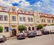
Hotels and Places to Stay
Hotel Sokół Wellness & SPA
Vis á Vis Łańcut
Videos from this area
These are videos related to the place based on their proximity to this place.
Śladami Przeszłości: Łańcut
Stary cmentarz żydowski z 17 w. Zdewastowany. Jedyna cała macewa. Fragmanty macew w synagodze. Nagranie z 2005 r.
Kandydaci na burmistrza Łańcuta, blekitna.tv
WWW.BLEKITNA.TV Spotkanie wyborcze kandydatów na burmistrza Łańcuta WWW.BLEKITNA.TV.
Bloons Tower Defense 5 Volcano *Hard*
Witam i zapraszam do oglądania. Tym razem coś nowego, a mianowicie Bloons TD 5 czyli fajna darmowa...
Ohele : Sieniawa i Łancut
W omawianych ohelach spoczywają: w Sieniawie - Ezechiel Szraga Halberstam z Sieniawy, Nachum Weidenfeld z Dąbrowy. W Łancucie - Naftali Cwi Horowic z Rapczyc, Eleazar Szapiro z Łancuta.
Gmina Hyżne w fotografii
Gmina Hyżne - Ziemia rodzinna poetki i animatorki kultury Marii Bednarek. Film zrealizowany na podstawie zdjęć wykonanych w Gminie Hyżne podczas XII Zlotu szlakiem rodowodu Generała...
Videos provided by Youtube are under the copyright of their owners.
Attractions and noteworthy things
Distances are based on the centre of the city/town and sightseeing location. This list contains brief abstracts about monuments, holiday activities, national parcs, museums, organisations and more from the area as well as interesting facts about the region itself. Where available, you'll find the corresponding homepage. Otherwise the related wikipedia article.
Podkarpackie Voivodeship
Podkarpackie Voivodeship or Podkarpacie Province, also known as Subcarpathian Voivodeship, is a voivodeship, or province, in extreme-southeastern Poland. Its administrative capital and largest city is Rzeszów. (Historically Lwów was the administrative center of this part of Poland, but after 1945, when Lwów became part of the Soviet Union, that city's role was relinquished to Rzeszów.
Cierpisz, Łańcut County
Cierpisz is a village in the administrative district of Gmina Łańcut, within Łańcut County, Subcarpathian Voivodeship, in south-eastern Poland. It lies approximately 8 kilometres south-west of Łańcut and 12 km east of the regional capital Rzeszów. The village has a population of 790. Cierpisz originally Kraczkowa and hamlets named Wólki Kraczkowski.
Błędowa Tyczyńska
Błędowa Tyczyńska is a village in the administrative district of Gmina Chmielnik, within Rzeszów County, Subcarpathian Voivodeship, in south-eastern Poland. It lies approximately 15 km south-east of the regional capital Rzeszów.
Borówki, Podkarpackie Voivodeship
Borówki is a village in the administrative district of Gmina Chmielnik, within Rzeszów County, Subcarpathian Voivodeship, in south-eastern Poland. It lies approximately 4 kilometres south-east of Chmielnik and 15 km south-east of the regional capital Rzeszów.
Chmielnik, Podkarpackie Voivodeship
Chmielnik is a village in Rzeszów County, Subcarpathian Voivodeship, in south-eastern Poland. It is the seat of the gmina (administrative district) called Gmina Chmielnik. It lies approximately 13 km south-east of the regional capital Rzeszów. The village has a population of 3,466.
Wola Rafałowska, Podkarpackie Voivodeship
Wola Rafałowska is a village in the administrative district of Gmina Chmielnik, within Rzeszów County, Subcarpathian Voivodeship, in south-eastern Poland. It lies approximately 3 kilometres east of Chmielnik and 14 km south-east of the regional capital Rzeszów.
Zabratówka
Zabratówka is a village in the administrative district of Gmina Chmielnik, within Rzeszów County, Subcarpathian Voivodeship, in south-eastern Poland. It lies approximately 16 km south-east of the regional capital Rzeszów.


