Safety Score: 2,8 of 5.0 based on data from 9 authorites. Meaning we advice caution when travelling to Poland.
Travel warnings are updated daily. Source: Travel Warning Poland. Last Update: 2024-08-13 08:21:03
Discover Jarnołtówek
Jarnołtówek in Powiat nyski (Województwo Opolskie) is a place in Poland about 205 mi (or 330 km) south-west of Warsaw, the country's capital city.
Current time in Jarnołtówek is now 10:46 AM (Friday). The local timezone is named Europe / Warsaw with an UTC offset of one hour. We know of 11 airports near Jarnołtówek, of which 3 are larger airports. The closest airport in Poland is Opole-Polska Nowa Wieś Airport in a distance of 29 mi (or 46 km), North-East. Besides the airports, there are other travel options available (check left side).
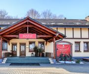
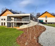
There are several Unesco world heritage sites nearby. The closest heritage site is Holy Trinity Column in Olomouc in Czechia at a distance of 48 mi (or 78 km). The closest in Poland is Centennial Hall in Wrocław in a distance of 59 mi (or 78 km), South. If you need a hotel, we compiled a list of available hotels close to the map centre further down the page.
While being here, you might want to pay a visit to some of the following locations: Glucholazy, Prudnik, Lubrza, Nysa and Biala. To further explore this place, just scroll down and browse the available info.
Local weather forecast
Todays Local Weather Conditions & Forecast: 2°C / 35 °F
| Morning Temperature | -1°C / 31 °F |
| Evening Temperature | -2°C / 29 °F |
| Night Temperature | -2°C / 29 °F |
| Chance of rainfall | 1% |
| Air Humidity | 60% |
| Air Pressure | 1000 hPa |
| Wind Speed | Moderate breeze with 9 km/h (6 mph) from East |
| Cloud Conditions | Overcast clouds, covering 97% of sky |
| General Conditions | Snow |
Saturday, 23rd of November 2024
3°C (37 °F)
-1°C (29 °F)
Light snow, fresh breeze, few clouds.
Sunday, 24th of November 2024
2°C (36 °F)
5°C (42 °F)
Rain and snow, gentle breeze, overcast clouds.
Monday, 25th of November 2024
10°C (49 °F)
4°C (39 °F)
Broken clouds, gentle breeze.
Hotels and Places to Stay
Videos from this area
These are videos related to the place based on their proximity to this place.
Ewa Farna ♥ Oblíbená věc ~ Zlaté Hory ~ 26.7.2014 ~ Live HD
Zlaté dny města Zlaté hory 2014 Místo konání : Zlaté Hory Datum : 26.7.2014 Čas : cca 22:15 - 23:30 Vstupné : Zdarma Kamera : Sony Hx9v Jak se mi to líbilo : Mooooc. Ewa je neeeej...
Zlaté Hory - Hasiči - mezinárodní cvičení
Mezinárodní česko-polské taktické cvičení. Hotel ZIEMOWIT - Jarnoltowek. Požár s následnou evakuací a záchranou osob. Pro www.zlatehory.com JNEK.
2014-06-27 Zásah - Vyproštění uvízlé osoby pod transformatorem - Zlaté Hory
Téměř hodinu zabrala hasičům záchrana muže, kterého uvěznilo těžké kovové břemeno ve Zlatých Horách. Oznámení o události přijalo operační středisko HZS Olomouckého kraje...
JARNOLTOWEK POLSKA GRA. Opolskie ko.Pokrzywna i Zlate Hory
Jarnoltowek POLSKA. Perła Opolszczyzny. wojewodztwo opolskie.Obok Pokrzywna. Opis na www.jar400.pl Pod Biskupią Kopą. Agroturystyka, apartamenty Droga rowerowa Prudnik - Zlate Hory.
Uliczka Zlate Hory 2012
Uliczka w miejscowości Zlate Hory łącząca Kościół z główną ulicą w mieście. Widać kościół oraz jakąś knajpkę. Filmik zrobiony w 2012 roku, kiedy przebywałem w tej atrakcyjnej...
Zlate Hory na granicy Czesko-Polskiej
Miejscowość Zlate Hory na granicy Czesko-Polskiej. Widać śliczny Kościół na ulicy Kostelni. Miejsce atrakcyjne dla zawziętych turystów lubiących piesze wycieczki z Głuchołaz w kierunku...
Videos provided by Youtube are under the copyright of their owners.
Attractions and noteworthy things
Distances are based on the centre of the city/town and sightseeing location. This list contains brief abstracts about monuments, holiday activities, national parcs, museums, organisations and more from the area as well as interesting facts about the region itself. Where available, you'll find the corresponding homepage. Otherwise the related wikipedia article.
Zlaté Hory
Zlaté Hory is a town in the Jeseník District, Olomouc Region, Czech Republic, on the border with Poland. It has a population of 4,447 (2006). The town was founded in 1224. Administrative parts: Rejvíz, Horní a Dolní Údolí and Ondřejovice According to the Austrian census of 1910 the town had 4,520 inhabitants, 4,341 of whom had permanent residence there. Census asked people for their native language, 4,341 (100%) were German-speaking.
Jarnołtówek
Jarnołtówek is a village in the administrative district of Gmina Głuchołazy, within Nysa County, Opole Voivodeship, in south-western Poland, close to the Czech border. It lies approximately 5 kilometres south-east of Głuchołazy, 22 km south of Nysa, and 56 km south-west of the regional capital Opole. Before 1945 the area was part of Germany. The village has a population of 820.
Konradów, Opole Voivodeship
Konradów (German Dürr-Kunzendorf) is a village in the administrative district of Gmina Głuchołazy, within Nysa County, Opole Voivodeship, in south-western Poland, close to the Czech border. It lies approximately 3 kilometres south-east of Głuchołazy, 21 km south of Nysa, and 56 km south-west of the regional capital Opole. Before 1945 the area was part of Germany. The village has a population of 880.
Pokrzywna, Opole Voivodeship
Pokrzywna (German Wildgrund) is a village in the administrative district of Gmina Głuchołazy, within Nysa County, Opole Voivodeship, in south-western Poland, close to the Czech border. It lies approximately 7 kilometres south-east of Głuchołazy, 23 km south of Nysa, and 55 km south-west of the regional capital Opole. Before 1945 the area was part of Germany. The village has a population of 210.
Skowronków
Skowronków is a village in the administrative district of Gmina Głuchołazy, within Nysa County, Opole Voivodeship, in south-western Poland, close to the Czech border. It lies approximately 4 kilometres south-east of Głuchołazy, 22 km south of Nysa, and 57 km south-west of the regional capital Opole. Before 1958 the area was part of Czechoslovakia.


