Safety Score: 2,8 of 5.0 based on data from 9 authorites. Meaning we advice caution when travelling to Poland.
Travel warnings are updated daily. Source: Travel Warning Poland. Last Update: 2024-08-13 08:21:03
Discover Żyrowa
Żyrowa in Powiat krapkowicki (Województwo Opolskie) is a place in Poland about 175 mi (or 281 km) south-west of Warsaw, the country's capital city.
Current time in Żyrowa is now 04:58 AM (Friday). The local timezone is named Europe / Warsaw with an UTC offset of one hour. We know of 11 airports near Żyrowa, of which 3 are larger airports. The closest airport in Poland is Opole-Polska Nowa Wieś Airport in a distance of 20 mi (or 32 km), North-West. Besides the airports, there are other travel options available (check left side).
There are several Unesco world heritage sites nearby. The closest heritage site in Poland is Auschwitz Birkenau German Nazi Concentration and Extermination Camp (1940-1945) in a distance of 54 mi (or 87 km), South-East. We encountered 1 points of interest in the vicinity of this place. If you need a hotel, we compiled a list of available hotels close to the map centre further down the page.
While being here, you might want to pay a visit to some of the following locations: Zdzieszowice, Lesnica, Gogolin, Izbicko and Renska Wies. To further explore this place, just scroll down and browse the available info.
Local weather forecast
Todays Local Weather Conditions & Forecast: 8°C / 47 °F
| Morning Temperature | 6°C / 42 °F |
| Evening Temperature | 7°C / 44 °F |
| Night Temperature | 4°C / 39 °F |
| Chance of rainfall | 0% |
| Air Humidity | 70% |
| Air Pressure | 1025 hPa |
| Wind Speed | Gentle Breeze with 8 km/h (5 mph) from South-East |
| Cloud Conditions | Broken clouds, covering 68% of sky |
| General Conditions | Broken clouds |
Saturday, 16th of November 2024
8°C (47 °F)
6°C (42 °F)
Sky is clear, fresh breeze, clear sky.
Sunday, 17th of November 2024
7°C (44 °F)
6°C (44 °F)
Light rain, moderate breeze, broken clouds.
Monday, 18th of November 2024
6°C (43 °F)
3°C (37 °F)
Light rain, moderate breeze, broken clouds.
Hotels and Places to Stay
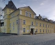
Pałac Lucja
Viktorjan Hotel & Restauracja
Videos from this area
These are videos related to the place based on their proximity to this place.
Ruch Zdzieszowice MKS Kluczbork 2013 11 16 skrót meczu
Kolejny derbowy pojedynek zakończony remisem. Tym razem 2:2.
Zdzieszowice - przeprawa promowa przez Odrę w Zdzieszowicach
Zdzieszowice - prom przez Odrę w Zdzieszowicach http://www.strzelce-opolskie.powiat.pl/ Prom w Zdzieszowicach znajduje się w pobliżu zdzieszowickiego cmentarza. Dziennie przeprawiają...
Szkolenie wstępne BHP Zdzieszowice
Szkolenie wstępne BHP Zdzieszowice - zamów Telefon: 602 718 659 http://www.pwljm.pl/szkolenie-wstepne-bhp-druk/ Prezentacja poruszająca temat szkolenia wstępnego BHP Zdzieszowice, a w...
ZS Zdzieszowice 2014 - spot reklamowy (ver.I)
Zespół Szkół im Jana Pawła II w Zdzieszowicach. Wersja reżyserska. Materiał składano w II-III 2014r. Ujęcia wykorzystane w klipie pochodzą z roku szkolnego 2013-2014.
kowal koncert charytatywny Zdzieszowice
Koncert Charytatywny zorganizowany by pomóc Karolinie i Szymonowi na którym wystąpiło wielu wykonawców w tym między innymi Kowal ze Zdzieszowic, na wsparciu SOS za gramofonami dj Uzik....
Videos provided by Youtube are under the copyright of their owners.
Attractions and noteworthy things
Distances are based on the centre of the city/town and sightseeing location. This list contains brief abstracts about monuments, holiday activities, national parcs, museums, organisations and more from the area as well as interesting facts about the region itself. Where available, you'll find the corresponding homepage. Otherwise the related wikipedia article.
Góra Świętej Anny
Góra Świętej Anny is a village in the Opole Voivodeship, Strzelce County, and Gmina Leśnica of Poland. The village is located on the hill from which its name derives, and a 15th-century church and monastery dedicated to Saint Anne are located in the village. The settlement lies within the protected area called Góra Świętej Anny Landscape Park. In 1921, while still part of Germany, the hill was the site of the Battle of Annaberg during the Silesian Uprisings.
Januszkowice, Opole Voivodeship
Januszkowice is a village in the administrative district of Gmina Zdzieszowice, within Krapkowice County, Opole Voivodeship, in south-western Poland. Before 1945 the area was part of Germany.
Jasiona, Krapkowice County
Jasiona is a village in the administrative district of Gmina Zdzieszowice, within Krapkowice County, Opole Voivodeship, in south-western Poland. Before 1945 the area was part of Germany.
Oleszka
Oleszka is a village in the administrative district of Gmina Zdzieszowice, within Krapkowice County, Opole Voivodeship, in south-western Poland. Before 1945 the area was part of Germany.
Rozwadza
Rozwadza is a village in the administrative district of Gmina Zdzieszowice, within Krapkowice County, Opole Voivodeship, in south-western Poland. It lies approximately 3 kilometres north-west of Zdzieszowice, 11 km east of Krapkowice, and 29 km south-east of the regional capital Opole. Before 1945 the area was part of Germany. The village has a population of 1,100.
Żyrowa
Żyrowa is a village in the administrative district of Gmina Zdzieszowice, within Krapkowice County, Opole Voivodeship, in south-western Poland. It lies approximately 4 kilometres north of Zdzieszowice, 11 km east of Krapkowice, and 28 km south-east of the regional capital Opole. Before 1945 the area was part of Germany. The village has a population of 760.
Ligota Dolna, Strzelce County
Ligota Dolna, German Nieder Ellguth is a village in the administrative district of Gmina Strzelce Opolskie, within Strzelce County, Opole Voivodeship, in south-western Poland. It lies approximately 12 kilometres west of Strzelce Opolskie and 25 km south-east of the regional capital Opole. Before 1945 the area was part of Germany.
Ligota Górna, Strzelce County
Ligota Górna is a village in the administrative district of Gmina Strzelce Opolskie, within Strzelce County, Opole Voivodeship, in south-western Poland. It lies approximately 10 kilometres west of Strzelce Opolskie and 26 km south-east of the regional capital Opole. Before 1945 the area was part of Germany. The village has a population of 120.


