Safety Score: 2,8 of 5.0 based on data from 9 authorites. Meaning we advice caution when travelling to Poland.
Travel warnings are updated daily. Source: Travel Warning Poland. Last Update: 2024-08-13 08:21:03
Delve into Zuzela
Zuzela in Powiat krapkowicki (Województwo Opolskie) is a city located in Poland about 180 mi (or 290 km) south-west of Warsaw, the country's capital town.
Current time in Zuzela is now 07:10 AM (Friday). The local timezone is named Europe / Warsaw with an UTC offset of one hour. We know of 11 airports closer to Zuzela, of which 3 are larger airports. The closest airport in Poland is Opole-Polska Nowa Wieś Airport in a distance of 17 mi (or 28 km), North-West. Besides the airports, there are other travel options available (check left side).
There are several Unesco world heritage sites nearby. The closest heritage site in Poland is Auschwitz Birkenau German Nazi Concentration and Extermination Camp (1940-1945) in a distance of 58 mi (or 94 km), South-East. We saw 1 points of interest near this location. In need of a room? We compiled a list of available hotels close to the map centre further down the page.
Since you are here already, you might want to pay a visit to some of the following locations: Walce, Krapkowice, Gogolin, Zdzieszowice and Strzeleczki. To further explore this place, just scroll down and browse the available info.
Local weather forecast
Todays Local Weather Conditions & Forecast: 8°C / 47 °F
| Morning Temperature | 6°C / 42 °F |
| Evening Temperature | 6°C / 43 °F |
| Night Temperature | 4°C / 39 °F |
| Chance of rainfall | 0% |
| Air Humidity | 69% |
| Air Pressure | 1025 hPa |
| Wind Speed | Gentle Breeze with 8 km/h (5 mph) from South-East |
| Cloud Conditions | Broken clouds, covering 70% of sky |
| General Conditions | Broken clouds |
Saturday, 16th of November 2024
8°C (47 °F)
5°C (40 °F)
Sky is clear, moderate breeze, clear sky.
Sunday, 17th of November 2024
7°C (45 °F)
6°C (43 °F)
Light rain, gentle breeze, broken clouds.
Monday, 18th of November 2024
6°C (43 °F)
3°C (37 °F)
Light rain, moderate breeze, broken clouds.
Hotels and Places to Stay
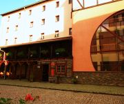
Zamkowy Młyn
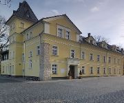
Hotel Nova
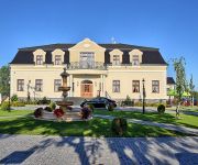
Pałac Lucja
Dworek Komorno
Videos from this area
These are videos related to the place based on their proximity to this place.
Policja nadal szuka Wiktorii
Poszukiwania rozszerzone Po dwukrotnym bardzo dokładnym przeszukaniu terenu gminy Krapkowice i Gogolin. Poszukiwania 15-letniej Wiktorii Cichockiej zostały rozszerzone. W ostatnich dniach...
Para-kite Team 1 Lato na Opolszczyźnie-Krapkowice Maron
Ostatnio dużo się dzieje, Jak wieje, to wyciągamy latawce, a gdy brak wiatru, to latawce do plecaków i zaczyna się akcja w przestworzach! Wreszcie pasuje nam każdy warun! Nie ma nudy!!...
Pałac w Krapkowicach
Pałac w Krapkowicach tuż niedaleko rzeki. Usytuowany na skarpie lokalnej rzeki Osobłogi, z kamiennymi tarasami wzmocnionymi obmurowaniem. Obecny pałac jest w stylu barokowym Adres i dane...
Rynek w Krapkowicach 2012
Atrakcje turystyczne Śląska Opolskiego Rynek w Krapkowicach widziany od strony ulicy Wolności. Widać kilka ciekawych kamieniczek, kościół oraz sam wystrój Rynku. W zasięgu wzroku tablica...
Muzyka bez granic - PSM I st. W Krapkowicach - część 2
Koncert w wykonaniu uczniów Państwowej Szkoły Muzycznej I st. im. Piotra Świerca w Krapkowicach. Część 1 - http://www.youtube.com/watch?v=MNPMqzMykf4.
GOGOLIN Kapliczka Maryjna Gottesmutter Kapelle
Kapliczka Maryjna -Gottesmutter Kapelle Gogolin Maiandacht Sonntag 16 Uhr- Majówka Niedziela godz.16.00Autobahn/Autostrada A4 Geographische Koordinaten: Współrzędne geograficzne: N ...
Videos provided by Youtube are under the copyright of their owners.
Attractions and noteworthy things
Distances are based on the centre of the city/town and sightseeing location. This list contains brief abstracts about monuments, holiday activities, national parcs, museums, organisations and more from the area as well as interesting facts about the region itself. Where available, you'll find the corresponding homepage. Otherwise the related wikipedia article.
Ligota, Opole Voivodeship
Ligota is a village in the administrative district of Gmina Krapkowice, within Krapkowice County, Opole Voivodeship, in south-western Poland. Before 1945 the area was part of Germany. 40x40px Wikimedia Commons has media related to: Ligota
Obrowiec, Opole Voivodeship
Obrowiec (German Oberwitz) is a village in the administrative district of Gmina Gogolin, within Krapkowice County, Opole Voivodeship, in south-western Poland. It lies approximately 5 kilometres south of Gogolin, 4 km south-east of Krapkowice, and 25 km south of the regional capital Opole. Before 1945 the area was part of Germany.
Brożec, Opole Voivodeship
Brożec is a village in the administrative district of Gmina Walce, within Krapkowice County, Opole Voivodeship, in south-western Poland. It lies approximately 6 kilometres north of Walce, 6 km south of Krapkowice, and 29 km south of the regional capital Opole. Before 1945 the area was part of Germany. 40x40px Wikimedia Commons has media related to: Brożec
Grocholub
Grocholub is a village in the administrative district of Gmina Walce, within Krapkowice County, Opole Voivodeship, in south-western Poland. It lies approximately 3 kilometres north-east of Walce, 10 km south-east of Krapkowice, and 32 km south of the regional capital Opole. Before 1945 the area was part of Germany.
Kromołów, Opole Voivodeship
Kromołów is a village in the administrative district of Gmina Walce, within Krapkowice County, Opole Voivodeship, in south-western Poland. It lies approximately 4 kilometres north-west of Walce, 8 km south of Krapkowice, and 30 km south of the regional capital Opole. Before 1945 the area was part of Germany. The village has a population of 469.
Posiłek, Gmina Walce
Posiłek is a village in the administrative district of Gmina Walce, within Krapkowice County, Opole Voivodeship, in south-western Poland. It lies approximately 3 kilometres north-west of Walce, 9 km south of Krapkowice, and 32 km south of the regional capital Opole. Before 1945 the area was part of Germany.
Swornica
Swornica is a village in the administrative district of Gmina Walce, within Krapkowice County, Opole Voivodeship, in south-western Poland. It lies approximately 3 kilometres north-east of Walce, 10 km south-east of Krapkowice, and 32 km south of the regional capital Opole. Before 1945 the area was part of Germany.
Stradunia, Opole Voivodeship
Stradunia is a village in the administrative district of Gmina Walce, within Krapkowice County, Opole Voivodeship, in south-western Poland. It lies approximately 6 kilometres north-east of Walce, 9 km south-east of Krapkowice, and 30 km south of the regional capital Opole. Before 1945 the area was part of Germany. Back than Stradunia was called "Tiefenburg" 40x40px Wikimedia Commons has media related to: Stradunia


