Safety Score: 2,8 of 5.0 based on data from 9 authorites. Meaning we advice caution when travelling to Poland.
Travel warnings are updated daily. Source: Travel Warning Poland. Last Update: 2024-08-13 08:21:03
Delve into Solec
The district Solec of Śródmieście in Warszawa (Województwo Mazowieckie) is a subburb in Poland a little east of Warsaw, the country's capital town.
If you need a hotel, we compiled a list of available hotels close to the map centre further down the page.
While being here, you might want to pay a visit to some of the following locations: Warsaw, Zabki, Marki, Piaseczno and Konstancin-Jeziorna. To further explore this place, just scroll down and browse the available info.
Local weather forecast
Todays Local Weather Conditions & Forecast: 6°C / 43 °F
| Morning Temperature | 4°C / 40 °F |
| Evening Temperature | 5°C / 41 °F |
| Night Temperature | 5°C / 42 °F |
| Chance of rainfall | 0% |
| Air Humidity | 74% |
| Air Pressure | 1005 hPa |
| Wind Speed | Moderate breeze with 11 km/h (7 mph) from East |
| Cloud Conditions | Overcast clouds, covering 100% of sky |
| General Conditions | Light rain |
Monday, 18th of November 2024
5°C (41 °F)
3°C (37 °F)
Moderate rain, moderate breeze, overcast clouds.
Tuesday, 19th of November 2024
4°C (39 °F)
8°C (46 °F)
Moderate rain, moderate breeze, overcast clouds.
Wednesday, 20th of November 2024
4°C (39 °F)
2°C (35 °F)
Light rain, moderate breeze, overcast clouds.
Hotels and Places to Stay
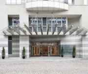
Sheraton Warsaw Hotel
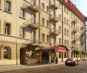
Chmielna Guest House
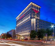
Hotel Mercure Warszawa Grand
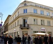
Hotel Indigo WARSAW - NOWY SWIAT
SixtySix
Studio Copernicus
Royal Route Residence
Apartament Pablo by Your Freedom
Smolna Apartments by Your Freedom
Hetman
Videos from this area
These are videos related to the place based on their proximity to this place.
The National Stadium in Warsaw (Stadion Narodowy)
Do you want to see how looks The National Stadium in Warsaw two months before EURO 2012? Here is a video about one of the biggest stadiums of the Europe. It really looks impresive in my opinion.
Metro in Warsaw - line M2, part 3
Second line in Warsaw ... station Centrum Nauki Kopernik. 08.03.2015 r.
Warsaw Tattoo Convention - second edition
W dniach 29-30 listopada 2014 roku, odbyła się druga edycja Warsaw Tattoo Convention.
Wycieczka rowerowa wzdłuż i wokół Wisły w Warszawie (bicycle round trip: Vistula in Warsaw)
Jednominutowa relacja z wycieczki rowerowej trasą: róg Czerniakowskiej/Zaruskiego - most Łazienkowski - ścieżka wzdłuż Wisły - most Świętokrzyski - Biblioteka UW - Centrum Kopernika...
Jak zrozumieć i wpłynąć na customer journey - Netsprint
Artur Banach, prezes Netsprint - prezentacja z konferencji AdUniverse Warszawa, 28.01.2014.
Sin City - Urban (Cirque du Soleil) + choreografia
Nagranie pochodzi z próby dźwięku przed występem dla amerykańskiej firmy "Mona Vie" na warszawskim Torwarze.
Poland: Travelling across the Vistula River between Warszawa Centralna & Wschodnia stations
Travelling on an eastbound train across the Vistula River between Warszawa Centralna & Wschodnia stations. The train we are on is running parallel with another eastbound train formed of graffiti...
Trening Argentyny przed meczem z Polska / Argentina freestyle training
Trening Argentyny przed meczem z reprezentacja Polski na Pepsi Arena 05.06.2011.
Warsaw go out: beach pub Temat Rzeka and beach at Vistula - Stadionu Narodowego
Warsaw is a very cool city. In Warsaw is a lot of very nice pubs. In Warsaw is a lot of very cool discos. The Warsaw cheap. Shot costs 1 euro - 2 euros. :) Come to Poland and have fun. :)...
Videos provided by Youtube are under the copyright of their owners.
Attractions and noteworthy things
Distances are based on the centre of the city/town and sightseeing location. This list contains brief abstracts about monuments, holiday activities, national parcs, museums, organisations and more from the area as well as interesting facts about the region itself. Where available, you'll find the corresponding homepage. Otherwise the related wikipedia article.
People's Republic of Poland
The People's Republic of Poland was the official name of Poland from 1952 to 1989. From 1944 to 1952 Rzeczpospolita Polska (The Republic of Poland) was the name of the Polish state. The Soviet Union had much influence over internal affairs and foreign affairs, and Red Army forces were stationed in Poland (1945 - 500,000; until 1955 - 120,000 to 150,000, until 1989 - 40,000). Therefore the People's Republic of Poland has been described as a satellite state of the Soviet Union.
Polish government-in-exile
The Polish government-in-exile, formally known as the Government of the Republic of Poland in exile (Polish: Rząd Rzeczypospolitej Polskiej na uchodźstwie), was the government in exile of Poland formed in the aftermath of the Invasion of Poland of September 1939, and the subsequent occupation of Poland by Nazi Germany and the Soviet Union, which brought to an end the Second Polish Republic founded in 1918.
10th-Anniversary Stadium
10th-Anniversary Stadium, opened in 1955, was for decades the largest stadium in Warsaw, and one of the largest in Poland. Under the Polish People's Republic, it was one of the most advertised construction sites and a principal venue for Party and state festivities. In the 1980s the stadium became dilapidated, as no funds could be found to refurbish it.
Warsaw Stock Exchange
The Warsaw Stock Exchange (WSE), Polish: Giełda Papierów Wartościowych w Warszawie, is a stock exchange located in Warsaw, Poland. It has a capitalization of PLN 517 bln (as of Nov 30, 2012). The WSE is a member of the World Federation of Exchanges and the Federation of European Securities Exchanges.
Powiśle
Powiśle is a neighbourhood in Warsaw's borough of Śródmieście (city centre). It is located between the Vistula river and its escarpment. Historically it is composed of three neighbourhoods: the Powiśle proper, Mariensztat to the north (just below the Warsaw's Old Town) and Solec to the south. In 17th and 18th centuries the area became populated mostly with the poor of Warsaw. Little changed in 19th century when the neighbourhood became slightly industrialized.
Ujazdów Castle
Ujazdów Castle is a castle in the historic Ujazdów district, between Ujazdów Park and the Royal Baths Park (Łazienki Królewskie), in Warsaw, Poland. Its beginnings date to 13th century, and it was rebuild several times. Like many structures in Warsaw, it sustained much damage in the Warsaw Uprising. Reconstructed after the war, it now houses the Warsaw's Center for Contemporary Art.
Polish Army Stadium
Pepsi Arena is an all-seater football-specific stadium in Warsaw, Poland. It is the home of Legia Warsaw football club, which has been playing there since August 9, 1930. With space for 31,000 spectators it is the 5th biggest football stadium in Ekstraklasa. The stadium, which for decades belonged to the Polish Army, is currently owned by the City of Warsaw. Since 2011 it is officially known as Pepsi Arena on the basis of a sponsorship agreement with PepsiCo.
Torwar Hall
Torwar Hall is an indoor arena in Warsaw, Poland. It opened in 1953, was modernized in 1999, and holds 4,838 people. It is located adjacent to Legia Stadium and is primarily used for popular music concerts, ice hockey and other indoor sports, and it is the home of the hockey team UHKS Mazowsze. Torwar Hall hosted the 2001 Saporta Cup final in which Maroussi BC defeated Elan Sportif Chalonnais. On January 22–28, 2007 the Hall hosted the 2007 European Figure Skating Championships.
National Museum, Warsaw
The National Museum in Warsaw (Polish: Muzeum Narodowe w Warszawie), Poland, is a national institution of culture, one of the largest museums in Poland and the largest in Warsaw. It comprises a rich collection of ancient art, counting about 11,000 pieces, an extensive gallery of Polish painting since the 16th century and a collection of foreign painting including some paintings from Adolf Hitler's private collection, ceded to the Museum by the American authorities in post-war Germany.
Polish Army Museum
Museum of the Polish Army (Polish: Muzeum Wojska Polskiego) is a museum in Warsaw documenting the military aspects of the history of Poland. Created in 1920, it occupies a wing of the building of the Polish National Museum as well as several branches in Poland. It's Warsaw's second largest museum and the largest collection of military objects in Poland. The collection illustrates a thousand years of Polish military history - from the 10th century to the Second World War.
Debrecen Stadion
Debrecen Stadion or Nagyerdei Stadion is a football stadium in Debrecen, Hungary, under construction as of 2013. Once completed in 2014, it will be used for football matches and will serve the home matches of Debreceni VSC. The stadium will have seating capacity for 20,020 people and will replace their current stadium Stadion Oláh Gábor Út. After its completion it will be the second largest stadium in Hungary.
Tamka street, Warsaw
Tamka, or ulica Tamka, is a street in the Powiśle district of Warsaw, Poland. The street runs downhill from central Warsaw toward the Vistula River and connects ulica Świętokrzyska with the Wisłostrada. The street's name originates from a small dam that once dammed a stream that formerly flowed along the course of the present street.
Poniatowski Bridge
Poniatowski Bridge is a bridge in Warsaw. Originally built between 1904 and 1914, it was damaged in each of the World Wars and rebuilt afterwards. It spans the Vistula, connecting Powiśle with the Praga quarter on the other side. Its viaduct is an extension of Aleje Jerozolimskie.
National Stadium, Warsaw
The National Stadium in the name of Kazimierz Górski is a retractable roof football stadium located in Warsaw, Poland. It is used mostly for football matches and it is the home stadium of Poland national football team. The stadium has a seating capacity of 58,145 which makes it the largest association football arena in Poland. Its construction started in 2008 and finished in November 2011.
Fryderyk Chopin University of Music
The Fryderyk Chopin University of Music (Uniwersytet Muzyczny Fryderyka Chopina) is located at ulica Okólnik 2 in central Warsaw, Poland. It is the oldest and largest music school in Poland, and one of the largest in Europe.
Łazienkowski Bridge
Łazienkowski Bridge is a five-span steel bridge 423 m long and 28 m wide, across the Vistula in Warsaw, Poland. It was opened on 22 July 1974, after three years' construction. There are three lanes for vehicles and a pavement each way. The name refers to Łazienki Park and Łazienki Palace, located to the south-west of the bridge. The full official name, adopted in 1981, is Most Łazienkowski im. gen.
Copernicus Science Centre
Copernicus Science Center (Polish: Centrum Nauki Kopernik) is a science museum standing on the bank of the Vistula River in Warsaw, Poland. It contains over 450 interactive exhibits that enable visitors to single-handedly carry out experiments and discover the laws of science for themselves. The Center is the largest institution of its type in Poland and one of the most advanced in Europe. On 25 September 2012 the Center celebrated its two-millionth visitor.
Asia and Pacific Museum
The Asia and Pacific Museum in Warsaw was founded in 1973 on the basis of a private collection of oriental art amassed and later donated to the Polish State by Andrzej Wawrzyniak - Polish sailor, diplomat, connoisseur and collector of the Oriental art. After his return to Poland, he donated his, numbering over 3 000 objects, collection to the Polish State. On that base the Nusantara Archipelago Museum was founded in Warsaw in 1973.
Centrum Nauki Kopernik metro station
Warsaw Metro station B-14 Centrum Nauki Kopernik will be the fifth station of the central part of the Warsaw Metro line 2, which is now under construction. It should be built by 27 October 2013, but it won't be operational until the whole central part of the line 2 is finished, which is scheduled for the end of 2013. The station will be near the Wybrzeże Kościuszkowskie street, very close to the bank of the Vistula river.
Museum of the Earth of Polish Academy of Sciences
The Museum of the Earth in Warsaw, established in 1948 and continuing a tradition initiated by Earth Museum Society back in 1932, has been operating within the structure of the Polish Academy of Sciences since 1959. The Museum of the Earth is located in two historical buildings at Na Skarpie Avenue in the center of Warsaw, perched on high Vistula escarpment.
Museum of Scouting, Warsaw
Museum of Scouting is a museum in Warsaw, Poland. The museum was established in 2001.
Museum of the Castle and Military Hospital at Ujazdów
Muzeum Zamku i Szpitala Wojskowego na Ujazdowie is a museum in Warsaw, Poland. It is located in the Ujazdów Castle, in one of the rooms belonging to the Centre for the Contemporary Art, in the north-west tower of the castle. The exhibition includes objects and photographs related to the history of the Ujazdów Castle and the Ujazdów military hospital.
Warszawa Powiśle railway station
Warsaw Powiśle is a railway station in Warsaw, Poland. Located in the district of Powiśle stretching between Aleje Jerozolimskie near Rondo Charles'a de Gaulle'a (high-level entrance) and the intersection of Aleja 3 Maja and ul. Kruczkowskiego (low-level entrance). The station sits on a rail embankment extending from the terrace of the Vistula river on which the city centre is built, ending at its western side with the entrance to the Cross-City tunnel.
Warszawa Stadion railway station
Warszawa Stadion is a railway station in Warsaw, Poland, located in the district of Praga Południe close to the National Stadium. The station has two side platforms flanking the suburban tracks of the Warsaw Cross-City Line. The platforms are used by regional trains run by Koleje Mazowieckie and Szybka Kolej Miejska. The station building was designed by Arseniusz Romanowicz and Piotr Szymaniak in 1955.
Żyleta
Żyleta is a common name of a northern stand in the Polish Army Stadium in Warsaw, Poland, traditionally occupied by the most spontaneous and fanatical fans of Legia Warsaw football club. Before the stadium renovation (2008–2011), the “old” Żyleta referred only to the center section within the eastern stand of the stadium (occasionally, it would also refer to eastern stand as a whole). There is a special exhibition dedicated to the "old" Żyleta in the Legia club museum.


