Safety Score: 2,8 of 5.0 based on data from 9 authorites. Meaning we advice caution when travelling to Poland.
Travel warnings are updated daily. Source: Travel Warning Poland. Last Update: 2024-08-13 08:21:03
Delve into Węgłów
Węgłów in Powiat strzeliński (Województwo Dolnośląskie) is a city located in Poland about 192 mi (or 309 km) south-west of Warsaw, the country's capital town.
Current time in Węgłów is now 06:21 PM (Thursday). The local timezone is named Europe / Warsaw with an UTC offset of one hour. We know of 10 airports closer to Węgłów, of which two are larger airports. The closest airport in Poland is Opole-Polska Nowa Wieś Airport in a distance of 24 mi (or 39 km), East. Besides the airports, there are other travel options available (check left side).
There are several Unesco world heritage sites nearby. The closest heritage site in Poland is Centennial Hall in Wrocław in a distance of 27 mi (or 43 km), North. In need of a room? We compiled a list of available hotels close to the map centre further down the page.
Since you are here already, you might want to pay a visit to some of the following locations: Grodkow, Skoroszyce, Kamiennik, Skarbimierz Osiedle and Pakoslawice. To further explore this place, just scroll down and browse the available info.
Local weather forecast
Todays Local Weather Conditions & Forecast: 6°C / 42 °F
| Morning Temperature | 3°C / 37 °F |
| Evening Temperature | 5°C / 42 °F |
| Night Temperature | 6°C / 43 °F |
| Chance of rainfall | 0% |
| Air Humidity | 72% |
| Air Pressure | 1023 hPa |
| Wind Speed | Moderate breeze with 12 km/h (8 mph) from North-East |
| Cloud Conditions | Overcast clouds, covering 99% of sky |
| General Conditions | Overcast clouds |
Friday, 15th of November 2024
9°C (48 °F)
4°C (39 °F)
Broken clouds, gentle breeze.
Saturday, 16th of November 2024
9°C (48 °F)
3°C (38 °F)
Sky is clear, gentle breeze, clear sky.
Sunday, 17th of November 2024
8°C (46 °F)
5°C (41 °F)
Light rain, fresh breeze, broken clouds.
Hotels and Places to Stay
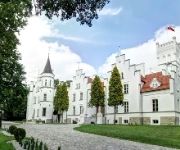
Pałac Sulisław Hotel & Spa
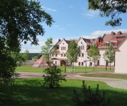
Hotel Sulisław
Videos from this area
These are videos related to the place based on their proximity to this place.
Marker Spyder Shutter - Skarbimierz Lotnisko
Pierwsze strzelanie po reanimacji markera Spyder Shutter na czerwonym lotnisku na Skarbimierzu. Można powiedzieć że jest gotowy do malowania :) przepraszamy że bez maski :P tester- Miluś.
Alarmowanie OSP WIązów
04.04.2012 Wyjazd do pożaru róży energetycznej składowanej na chałdzie w miejscowości Zborowice. Po Dojeździe na Miejsce pierwszego zastępu został zadysponowany drugi zastęp z OSP ...
Mazureczek (Hej z góry z góry) - akordeon
Gram na akordeonie od jakichś dwóch miesięcy, tak więc myślę, że już mogę co nieco pokazać. Proszę o wyrozumiałość, gdyż jestem samoukiem, a nie żadnym wirtuozem i gram dla...
Videos provided by Youtube are under the copyright of their owners.
Attractions and noteworthy things
Distances are based on the centre of the city/town and sightseeing location. This list contains brief abstracts about monuments, holiday activities, national parcs, museums, organisations and more from the area as well as interesting facts about the region itself. Where available, you'll find the corresponding homepage. Otherwise the related wikipedia article.
Królewiec, Lower Silesian Voivodeship
Królewiec is a village in the administrative district of Gmina Przeworno, within Strzelin County, Lower Silesian Voivodeship, in south-western Poland. Prior to 1945 it was in Germany. It lies approximately 15 kilometres east of Przeworno, 15 km south-east of Strzelin, and 49 km south of the regional capital Wrocław.
Jutrzyna
Jutrzyna is a village in the administrative district of Gmina Wiązów, within Strzelin County, Lower Silesian Voivodeship, in south-western Poland. Prior to 1945 it was in Germany. It lies approximately 9 kilometres south-east of Wiązów, 15 kilometres east of Strzelin, and 45 kilometres south of the regional capital Wrocław.
Kowalów, Lower Silesian Voivodeship
Kowalów is a village in the administrative district of Gmina Wiązów, within Strzelin County, Lower Silesian Voivodeship, in south-western Poland. Prior to 1945 it was in Germany. It lies approximately 7 kilometres south of Wiązów, 12 km east of Strzelin, and 43 km south of the regional capital Wrocław.
Krajno
Krajno is a village in the administrative district of Gmina Wiązów, within Strzelin County, Lower Silesian Voivodeship, in south-western Poland. Prior to 1945 it was in Germany. It lies approximately 8 kilometres south-east of Wiązów, 14 km east of Strzelin, and 45 km south of the regional capital Wrocław.
Łojowice, Lower Silesian Voivodeship
Łojowice is a village in the administrative district of Gmina Wiązów, within Strzelin County, Lower Silesian Voivodeship, in south-western Poland. It lies approximately 10 kilometres south of Wiązów, 12 km south-east of Strzelin, and 46 km south of the regional capital Wrocław. Between 1975 and 1998 it was in the administrative district of Wrocław. The entire region was annexed by Prussia in 1740 and therefore found itself in Germany from 1871 until transferred to Poland in 1945.
Bąków, Brzeg County
Bąków is a village in the administrative district of Gmina Grodków, within Brzeg County, Opole Voivodeship, in south-western Poland. It lies approximately 11 kilometres north-west of Grodków, 18 km south-west of Brzeg, and 48 km west of the regional capital Opole. Before 1945 the area was part of Germany. The village has an approximate population of 600.
Jeszkotle
Jeszkotle (German Jäschkittel) is a village in the administrative district of Gmina Grodków, within Brzeg County, Opole Voivodeship, in south-western Poland. It lies approximately 9 kilometres west of Grodków, 25 km south-west of Brzeg, and 49 km west of the regional capital Opole. Before 1945 the area was part of Germany.
Zielonkowice
Zielonkowice is a village in the administrative district of Gmina Grodków, within Brzeg County, Opole Voivodeship, in south-western Poland. It lies approximately 9 kilometres north-west of Grodków, 22 km south-west of Brzeg, and 48 km west of the regional capital Opole. Before 1945 the area was part of Germany.


