Safety Score: 2,8 of 5.0 based on data from 9 authorites. Meaning we advice caution when travelling to Poland.
Travel warnings are updated daily. Source: Travel Warning Poland. Last Update: 2024-08-13 08:21:03
Delve into Smardzów
Smardzów in Powiat oleśnicki (Województwo Dolnośląskie) is located in Poland about 173 mi (or 278 km) south-west of Warsaw, the country's capital town.
Current time in Smardzów is now 11:09 AM (Monday). The local timezone is named Europe / Warsaw with an UTC offset of one hour. We know of 9 airports close to Smardzów, of which one is a larger airport. The closest airport in Poland is Copernicus Wrocław Airport in a distance of 20 mi (or 33 km), West. Besides the airports, there are other travel options available (check left side).
There are several Unesco world heritage sites nearby. The closest heritage site in Poland is Centennial Hall in Wrocław in a distance of 13 mi (or 20 km), South-West. We encountered 1 points of interest near this location. If you need a hotel, we compiled a list of available hotels close to the map centre further down the page.
While being here, you might want to pay a visit to some of the following locations: Dlugoleka, Czernica, Bierutow, Siechnice and Wroclaw. To further explore this place, just scroll down and browse the available info.
Local weather forecast
Todays Local Weather Conditions & Forecast: 10°C / 50 °F
| Morning Temperature | 6°C / 42 °F |
| Evening Temperature | 6°C / 43 °F |
| Night Temperature | 5°C / 41 °F |
| Chance of rainfall | 0% |
| Air Humidity | 66% |
| Air Pressure | 1018 hPa |
| Wind Speed | Moderate breeze with 11 km/h (7 mph) from North-East |
| Cloud Conditions | Few clouds, covering 20% of sky |
| General Conditions | Few clouds |
Tuesday, 26th of November 2024
6°C (43 °F)
3°C (38 °F)
Light rain, moderate breeze, overcast clouds.
Wednesday, 27th of November 2024
6°C (43 °F)
4°C (38 °F)
Sky is clear, moderate breeze, clear sky.
Thursday, 28th of November 2024
6°C (43 °F)
5°C (40 °F)
Moderate rain, fresh breeze, scattered clouds.
Hotels and Places to Stay
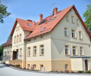
Dwór Spalice
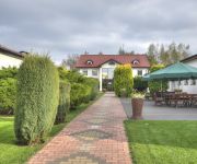
Perła
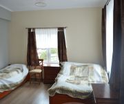
Garden
Czerwone Koszary
Videos from this area
These are videos related to the place based on their proximity to this place.
12.08.2014 Oleśnica - spieniona fontanna na pl. Zwycięstwa
http://mojaolesnica.pl/article.php?id=11665.
Instytut Urody Masumi Oleśnica
Film promocyjny Instytutu Urody Masumi w Oleśnicy http://masumi.com.pl/ Realizacja: http://www.bostudio.biz/
S8/A8 Oleśnica (# Dąbrowa) - Wrocław Północ
Przejazd drogą S8/A8 Oleśnica (# Dąbrowa) - Wrocław Północ.
Pogoń Oleśnica 2 - 0 Wiwa Goszcz (juniorzy) 22.03.2015
Skrót meczu w ramach Okręgowej Ligi Juniorów Starszych.
UFO Oleśnica
przelot kilkunastu nieznanych obiektów nad Oleśnicą , z tego sfilmowano na tym filmiku 4.
14.08.2013 Oleśnica - wypadek kabrioletu i karetki pogotowia
http://mojaolesnica.pl/article.php?id=8960.
Videos provided by Youtube are under the copyright of their owners.
Attractions and noteworthy things
Distances are based on the centre of the city/town and sightseeing location. This list contains brief abstracts about monuments, holiday activities, national parcs, museums, organisations and more from the area as well as interesting facts about the region itself. Where available, you'll find the corresponding homepage. Otherwise the related wikipedia article.
Dobra, Oleśnica County
Dobra is a village in the administrative district of Gmina Dobroszyce, within Oleśnica County, Lower Silesian Voivodeship, in south-western Poland. Prior to 1945 it was in Germany. It lies approximately 4 kilometres south-west of Dobroszyce, 7 kilometres north-west of Oleśnica, and 23 kilometres north-east of the regional capital Wrocław. The village has a population of 350.
Dąbrowa, Gmina Oleśnica
Dąbrowa is a village in the administrative district of Gmina Oleśnica, within Oleśnica County, Lower Silesian Voivodeship, in south-western Poland. Prior to 1945 it was in Germany. It lies approximately 4 kilometres north of Oleśnica, and 26 kilometres north-east of the regional capital Wrocław. The village has an approximate population of 360.
Jenkowice, Oleśnica County
Jenkowice is a village in the administrative district of Gmina Oleśnica, within Oleśnica County, Lower Silesian Voivodeship, in south-western Poland. Prior to 1945 it was in Germany. It is approximately 6 kilometres north-west of Oleśnica, and 24 kilometres north-east of the regional capital Wrocław.
Nieciszów
Nieciszów is a village in the administrative district of Gmina Oleśnica, within Oleśnica County, Lower Silesian Voivodeship, in south-western Poland. Prior to 1945 it was in Germany. It lies approximately 5 kilometres south-west of Oleśnica, and 21 kilometres east of the regional capital Wrocław. The village has a population of 368.
Stępin
Stępin is a village in the administrative district of Gmina Długołęka, within Wrocław County, Lower Silesian Voivodeship, in south-western Poland. Prior to 1945 it was in Germany. It lies approximately 8 kilometres north-east of Długołęka, and 20 kilometres north-east of the regional capital Wrocław. The village has a population of 380.


