Safety Score: 2,8 of 5.0 based on data from 9 authorites. Meaning we advice caution when travelling to Poland.
Travel warnings are updated daily. Source: Travel Warning Poland. Last Update: 2024-08-13 08:21:03
Touring Miłoszów
Miłoszów in Powiat lubański (Województwo Dolnośląskie) is a town located in Poland about 261 mi (or 420 km) west of Warsaw, the country's capital place.
Time in Miłoszów is now 12:35 AM (Saturday). The local timezone is named Europe / Warsaw with an UTC offset of one hour. We know of 9 airports nearby Miłoszów, of which 4 are larger airports. The closest is airport we know is Dresden Airport in Germany in a distance of 65 mi (or 104 km). The closest airport in Poland is Copernicus Wrocław Airport in a distance of 71 mi (or 104 km), West. Besides the airports, there are other travel options available (check left side).
There are several Unesco world heritage sites nearby. The closest heritage site in Poland is Churches of Peace in Jawor and Świdnica in a distance of 41 mi (or 66 km), East. Need some hints on where to stay? We compiled a list of available hotels close to the map centre further down the page.
Being here already, you might want to pay a visit to some of the following locations: Luban, Gryfow Slaski, Nowogrodziec, Lubomierz and Zgorzelec. To further explore this place, just scroll down and browse the available info.
Local weather forecast
Todays Local Weather Conditions & Forecast: 8°C / 46 °F
| Morning Temperature | 6°C / 42 °F |
| Evening Temperature | 7°C / 45 °F |
| Night Temperature | 4°C / 40 °F |
| Chance of rainfall | 0% |
| Air Humidity | 79% |
| Air Pressure | 1025 hPa |
| Wind Speed | Moderate breeze with 9 km/h (6 mph) from East |
| Cloud Conditions | Overcast clouds, covering 85% of sky |
| General Conditions | Overcast clouds |
Saturday, 16th of November 2024
9°C (48 °F)
4°C (38 °F)
Few clouds, gentle breeze.
Sunday, 17th of November 2024
5°C (41 °F)
4°C (40 °F)
Moderate rain, moderate breeze, overcast clouds.
Monday, 18th of November 2024
4°C (40 °F)
2°C (35 °F)
Rain and snow, fresh breeze, broken clouds.
Hotels and Places to Stay
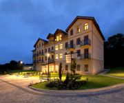
Cottonina Villa Mineral SPA Resort
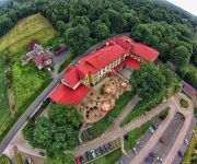
Malinowy Dwór Hotel**** Medical SPA
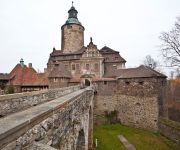
Zamek Czocha
Videos from this area
These are videos related to the place based on their proximity to this place.
Nové Město pod Smrkem - lyžování 2011
Lyžování v roce 2011 - Hřebenáč - mezi Novým Městem pod Smrkem a Jindřichovicemi pod Smrkem. Trasa běžecké stopy vede územím, kde bude v roce 2011 vybudována nová trasa Singltreku....
Nové Město pod Smrkem vysílačka Izerském stógu a rozhledna na Smrku
Informace o Izerskén stógu najdete http://cs.wikipedia.org/wiki/St%C3%B3g_Izerski Na izerské stógu je lanovka s 2,5 km sjezdovkou http://skisun.pl/ http://www.lanove-drahy.cz/?page=lan_pl&l...
Lyžování 2012 Nové Město pod Smrkem - Hřebenáč (566m) - cross-country skiing
Lyžování na několika kilometrovém okruhu. Mapa: http://www.nmps.cz/aktuality/2012/Mapa_stopy_2011.jpg Informace o úpravě stop: http://www.facebook.com/stopynmps Cross-country skiing.
Lyžování 2012 Nové Město pod Smrkem - od rybízového pole k Singltrekovému centru.
Mapa běžeckých stop: http://www.nmps.cz/aktuality/2012/Mapa_stopy_2011.jpg Aktuální informace o stopě a počasí: http://www.facebook.com/stopynmps cross-country skiing.
Powódź Leśna dokument dla ludzi i władz 07 sierpnia 2010
Film z powodzi w mieście Leśna z 07 sierpnia 2010 roku. Sfilmował: Karol Mąkowski - www.studio810.pl.
Leśna Powódź / Trasa Leśna-Miłoszow / dzień po 08.08.2010
Film nakręcony dzień po powodzi 08 sierpnia 2010 telefonem komórkowym z samochodu na trasie Leśna - Miłoszów.
Droga wojewódzka nr 358: Leśna - Włosień
Przejazd drogą wojewódzką nr 358 z centrum Leśnej do Włosienia (skrzyżowania z drogą wojewódzką nr 357).
WOŚP 2012 Leśna światełko do nieba.
Tradycją podczas finałów Wielkiej Orkiestry Świątecznej Pomocy jest Światełko do Nieba. Zobacz jak wyglądało to w Leśnej.
Videos provided by Youtube are under the copyright of their owners.
Attractions and noteworthy things
Distances are based on the centre of the city/town and sightseeing location. This list contains brief abstracts about monuments, holiday activities, national parcs, museums, organisations and more from the area as well as interesting facts about the region itself. Where available, you'll find the corresponding homepage. Otherwise the related wikipedia article.
Leśna
Leśna is a town in Lubań County, Lower Silesian Voivodeship, in south-western Poland. It is the seat of the administrative district called Gmina Leśna, close to the Czech border. Prior to 1945 it was in Germany. It lies approximately 11 kilometres south of Lubań, and 125 kilometres west of the regional capital Wrocław. As at 2006, the town has a population of 4,752.
Smolnik, Lower Silesian Voivodeship
Smolnik is a village in the administrative district of Gmina Leśna, within Lubań County, Lower Silesian Voivodeship, in south-western Poland. Prior to 1945 it was in Germany. It lies approximately 2 kilometres north-west of Leśna, 10 km south of Lubań, and 125 km west of the regional capital Wrocław.
Smolnik-Jurków
Smolnik-Jurków is a village in the administrative district of Gmina Leśna, within Lubań County, Lower Silesian Voivodeship, in south-western Poland. Prior to 1945 it was in Germany. It lies approximately 3 kilometres north-west of Leśna, 11 km south-west of Lubań, and 127 km west of the regional capital Wrocław.


