Safety Score: 2,8 of 5.0 based on data from 9 authorites. Meaning we advice caution when travelling to Poland.
Travel warnings are updated daily. Source: Travel Warning Poland. Last Update: 2024-08-13 08:21:03
Discover Wapienniki
The district Wapienniki of Ludowe in Powiat kłodzki (Województwo Dolnośląskie) is a district in Poland about 237 mi south-west of Warsaw, the country's capital city.
Looking for a place to stay? we compiled a list of available hotels close to the map centre further down the page.
When in this area, you might want to pay a visit to some of the following locations: Duszniki-Zdroj, Kudowa-Zdroj, Polanica-Zdroj, Jedlina-Zdroj and Pieszyce. To further explore this place, just scroll down and browse the available info.
Local weather forecast
Todays Local Weather Conditions & Forecast: 5°C / 41 °F
| Morning Temperature | 2°C / 36 °F |
| Evening Temperature | 2°C / 36 °F |
| Night Temperature | 1°C / 34 °F |
| Chance of rainfall | 0% |
| Air Humidity | 79% |
| Air Pressure | 1026 hPa |
| Wind Speed | Light breeze with 5 km/h (3 mph) from East |
| Cloud Conditions | Broken clouds, covering 81% of sky |
| General Conditions | Broken clouds |
Saturday, 16th of November 2024
5°C (42 °F)
1°C (33 °F)
Sky is clear, gentle breeze, clear sky.
Sunday, 17th of November 2024
3°C (37 °F)
2°C (36 °F)
Light rain, moderate breeze, overcast clouds.
Monday, 18th of November 2024
1°C (35 °F)
-2°C (29 °F)
Rain and snow, moderate breeze, overcast clouds.
Hotels and Places to Stay
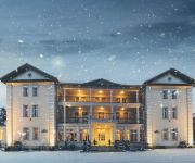
Wellness & Spa WERONA
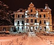
Impresja
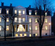
Fryderyk
De Esperanto Medical & SPA
Sonata Hotel
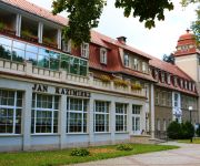
Jan Kazimierz
Videos from this area
These are videos related to the place based on their proximity to this place.
Muzeum Papiernictwa Duszniki Zdrój
W XVII-wiecznym młynie papierniczym, unikatowym zabytku techniki mieści się Muzeum Papiernictwa w Dusznikach Zdroju.
Kongres Młodego Samorządu 19-21.03.2015, Duszniki-Zdrój
Organizowany w dniach 19-21 marca 2015 roku w Dusznikach-Zdroju Kongres stał się miejscem wymiany myśli o samorządzie oraz stanowił istotne wsparcie dla nowoczesnego i harmonijnego ...
Duszniki Zdrój Styczeń 2011
Duszniki-Zdrój (niem. Bad Reinerz, czes. Dušníky) -- gmina miejska w województwie dolnośląskim, w powiecie kłodzkim. Położone w południowo-zachodniej części Ziemi Kłodzkiej w dolinie...
DK 8 Odcinek Duszniki-Zdrój - Kudowa-Zdrój wyprzedzanie na podwójnej ciągłej
DKL MC49 kierowca nie popisał się umiejętnością myślenia wykonując manewr wyprzedzania na odcinku drogi składającym się z samych ostrych zakrętów gdzie widoczność jest bardzo...
Videos provided by Youtube are under the copyright of their owners.
Attractions and noteworthy things
Distances are based on the centre of the city/town and sightseeing location. This list contains brief abstracts about monuments, holiday activities, national parcs, museums, organisations and more from the area as well as interesting facts about the region itself. Where available, you'll find the corresponding homepage. Otherwise the related wikipedia article.
Wambierzyce
Wambierzyce, the "Silesian Jerusalem", is one of the most popular pilgrimage sites in southern Poland. The village is situated at an altitude of 370–410 m in the picturesque Cedron valley on the eastern slopes of the Table Mountains in Lower Silesian Voivodeship. The place was first mentioned in 1330 Alberndorf, 1398 Alberdorf, 1418 Alberti villa, 1560 Alberichsdorf, which then evolved into the (German) name Albendorf. Czech pilgrims from Bohemia and Moravia called the place Vambeřice.
Duszniki-Zdrój
Duszniki-Zdrój is a spa town in the Klodzko Valley on the Bystrzyca River in Kłodzko County, Lower Silesian Voivodeship, Poland. It is a notable spa town and a major tourist attraction of the area.
Polanica-Zdrój
Polanica-Zdrój is a town in Kłodzko County, Lower Silesian Voivodeship, in south-western Poland. It lies approximately 11 kilometres south-west of Kłodzko, and 89 kilometres south-west of the regional capital Wrocław. As at 2006, the town has a population of 6,900. Polanica-Zdrój was first documented in 1347 under the name Heyde; at the time it belonged to the House of Glaubitz, Bohemia within the Holy Roman Empire. In 1645 the town was destroyed by Swedish troops during the Thirty Years' War.
Stołowe Mountains
Stołowe Mountains; also known as the Table Mountains are a 42-kilometre -long mountain range in Poland and the Czech Republic, part of the Central Sudetes. The range is situated southeast of the Karkonosze. The Polish part of the range is protected as the Stołowe Mountains National Park. The highest peak of the range is Szczeliniec Wielki at 919 m a.s.l. The range is built of sandstone and, as the only one in Poland, presents plated structure with sheer mountain ledges.
Machov
Machov is a market town situated in the Czech Republic and in the Hradec Králové Region. It has around 1,100 inhabitants. It lies just next to the border with Poland. Machov has always had a majority of Czech inhabitants although strong ties with Polish and German borderlands existed. Machov lies in a valley of the brook Židovka and under a dominant mountain Bor, which is one of the famous Table Mountains in Poland.
Radków
Radków is a town in Kłodzko County, Lower Silesian Voivodeship, in south-western Poland. It is the seat of the administrative district called Gmina Radków, close to the Czech border. Prior to 1945 it was in Germany. As at 2006, the town has a population of 2,460.
Szczytna
Szczytna is a town in Kłodzko County, Lower Silesian Voivodeship, in south-western Poland. It is the seat of the administrative district called Gmina Szczytna, close to the Czech border. Prior to 1945 it was in Germany. It lies approximately 16 kilometres west of Kłodzko, and 90 kilometres south-west of the regional capital Wrocław. As at 2006, the town has a population of 5,234. Two of the skirmishes of the War of the Bavarian Succession (1778–1779) occurred at the hamlet of Biebersdorf.
Kulin Kłodzki
Kulin Kłodzki is a village in the administrative district of Gmina Lewin Kłodzki, within Kłodzko County, Lower Silesian Voivodeship, in south-western Poland. Prior to 1945 it was in Germany. It lies approximately 4 kilometres east of Lewin Kłodzki, 24 km west of Kłodzko, and 93 km south-west of the regional capital Wrocław.
Witów, Lower Silesian Voivodeship
Witów is a village in the administrative district of Gmina Lewin Kłodzki, within Kłodzko County, Lower Silesian Voivodeship, in south-western Poland. Prior to 1945 it was in Germany. It lies approximately 4 kilometres south-east of Lewin Kłodzki, 24 km west of Kłodzko, and 95 km south-west of the regional capital Wrocław. The village has a population of 16.
Zimne Wody
Zimne Wody is a village in the administrative district of Gmina Lewin Kłodzki, within Kłodzko County, Lower Silesian Voivodeship, in south-western Poland. Prior to 1945 it was in Germany. It lies approximately 6 kilometres south-east of Lewin Kłodzki, 24 km west of Kłodzko, and 97 km south-west of the regional capital Wrocław.
Karłów
Karłów is a village in the administrative district of Gmina Radków, within Kłodzko County, Lower Silesian Voivodeship, in south-western Poland. Prior to 1945 it was in Germany. It lies approximately 7 kilometres south-west of Radków, 23 km west of Kłodzko, and 89 km south-west of the regional capital Wrocław.
Łężyce, Lower Silesian Voivodeship
Łężyce is a village in the administrative district of Gmina Szczytna, within Kłodzko County, Lower Silesian Voivodeship, in south-western Poland. Prior to 1945 it was in Germany. It lies approximately 7 kilometres west of Szczytna, 22 km west of Kłodzko, and 91 km south-west of the regional capital Wrocław.
Słoszów
Słoszów is a village in the administrative district of Gmina Szczytna, within Kłodzko County, Lower Silesian Voivodeship, in south-western Poland. Prior to 1945 it was in Germany. It lies approximately 6 kilometres west of Szczytna, 21 km west of Kłodzko, and 93 km south-west of the regional capital Wrocław.
Borová (Náchod District)
Borová is a village and municipality in Náchod District in the Hradec Králové Region of the Czech Republic. It is located, near the border with Poland.
Božanov
Božanov is a village and municipality in Náchod District in the Hradec Králové Region of the Czech Republic. It is located, near the border with Poland.
Česká Čermná
Česká Čermná is a village and municipality in Náchod District in the Hradec Králové Region of the Czech Republic.
Nový Hrádek
Nový Hrádek is a market town and municipality in Náchod District in the Hradec Králové Region of the Czech Republic.
Bystré (Rychnov nad Kněžnou District)
Bystré (Rychnov nad Kněžnou District) is a village and municipality in Rychnov nad Kněžnou District in the Hradec Králové Region of the Czech Republic.
Dobřany (Rychnov nad Kněžnou District)
Dobřany (Rychnov nad Kněžnou District) is a village and municipality in Rychnov nad Kněžnou District in the Hradec Králové Region of the Czech Republic.
Janov (Rychnov nad Kněžnou District)
Janov (Rychnov nad Kněžnou District) is a village and municipality in Rychnov nad Kněžnou District in the Hradec Králové Region of the Czech Republic.
Kounov (Rychnov nad Kněžnou District)
Kounov (Rychnov nad Kněžnou District) is a village and municipality in Rychnov nad Kněžnou District in the Hradec Králové Region of the Czech Republic.
Olešnice v Orlických horách
Olešnice v Orlických horách is a village and municipality in Rychnov nad Kněžnou District in the Hradec Králové Region of the Czech Republic.
Sedloňov
Sedloňov is a village and municipality in Rychnov nad Kněžnou District in the Hradec Králové Region of the Czech Republic.
Sněžné (Rychnov nad Kněžnou District)
Sněžné (Rychnov nad Kněžnou District) is a village and municipality in Rychnov nad Kněžnou District in the Hradec Králové Region of the Czech Republic. The first known mention of the town is from the fifteen hundreds.
Skull Chapel in Czermna
Skull Chapel in Czermna (Kaplica Czaszek) is a chapel located in Kudowa-Zdrój, Lower Silesian Voivodeship, Poland.


