Safety Score: 2,8 of 5.0 based on data from 9 authorites. Meaning we advice caution when travelling to Poland.
Travel warnings are updated daily. Source: Travel Warning Poland. Last Update: 2024-08-13 08:21:03
Discover Gorzyniec
The district Gorzyniec of Piechowice in Powiat jeleniogórski (Województwo Dolnośląskie) is a district in Poland about 252 mi south-west of Warsaw, the country's capital city.
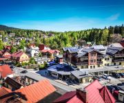
Looking for a place to stay? we compiled a list of available hotels close to the map centre further down the page.
When in this area, you might want to pay a visit to some of the following locations: Lubomierz, Jezow Sudecki, Wlen, Karpacz and Gryfow Slaski. To further explore this place, just scroll down and browse the available info.
Local weather forecast
Todays Local Weather Conditions & Forecast: 1°C / 33 °F
| Morning Temperature | -0°C / 32 °F |
| Evening Temperature | 1°C / 34 °F |
| Night Temperature | 1°C / 33 °F |
| Chance of rainfall | 5% |
| Air Humidity | 94% |
| Air Pressure | 1011 hPa |
| Wind Speed | Moderate breeze with 9 km/h (6 mph) from East |
| Cloud Conditions | Overcast clouds, covering 100% of sky |
| General Conditions | Snow |
Monday, 18th of November 2024
-0°C (32 °F)
-5°C (24 °F)
Snow, gentle breeze, overcast clouds.
Tuesday, 19th of November 2024
3°C (38 °F)
4°C (40 °F)
Rain and snow, fresh breeze, overcast clouds.
Wednesday, 20th of November 2024
-3°C (27 °F)
-4°C (25 °F)
Rain and snow, moderate breeze, overcast clouds.
Hotels and Places to Stay
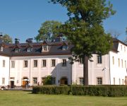
Palac Pakoszow
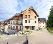
Czarny Kamień RESORT & SPA
Cristal Resort Szklarska Poręba
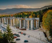
Blue Mountain Resort
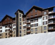
Sun&Snow Resort Apartamenty
Kryształ Conference & Spa
Apartamenty Lola
Hotel & Sound Bossa Nova
Interferie Sport Hotel w Szklarskiej Porębie
Hotel Las Piechowice
Videos from this area
These are videos related to the place based on their proximity to this place.
Piechowice - Szklarska Poręba droga dojazdowa
Droga dojazdowa do Szklarskiej Poręby. Odcinek Piechowice do Muzeum Minerałów.
Droga krajowa nr 3: Piechowice - Szklarska Poręba
Przejazd drogą krajową nr 3 z Piechowic (od skrzyżowania z drogą wojewódzką nr 366) do Szklarskiej Poręby (na bezpłatny parking przy Wodospadzie Kamieńczyka).
2013.11.16 EU07-169 R7621 Kamieńczyk Poznań Główny - Szklarska Poręba Górna
Pierwszy po remoncie odcinka Piechowice - Szklarska Poręba Górna pociąg z Poznania. Szklarska Poręba Dolna 16.11.2013 13:40.
Maseli w Teatrze Naszym
A little village among Karkonosze Mouintain, little private theater ( http://teatrnasz.pl ) in Michalowice. Bernard Maseli, the best vibraphone- musician of Poland, is playing Hendrix's cover....
Videos provided by Youtube are under the copyright of their owners.
Attractions and noteworthy things
Distances are based on the centre of the city/town and sightseeing location. This list contains brief abstracts about monuments, holiday activities, national parcs, museums, organisations and more from the area as well as interesting facts about the region itself. Where available, you'll find the corresponding homepage. Otherwise the related wikipedia article.
Szklarska Poręba
Szklarska Poręba is a town in Jelenia Góra County, Lower Silesian Voivodeship, in south-western Poland. The town has a population of around 7,000. It is a popular ski resort. An important regional and national centre for mountain hiking, cycling and skiing, Szklarska Poręba is situated in the valley of the Kamienna, between the Karkonosze Mountains in the south and Jizera Mountains in the west, at about 1,900 ft. above sea level, 16 miles south-west of Jelenia Góra.
Mały Szyszak
Mały Szyszak (Czech Malý Šišák, German Kleine Sturmhaube, literally Small Helmet) is a mountain on the border between the Czech Republic and Poland. It is situated in the central (Silesian) part of the main mountain range of the Giant Mountains, right above the villages Przesieka and Špindlerův Mlýn. It is separated from the mountain called Wielki Szyszak by Ptasi Kamień, Karkonoska Mountain Pass (Polish "Przełęcz Karkonoska"), Śląskie Kamienie, Czeskie Kamienie and Śmielec.
Karkonosze National Park
The Karkonosze National Park (Polish: Karkonoski Park Narodowy) is a National Park in the Karkonosze Mountains in southwestern Poland, along the border with the Czech Republic. The park is located in Lower Silesian Voivodeship, in the highest part of the Sudetes. It was created in 1959 to cover an area of 55.10 km². Today it is slightly larger at 55.76 km, of which 17.18 km² is strictly protected. The majority of the park area, around 33.80 km², consists of forests.
Wielki Szyszak
Wielki Szyszak (Czech: Vysoké Kolo, German: Hohes Rad, literally Big Helmet) is a mountain on the border between the Czech Republic and Poland. It is situated in the central part of the main mountain range of the Karkonosze, right above the village of Jagniątków. Its peak is at 1509 m above sea level. It is situated between Śnieżne Kotły and Śmielec. Mount Wielki Szyszak is the tenth-highest mountain in the Czech Republic.
Sobieszów
Sobieszów (German: Hermsdorf am Kynast) is a part of the town of Jelenia Góra in Poland. It is located near Karkonosze National Park. The ruined castle Chojnik is located in Sobieszów.
Piechowice
Piechowice is a town in Jelenia Góra County, Lower Silesian Voivodeship, in south-western Poland. Prior to 1945 it was in Germany. It lies approximately 10 kilometres south-west of Jelenia Góra, and 104 kilometres west of the regional capital Wrocław. As of 2006, the town has a population of 6,494.
Marczyce
Marczyce is a village in the administrative district of Gmina Podgórzyn, within Jelenia Góra County, Lower Silesian Voivodeship, in south-western Poland. Prior to 1945 it was in Germany. It lies approximately 3 kilometres east of Podgórzyn, 8 km south of Jelenia Góra, and 99 km west of the regional capital Wrocław.
Podgórzyn, Lower Silesian Voivodeship
Podgórzyn is a village in Jelenia Góra County, Lower Silesian Voivodeship, in south-western Poland. It is the seat of the administrative district called Gmina Podgórzyn. Prior to 1945 it was in Germany. It lies approximately 9 kilometres south-west of Jelenia Góra and 101 km west of the regional capital Wrocław. The village has a population of 1,700.
Zachełmie, Lower Silesian Voivodeship
Zachełmie is a village in the administrative district of Gmina Podgórzyn, within Jelenia Góra County, Lower Silesian Voivodeship, in south-western Poland. It lies approximately 3 kilometres south-west of Podgórzyn, 11 km south-west of Jelenia Góra, and 103 km west of the regional capital Wrocław.
Nowa Kamienica
Nowa Kamienica is a village in the administrative district of Gmina Stara Kamienica, within Jelenia Góra County, Lower Silesian Voivodeship, in south-western Poland. Prior to 1945 it was in Germany. It lies approximately 3 kilometres north-west of Stara Kamienica, 15 km west of Jelenia Góra, and 108 km west of the regional capital Wrocław.
Rybnica, Jelenia Góra County
Rybnica is a village in the administrative district of Gmina Stara Kamienica, within Jelenia Góra County, Lower Silesian Voivodeship, in south-western Poland. Prior to 1945 it was in Germany. It lies approximately 4 kilometres east of Stara Kamienica, 9 km west of Jelenia Góra, and 103 km west of the regional capital Wrocław.
Wojcieszyce, Lower Silesian Voivodeship
Wojcieszyce is a village in the administrative district of Gmina Stara Kamienica, within Jelenia Góra County, Lower Silesian Voivodeship, in south-western Poland. Prior to 1945 it was in Germany. It lies approximately 7 kilometres south-east of Stara Kamienica, 8 km west of Jelenia Góra, and 103 km west of the regional capital Wrocław. The village has a population of 1,000.
Maciejowiec
Maciejowiec is a village in the administrative district of Gmina Lubomierz, within Lwówek Śląski County, Lower Silesian Voivodeship, in south-western Poland. Prior to 1945 it was in Germany. It lies approximately 9 kilometres south-east of Lubomierz, 17 km south of Lwówek Śląski, and 102 km west of the regional capital Wrocław.
Pasiecznik, Lower Silesian Voivodeship
Pasiecznik is a village in the administrative district of Gmina Lubomierz, within Lwówek Śląski County, Lower Silesian Voivodeship, in south-western Poland. Prior to 1945 it was in Germany. It lies approximately 13 kilometres south-east of Lubomierz, 23 kilometres south of Lwówek Śląski, and 105 kilometres west of the regional capital Wrocław. The village has a population of 584.
Pokrzywnik, Lwówek Śląski County
Pokrzywnik is a village in the administrative district of Gmina Lubomierz, within Lwówek Śląski County, Lower Silesian Voivodeship, in south-western Poland. Prior to 1945 it was in Germany. It lies approximately 10 kilometres south-east of Lubomierz, 18 km south of Lwówek Śląski, and 100 km west of the regional capital Wrocław.
Popielówek
Popielówek is a village in the administrative district of Gmina Lubomierz, within Lwówek Śląski County, Lower Silesian Voivodeship, in south-western Poland. Prior to 1945 it was in Germany. It lies approximately 4 kilometres south of Lubomierz, 16 kilometres south of Lwówek Śląski, and 107 kilometres west of the regional capital Wrocław.
Wojciechów, Lwówek Śląski County
Wojciechów is a village in the administrative district of Gmina Lubomierz, within Lwówek Śląski County, Lower Silesian Voivodeship, in south-western Poland. Prior to 1945 it was in Germany.
Janice, Lower Silesian Voivodeship
Janice is a village in the administrative district of Gmina Lubomierz, within Lwówek Śląski County, Lower Silesian Voivodeship, in south-western Poland. Prior to 1945 it was in Germany. It lies approximately 7 kilometres south of Lubomierz, 19 kilometres south of Lwówek Śląski, and 108 kilometres west of the regional capital Wrocław.
Grudza
Grudza is a village in the administrative district of Gmina Mirsk, within Lwówek Śląski County, Lower Silesian Voivodeship, in south-western Poland, close to the Czech border. Prior to 1945 it was in Germany. It lies approximately 10 kilometres east of Mirsk, 20 kilometres south of Lwówek Śląski, and 110 kilometres west of the regional capital Wrocław.
Kwieciszowice
Kwieciszowice is a village in the administrative district of Gmina Mirsk, within Lwówek Śląski County, Lower Silesian Voivodeship, in south-western Poland, close to the Czech border. Prior to 1945 it was in Germany. The village has a population of 135.
Proszowa
Proszowa is a village in the administrative district of Gmina Mirsk, within Lwówek Śląski County, Lower Silesian Voivodeship, in south-western Poland, close to the Czech border. Prior to 1945 it was in Germany. It lies approximately 9 kilometres south-east of Mirsk, 22 kilometres south of Lwówek Śląski, and 111 kilometres west of the regional capital Wrocław. The village has a population of 139.
Pilchowice, Lower Silesian Voivodeship
Pilchowice is a village in the administrative district of Gmina Wleń, within Lwówek Śląski County, Lower Silesian Voivodeship, in south-western Poland. Prior to 1945 it was in Germany. It lies approximately 5 kilometres south-west of Wleń, 16 km south of Lwówek Śląski, and 100 km west of the regional capital Wrocław.
Śnieżne Kotły
Śnieżne Kotły (1,175 m, Czech: Sněžné jámy, German: Schneegruben, literally Snowy Pits, Snowy Cirque) are two glacial cirques in the western Krkonoše mountains (Giant Mountains), situated in the Karkonosze National Park on the Polish side of the border. They are a unique example of the alpine landscape in the area and have been a nature reserve since 1933.
Śmielec
Śmielec (1424 m a.s.l. ) is a mountain peak situated in the western part of Karkonosze on Polish and Czech border within the Karkonosze National Park. The prak is covered in granite rubble.
Siedlęcin Tower
Siedlęcin Tower is the 14th century tower castle, situated in a village of Siedlęcin in the administrative district of Gmina Jeżów Sudecki, within Jelenia Góra County, Lower Silesian Voivodeship, in south-western Poland. The keep in Siedlęcin is one of the best-preserved examples of such buildings in Central Europe; its construction was probably started in 1313 or 1314 by Henry I of Jawor.


