Safety Score: 2,8 of 5.0 based on data from 9 authorites. Meaning we advice caution when travelling to Poland.
Travel warnings are updated daily. Source: Travel Warning Poland. Last Update: 2024-08-13 08:21:03
Touring Podlesie
Podlesie in Powiat dzierżoniowski (Województwo Dolnośląskie) is a town located in Poland about 208 mi (or 335 km) south-west of Warsaw, the country's capital place.
Time in Podlesie is now 04:25 AM (Tuesday). The local timezone is named Europe / Warsaw with an UTC offset of one hour. We know of 10 airports nearby Podlesie, of which two are larger airports. The closest airport in Poland is Copernicus Wrocław Airport in a distance of 28 mi (or 46 km), North. Besides the airports, there are other travel options available (check left side).
There are several Unesco world heritage sites nearby. The closest heritage site in Poland is Centennial Hall in Wrocław in a distance of 30 mi (or 49 km), North. Need some hints on where to stay? We compiled a list of available hotels close to the map centre further down the page.
Being here already, you might want to pay a visit to some of the following locations: Pilawa Gorna, Jordanow Slaski, Dzierzoniow, Ziebice and Sobotka. To further explore this place, just scroll down and browse the available info.
Local weather forecast
Todays Local Weather Conditions & Forecast: 5°C / 41 °F
| Morning Temperature | 4°C / 39 °F |
| Evening Temperature | 6°C / 42 °F |
| Night Temperature | 3°C / 37 °F |
| Chance of rainfall | 3% |
| Air Humidity | 87% |
| Air Pressure | 1018 hPa |
| Wind Speed | Gentle Breeze with 8 km/h (5 mph) from North-East |
| Cloud Conditions | Overcast clouds, covering 100% of sky |
| General Conditions | Moderate rain |
Wednesday, 27th of November 2024
7°C (45 °F)
5°C (42 °F)
Scattered clouds, gentle breeze.
Thursday, 28th of November 2024
6°C (43 °F)
3°C (38 °F)
Light rain, fresh breeze, broken clouds.
Friday, 29th of November 2024
3°C (38 °F)
1°C (34 °F)
Rain and snow, moderate breeze, overcast clouds.
Hotels and Places to Stay
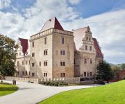
Uroczysko Siedmiu Stawów Luxury Hotel
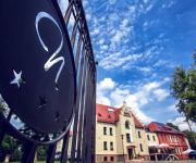
Niemcza SPA
Videos from this area
These are videos related to the place based on their proximity to this place.
OSP Przerzeczyn-Zdrój
W rolach głównych - OSP Przerzeczyn-Zdrój - OSP Piława Górna - OSP Roztocznik.
Orzel Przerzeczyn-Zdrój 6 - 1 Iskra Janówek
Mecz Serie-B Orzel Przerzeczyn-Zdrój 6 - 1 Iskra Janówek.
ORZEŁ Przerzeczyn Zdrój 2:0 LKS II Bystrzyca Górna
www.orzelprzerzeczynzdroj.futbolowo.pl www.facebook.com/orzelprzerzeczynzdroj.
Orzeł Przerzeczyn-Zdrój wygrywa turniej o Puchar Sołtysa wsi Ciepłowody
Wyniki: Ślęża Ciepłowody - Przedborowianka Przedborowa 3:0 Orzeł Przerzeczyn Zdrój - Ślęża Ciepłowody 3:2 Przedborowianka Przedborowa - Orzeł Przerezczyn Zdrój 1:6 Tabela: Orzeł...
2011-09-25 Przerzeczyn Zdr. latanie
Przerzeczyn Zdrój z lotu ptaka. Lot modelem FPV Trainer z cyber-fly.pl. Kamera Sony SuperHAD 520TVL. Nadajnik video Airwave 633TX (27dBm). Odbiornik video diversity Airwave 635RX.
NIEMCZA I SZKOŁA 70
MAŁY FRAGMENT (OKOŁO 5%) CAŁOŚCI FILMÓW PANA KAZIMIERZA DENEGI, ZA ZGODĄ WŁAŚCICIELA.
Hotel Niemcza SPA
http://www.hotelniemcza.pl Hotel Niemcza SPA *** położony u podnóża Gór Sowich (woj. dolnośląskie) w malowniczym parku ze starodrzewem to zjawiskowe miejsce. W odrestaurowanych wnętrzach.
Videos provided by Youtube are under the copyright of their owners.
Attractions and noteworthy things
Distances are based on the centre of the city/town and sightseeing location. This list contains brief abstracts about monuments, holiday activities, national parcs, museums, organisations and more from the area as well as interesting facts about the region itself. Where available, you'll find the corresponding homepage. Otherwise the related wikipedia article.
Niemcza
Niemcza is a town in Dzierżoniów County, Lower Silesian Voivodeship, in south-western Poland. It is the seat of the administrative district called Gmina Niemcza. The town lies on the Ślęza River, approximately 20 kilometres east of Dzierżoniów, and 48 kilometres south of the regional capital Wrocław. From 1975 to 1998 Niemcza was in Wałbrzych Voivodeship.
Ligota Mała, Dzierżoniów County
Ligota Mała is a village in the administrative district of Gmina Niemcza, within Dzierżoniów County, Lower Silesian Voivodeship, in south-western Poland. Prior to 1945 it was in Germany. It lies approximately 6 kilometres south of Niemcza, 20 km east of Dzierżoniów, and 54 km south of the regional capital Wrocław. The village has a population of 60.
Podlesie, Dzierżoniów County
Podlesie is a village in the administrative district of Gmina Niemcza, within Dzierżoniów County, Lower Silesian Voivodeship, in south-western Poland. Prior to 1945 it was in Germany. It lies approximately 5 kilometres south-east of Niemcza, 23 km east of Dzierżoniów, and 51 km south of the regional capital Wrocław. The village has a population of 200.
Brochocin, Ząbkowice Śląskie County
Brochocin is a village in the administrative district of Gmina Ciepłowody, within Ząbkowice Śląskie County, Lower Silesian Voivodeship, in south-western Poland. Prior to 1945 it was in Germany. It lies approximately 4 kilometres north of Ciepłowody, 14 kilometres north-east of Ząbkowice Śląskie, and 49 kilometres south of the regional capital Wrocław.
Karczowice, Lower Silesian Voivodeship
Karczowice is a village in the administrative district of Gmina Ciepłowody, within Ząbkowice Śląskie County, Lower Silesian Voivodeship, in south-western Poland. Prior to 1945 it was in Germany. It lies approximately 3 kilometres west of Ciepłowody, 10 kilometres north of Ząbkowice Śląskie, and 53 kilometres south of the regional capital Wrocław.
Kobyla Głowa, Lower Silesian Voivodeship
Kobyla Głowa is a village in the administrative district of Gmina Ciepłowody, within Ząbkowice Śląskie County, Lower Silesian Voivodeship, in south-western Poland. Prior to 1945 it was in Germany. It lies approximately 3 kilometres south-west of Ciepłowody, 9 kilometres north-east of Ząbkowice Śląskie, and 54 kilometres south of the regional capital Wrocław.
Tomice, Ząbkowice Śląskie County
Tomice is a village in the administrative district of Gmina Ciepłowody, within Ząbkowice Śląskie County, Lower Silesian Voivodeship, in south-western Poland. Prior to 1945 it was in Germany. It lies approximately 4 kilometres south-west of Ciepłowody, 8 km north of Ząbkowice Śląskie, and 55 km south of the regional capital Wrocław.
Wojsławice Arboretum
Wojsławice Arboretum is an arboretum, located in Wojsławice, Dzierżoniów County, Lower Silesian Voivodeship, in south-western Poland. It occupies area of 70 ha. The Arboretum includes 1500 different species of trees, 470 different species of Rhododendrons. It lies approximately 2 kilometres east of Niemcza and 14 kilometres east of Dzierżoniów.


