Safety Score: 3,3 of 5.0 based on data from 9 authorites. Meaning please reconsider your need to travel to Peru.
Travel warnings are updated daily. Source: Travel Warning Peru. Last Update: 2024-08-13 08:21:03
Discover Urbanización La Encantada
The district Urbanización La Encantada of in Región de San Martín is a district in Peru a little south of Lima, the country's capital city.
Looking for a place to stay? we compiled a list of available hotels close to the map centre further down the page.
When in this area, you might want to pay a visit to some of the following locations: La Molina, Lima, Callao, Vitarte and Cieneguilla. To further explore this place, just scroll down and browse the available info.
Local weather forecast
Todays Local Weather Conditions & Forecast: 20°C / 68 °F
| Morning Temperature | 18°C / 64 °F |
| Evening Temperature | 20°C / 68 °F |
| Night Temperature | 19°C / 66 °F |
| Chance of rainfall | 0% |
| Air Humidity | 74% |
| Air Pressure | 1017 hPa |
| Wind Speed | Gentle Breeze with 7 km/h (4 mph) from North |
| Cloud Conditions | Broken clouds, covering 54% of sky |
| General Conditions | Broken clouds |
Friday, 22nd of November 2024
20°C (68 °F)
19°C (66 °F)
Overcast clouds, gentle breeze.
Saturday, 23rd of November 2024
19°C (67 °F)
19°C (66 °F)
Overcast clouds, gentle breeze.
Sunday, 24th of November 2024
19°C (67 °F)
19°C (66 °F)
Overcast clouds, gentle breeze.
Hotels and Places to Stay
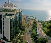
Belmond Miraflores Park
Hotel Nobility
Casa Falleri Boutique Hotel
Casa Andina Standard Miraflores San Antonio
Acuario Hotel & Suites
Killari
Miraflores Boutique Hotel
Re entals In Miraflores
Casa Fanning Apart Hotel
Nirvana
Videos from this area
These are videos related to the place based on their proximity to this place.
Campus Villa UPC: El campus más impresionante a un solo paso.
Nuevos espacios y servicios para potenciar tu talento y maximizar tu experiencia universitaria. - Un campus más grande y moderno con 51234 m2 de terreno, diseñado especialmente para satisfacer...
Venta de Departamento en Chorrillos: Cedros de Villa
Departamento con 3 dormitorios, 2 baños, sala, comedor, cocina, cochera, azotea con 1 dormitorio de servicio y baño, instalaciones para lavadora y secadora. piso de parket, con reposteros...
Aviones en exhibición en los cielos del Village Dakar - Magdalena
Avionetas acrobatas en el Dakar 2013 Perú - Lima.
Ishua 2010: Carnavales en Villa Marina
Video que muestra el ingreso de una comparsa de carnavales, tal como se realizaba antaño, en la comunidad ayacuchana de San Diego de Ishua. Las yunzas actuales son un moda traída desde las...
Pasacalle Ayacuchano Villa Alarife Kinder Blue 2011
Pasacalle Ayacuchano - Villa Alarife - Kinder Blue 2011.
Videos provided by Youtube are under the copyright of their owners.
Attractions and noteworthy things
Distances are based on the centre of the city/town and sightseeing location. This list contains brief abstracts about monuments, holiday activities, national parcs, museums, organisations and more from the area as well as interesting facts about the region itself. Where available, you'll find the corresponding homepage. Otherwise the related wikipedia article.
International Potato Center
The International Potato Center (known by its Spanish acronym CIP) is a root and tuber research-for-development institution located in Lima, Peru. It is one of 15 centers supported by CGIAR - a global agriculture research partnership, a group of about 60 donors, including national governments, international organizations and private foundations around the world.
Japanese embassy hostage crisis
The Japanese embassy hostage crisis began on 17 December 1996 in Lima, Peru, when 14 members of the Túpac Amaru Revolutionary Movement (MRTA) took hostage hundreds of high-level diplomats, government and military officials and business executives who were attending a party at the official residence of Japan's ambassador to Peru, Morihisa Aoki, in celebration of Emperor Akihito's 63rd birthday.
San Isidro District, Lima
San Isidro (Lima 27) is a district of the Lima Province in Peru, and one of the upscale districts that comprise the city of Lima. Officially established on April 24, 1930, San Isidro has become a major financial quarter in recent years, as many banks and businesses left downtown Lima to set up their headquarters in modern office blocks.
Estadio Nacional (Lima)
The Estadio Nacional of Peru is a multi-purpose stadium located in Lima, Peru. Its current capacity is 40,000 seats as stated by the Peruvian Football Federation without the lodges for some thousands more . The stadium was first inaugurated on 27 October 1952 for the 1953 South American Championship—replacing the Stadium Nacional—and is Peru's principal and national stadium. It has hosted three of the six South American Championship/Copa América football competitions held in Peru.
Barranco District
Barranco is one of 43 districts in Lima, Peru. Its current mayor is Jessica Vargas and its postal code is 04. The district is considered to be the city's most romantic and bohemian, being the home and working place of many of Peru's leading artists, musicians, designers and photographers. In the 19th-century, it was a very fashionable beach resort for the Limeño aristocracy, and many people used to spend the summer here and in neighboring Chorrillos.
Tarata bombing
The Tarata bombing was a terrorist attack in Lima, Peru, on July 16, 1992, by the Shining Path terrorist group. The blast was the deadliest Shining Path bombing during the Internal conflict in Peru and was part of a larger bombing campaign in the city. The explosions happened on Tarata Street, the business area of Miraflores Ward, an upscale district of the city. Two trucks, each packed with 1,000 kg of explosives, exploded on the street at 9:15 pm, killing 25 and wounding up to 200.
University of the Pacific (Peru)
University of the Pacific (UP) is a small private university in the Jesús María District of Lima, Peru. It was established in 1962 by a group of Peruvian entrepreneurs supported by the Society of Jesus. In the past three decades, Universidad del Pacifico has been ranked as one of the most esteemed universities in fields of economics, law, finance, accounting, and business administration in Peru and among the leading institutions of its kind in the Latin American region.
Villa María del Triunfo
Villa María del Triunfo is a district of the Lima Province in Peru. It located in the Cono Sur area of the city of Lima. Officially established as a district on December 28, 1961, the current mayor of Villa María del Triunfo is Silvia Barrera. The district's postal code is 35.
Estadio Alejandro Villanueva
Estadio Alejandro Villanueva is a stadium located in the neighborhood of Matute in La Victoria District in Lima, Peru. The stadium is the home field of the football club Alianza Lima. The stadium has a capacity of 40,000 people. It is named after former Alianza Lima player Alejandro Villanueva.
Museo Nacional de Arqueología, Antropología e Historia del Perú
The Museo Nacional de Arqueología Antropología e Historia del Perú is the largest and oldest museum in Peru, located on Plaza Bolívar in the Pueblo Libre district of Lima. The museum houses more than 100,000 artifacts spanning the entire history of human occupation in what is now Peru. Highlights include the Raimondi Stela and the Tello Obelisk from Chavín de Huantar, and an impressive scale model of the Inca citadel, Machu Picchu.
El Campo de Marte
The Campo de Marte is one of the largest parks in the metropolitan area of Lima, capital city of Peru. Similar in size to Parque de la Exposición and Parque de la Reserva. Campo de Marte originally was part of Exposición and later a horse racetrack, the Hipódromo de Santa Beatriz, in operation from 1903 to 1938.
Larco Museum
The Larco Museum (Spanish: Museo Arqueológico Rafael Larco Herrera) is a privately owned museum of pre-Columbian art, located in the Pueblo Libre District of Lima, Peru. The museum is housed in an 18th century vice-royal building built over a 7th century pre-Columbian pyramid. It showcases chronological galleries that provide a thorough overview of 4,000 years of Peruvian pre-Columbian history. It is well known for its gallery of pre-Columbian erotic pottery.
Coliseo Mariscal Caceres
The Coliseo Mariscal Caceres is a multi-purpose indoor arena situated in the Chorrillos District of Lima, Peru. It has a capacity for 7000 people. While volleyball is the principal sport played at the facility, it also hosts karate and tae kwon do events, as well as serving as a convention center. The arena is owned by the Peruvian Army.
Coliseo Eduardo Dibos
The Coliseo Eduardo Dibos is a multi-propose indoor arena located in San Borja Lima, Peru, exactly between Angamos Ave. and Aviación Ave. The arena has a capacity for 6,000 people. This arena is used to host sport events as volleyball and basketball, also many other secondary sports. It is also used for circus events and Bugs Bunny on Ice in August 2006. The Coliseo Dibos, with the Coliseo Mariscal Caceres, are the most important venues for non-football sports in Lima.
Hipódromo de Monterrico
The Hipódromo de Monterrico is a Thoroughbred horse racing facility opened in 1960 in Lima, Peru. Operated by the Jockey Club del Peru, it has a one and one-eight mile dirt racetrack with a one mile inside track for turf racing. Major races at Hipódromo de Monterrico include the four Group One races that comprise the Peruvian Quadruple Crown: 1. a :es:Polla de Potrillos (Perú) - September, 1,600 metres 1. b) :es:Polla de potrancas - September, 1,600 metres 2.
Park of the Reserve
The Park of the Reserve or the Parque de la Reserva in Spanish is a park located in downtown Lima, in Peru. Built in an irregular shape, it is located between two of the city's principal streets, the Paseo de la Republica expressway and Arequipa Avenue.
La Cruz del Viajero
La Cruz del Viajero (The Cross of the Traveller) is a monument placed by Franciscan monks in 1672 in the small town of Magdalena Vieja, just outside Lima, the capital city of Peru, and the old centre of the Spanish Empire in the Americas. This followed a tradition started by Conquistador Francisco Pizarro, requiring the placement of a cross on the main routes to other parts of the country.
Universidad San Ignacio de Loyola
The St. Ignacio de Loyola University (Spanish: Universidad San Ignacio de Loyola) (USIL) is a private university located in Lima, Perú, it was founded by businessman and politician Raúl Diez Canseco in 1993.
Teatro Peruano Japonés
The Teatro Peruano Japonés is a theatre in Lima, Peru.
Larcomar
The Larcomar is a shopping center in the Miraflores district of Lima, Peru owned by Chilean company Parque Arauco S.A. . It is frequently visited by international tourists, as well as by locals from Miraflores and other parts of Lima. It is located on Avenida Jose Larco, and it is along the cliff next to the ocean thus the name Larcomar. The Larcomar has indoor and outdoor areas. The Larcomar includes a cinema, bowling lanes, a food court, museum, tourist shops, Tony Roma's, T.G.I.
Cristo del Pacífico
Cristo del Pacífico, "the Christ of the Pacific", is a 37 metre high statue of Jesus erected in Lima, Peru, in 2011. Its erection was ordered by Alan García, the president of Peru, and described as a parting gift to the nation on occasion of his leaving office after the 2011 presidential election. It was inspired by, and has been described as a copy of, the Christ the Redeemer statue in Rio de Janeiro.
Park of the Exposition
The Park of the Exposition is a park located in the Santa Beatriz neighborhood of downtown Lima, capital of Peru.
Embassy of Colombia, Lima
The Embassy of Colombia in Lima is the diplomatic mission of the Republic of Colombia to the Republic of Peru; it is headed by the Ambassador of Colombia to Peru. It is located in the San Isidro district of Lima, precisely at Avenida Jorge Basadre Grohmann 1580 at the intersection of Los Eucaliptos.
Limatambo international airport
Limatambo international airport was the international airport of Lima until 1960, when was replaced by the Jorge Chávez International Airport. Today the terminal is the headquarter of Ministry of the Interior of Peru, and the runways are incorporated within the city as the Guardia Civil and Principal avenues
Las Palmas Air Base
Las Palmas Air Base is a military airport in the city of Lima, Peru.


