Safety Score: 3,0 of 5.0 based on data from 9 authorites. Meaning we advice caution when travelling to Panama.
Travel warnings are updated daily. Source: Travel Warning Panama. Last Update: 2024-08-13 08:21:03
Delve into Mocambo Arriba
The district Mocambo Arriba of in Provincia de Panamá is a district located in Panama a little north-west of Panama, the country's capital town.
In need of a room? We compiled a list of available hotels close to the map centre further down the page.
Since you are here already, you might want to pay a visit to some of the following locations: Alcalde Diaz, Chilibre, Panama, San Miguelito and Arraijan. To further explore this place, just scroll down and browse the available info.
Local weather forecast
Todays Local Weather Conditions & Forecast: 27°C / 81 °F
| Morning Temperature | 24°C / 74 °F |
| Evening Temperature | 25°C / 77 °F |
| Night Temperature | 24°C / 76 °F |
| Chance of rainfall | 13% |
| Air Humidity | 81% |
| Air Pressure | 1012 hPa |
| Wind Speed | Light breeze with 4 km/h (2 mph) from North-West |
| Cloud Conditions | Broken clouds, covering 65% of sky |
| General Conditions | Moderate rain |
Friday, 22nd of November 2024
27°C (81 °F)
23°C (74 °F)
Moderate rain, light breeze, overcast clouds.
Saturday, 23rd of November 2024
28°C (82 °F)
24°C (74 °F)
Light rain, gentle breeze, overcast clouds.
Sunday, 24th of November 2024
27°C (81 °F)
24°C (74 °F)
Light rain, gentle breeze, overcast clouds.
Hotels and Places to Stay
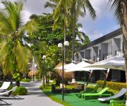
GAMBOA RAINFOREST RESORT
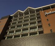
Radisson Summit Hotel and Golf Panama
RIANDE AEROPUERTO HOTEL RESORT
Novotel Panama City
WYNDHAM GARDEN PANAMA CITY
BEST WESTERN PLUS PANAMA ZEN
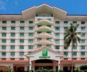
Holiday Inn PANAMA CANAL
Bienvenue chez nous
HOTEL ROMA PLAZA
The Saba Hotel
Videos from this area
These are videos related to the place based on their proximity to this place.
Residencia Las Cumbres Panama
Bella Residencia en Las cumbres con vista al lago, 14000 Mts de terreno 600 Mts,Aprox de construccion, $895000.00.
Summer Village
Summer Village es un proyecto residencial tipo PH ubicado en Milla 8, a tan solo 5 minutos de la estación del Metro de los Andes y la entrada del Corredor Norte, muy proximo al centro de la...
PROYECTO CINTA NORTEÑA
El proyecto de la Cinta Norteña conceptúa un conjunto de sistemas urbanísticos basados en una zona de reunión social, creativa y recreativa, en el que se puede pasear, leer un libro, practicar...
¡A por ellos! - teaser 3
La obra de teatro ¡A POR ELLOS! estará presentándose en el Teatro La Quadra desde el 3 de Agosto al 1 de Septiembre de 2012. Para conocer todos los detalles sobre la obra ingresa a ...
Noche de viernes - skateboardingpanama.com
Desde el Hangar 507, un viernes a la noche cualquiera con la presencia de Luis Aponte, Jerzick Oliveros, Francisco Malaga, Josue Watts, Julio Cesar Delgado, Ricauter Marengo, Angello Morales,...
Punk Monkey Floating Hostel
Don't just visit the Panama Canal - Live it! Take a virtual tour of our unique all-inclusive floating hostel - located right in the middle of the Panama Canal. Encounter monkeys, sloths, toucans...
Carreras FISC UTP
Carreras que Ofrece la Facultad de Sistemas Computacionales de la Universidad Tecnológica de Panamá.
Diablo Rojo on Via Espana in Panama City
Diablos Rojo-Red Devil buses zooming along Via Espana in the Bella Vista area of Panama City. March 2012 January 2011 video: PANAMA: Last Days of the Diablo Rojo Bus ...
Videos provided by Youtube are under the copyright of their owners.
Attractions and noteworthy things
Distances are based on the centre of the city/town and sightseeing location. This list contains brief abstracts about monuments, holiday activities, national parcs, museums, organisations and more from the area as well as interesting facts about the region itself. Where available, you'll find the corresponding homepage. Otherwise the related wikipedia article.
Panama City
Panama City (Spanish: Panamá) is the capital and largest city of the Republic of Panama. It has a population of 880,691, with a total metro population of 1,272,672, and it is located at the Pacific entrance of the Panama Canal, in the province of Panama. The city is the political and administrative center of the country as well as a hub for international banking and commerce. It is considered a Beta - World City and one of three Central American cities listed in this category.
Panama Canal Railway
The Panama Canal Railway Company is a railway line that links the Atlantic Ocean to the Pacific Ocean across Panama in Central America. It is jointly owned by Kansas City Southern and Mi-Jack Products. The route stretches 47.6 miles across the Isthmus of Panama from Colón (Atlantic) to Balboa.
San Miguelito District
San Miguelito is a city and district (distrito) of Panamá Province in Panama. The population according to the 2000 census was 293,745. The district covers a total area of 50 km². San Miguelito separates Panama City and Colon and it is included in the Panama City Metropolitan Area. Soccer player Luis Tejada was born in San Miguelito and both Blas Pérez and Kevin Kurányi were once residents of the district.
Miraflores (Panama)
Miraflores is the name of one of the three locks that form part of the Panama Canal and the name of the small lake that separates these locks from the Pedro Miguel Locks upstream. In the Miraflores locks, vessels are lifted (or lowered)Bad rounding here{{#invoke:Math|precision_format| 16.5*1/0.3048 | 1-1 }} feet (16.5 m) in two stages, allowing them to transit to or from the Pacific Ocean port of Balboa. Ships cross below the Puente de las Américas which connects North and South America.
Centennial Bridge, Panama
Panama's Centennial Bridge is a major bridge crossing the Panama Canal. It was built to supplement the overcrowded Bridge of the Americas, and to replace it as the carrier of the Pan-American Highway; upon its opening in 2004, it became only the second permanent crossing of the canal.
Estadio Nacional de Panamá
Estadio Nacional de Panama, also called Rod Carew Stadium, is a multi-purpose stadium in Panama City, Panama. The stadium has a capacity of 27,000 and was built in 1999. It is currently used mostly for baseball matches from the national league, and Panama national baseball team matches. http://www. worldstadiums. com/middle_america/countries/panama. shtml It has also hosted many international baseball competitions as well as many concerts and different types of events.
Panama Canal expansion project
The expansion of the Panama Canal (Third Set of Locks Project) is a project that will double the capacity of the Panama Canal by 2015 by allowing more and larger ships to transit. Then-Panamanian President Martín Torrijos presented the plan on April 24, 2006, and Panamanian citizens approved it in a national referendum by 76.8 percent of the vote on October 22, 2006. The project creates a new lane of traffic along the canal by constructing a new set of locks.
Diablo, Panama
Diablo was one of many townships in the Panama Canal Zone. It was established in 1905 by William Luke Jenkins. It was located directly across from the entrance to Albrook AFB, on a low hill overlooking the canal just past Balboa Harbor. The Diablo clubhouse was a center for social activity, and included a restaurant and a number of other services.
Albrook Air Force Station
Albrook Air Force Station is a former United States Air Force facility in Panama. It was closed on 30 September 1997 as a result of the Torrijos-Carter Treaties which specified that United States military facilities in the former Panama Canal Zone be closed and the facilities be turned over to the Panamanian government. It was located on the east side of the Panama Canal just south of Fort Clayton and north of the township of Balboa, Panama.
University of Panama
The University of Panama was founded on October 7, 1935, with a student body of 175 in the fields of Education, Commerce, Natural Sciences, Pharmacy, Pre-Engineering and Law. As of 2008, it maintains a student body of 74,059 distributed in 228 buildings around the country. The University of Panama was founded under the administration of the President of the Republic, Dr. Harmodio Arias Madrid. Its founder and first President was the distinguished citizen Dr. Octavio Méndez Pereira.
Paraíso, Panama
Paraíso is a town in the Republic of Panama, located just north of the Panama Canal's Pedro Miguel Locks. It was a vibrant township of the old Canal Zone, though it was segregated for most of its history.
Fort Clayton
Fort Clayton was a United States Army base in the former Panama Canal Zone, later part of the Republic of Panama. Fort Clayton was located northwest of Balboa, Panama, with the Panama Canal located nearby. It closed in 1999 pursuant to the Torrijos-Carter Treaties. The Southern Command Network and 193rd Infantry Brigade were both headquartered there, as was the headquarters of United States Army South prior to its relocation to Fort Buchanan, Puerto Rico.
Estadio Bernardo Gil
Estadio Bernardo "Candela" Gil is a Football stadium in San Miguelito, Panamá which hosts ANAPROF team Sporting San Miguelito, Chepo F.C. and Plaza Amador and Primera A teams Orión and Paraiso F.C.. The stadium was formerly known as 'Estadio 28 de Diciembre which had a small 90x57 meter field of mixed sand and gravel, which made it hard for players to compete and therefore could not be used for ANAPROF games.
Corozal American Cemetery and Memorial
Corozal American Cemetery and Memorial is located approximately 3 miles north from Panama City, Panama in the city of Corozal and is the location of 5,336 American veterans and others. A paved walk leads from the Visitor Center to a small memorial that sits atop a knoll overlooking the graves area. The memorial was established in 1923 by Congress to remember people that served overseas since 1917.
Estadio Camping Resort
Estadio Camping Resort is a Football stadium in Chilibre, Panamá who hosts ANAPROF team Alianza F.C. since 2001.
Soberanía National Park
Soberanía National Park (Parque Nacional Soberanía) is a national park in Panama near the banks of the Panama Canal in the provinces of Panamá and Colón, some 25 kilometres from Panama City. The Chagres River runs through the park. Established as a national park in 1980, the park covers 55,000 acres . The park is popular with birdwatchers due to the abundance of bird species in the park, including motmots, toucans, trogons, flycatchers, antbirds, woodpeckers, tanagers, and hawks.
Estadio Javier Cruz
Estadio Javier Cruz 'Artes y Oficios' is a multi-purpose stadium. It located at the corner of Ricardo J. Alfaro Avenue and Vía Simón Bolivar in Panama City, Republic of Panama; close to Colegio de Artes Y Oficios Melchor Lasso de La Vega, from which it has received part of his name. It is currently used mostly for football matches and is the home stadium of Chorrillo F.C. and Plaza Amador from the Liga Panameña de Futbol. The stadium holds 2,500 spectators.
Technological University of Panama
The Technological University of Panama, Universidad Tecnológica de Panamá (UTP) in Spanish, is the second largest university in Panama. It is a state university comprising six faculties in seven campuses nationwide. The main campus is a 60-hectare piece of land located in Panama City, the country’s capital city.
Parque Municipal Summit
The Parque Municipal Summit (Summit Municipal Park) is a botanical garden and a zoo of 250 hectares in total area (of which 55 hectares belong to the botanical garden), which is located on the outskirts of Panama City at about kilometer 18 on the road leading to Gamboa.
Anton Army Airfield
Anton Army Airfield is a former United States Army Air Forces World War II airfield in Panama used as an auxiliary of Howard Field as part of the defense of the Panama Canal. Wartime units assigned to the station were: 30th Fighter Squadron, 3 January-10 February 1943 (P-40 Warhawk) 29th Bombardment Squadron, 29 March-13 May 1943 (Northrup A-17 Nomad) Today there is little or no trace of the airfield.
Universidad Católica Santa María La Antigua
The Universidad Católica Santa María La Antigua (USMA), is a private university in Panama City, Panama. The institution was created as the first private university of Panama, starting on May 27, 1965. Its academic activities started with 232 students on 9 careers and 21 professors. Today the university has about 25,000 former students, 3,000 students, 500 professors and more than 80 academic programs from undergraduate to post graduate and four regional centers spread across the country.
Florida State University-Panama
Florida State University-Panama, or FSU-Panama is an international branch campus of Florida State University located on the isthmus of Panama. FSU has operating a broad curriculum program in Panama City of the Republic of Panama for over 50 years.
Metropolitan Natural Park
Metropolitan Natural Park (Parque Natural Metropolitano) is a park in Panama City, Panama. It is the only wildlife refuge in the city. Wildlife found in the park include bird species and Geoffroy's Tamarin. The park was first proposed in 1974 and was inaugurated on June 5, 1988.
Panama Metro
The Panamá Metro is a transport project in Panama City, in Panama, planned to open in January 2014.
Latin American University of Science and Technology
The Latin American University of Science and Technology-Laureate International Universities (ULACIT-LIU) is a private university located in Panama City, Panama. Through Resuelto (Legal Order) N°3 del 7 de mayo de 1991, the Ministry of Education of Panama, under supervision of the University of Panama, approved the foundation of ULACIT.


