Safety Score: 3,0 of 5.0 based on data from 9 authorites. Meaning we advice caution when travelling to Panama.
Travel warnings are updated daily. Source: Travel Warning Panama. Last Update: 2024-08-13 08:21:03
Explore Tubusinica
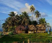
Tubusinica in Guna Yala is located in Panama about 55 mi (or 89 km) north-east of Panama, the country's capital.
Local time in Tubusinica is now 06:27 PM (Thursday). The local timezone is named America / Panama with an UTC offset of -5 hours. We know of 8 airports in the wider vicinity of Tubusinica, of which one is a larger airport. The closest airport in Panama is San Blas Airport in a distance of 7 mi (or 11 km), West. Besides the airports, there are other travel options available (check left side).
There are two Unesco world heritage sites nearby. The closest heritage site in Panama is Fortifications on the Caribbean Side of Panama: Portobelo-San Lorenzo in a distance of 37 mi (or 60 km), East. If you need a place to sleep, we compiled a list of available hotels close to the map centre further down the page.
Depending on your travel schedule, you might want to pay a visit to some of the following locations: El Porvenir, Canita, Santa Isabel, Palmira and Las Margaritas. To further explore this place, just scroll down and browse the available info.
Local weather forecast
Todays Local Weather Conditions & Forecast: 27°C / 81 °F
| Morning Temperature | 24°C / 75 °F |
| Evening Temperature | 25°C / 77 °F |
| Night Temperature | 24°C / 75 °F |
| Chance of rainfall | 3% |
| Air Humidity | 83% |
| Air Pressure | 1012 hPa |
| Wind Speed | Gentle Breeze with 6 km/h (4 mph) from North |
| Cloud Conditions | Overcast clouds, covering 86% of sky |
| General Conditions | Light rain |
Thursday, 21st of November 2024
28°C (83 °F)
23°C (74 °F)
Moderate rain, light breeze, overcast clouds.
Friday, 22nd of November 2024
27°C (80 °F)
23°C (73 °F)
Light rain, light breeze, overcast clouds.
Saturday, 23rd of November 2024
28°C (83 °F)
23°C (74 °F)
Moderate rain, calm, broken clouds.
Hotels and Places to Stay
Hotel Cabañas Coco Blanco
Hotel Porvenir
Videos from this area
These are videos related to the place based on their proximity to this place.
Pista de aterrizaje El Porvenir, San Blas, Panamá
Fotos: Cherlinda Arias. Isla El Porvenir, San Blas (Kuna Yala). Lugar para disfrutar las playas, animales marinos, paisajes hermosos del área marina.
Taking off 9 Passenger Britten Norman BN2/Islander, El Porvenir,Kuna Yala, Panama
Taking off 9 Passenger Britten Norman BN2/Islander, El Porvenir,Kuna Yala, Panama.
s-214
Passengers board plane at Porvenir Airport near Wichubualá island in San Blas (Kuna Yala) Panama.
worlds smallest habited paradise island in panama
probably the smallest habited island in the world in kuna yala (san blas) panama. a kuna indian family lives here.
ISLA ARENA, ISLA AGUJA, ISLAS DE SAN BLAS TOUR X VILLA MICHELLE GUIA TURISTICA Y HOTEL EN PANAMA
ISLA ARENA, ISLA AGUJA, ISLAS DE SAN BLAS, ISLAS DE PANAMA, PANAMA TOURS x VILLA MICHELLE UNA GUIA DE TURISMO Y UN LUJOSO HOSPEDAJE EN PANAMA. En Panamá hay ...
SAN BLAS BEACHES TOUR X VILLA MICHELLE A TRAVEL GUIDE AND HOTEL IN PANAMA
SAN BLAS BEACHES, PANAMA BEACHES TOURS X VILLA MICHELLE A TOUR GUIDE AND ACCOMMODATION IN PANAMA. YOU WANT TO MAKE TOURISM IN PANAMA. YOU COME FROM A ...
SAN BLAS ISLANDS BY CAR TOUR X VILLA MICHELLE A TRAVEL GUIDE AND HOTEL IN PANAMA
Las islas de San Blas de Panamá son un archipiélago de 365 islas de la costa del norte del istmo de Panama, al este del Canal de Panamá. Hogar a los indios de Kuna, son una parte del Comarca...
Videos provided by Youtube are under the copyright of their owners.
Attractions and noteworthy things
Distances are based on the centre of the city/town and sightseeing location. This list contains brief abstracts about monuments, holiday activities, national parcs, museums, organisations and more from the area as well as interesting facts about the region itself. Where available, you'll find the corresponding homepage. Otherwise the related wikipedia article.
Soledad Miria
Soledad Miria is a small Caribbean island of Panama with 1,014 inhabitants, lying at {{#invoke:Coordinates|coord}}{{#coordinates:9|26|42|N|78|53|59.63|W| | |name= }}. The island is only 700 metres long but is densely populated. At approximately 9:30 pm on December 26, 2006, a fire started by the explosion of a gas cooker destroyed 39 buildings within 10 minutes, approximately half of those on the island. 348 people were injured, but none died. The island was left with no potable water.


