Safety Score: 4,0 of 5.0 based on data from 9 authorites. Meaning please reconsider your need to travel to Palestinian Territory.
Travel warnings are updated daily. Source: Travel Warning Palestinian Territory. Last Update: 2024-08-13 08:21:03
Delve into Silwān
The district Silwān of in West Bank is a district located in Palestinian Territory and is a district of the nations capital.
In need of a room? We compiled a list of available hotels close to the map centre further down the page.
Since you are here already, you might want to pay a visit to some of the following locations: Jerusalem, Jericho, Ash Shunah al Janubiyah, Ramla and Karney Shomron. To further explore this place, just scroll down and browse the available info.
Local weather forecast
Todays Local Weather Conditions & Forecast: 18°C / 65 °F
| Morning Temperature | 14°C / 57 °F |
| Evening Temperature | 18°C / 65 °F |
| Night Temperature | 16°C / 61 °F |
| Chance of rainfall | 0% |
| Air Humidity | 42% |
| Air Pressure | 1019 hPa |
| Wind Speed | Moderate breeze with 10 km/h (6 mph) from West |
| Cloud Conditions | Clear sky, covering 0% of sky |
| General Conditions | Sky is clear |
Sunday, 24th of November 2024
16°C (61 °F)
8°C (47 °F)
Light rain, strong breeze, few clouds.
Monday, 25th of November 2024
7°C (45 °F)
7°C (45 °F)
Light rain, fresh breeze, overcast clouds.
Tuesday, 26th of November 2024
7°C (45 °F)
6°C (43 °F)
Light rain, gentle breeze, overcast clouds.
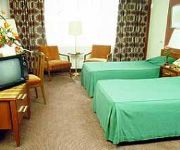
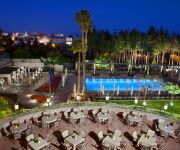
Hotels and Places to Stay
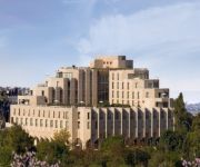
Inbal Jerusalem Hotel
The David Citadel Hotel
7 Arches Jerusalem
DAN PANORAMA JERUSALEM
Mamilla
The King David Jerusalem
Eldan Hotel Jerusalem
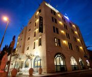
Dan Boutique Jerusalem
DAN BOUTIQUE JERUSALEM
Notre Dame Center of Jerusalem
Videos from this area
These are videos related to the place based on their proximity to this place.
JERUSALEM, OUTSIDE THE OLD CITY
Uno sguardo verso la valle di Cedron, situata tra la Città Vecchia di Gerusalemme e il Monte degli Ulivi. Il nome "Cedron", in ebraico "Qidròn", significa "oscuro", poiché originariamente...
Вебкамера Израиль Иерусалим (Israel Jerusalem)
Вебкамера Израиль Иерусалим (Israel Jerusalem) http://travel-cam.net.
Jerusalem Tourists
Bob gave us a great tour of the old City if Jerusalem, than we visited Yad Vashim, the Holocaust museum.
City of David, Jerusalem - the remains of King David's Palace, the Citadel of Zion ?
Zahi Shaked A tour guide in Israel and his camera zahigo25@walla.com 9726905522 tel סיור עם מורה הדרך ומדריך הטיולים צחי שקד 0546905522.
Givati Parking Lot dig, City of David, Jerusalem - Have we found the palace of Queen Helena?
Zahi Shaked A tour guide in Israel and his camera zahigo25@walla.com 9726905522 tel סיור עם מורה הדרך ומדריך הטיולים צחי שקד 0546905522 My name is Zahi...
New in the City of David, Jerusalem. A presentation of light & color in the Canaanite pool (3800 BC)
Zahi Shaked A tour guide in Israel and his camera zahigo25@walla.com 9726905522 tel סיור עם מורה הדרך ומדריך הטיולים צחי שקד 0546905522 My name is Zahi...
City of David. The Old City of Jerusalem - Herodian Road From Shiloah Pool to the Western Wall
Zahi Shaked A tour guide in Israel and his camera zahigo25@walla.com 9726905522 tel סיור עם מורה הדרך ומדריך הטיולים צחי שקד 0546905522.
City of David, Jerusalem - a view of the ancient cemetery of Jerusalem during the First Temple.
Zahi Shaked A tour guide in Israel and his camera zahigo25@walla.com 9726905522 tel סיור עם מורה הדרך ומדריך הטיולים צחי שקד 0546905522 My name is Zahi...
City of David - the sewage canal that built Herod the Great. Soon we will touch the Western Wall
Zahi Shaked A tour guide in Israel and his camera zahigo25@walla.com +972-54-6905522 tel סיור עם מורה הדרך ומדריך הטיולים צחי שקד 0546905522 My name is...
City of David - Herodian Road From Shiloah Pool to the Western Wall and the Jewish Temple
Zahi Shaked A tour guide in Israel and his camera zahigo25@walla.com 9726905522 tel סיור עם מורה הדרך ומדריך הטיולים צחי שקד 0546905522 My name is Zahi...
Videos provided by Youtube are under the copyright of their owners.
Attractions and noteworthy things
Distances are based on the centre of the city/town and sightseeing location. This list contains brief abstracts about monuments, holiday activities, national parcs, museums, organisations and more from the area as well as interesting facts about the region itself. Where available, you'll find the corresponding homepage. Otherwise the related wikipedia article.
Oskar Schindler
Oskar Schindler (28 April 1908 – 9 October 1974) was an ethnic German industrialist, German spy, and member of the Nazi party who is credited with saving the lives of over 1,200 Jews during the Holocaust by employing them in his enamelware and ammunitions factories, which were located in what is now Poland and the Czech Republic respectively.
Akeldama
Aceldama or Akeldama is the Aramaic name for a place in Jerusalem associated with Judas Iscariot, one of the followers of Jesus. The earth in this area is composed of rich clay and was formerly used by potters. For this reason the field was known as the Potter's Field. The clay had a strong red colour, which may be the origin of the modern name. More recently it was used as a burial place for non-Jews. It was used for this purpose up to the first quarter of the 19th century.
Pool of Siloam
Pool of Siloam (Breikhat Hashiloah) is a rock-cut pool on the southern slope of the City of David, the original site of Jerusalem, located outside the walls of the Old City to the southeast. The pool was fed by the waters of the Gihon Spring, carried there by two aqueducts.
City of David
The City of David is the oldest settled neighborhood of Jerusalem and a major archaeological site due to recognition as biblical Jerusalem. It is a narrow ridge running south from the Temple Mount. It was a walled city in the Bronze Age and, according to tradition, it is the place where King David built his palace and established his capital.
Zion
Zion (also transliterated Sion, Tzion or Tsion) is a place name often used as a synonym for Jerusalem. The word is first found in Samuel II, 5:7 dating to c.630–540 BCE according to modern scholarship. It commonly referred to a specific mountain near Jerusalem, on which stood a Jebusite fortress of the same name that was conquered by David and was named the City of David.
Names of Jerusalem
Names of Jerusalem refers to the multiple names by which the city of Jerusalem has been known and the etymology of the word in different languages. According to the Jewish Midrash, "Jerusalem has 70 names". Lists have been compiled of 72 different Hebrew names for Jerusalem in Jewish scripture. Today, Jerusalem is called Yerushalyim in Hebrew.
Siloam
Siloam is an ancient site in Jerusalem, south of the Old City. According to the Hebrew Bible, Siloam was built around the "serpent-stone", Zoheleth, where Adonijah gave his feast in the time of Solomon. It is the site of the Pool of Siloam and the Tower of Siloam, both mentioned in the New Testament.
Large Stone Structure
The Large Stone Structure is the name given to the remains of a large public building in the City of David neighborhood of central Jerusalem, south of the Old City, tentatively dated to 10th to 9th century BCE. The name was given to the structure, as a result of its proximity with another site known as the Stepped Stone Structure, by the discoverer of the site, Eilat Mazar.
Gihon Spring
For the river mentioned in Genesis, see Gihon. The Gihon Spring was the main source of water for the City of David, the original site of Jerusalem. One of the world's major intermittent springs - and a reliable water source that made human settlement possible in ancient Jerusalem - the spring was not only used for drinking water, but also initially for irrigation of gardens in the adjacent Kidron Valley which provided a food source for the ancient settlement.
Tomb of Zechariah
The Tomb of Zechariah is an ancient stone monument adjacent to the Bnei Hazir tomb.
Hezekiah's Tunnel
Hezekiah's Tunnel, or the Siloam Tunnel is a tunnel that was dug underneath the City of David in Jerusalem in ancient times. Its popular name is due to the most common hypothesis of its origin, namely that it dates from the reign of Hezekiah of Judah (late 8th and early 7th century BCE) and corresponds to the waterworks mentioned in 2 Kings 20:20 in the Bible.
Solomon's Stables
Solomon's Stables or Marwani Prayer Hall is an underground vaulted space now used as a Muslim prayer hall, some 600 square yards (500 square metres) in area, at the bottom of stairs which lead down from the al-Aqsa Mosque, under the Temple Mount, to the base of the southern wall of the Temple Mount in Jerusalem. Solomon's Stables are located under the southeastern corner of the Temple Mount, 12½ metres below the courtyard and feature twelve rows of pillars and arches.
Dung Gate
The Dung Gate is one of the gates in the walls of the Old City of Jerusalem. The gate is situated near the southeast corner of the old city, southwest of the Temple Mount. The gate is the closest to the Western Wall and is a main passage for vehicles. It was originally much smaller, but was enlarged in 1952, after the Old City came under Jordanian control in 1948. After its capture by Israel in 1967, architect Shlomo Aronson was commissioned to renovate this gate.
Acra (fortress)
The Acra, was a fortified compound in Jerusalem built by Antiochus Epiphanes, ruler of the Seleucid Empire, following his sack of the city in 168 BCE. The fortress played a significant role in the events surrounding the Maccabean Revolt and the formation of the Hasmonean Kingdom. It was destroyed by Simon Maccabeus during this struggle. The exact location of the Acra, critical to understanding Hellenistic Jerusalem, remains a matter of ongoing discussion.
Warren's Shaft
Warren's Shaft is an archaeological feature in Jerusalem discovered in 1867 by British engineer Sir Charles Warren (1840–1927). It runs from within the old city to a spot near the Gihon Spring, and after its 19th-century discovery was thought to have been the centrepiece of the city's early water supply system, since it would have enabled the city's occupants to safely reach fresh water in times of siege.
Huldah Gates
The Huldah Gates are the two sets of now-blocked gates in the Southern Wall of the Temple Mount, situated in Jerusalem's Old City. The western set is a double arched gate (the double gate), and the eastern is a triple arched gate (the triple gate).
Church of St. Peter in Gallicantu
The Church of Saint Peter in Gallicantu is a Roman Catholic church located on the eastern slope of Mount Zion, just outside the Old (walled) City of Jerusalem.
Abu Tor
Abu Tor (lit. "Father of the Bull") is a mixed Jewish and Arab neighborhood in East Jerusalem, south of the Old City.
Silwan
Silwan is a predominantly Palestinian neighborhood on the outskirts of the Old City of Jerusalem. Forty Jewish families also live in the area. Silwan is located in East Jerusalem. After 1948 Palestine War, the village fell under Jordanian occupation. Jordanian rule lasted until the 1967 Six-Day War after which it was occupied and later annexed by Israel. Silwan is under the administrative jurisdiction of the Jerusalem Municipality.
Ophel
The Ophel or Ophlas, meaning fortified hill or risen area, is the biblical name given to a certain part of a settlement or city that is elevated from its surroundings. In the bible the Ophel refers to the elevation in two cities: the City of David in the Old City of Jerusalem, and at Samaria, the ancient capital of the Kingdom of Israel. Ernest L.
Siebenberg House
Siebenberg House is a museum below a house on 5 Beit HaShoeva Alley in the Old City of Jerusalem Theo and Miriam Siebenberg bought the house in 1970 and Theo was convinced that it was built over significant archaeological remains. But archaeologists were skeptical, so he conducted and financed the excavations himself.
Ras al-Amud
Ras al-Amud is a Palestinian neighborhood in East Jerusalem, located southeast of the Old City, overlooking Silwan to the south, Abu Dis and al-Eizariya to the east, and the Temple Mount (known to Arabs as Haram ash-Sharif) to the north. There were about 11,922 Palestinians living in the neighborhood in 2003.
Southern Wall
The Southern Wall is a wall at the southern end of the Temple Mount and the former southern side of the Second Temple in Jerusalem. It was built during King Herod's expansion of the Temple Mount platform southward on to the Ophel.
Royal Stoa (Jerusalem)
The Royal Stoa was an ancient basilica constructed by Herod the Great during his renovation of the Temple Mount at the end of the 1st century BCE. Probably Herod's most magnificent secular construction, the three-aisled structure was described by Josephus as deserving "to be mentioned better than any other under the sun. " A center of public and commercial activity, the Royal Stoa was the likely location of Jesus' Cleansing of the Temple.
Ma'ale ha-Zeitim
Ma'ale ha-Zeitim is a Jewish neighborhood on the Mount of Olives in East Jerusalem, near the Arab neighborhood of Ras al-Amud.


