Safety Score: 4,0 of 5.0 based on data from 9 authorites. Meaning please reconsider your need to travel to Palestinian Territory.
Travel warnings are updated daily. Source: Travel Warning Palestinian Territory. Last Update: 2024-08-13 08:21:03
Delve into Shu‘fāţ
Shu‘fāţ in West Bank is a town located in Palestinian Territory about 3,181 mi (or 5,119 km) north-east of , the country's capital town.
Time in Shu‘fāţ is now 11:28 PM (Friday). The local timezone is named Asia / Hebron with an UTC offset of 2 hours. We know of 11 airports closer to Shu‘fāţ, of which 5 are larger airports. The closest is airport we know is Ben Gurion International Airport in Israel in a distance of 24 mi (or 39 km). Besides the airports, there are other travel options available (check left side).
There are several Unesco world heritage sites nearby. The closest heritage site in Palestinian Territory is Birthplace of Jesus: Church of the Nativity and the Pilgrimage Route, Bethlehem in a distance of 8 mi (or 13 km), South. We saw 8 points of interest near this location. In need of a room? We compiled a list of available hotels close to the map centre further down the page.
Since you are here already, you might want to pay a visit to some of the following locations: Jerusalem, Jericho, Karney Shomron, Ramla and Ash Shunah al Janubiyah. To further explore this place, just scroll down and browse the available info.
Local weather forecast
Todays Local Weather Conditions & Forecast: 21°C / 69 °F
| Morning Temperature | 14°C / 56 °F |
| Evening Temperature | 19°C / 65 °F |
| Night Temperature | 14°C / 58 °F |
| Chance of rainfall | 0% |
| Air Humidity | 39% |
| Air Pressure | 1015 hPa |
| Wind Speed | Moderate breeze with 11 km/h (7 mph) from South-East |
| Cloud Conditions | Clear sky, covering 4% of sky |
| General Conditions | Sky is clear |
Saturday, 16th of November 2024
19°C (66 °F)
14°C (57 °F)
Scattered clouds, moderate breeze.
Sunday, 17th of November 2024
19°C (66 °F)
15°C (59 °F)
Overcast clouds, gentle breeze.
Monday, 18th of November 2024
17°C (63 °F)
13°C (56 °F)
Light rain, fresh breeze, clear sky.
Hotels and Places to Stay
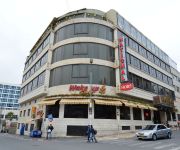
DAN JERUSALEM
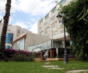
Addar
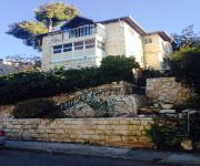
American Colony Hotel
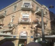
Commodore Hotel
National Hotel Jerusalem
Ambassador Jerusalem
ibis Styles Jerusalem Sheikh Jarrah
JERUSALEM INN
House 57
Habira
Videos from this area
These are videos related to the place based on their proximity to this place.
Second Temple Period Quarry Excavated in Jerusalem
Within the framework of an excavation project the Israel Antiquities Authority is conducting prior to the construction of Highway 21 by the Moriah Company, an enormous quarry dating to the...
Matzoh Baking 2012
Shiur Gimel of Yeshivas Chemdas Hatorah of Ramat Beit Shemesh A visits the "Brisker Chabura" run of matzos at a factory in Jerusalem Israel on 13-Mar-12.
ירושלים - רמת שלמה. אחד מתוך 17העתקים בעולם של מרכז חסידות חבד (770), ובית הרבי מליובאוויטש.
Zahi Shaked A tour guide in Israel and his camera zahigo25@walla.com 9726905522 tel סיור עם מורה הדרך ומדריך הטיולים צחי שקד 0546905522 My name is Zahi...
Jerusalem streets drive
Drive on streets Ezra, Nehemiah and Zephaniah in Jerusalem. January 1, 2010.
13.12.2013 Jerusalem, Pisgat Ze'ev, Snow
Israel, Jerusalem, Pisgat Ze'ev, Snow Израиль, снег в Иерусалиме צלם: ודים מיכיילוב Photohrapher: Vadim Mikhailov 0547-400212 072-2126424 www.vadimm.com.
Jerusalem LRT returns to service after the arab riots
The Palestinians destroyed 2 tram stations, tried to saw the tracks and the catenary poles. For now the service in this area is conducted without signaling and communications.
איפה הספרייה?
לפני חצי שנה נפתחה בפסגת זאב ספרייה חדשה, אלא שדבר אחד שכחו לשים שם, שלט. אורי ארליך הלך לאיבוד במדור הגיאוגרפ...
Путешествие по Израилю. Израильский цикл. 480p.
Фильм-путешествие абхазского журналиста Мананы Кокоскир по Израилю. Библейская история Израиля. Сегодняшн...
Videos provided by Youtube are under the copyright of their owners.
Attractions and noteworthy things
Distances are based on the centre of the city/town and sightseeing location. This list contains brief abstracts about monuments, holiday activities, national parcs, museums, organisations and more from the area as well as interesting facts about the region itself. Where available, you'll find the corresponding homepage. Otherwise the related wikipedia article.
Gibeah
Gibeah is a place name appearing in several books of the Bible. It is generally identified with a hill in Jerusalem, on the outskirts of the Pisgat Ze'ev and Shuafat neighborhoods, known as Tell el-Ful. However, this identification was challenged by Israel Finkelstein in 2011.
French Hill
For the community in California, see French Hill, California. French Hill, also Giv'at Shapira is a neighborhood in northern East Jerusalem. It is located on territory occupied during the Six-Day War in 1967, later annexed to Israel under the Jerusalem Law in 1980. The United Nations Security Council declared this law a violation of international law, and states that the Council will not recognize this law, and calls on member states to accept the decision of the council.
Shuafat
Shu'fat, also Shuafat and Sha'fat, is a Palestinian Arab neighborhood of East Jerusalem, forming part of north-eastern Jerusalem. Located on the old Jerusalem-Ramallah road about three miles north of the Old City, Shu'fat has a population of 35,000 residents. The Shu'fat refugee camp, established in 1965, just north of Jerusalem. It is located on the traditional lands of the town of Shu'fat.
Battle of Ammunition Hill
Ammunition Hill was a military post in the northern part of Jordanian controlled East Jerusalem, and the site of one of the fiercest battles of the Six-Day War.
Ramat Eshkol
Ramat Eshkol is a neighborhood in north-eastern Jerusalem. It was built on land captured from Jordan in the Six-Day War and was the first neighborhood built in East Jerusalem after the Six-Day War in 1967. The international community considers Israeli settlements in East Jerusalem illegal under international law, but the Israeli government disputes this.
Ramat Shlomo
Ramat Shlomo is a large Jewish housing development in northern East Jerusalem. The population, mostly ultra-Orthodox, is 18,000-20,000. Ramat Shlomo was built on land formerly occupied by Jordan from 1948 through 1967 and captured by Israel in the 1967 Six-Day War and occupied since. In a move ruled null and void by the UN Security Council, Israel subsequently unilaterally annexed East Jerusalem and surrounding areas.
Sultan Ibrahim Ibn Adham Mosque
The Sultan Ibrahim Ibn Adham Mosque is the largest mosque in the Palestinian town of Beit Hanina, located northeast of Jerusalem. It is named after a Muslim who lived in the town and worked as collector of olive products. An engraving in a stone in front of the mosque reads, "this mosque was built by Suwaid Abul Hamayel in the year 336 after Hijrah". The area of the mosque was expanded in 1938 by the residents of Beit Hanina. In 1993, a boys primary school was built alongside the mosque.
Sanhedria Murhevet
Sanhedria HaMurhevet is a Haredi neighborhood in Jerusalem, Israel. Its name translates as "expanded Sanhedria". The neighborhood was founded in 1970 as a northern expansion of Sanhedria. The neighborhood is horseshoe-shaped. As of 2007 it has 784 residences. The neighborhood is closed to automobile traffic on Shabbat and Jewish holidays. Sanhedria Murhevet is home to Yeshivat Tiferet Zvi, Yeshiva Toras Moshe, Yeshiva Chofetz Chaim, the Jerusalem Kollel, and Kollel Meshech Chochma.
Givat HaMivtar
Givat HaMivtar is a Jewish neighborhood in northern Jerusalem established in 1970 between Ramat Eshkol and French Hill. It is located on a hill where an important battle took place in the Six Day War. Archaeological excavations have revealed important ancient Jewish tombs in the region. Givat Hamivtar was one of the first "Build Your Own Home" neighborhoods in Jerusalem.
Royal Palace, Tell el-Ful
The Royal Palace at Tell el-ful stands near Beit Hanina, atop a hill named Tell el-Ful . It was intended to be a summer residence for King Hussein of Jordan, who had controlled Jerusalem and the rest of the West Bank by annexing the territory after the 1948 Arab-Israeli War. Construction started in the mid-1960s, but was interrupted when Israel captured the area during the 1967 War. Still owned by the Hashemite Kingdom, it remains today as found in 1967, an unfinished shell.
Jerusalem Road 20
Jerusalem Road 20, is the designation of a combination of existing roads and new construction creating a continuous route between Jerusalem's Begin Highway (Highway 50) and Pisgat Ze'ev via Beit Hanina. The final cost expected to be NIS 150 million and be completed by April 2013.
Jerusalem Road 21
Jerusalem Road 21, is the designation of a new road beginning at Highway 1 between Ramat Shlomo and Shu'afat northward to Beit Hanina and the Atarot Industrial Park. Plans call for a boulevard with two lanes in each direction. Construction is expected to cost NIS 112 million and be completed by January 2015.


