Safety Score: 4,0 of 5.0 based on data from 9 authorites. Meaning please reconsider your need to travel to Palestinian Territory.
Travel warnings are updated daily. Source: Travel Warning Palestinian Territory. Last Update: 2024-08-13 08:21:03
Discover Khirbat Ţablīyah
Khirbat Ţablīyah in West Bank is a place in Palestinian Territory about 3,177 mi (or 5,112 km) north-east of , the country's capital city.
Current time in Khirbat Ţablīyah is now 02:44 AM (Saturday). The local timezone is named Asia / Hebron with an UTC offset of 2 hours. We know of 11 airports near Khirbat Ţablīyah, of which 5 are larger airports. The closest is airport we know is Ben Gurion International Airport in Israel in a distance of 26 mi (or 42 km). Besides the airports, there are other travel options available (check left side).
There are several Unesco world heritage sites nearby. The closest heritage site in Palestinian Territory is Birthplace of Jesus: Church of the Nativity and the Pilgrimage Route, Bethlehem in a distance of 2 mi (or 4 km), South. We encountered 8 points of interest in the vicinity of this place. If you need a hotel, we compiled a list of available hotels close to the map centre further down the page.
While being here, you might want to pay a visit to some of the following locations: Jerusalem, Jericho, Ramla, Karney Shomron and Ash Shunah al Janubiyah. To further explore this place, just scroll down and browse the available info.
Local weather forecast
Todays Local Weather Conditions & Forecast: 18°C / 65 °F
| Morning Temperature | 12°C / 53 °F |
| Evening Temperature | 16°C / 61 °F |
| Night Temperature | 13°C / 55 °F |
| Chance of rainfall | 0% |
| Air Humidity | 53% |
| Air Pressure | 1018 hPa |
| Wind Speed | Moderate breeze with 10 km/h (6 mph) from South-East |
| Cloud Conditions | Few clouds, covering 24% of sky |
| General Conditions | Few clouds |
Sunday, 17th of November 2024
18°C (65 °F)
14°C (58 °F)
Overcast clouds, gentle breeze.
Monday, 18th of November 2024
16°C (62 °F)
12°C (54 °F)
Light rain, fresh breeze, clear sky.
Tuesday, 19th of November 2024
16°C (61 °F)
13°C (55 °F)
Light rain, moderate breeze, scattered clouds.
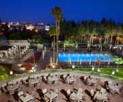
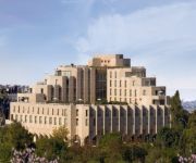
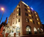
Hotels and Places to Stay
RAMADAJERUSALEM HOTEL
The King David Jerusalem
Mamilla
DAN PANORAMA JERUSALEM
Inbal Jerusalem Hotel
BEIT YEHUDAH GUEST HOUSE
Eldan Hotel Jerusalem
Dan Boutique Jerusalem
DAN BOUTIQUE JERUSALEM
RIMONIM JERUSALEM
Videos from this area
These are videos related to the place based on their proximity to this place.
video3.mov: 2013-11-28 Jerusalem to Bethlehem
See the entire trip at http://www.everytrail.com. Last day in Jerusalem. Janet suggested I ride my bike to Bethlehem which I did. Interesting riding my bike thru the wall's checkpoint. Had...
A Real Resurrection Rose from God's Garden in the Land of Israel
www.roseofbethlehem.com. A real resurrection flower from the Holy Land. Your direct connection to the Land of Israel. The amazing Rose of Bethlehem re-bloom again and again for years with just...
Visiting the West Bank Barrier Wall, Bethlehem Palestine (Video #23)
Video #4 from Bethlehem. Glenn Campbell visits the Isreali West Bank wall, in Bethlehem on the Palestinian side. The wall looks remarkably like the Berlin Wall in its heyday. Filmed on Christmas...
Claire Anastas on living in Ghetto Bethlehem
Holy Star Gifts Souvenir by Claire Anastas | www.anastas-bethlehem.com | (Palestinian Gifts and Accommodation Olive Wood, Handicrafts Handmade in Bethlehem, Palestine.
The Peace Café [27.03.09] 1 @ Tālītā Qūmī School
Four Peace Café meeting. Beit Jalla, March 27, 2009 http://mepeace.org.
visit palestine tour of israelis in Beth Lehem
this is one of the first groups of israelies authorised in A area sience 2000.
Battir
Battir, Bittir, Palestine, بتير فلسطين Battir stories, people and culture worth remembering. Battir an amazing landscape of nature, The village of Battir's archaeological site contains...
Weekly Battle in Jerusalem
Clash between Israeli IDF and Palestinians in the Jerusalem neighborhood of Silwan, just south of the Old City. Friday March 25th.
video9.mov: 2013-02-08 Womb to Tomb: Bethlehem to Calvary
See the entire trip at http://www.everytrail.com. Janet and I had a free day so I decided to take an adventure. I called my friend George in Bethlehem and he picked me up and drove me to the...
Videos provided by Youtube are under the copyright of their owners.
Attractions and noteworthy things
Distances are based on the centre of the city/town and sightseeing location. This list contains brief abstracts about monuments, holiday activities, national parcs, museums, organisations and more from the area as well as interesting facts about the region itself. Where available, you'll find the corresponding homepage. Otherwise the related wikipedia article.
Jerusalem Malha Railway Station
Jerusalem Malha Railway Station is the main Israel Railways station in Jerusalem. The station is located in the southern neighborhood of Malha, across from the Jerusalem Shopping Mall and Teddy Stadium.
Teddy Stadium
Teddy Stadium is a football stadium in Jerusalem, Israel. Two football teams currently use the stadium - Beitar Jerusalem and Hapoel Jerusalem. The stadium is named for long-time Jerusalem mayor Teddy Kollek, who was in office during the time of its construction and was one of its prominent advocates. For Beitar, the stadium was a major upgrade after years of playing at the YMCA Stadium, nicknamed "The Sandbox".
Gilo
Gilo is a large residential area in south-western East Jerusalem with a population of 40,000, mostly Jewish. It is widely considered an Israeli settlement because as one of the five Ring Neighborhoods built by Israel surrounding Jerusalem, it was built on land in the West Bank that was occupied by and annexed to Israel following the 1967 Six-Day War and 1980 Jerusalem Law. The international community regards Israeli settlements illegal under international law, although Israel disputes this.
Malha Mall
Malha Mall, also known as Jerusalem Mall, is an indoor shopping mall in the southwestern neighbourhood of Malha, Jerusalem. The mall, which opened in 1993, has 260 stores on 3 levels with a shopping area of 37,000 square metres and 3,000 square metres of office space. It is one of seven malls built in Israel by David Azrieli. According to Gideon Avrahami, director of the mall, the mall is popular among both Jewish and Arab shoppers.
Yeshivat Eretz HaTzvi
Yeshivat Eretz Hatzvi is a Modern Orthodox yeshiva, located in Katamon, Jerusalem, Israel. It was founded in 2004 Rabbi David Ebner and Rabbi Yehuda Susman serve as the Rashei Yeshiva. Rav Ebner also serves as the Yeshiva's Mashgiach ruchani. The menahel of the Yeshiva is Rav Benny Pflanzer.
Beit Safafa
Beit Safafa is an Arab neighborhood in southern Jerusalem. Beit Safafa covers an area of 1,577 dunams. Since 1949, the neighborhood has been divided by the Green Line. Until 1967, the southern two-thirds were under Jordanian rule and the northern third under Israeli rule. After the Six-Day War, the two sides were reunited. In 2010, Beit Safafa had a population of 5,463.
Palestinian Heritage Center
The Palestinian Heritage Center is a Palestinian cultural center located in Bethlehem. It was established in 1991 by Maha Saca. The center contains several exhibitions on Palestinian costumes, folklore, history, and other cultural aspects.
Givat HaMatos
Givat HaMatos is a caravan village in southern Jerusalem established as temporary housing for Ethiopian Jewish immigrants in Israel. The village encompasses an area of 170 dunams. It is bordered by Talpiot in the north, Gilo in the south, and Beit Safafa in the west.
Israel State Archives
Israel State Archives is the national archive of Israel, located in Jerusalem. The archive houses some 400 million documents, maps, stamps, audio tapes, video clips, photographs and special publications.
Jerusalem Arena
The Arena, known for sponsorship reasons as Jerusalem HaPayis Hall, is a multi-purpose sports arena currently being built in Jerusalem by the city council and the betting company Mifal HaPayis. The stadium will be build in Jerusalem's southwest Malha neighborhood, adjacent to Teddy Stadium. According to Jerusalem Mayor Nir Barkat, the new arena will be the largest indoor space in Jerusalem able to host professional sports, world-class concerts, international conferences and cultural events.
Pat, Jerusalem
Pat is a neighborhood in southwestern Jerusalem, located at the border of the Green line on the Israeli side between Katamon (Israël) and Beit Safafa.
Jerusalem Technology Park
Jerusalem Technology Park, also Malha Technology Park is a high-tech industrial park located in the Malha neighborhood of southwest Jerusalem, Israel. The Jerusalem Technology Park covers an area of about 15 acres and was built gradually and populated since 1996, along with the development of the entire area, which includes: the Jerusalem Mall, Teddy Stadium, Jerusalem Malha Railway Station, Jerusalem Tennis center, the Biblical Zoo, a residential neighborhood and a park.






!['The Peace Café [27.03.09] 1 @ Tālītā Qūmī School' preview picture of video 'The Peace Café [27.03.09] 1 @ Tālītā Qūmī School'](https://img.youtube.com/vi/iTWo31WDEG4/mqdefault.jpg)


