Safety Score: 4,0 of 5.0 based on data from 9 authorites. Meaning please reconsider your need to travel to Palestinian Territory.
Travel warnings are updated daily. Source: Travel Warning Palestinian Territory. Last Update: 2024-08-13 08:21:03
Discover ‘Anātā
‘Anātā in West Bank with it's 11,946 citizens is a town in Palestinian Territory about 3,182 mi (or 5,121 km) north-east of , the country's capital city.
Current time in ‘Anātā is now 05:40 PM (Sunday). The local timezone is named Asia / Hebron with an UTC offset of 2 hours. We know of 11 airports near ‘Anātā, of which 5 are larger airports. The closest is airport we know is Ben Gurion International Airport in Israel in a distance of 26 mi (or 42 km). Besides the airports, there are other travel options available (check left side).
There are several Unesco world heritage sites nearby. The closest heritage site in Palestinian Territory is Birthplace of Jesus: Church of the Nativity and the Pilgrimage Route, Bethlehem in a distance of 8 mi (or 13 km), South. We discovered 8 points of interest in the vicinity of this place. Looking for a place to stay? we compiled a list of available hotels close to the map centre further down the page.
When in this area, you might want to pay a visit to some of the following locations: Jerusalem, Jericho, Ash Shunah al Janubiyah, Karney Shomron and Ramla. To further explore this place, just scroll down and browse the available info.
Local weather forecast
Todays Local Weather Conditions & Forecast: 19°C / 66 °F
| Morning Temperature | 12°C / 54 °F |
| Evening Temperature | 17°C / 63 °F |
| Night Temperature | 15°C / 59 °F |
| Chance of rainfall | 0% |
| Air Humidity | 36% |
| Air Pressure | 1016 hPa |
| Wind Speed | Gentle Breeze with 7 km/h (4 mph) from South-East |
| Cloud Conditions | Few clouds, covering 18% of sky |
| General Conditions | Few clouds |
Monday, 18th of November 2024
17°C (62 °F)
13°C (55 °F)
Light rain, fresh breeze, few clouds.
Tuesday, 19th of November 2024
17°C (62 °F)
14°C (57 °F)
Light rain, gentle breeze, broken clouds.
Wednesday, 20th of November 2024
18°C (64 °F)
14°C (57 °F)
Few clouds, light breeze.
Hotels and Places to Stay
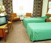
7 Arches Jerusalem
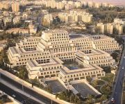
DAN JERUSALEM
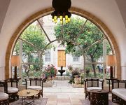
American Colony Hotel
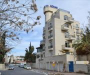
Addar
National Hotel Jerusalem
Notre Dame Center of Jerusalem
Ambassador Jerusalem
Commodore Hotel
HOTEL 7 ARCHES JERUSALEM
ibis Styles Jerusalem Sheikh Jarrah
Videos from this area
These are videos related to the place based on their proximity to this place.
גרסימוס הקדוש - אבי מדבר הירדן (מדבר יהודה) - התקנון של המנזר (דיר חג'לה)
Zahi Shaked A tour guide in Israel and his camera zahigo25@walla.com +972-54-6905522 tel סיור עם מורה הדרך ומדריך הטיולים צחי שקד 0546905522 My name is Zahi...
13.12.2013 Jerusalem, Pisgat Ze'ev, Snow
Israel, Jerusalem, Pisgat Ze'ev, Snow Израиль, снег в Иерусалиме צלם: ודים מיכיילוב Photohrapher: Vadim Mikhailov 0547-400212 072-2126424 www.vadimm.com.
מערת קבורה מימי בית שני בהר הצופים, ירושלים
Zahi Shaked A tour guide in Israel and his camera zahigo25@walla.com 9726905522 tel סיור עם מורה הדרך ומדריך הטיולים צחי שקד 0546905522 באתר נחשפו...
City of David's Alternate History
Palestinian residents are evicted and exploited to make way for excavations of ancient holy sites. See more videos from The Tiziano Project's program in East Jerusalem on StoriesFrom: http://www.s...
day 49
omer counting at aaronrotenberg.wordpress.com Omer Cento My familiar arms will cling to your neck. I'll be looking for a ride then asking for a kiss Guide my...
איפה הספרייה?
לפני חצי שנה נפתחה בפסגת זאב ספרייה חדשה, אלא שדבר אחד שכחו לשים שם, שלט. אורי ארליך הלך לאיבוד במדור הגיאוגרפ...
محمد عساف ونجاحه وفرحة اهل عناتا - القدس
محمد عساف ارب ايدول وفرحة اهل عناتا بهذا النجاح وتحقيق حلمه والنار مولعة.
Corpral David from Palestine
L'antiterrorisme commenté par M. David. Counter-terrorism commented by M. David. Turn subtitles on, jews.
GUIDE21 - ДОРОГАМИ ПРОРОКА ИЕРЕМИИ
Минуя иерусалимский район Писгат-Зеэв, подъезжаем к контрольно-пропускному пункту израильской армии,...
Videos provided by Youtube are under the copyright of their owners.
Attractions and noteworthy things
Distances are based on the centre of the city/town and sightseeing location. This list contains brief abstracts about monuments, holiday activities, national parcs, museums, organisations and more from the area as well as interesting facts about the region itself. Where available, you'll find the corresponding homepage. Otherwise the related wikipedia article.
French Hill
For the community in California, see French Hill, California. French Hill, also Giv'at Shapira is a neighborhood in northern East Jerusalem. It is located on territory occupied during the Six-Day War in 1967, later annexed to Israel under the Jerusalem Law in 1980. The United Nations Security Council declared this law a violation of international law, and states that the Council will not recognize this law, and calls on member states to accept the decision of the council.
Bezalel Academy of Art and Design
Bezalel Academy of Arts and Design is Israel's national school of art, founded in 1906 by Boris Schatz. It is named for the Biblical figure Bezalel, son of Uri, who was appointed by Moses to oversee the design and construction of the Tabernacle.
Hadassah Medical Center
Hadassah Medical Center is a medical organization that operates two university hospitals at Ein Kerem and Mount Scopus in Jerusalem, Israel, as well as schools of medicine, dentistry, nursing, and pharmacology affiliated with the Hebrew University of Jerusalem. Its declared mission is to extend a “hand to all, without regard for race, religion or ethnic origin.
E1 (Jerusalem)
E1(short for East 1), also named Mevaseret Adumim is an area of the the West Bank within the municipal boundary of the Israeli settlement of Maale Adumim, located in immediately adjacent to East Jerusalem. It covers an area of 12 square kilometres, which although largely empty, is home to a number of Bedouin communities and their livestock as well as a large Israeli police headquarters.
Al-Issawiya
Al-Issawiya is an Arab village and neighborhood in Jerusalem, Israel. Located on Mount Scopus near Hadassah Hospital, it formed part of an Israeli enclave between 1949-1967.
Hebrew University bombing
The Hebrew University bombing or the Hebrew University massacre was a Palestinian terror attack which occurred on 31 July 2002 in a cafeteria at the Mount Scopus campus of the Hebrew University of Jerusalem. The attack killed 9 people, including American students, and injured about 100. It was carried out by an East Jerusalem-based Hamas cell whose members are serving multiple life sentences in Israeli prisons for that attack and others.
Jerusalem British War Cemetery
Jerusalem British War Cemetery is a British cemetery in Jerusalem (Jerusalem War Cemetery) is a military cemetery for fallen soldiers of the British Empire in the first World War in Israel. The cemetery is located on Mount Scopus.
Bab al Shams
Bab al-Shams was a Palestinian encampment in the West Bank that housed 250 Palestinian and foreign activists for two nights in January 2013. They erected 25 tents on private Palestinian land in the E1 area where Israel has decided to build more than 3500 housing units. It was in the E1 area Israel intends to fill with houses, and, according to David Shulman, impede thereby the construction of a Palestinian state.


