Safety Score: 3,0 of 5.0 based on data from 9 authorites. Meaning we advice caution when travelling to Palau.
Travel warnings are updated daily. Source: Travel Warning Palau. Last Update: 2024-08-13 08:21:03
Discover Medalaii Hamlet
The district Medalaii Hamlet of Koror in State of Koror is a subburb in Palau about 15 mi south-west of Melekeok, the country's capital city.
If you need a hotel, we compiled a list of available hotels close to the map centre further down the page.
While being here, you might want to pay a visit to some of the following locations: Ngetkib, Ngchemiangel, Ngereklmadel, Ngchesar Hamlet and Imeong Hamlet. To further explore this place, just scroll down and browse the available info.
Local weather forecast
Todays Local Weather Conditions & Forecast: 30°C / 86 °F
| Morning Temperature | 27°C / 81 °F |
| Evening Temperature | 29°C / 84 °F |
| Night Temperature | 28°C / 82 °F |
| Chance of rainfall | 0% |
| Air Humidity | 67% |
| Air Pressure | 1008 hPa |
| Wind Speed | Gentle Breeze with 6 km/h (3 mph) from West |
| Cloud Conditions | Overcast clouds, covering 100% of sky |
| General Conditions | Overcast clouds |
Thursday, 5th of December 2024
29°C (85 °F)
28°C (82 °F)
Light rain, gentle breeze, overcast clouds.
Friday, 6th of December 2024
30°C (86 °F)
28°C (83 °F)
Light rain, gentle breeze, broken clouds.
Saturday, 7th of December 2024
29°C (84 °F)
28°C (82 °F)
Light rain, gentle breeze, overcast clouds.
Hotels and Places to Stay
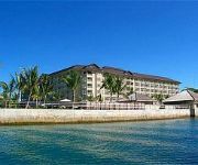
Palau Royal Resort
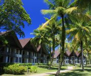
PALAU PACIFIC RESORT
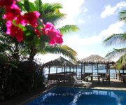
Palau Plantation Resort
Palasia Hotel Palau
Airai Water Paradise Hotel & Spa
Antelope Guesthouse
G.A.U. Mechang Lagoon Resort
Videos from this area
These are videos related to the place based on their proximity to this place.
[HD] T88GN T88TB and T88KH were down the Main street in Koror Is., Rep.of Palau
George T88GN took us around the island by his car on Sep/20/2010. filmed by Taki T88TB. We can see some old buildings which built in Japan occupied era. T88GN ジョージさんの車に乗せ...
[HD] T88KH on the air on 21MHz SSB from Downtown Koror Rep. of PALAU Sep/2010
Harry, T88KH on the air on 21MHz SSB, Filmed by Taki, T88TB on Sep/20/2010.
[HD] T88KH on the air in RTTY from Downtown Koror Rep.of Palau Sep/2010
Harry, T88KH is operating RTTY on 17meters band. The gear is Kenwood TS-850S running approx 50Watts bear-foot with an old IBM ThinkPad X21. Filmed by Nikon D5000 SLR on Sep/20 2010.
アキーラさん発見①親日国パラオ・コロール・港橋の日本からのODA援助の碑,MInato-bridgel,Koror-town ,Palau
パラオのコロール島とマラカル島に掛かるミナト橋。日本の技術・資金援助により修復された。それに対しての感謝の碑もある。平成25年(2013年...
Palau - Diving Chandelier Cave
In a small bay near Malakal Island, near the city of Koror, Palau, there is a natural cave tucked away behind the yacht moorings, in a place you would never guess such a cave could exist. The...
アキーラさん発見②親日国パラオ・コロール・港橋の日本からのODA援助の碑,MInato-bridgel,Koror-town ,Palau
パラオのコロール島とマラカル島に掛かるミナト橋。日本の技術・資金援助により修復された。それに対しての感謝の碑もある。平成25年(2013年...
アキーラさん訪問①親日国パラオ・コロール・ラーメンハウス・醤油ラーメン,Ramen-house,Koror,Palau
I ate Ramen for lunch in the down-town of Palau today昼食は、ラーメンハウスというラーメン屋がコロールの街中にありどんなものか確かめてみた。海外にある...
Palau - A day fishing with Erik Vereen
Erik runs a charter business called Island Seed Ltd that takes guests out on the reefs, lagoon, and open sea around Koror area, Palau. His small charter specializes in personal service, instructio...
アキーラさん宿泊③パラオ・コロール島・Green-Bay-hotel部屋編,Coror-island,Palau
国際&旅行ジャーナリスト 大川原 明のホームページは下記 http://yukokunoshi-akira.com/ 2013年6月にパラオを訪問した際に8泊9日間滞在したが、そ...
アキーラさん乗車①親日国パラオ・コロール島・送迎車・Coror,Palau
平成25年(2013年)6月に9日間、太平洋に浮かぶかつての日本の委任統治領であるパラオを訪問しました。パラオはかつて、ドイツの委任統治領でし...
Videos provided by Youtube are under the copyright of their owners.
Attractions and noteworthy things
Distances are based on the centre of the city/town and sightseeing location. This list contains brief abstracts about monuments, holiday activities, national parcs, museums, organisations and more from the area as well as interesting facts about the region itself. Where available, you'll find the corresponding homepage. Otherwise the related wikipedia article.
Geography of Palau
The Republic of Palau consists of eight principal islands and more than 250 smaller ones lying roughly 500 miles southeast of the Philippines. The islands of Palau constitute part of the Caroline Islands chain.
Palau
Palau, officially the Republic of Palau (Palauan: Beluu er a Belau), is an island country located in the western Pacific Ocean. Geographically part of the larger island group of Micronesia, with the country's population of around 21,000 people spread out over 250 islands forming the western chain of the Caroline Islands. The islands share maritime boundaries with Indonesia, the Philippines, and the Federated States of Micronesia.
Koror
Koror is the state comprising the main commercial centre of the Republic of Palau. It consists of several islands, the most prominent being Koror Island (also Oreor Island). The state of Koror (population 14,000 as of 2004) contains about 70% of the population of the country. The nation's former capital and largest town, also called Koror, is located here.
Airai
Airai, located on the southern coast of Babeldaob island, is the second-most populous state of Palau. It contains the country's chief airport, Roman Tmetuchl International Airport, and is connected by the Koror-Babeldaob Bridge to nearby Koror Island. The state has an area of 44 km² (17 mi²), and a total population, as of 2004, of 2700, the second largest in the country. Airai is also the name of a biggest town in the state, with a population of 920 people as of 2004.
Aimeliik
Aimeliik is an administrative division of the island country of Palau. It is one of the Republic of Palau's 16 states. It has an area of 52 km² and a population of 270 (census 2005). State capital is the village of Mongami. The island is the location to Palau's largest powerplant. The state is also a short distance from the international airport. In the village of Medorm there is the highest powered short wave radio station in Palau.
Ngchesar
Ngchesar is one of the sixteen states of the small pacific island nation of Palau. There are about 300 inhabitants, and its capital is Ngersuul. It is the sixth largest state in terms of land, with an area of roughly 40 square kilometers, and it is located on the eastern side of the island of Babeldoab Island, northwest of Airai State, and southeast of Melekeok State, where the Palauan government is situated. The sacred totem of Ngchesar is the Stingray.
Malakal Island
Malakal Island is an island in the state of Koror, Palau. It is located at 134.45, 7.330278. One of the tribes in Survivor: Micronesia was named Malakal. Malakal Island is the site of Koror's port, as well as the radio station T8AA-AM.
National Stadium (Palau)
The Palau national stadium (PCC Track & Field Stadium) is a multi-purpose sports stadium in Koror, Palau. It is used primarily for track and field events as well as many football matches. The stadium can seat 4000 people.
Ngatpang
Ngatpang is one of Palau's sixteen states. It comprises an area of around 47 square kilometers in the west of Palau's largest island, Babeldaob, facing onto Ngeremeduu Bay. The state capital is Oikuul. It has a population of 464, making it Palau's 5th largest state in population.
Koror–Babeldaob Bridge
The Koror-Babeldaob Bridge is a bridge in Palau that connects Koror and Babeldaob Islands. It is a reinforced concrete, portal frame, cable-stayed bridge with a total length of 413 m. It was built by the Kajima Corporation of Japan in 2002, to replace the former, collapsed bridge built by Socio Construction Co. of Korea.
Roman Tmetuchl International Airport
Roman Tmetuchl International Airport {{#invoke:InfoboxImage|InfoboxImage|image=FAT Boeing 757 Palau Airport Spijkers.
Ngerekebesang Island
Ngerekebesang Island (Arakabesan) is an island in the state of Koror, Palau, where the office of the President of the Republic of Palau was located before the capital was moved to the state of Melekeok. It is composed of three towns: Ngerekebesang, Meyuns, and Echang, where most Southwest Islanders moved to after a storm struck the southwest islands. They were later resettled. Meyuns is host to the largest hospital in Palau, Belau National Hospital.
Melekeok
Melekeok is a state of the Republic of Palau located on the central east coast of Babeldaob Island. The new capital of the Republic of Palau, Ngerulmud, is also located in this state. The state consists of long beaches, hill, steep ridges, rivers and the largest and only natural freshwater lake in the Republic of Palau and Micronesia, Lake Ngardok.
Belau National Museum
Belau National Museum was established in 1955 and is the oldest museum in Micronesia. It is located in Koror in Palau. It was located in the former Japanese Administration Weather Bureau building and later relocated to a new building.
Meyuns
Meyens is the second most populous city in the tiny Pacific island nation of Palau, with a population of approximately 1,000. Meyuns is comparable in population to Palau's third largest city, Airai. It is located in the State of Koror, where the nation's largest city, also called Koror, is located. Other than Koror, Meyuns is the only sizable town in the state of Koror.
Goby Lake
Goby Lake is a marine lake located on Koror island in Palau. There are about 70 other marine lakes located throughout the Rock Islands and Koror. Goby Lake is notable for endemic subspecies of golden jellyfish and is one of five marine lakes in Palau used for several scientific researches in evolutionary biology the other lakes being Jellyfish Lake, Clear Lake (Palau), Uet era Ngermeuangel, Uet era Ongael.
Uet era Ngermeuangel
Uet era Ngermeuangel (Ngermeuangel Lake, Big Jellyfish Lake) is a marine lake located on Koror island in Palau. There are about 70 other marine lakes located throughout the Rock Islands and Koror. Uet era Ngermeuangel is notable for endemic subspecies of golden jellyfish and is one of five marine lakes in Palau used for several scientific researches in evolutionary biology the other lakes being Jellyfish Lake, Clear Lake (Palau), Goby Lake, Uet era Ongael.
Uet era Ongael
Uet era Ongael (Ongael Lake) is a marine lake located on Ongael island, Koror, in Palau. There are about 70 other marine lakes located throughout the Rock Islands and Koror. Uet era Ongael is notable for endemic subspecies of golden jellyfish and is one of five marine lakes in Palau used for several scientific researches in evolutionary biology, the other lakes being Jellyfish Lake, Clear Lake, Uet era Ngermeuangel and Goby Lake.
Ngetkib
Ngetkib is a village in Palau, and the capital of the state of Airai. It has a population of 62.
Ngelsibel
Ngelsibel is an island of Palau.
Chouwid
Chouwid is an island of Palau.
Ngeanges
Ngeanges is an island of Palau.
Ongetkatel
Ongetkatel is a channel of water and island of Palau.
Chomedokl
Chomedokl is an island of Palau.
Ulong Island
Ulong is a major island and channel of western Palau. It is sometimes called Aulong and originally written Oroolong in English. Ulong is regarded by many as one of the best drift dives in the world.


!['[HD] T88GN T88TB and T88KH were down the Main street in Koror Is., Rep.of Palau' preview picture of video '[HD] T88GN T88TB and T88KH were down the Main street in Koror Is., Rep.of Palau'](https://img.youtube.com/vi/1ynnzz6Pvz4/mqdefault.jpg)
!['[HD] T88KH on the air on 21MHz SSB from Downtown Koror Rep. of PALAU Sep/2010' preview picture of video '[HD] T88KH on the air on 21MHz SSB from Downtown Koror Rep. of PALAU Sep/2010'](https://img.youtube.com/vi/BZ2ma4WpITY/mqdefault.jpg)
!['[HD] T88KH on the air in RTTY from Downtown Koror Rep.of Palau Sep/2010' preview picture of video '[HD] T88KH on the air in RTTY from Downtown Koror Rep.of Palau Sep/2010'](https://img.youtube.com/vi/tuqTuYLsdFg/mqdefault.jpg)


