Safety Score: 2,8 of 5.0 based on data from 9 authorites. Meaning we advice caution when travelling to Norway.
Travel warnings are updated daily. Source: Travel Warning Norway. Last Update: 2024-08-13 08:21:03
Delve into Langestrand
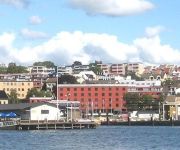
The district Langestrand of in Larvik (Vestfold) is a subburb in Norway about 65 mi south-west of Oslo, the country's capital town.
If you need a hotel, we compiled a list of available hotels close to the map centre further down the page.
While being here, you might want to pay a visit to some of the following locations: Larvik, Sandefjord, Langesund, Andebu and Stokke. To further explore this place, just scroll down and browse the available info.
Local weather forecast
Todays Local Weather Conditions & Forecast: -1°C / 31 °F
| Morning Temperature | -2°C / 29 °F |
| Evening Temperature | -2°C / 29 °F |
| Night Temperature | -2°C / 29 °F |
| Chance of rainfall | 0% |
| Air Humidity | 42% |
| Air Pressure | 993 hPa |
| Wind Speed | Gentle Breeze with 6 km/h (4 mph) from East |
| Cloud Conditions | Overcast clouds, covering 86% of sky |
| General Conditions | Light snow |
Saturday, 23rd of November 2024
2°C (35 °F)
-0°C (31 °F)
Sky is clear, moderate breeze, clear sky.
Sunday, 24th of November 2024
4°C (39 °F)
6°C (42 °F)
Rain and snow, moderate breeze, overcast clouds.
Monday, 25th of November 2024
9°C (48 °F)
8°C (46 °F)
Moderate rain, strong breeze, overcast clouds.
Hotels and Places to Stay
Hotel Wassilioff
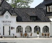
Trudvang Gjestegaard
Quality Hotel Grand Farris
Grev Gyldenløve Hotel
an Ascend Collection hotel Farris Bad
Videos from this area
These are videos related to the place based on their proximity to this place.
Larvik Håndballskole 2013- vi er i gang!
Mandag 24. juni startet Larvik Håndballskole 2013 i gang. Over 350 jenter i alderen 10-16 stiller til start.
Camp Senkveld Ta sjansen 2010 Team Larvik Billakkering Harald Thomas (1080p HD)
Team Larvik Billakkering vant klassen FLOTTESTE BÅT med M/S London i Ta sjansen 2010 i Indre Havn i Larvik! Team Harald og Team Thomas fra Senkveld og Camp Senkveld er også med!
Høydepunkter: Fram Larvik - Pors Grenland
Fram Larvik - Pors Grenland (1-0) 2-0 Dato: 27.04.2014 kl. 13.00 Turnering: Oddsen-Ligaen avd. 1 Arena: Framparken 1-0 Dardan Dreshaj (19) 2-0 Robin Gabriel Palacios Persson (68)
NSB, InterCity train departing Larvik station 20 minutes delayed (10-6-10).
This day I was out at Larvik to catch some trains. Since there only is two trains per hour at Larvik, this is all I got. Enjoy! Filmed by Jonern, Larvik, 10-6-10.
Jergersborgsgate 2 INTER EIENDOM AS 2015 - Larvik
Bevaringsverdig bygg i Larvik sentrum, Lokalisert i knutepunkt by-sentrum, med alle by fasiliteter.
The Posies - Ontario & Dream All Day - 2010-05-13 Larvik
The Posies - Ontario & Dream All Day 13 May 2010 Kulturhuset Bølgen, Larvik, Norway.
Videos provided by Youtube are under the copyright of their owners.
Attractions and noteworthy things
Distances are based on the centre of the city/town and sightseeing location. This list contains brief abstracts about monuments, holiday activities, national parcs, museums, organisations and more from the area as well as interesting facts about the region itself. Where available, you'll find the corresponding homepage. Otherwise the related wikipedia article.
Kaupang
For another Viking Age site, see Kaupanger. Kaupang was a Norse term for market-place. Today, it is generally used as a name of the first town-like market-place in Norway, the Kaupang in Skiringssal, which is located in Tjølling near Larvik in Vestfold. Kaupang was an important merchant and craft center during the Viking period and as yet the first known Norwegian trading outpost.
Numedalslågen
Numedalslågen is a river located in southeastern Norway.
Fredriksvern
Fredriksvern (also called Friderichsværn, Frederiksværn, Fredriksværen and abbreviated Frsværn) was an important Norwegian naval base, just south of Larvik in Vestfold. The town of Stavern has in many ways come to be because of this naval base. Fredriksvern or Stavern has probably been a harbor since ancient times. The name is found in written sources the 11th century and in the 12th century it is referred to as a good fishing harbor.
Stavern
Stavern is a small Norwegian town located in the municipality of Larvik, south of the city of Larvik in Vestfold. The port and naval base of Stavern (until 1930 named Fredriksvern) was established as a municipality 1 January 1838. Even though it was an important port it was first given its status as a town (kjøpstad) 1 July 1942. The small town and municipality of Stavern was merged with the larger town of Larvik 1 January 1988.
Farris
Farris is a 20 km long fresh water moraine-dammed lake near the Norwegian coastal town Larvik. The lake would have been a salt water fjord had it not been dammed by an end moraine left by the latest ice age. Farris is drinking water reservoir for some 170,000 people. The largest island in the lake is Bjørnøya.
Goksjø
Goksjø is a lake in the municipalities of Sandefjord, Larvik and Andebu in Vestfold county, Norway.
Hallevatnet
Hallevatnet is a lake in the municipality of Larvik in Vestfold county, Norway.
Brunlanes
Brunlanes is a parish and former municipality within Larvik municipality in Vestfold county, Norway.
Verningen
Verningen is a village in the municipality of Larvik, Norway. Its population is 806.
Minnehallen
Minnehallen or The hall of remembrance was commissioned by the Norwegian parliament after World War I to commemorate the fallen Norwegian sailors of the war. It was unveiled by king Haakon VII and was later converted to the national monument commemorating fallen sailors of both World War I and World War II. The interior of the hall is visited by some 20,000 people every year. The monument itself is a pyramid of locally quarried rock and is designed by two architects from Oslo, Andreas H.
Gjone
Gjone is a small part of the district Kvelde, which is situated approximately 20 km north of Larvik, Norway. It consists of six main farms. The three original farms, Nord Gjone, Mellem Gjone and Gjone Gård, were further divided into other farms due to the old system of land partition, whereby every son inherited his own portion of the land. Today, approximately forty people live in the Gjone area.
Komplett.no Arena
Komplett. no Arena is the current stadium of Sandefjord Fotball. It was opened on 21 July 2007, when Lyn visited Sandefjord, and is still the match with the highest attendance of 8,103. The stadium is named after the club's new sponsor Komplett. no.
Nevlunghavn
Nevlunghavn is a village in Larvik municipality, Norway. Before the municipal merge in 1988 it was a part of Brunlanes municipality. Nevlunghavn has grown together with the adjacent village Helgeroa. The two villages have a combined population of 1,573. The small fishing village and pilot harbor is located on the coast and has managed to preserve its original character. \t\t \t\t\tGurvika. jpg \t\t\t Gurvika and Oddane Sand \t\t\t \t\t \t\t \t\t\tHumlesekken.
Helgeroa
Helgeroa is a village in Larvik municipality, Norway. Before 1988 it was a part of Brunlanes municipality. Helgeroa has grown together with the adjacent village Nevlunghavn. The two villages have a combined population of 1,573.
Larvik Station
Larvik Station is a railway station on the Vestfold Line in Larvik, Norway. The station is served with InterCity Express trains operated by Norwegian State Railways. The station opened as part of the Vestfold Line in 1881.
German training ship Brummer
Brummer was a training ship of the German Kriegsmarine during World War II .
Tanum, Norway
Tanum is a parish and district in the municipality of Bærum, Norway. Its population (2007) is 2,751. Tanum is home for the romanesque Tanum Church, built between 1100 and 1130, and expanded in the 18th century. The church is known for its plaster art. The church is placed near the highest point of the Tanum plateau, located approximately 150 meters above sea level. This areas is also known for its archaeological findings of Viking graves from the Iron Age.
Arena Larvik
Arena Larvik is an indoor arena in Larvik, Norway. It was opened in September 2009. The arena will be primarily used for handball, but the hall has additional permanent floor marks for basketball, volleyball and floorball. Starting in September 2009, Arena Larvik will be the home court of Larvik HK. It is also one of the Norwegian venues selected to host the 2010 European Women's Handball Championship.
Lovisenlund
Lovisenlund is a multi-purpose stadium in Larvik, Norway. It is the home ground of Larvik Turn. The record attendance is about 17,000, from a 1956 match between Larvik Turn and Fredrikstad FK. It was used for the Norwegian football cup final of 1931, when Odd played Mjøndalen IF. The venue hosted the Norwegian Athletics Championships in 1979.
Tvistein Lighthouse
Tvistein Lighthouse is a coastal lighthouse in the municipality of Larvik in Vestfold, Norway. It was established in 1908, and was automated in 1988.
Svenner Lighthouse
Svenner Lighthouse is a coastal lighthouse in the municipality of Larvik in Vestfold, Norway. It was established in 1874 on the archipelago Svenner. The current tower was built in 1900. The lighthouse was listed as a protected site in 1997, and was automated in 2003.
Stavernsodden Lighthouse
Stavernsodden Lighthouse is a coastal lighthouse in the municipality of Larvik in Vestfold, Norway. It was established in 1855, and was automated in 1984. The lighthouse was listed as a protected site in 1997.
Svenner
Svenner is an archipelago in the municipality of Larvik in Vestfold, Norway. It is located outside the mouth of the fjord Larviksfjorden. A lighthouse was established in 1874 on the island Korpekollen. The smaller islands of Bølene, Strømsundholmen and Ferjeholmen were listed as bird sanctuaries in 2009. Geologically, the islands consist largely of syenite.
Larviksfjorden
Larviksfjorden is a fjord in the municipality of Larvik in Vestfold, Norway. The fjord has a length of about eight kilometers, and is about three kilometer wide at the mouth. The rivers Numedalslågen and Farriselva both discharge into the fjord. The towns Stavern and Larvik both border to the fjord. The two lighthouses Stavernsodden and Svenner are located near the mouth of the fjord.
Norsk Soyamelfabrikk
Norsk Soyamelfabrikk was a soy flour manufacturing company in Larvik, Norway. It was established in 1933, and was closed down in the 1970s.


