Safety Score: 2,8 of 5.0 based on data from 9 authorites. Meaning we advice caution when travelling to Norway.
Travel warnings are updated daily. Source: Travel Warning Norway. Last Update: 2024-08-13 08:21:03
Delve into Skor
Skor in Eidfjord (Hordaland Fylke) is located in Norway about 134 mi (or 216 km) west of Oslo, the country's capital town.
Current time in Skor is now 08:39 PM (Friday). The local timezone is named Europe / Oslo with an UTC offset of one hour. We know of 9 airports close to Skor, of which two are larger airports. The closest airport in Norway is Sogndal Airport in a distance of 46 mi (or 73 km), North. Besides the airports, there are other travel options available (check left side).
There are several Unesco world heritage sites nearby. The closest heritage site in Norway is Urnes Stave Church in a distance of 56 mi (or 91 km), North. If you need a hotel, we compiled a list of available hotels close to the map centre further down the page.
While being here, you might want to pay a visit to some of the following locations: Eidfjord, Ulvik, Granvin, Kinsarvik and Aurlandsvangen. To further explore this place, just scroll down and browse the available info.
Local weather forecast
Todays Local Weather Conditions & Forecast: -7°C / 20 °F
| Morning Temperature | -8°C / 17 °F |
| Evening Temperature | -4°C / 25 °F |
| Night Temperature | -2°C / 28 °F |
| Chance of rainfall | 2% |
| Air Humidity | 73% |
| Air Pressure | 997 hPa |
| Wind Speed | Light breeze with 5 km/h (3 mph) from North-East |
| Cloud Conditions | Few clouds, covering 14% of sky |
| General Conditions | Snow |
Saturday, 23rd of November 2024
-1°C (30 °F)
-5°C (23 °F)
Light snow, light breeze, overcast clouds.
Sunday, 24th of November 2024
0°C (33 °F)
2°C (35 °F)
Heavy snow, gentle breeze, overcast clouds.
Monday, 25th of November 2024
6°C (43 °F)
5°C (40 °F)
Rain and snow, light breeze, overcast clouds.
Hotels and Places to Stay
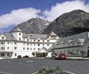
Quality Hotel Voeringsfoss
Videos from this area
These are videos related to the place based on their proximity to this place.
Eidjford Ggtort's photos around Eidfjord, Norway (el trenet senderista blod spot)
Preview of Ggtort's blog at TravelPod. Read the full blog here: http://www.travelpod.com/travel-blog-entries/ggtort/3/1219410000/tpod.html This blog preview was made by TravelPod using the...
Skandiabanken - FlytteLasse
Reklamefilm for Skandiabanken. 45 sekunder - for TV. Produsert av Sølvsuper - regi v/ Andreas Frølich. Skuespillere Benedicte Wedel Westbye og Geir Ottar Askvik. Musikk av Alexander Andresen,...
Hyllest til Norseman - eller slik oppdaget vi vintertriathlon
Dette var ikke en tur i regi av Norseman Xtreme Triathlon og det var ikke en test av et fremtidig konsept. Det var en gammel drøm, et uttrykk for kjærlighet til Norseman og sporten triathlon....
Velomobile WAW 045 uphill Måbødalen Norway
A spectacular valley in the Norwegian mountains. Steep climbing(10%) with WAW velomobile (50 kg total with luggage)
Ventura Cruise to Norway July 2011
Our Lovely Cruise to the Fjords in Norway in July 2011 on board Ventura Cruise Ship.
AIDAstella - Auslaufen Eidjord 22.08.2013
Auslaufen in Eidjord/Norwegen am 22.08.2013 Tour: Nordeuropa 14 Zeitraffer. Aufgenommen mit der GoPro Hero 2.
Videos provided by Youtube are under the copyright of their owners.
Attractions and noteworthy things
Distances are based on the centre of the city/town and sightseeing location. This list contains brief abstracts about monuments, holiday activities, national parcs, museums, organisations and more from the area as well as interesting facts about the region itself. Where available, you'll find the corresponding homepage. Otherwise the related wikipedia article.
Norseman triathlon
The Norseman xtreme triathlon is a non-Ironman branded triathlon, point to point, race held in Norway annually. The distances are equivalent to those of an Ironman race with the swim starting from the loading bay of a car ferry, through the water of the Hardangerfjord fjord to the local town, Eidfjord. At Eidfjord the competitors transition onto their bikes and then cycle 180 km through the mountains, the first 40 km of which is uphill (reaching 1200 m above sea level).


