Safety Score: 3,0 of 5.0 based on data from 9 authorites. Meaning we advice caution when travelling to New Zealand.
Travel warnings are updated daily. Source: Travel Warning New Zealand. Last Update: 2024-08-13 08:21:03
Delve into Seatoun
The district Seatoun of in Wellington City (Wellington) is a subburb in New Zealand a little south-east of Wellington, the country's capital town.
If you need a hotel, we compiled a list of available hotels close to the map centre further down the page.
While being here, you might want to pay a visit to some of the following locations: Wellington, Blenheim, Palmerston North, Nelson and Richmond. To further explore this place, just scroll down and browse the available info.
Local weather forecast
Todays Local Weather Conditions & Forecast: 15°C / 59 °F
| Morning Temperature | 16°C / 60 °F |
| Evening Temperature | 15°C / 59 °F |
| Night Temperature | 14°C / 58 °F |
| Chance of rainfall | 15% |
| Air Humidity | 97% |
| Air Pressure | 1009 hPa |
| Wind Speed | Strong breeze with 19 km/h (12 mph) from South |
| Cloud Conditions | Overcast clouds, covering 100% of sky |
| General Conditions | Moderate rain |
Saturday, 16th of November 2024
11°C (52 °F)
11°C (51 °F)
Light rain, strong breeze, overcast clouds.
Sunday, 17th of November 2024
13°C (56 °F)
9°C (48 °F)
Few clouds, moderate breeze.
Monday, 18th of November 2024
16°C (60 °F)
12°C (54 °F)
Sky is clear, gentle breeze, clear sky.
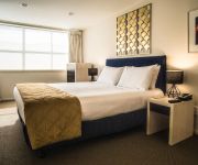
Hotels and Places to Stay
YHA Wellington City - Hostel
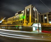
QT Museum Wellington Previously Museum Art Hotel
Acorns Wellington Bed and Breakfast
Ohtel
Edgewater Lodge
At Home Wellington City
Apollo Lodge Motel
Gourmet Stay
88 Wallace Court Motel
Halswell Lodge
Videos from this area
These are videos related to the place based on their proximity to this place.
Wellington Airport NZ 1963 - with Surprise Ending
Wellington Airport was opened in 1959. A major new terminal was completed in 1999 and integrated with the international terminal. The 'Vickers Viscount' aircraft at the end of my video suffered...
2013 Swindale Shield: Round Three - Marist St Pats vs Oriental Rongotai
The Red Machine: In Motion. Highlights of the third round matchup between Marist St Pats and Oriental Rongotai in the 2013 Swindale Shield. Follow us on Facebook: facebook.com/msprugby We...
Scots v Rongotai Haka 2011
The Haka between Wellington Premier 1 College Rugby teams, Scots College and Rongotai College, Saturday 24th June 2011. Rongotai deservedly won this encounter, but Scots had their ...
Breaker Bay, Wellington City, New Zealand.
Breaker Bay is a suburb on the south east coast of Wellington City in New Zealand, on the Miramar Peninsula. The suburb contains a 600 m wide bay of the same name, and is part of the western...
Approach and landing into Wellington International Airport NZWN GoPro 3
Taken from seat 21A while on board Jetstar Airways A320. Beautiful approach into runway 34. Being one of the windiest city in the world, these pilots are really skillful. Recorded using GoPro3 1080HD.
P3D - New Zealand - Wellington Intl. Airport, Levin - Seabird SB7L-360A - By JMCV 2013
Prepar3D (P3D) is a simulation platform developed by Lockheed Martin * Wellington International Airport (formerly known as Rongotai Airport) (NZWN) is an international airport located in...
Wellington to Fiji, Airbus A-320
Not too exciting, climbing out of Wellington through the cloud to 37000 feet en route to Fiji. Not a lot to see on this trip as cloud all the way and dark on landing.
Tuatara On Tour
The Department of Conservation (DOC) together with Air New Zealand and Ngāti Koata achieved the largest and most complex tuatara relocation ever undertaken. 260 tuatara travelled on commercial...
RealNZ Wellington Int'l Airport
A short look at Godzone's 'RealNZ' Wellington Int'l Airport for FSX Also available for FS2004, plus many other great products. www.windowlight.co.nz.
Videos provided by Youtube are under the copyright of their owners.
Attractions and noteworthy things
Distances are based on the centre of the city/town and sightseeing location. This list contains brief abstracts about monuments, holiday activities, national parcs, museums, organisations and more from the area as well as interesting facts about the region itself. Where available, you'll find the corresponding homepage. Otherwise the related wikipedia article.
Wahine disaster
The Wahine disaster occurred on 10 April 1968 when the TEV Wahine, a New Zealand inter-island ferry of the Union Company, foundered on Barrett Reef at the entrance to Wellington Harbour and capsized near Steeple Rock. Of the 610 passengers and 123 crew on board, 53 people died. The wrecking of the Wahine is one of the better known maritime disasters in New Zealand's history, although there have been worse with far greater loss of life.
Wellington Harbour
Wellington Harbour is the large natural harbour at the southern tip of New Zealand's North Island. New Zealand's capital, Wellington, is on the western side of Wellington Harbour. The harbour was officially named Port Nicholson until it assumed its current name in the 1980s. In Māori the harbour is Te Whanganui-a-Tara (the great harbour of Tara). A Māori name for Wellington, Pōneke is often said to be a transliteration of Port Nick, although this etymology is disputed.
Berhampore, New Zealand
Berhampore is a suburb of Wellington, the capital city of New Zealand. It lies towards the south of the city, seven kilometres from the city centre, and two kilometres from the coast of Cook Strait. It is surrounded by the suburbs of Vogeltown, Newtown, Melrose, Island Bay, Kingston, and Mornington. The suburb was named after Berhampore in Bengal, one of the battlefields at the start of the Battle of Plassey of 1757.
Miramar, New Zealand
Miramar is a suburb of Wellington, New Zealand, south-east of the city centre. It is on the Miramar Peninsula, directly east of the isthmus of Rongotai, the site of Wellington International Airport.
Miramar Peninsula
The Miramar Peninsula is a large peninsula on the southeastern side of the city of Wellington, New Zealand, at the entrance to Wellington Harbour. It forms part of Wellington's eastern suburbs. According to Maori legend, the peninsula was formed when the taniwha Whaitaitai beached as he tried to escape the confines of the harbour.
Scots College, Wellington
Scots College is a private (independent) boys' primary and secondary school located in the suburb of Strathmore Wellington, New Zealand. The College comprises both the primary and secondary institutions - the primary school section is typically referred to as the Preparatory School and has its own Head Teacher and staff.
Barrett Reef
The cluster of rocks that is Barrett Reef (often known as Barrett's Reef) is one of the most hazardous reefs in New Zealand. It lies on the western side of the entrance of Wellington Harbour, on the approaches to the city of Wellington, at coordinates {{#invoke:Coordinates|coord}}{{#coordinates:41|21|9|S|174|50|6|E| |primary |name= }}. The reef is named after Richard (Dicky) Barrett (1807–1847), a whaler and trader. Its Maori name is Tangihanga-a-Kupe. It is popular with recreational divers.
Hataitai
Hataitai is an inner-city suburb of Wellington, the capital of New Zealand, 3.5 kilometres southeast of the city centre. The suburb extends over the southeastern flank of Mount Victoria and down a valley between the Town Belt and a ridge along the shoreline of Evans Bay. Hataitai is bounded by Hepara Street, Grafton Road and the suburb of Roseneath in the north, Wellington Harbour in the east, Cobham Drive, Wellington Road and Crawford Road in the south, and Alexandra Road in the west.
Seatoun
Seatoun is an eastern suburb of Wellington, the capital city of New Zealand. It is on the east coast of the Miramar Peninsula, close to the entrance to Wellington Harbour, some seven kilometres southeast of the CBD. The suburb sits on an exposed promontory close to Barrett Reef, a dangerous area of rocky shallows upon which many ships have foundered, most notably the Inter-island ferry Wahine in 1968.
Wellington International Airport
Wellington International Airport (formerly known as Rongotai Airport) is an international airport located in the suburb of Rongotai in Wellington, the capital city of New Zealand. It is a secondary hub and focus city for Air New Zealand and its subsidiaries. The airport is operated by Wellington International Airport Limited, a joint venture between Infratil and the Wellington City Council.
Mount Victoria Tunnel
The Mount Victoria Tunnel in the New Zealand capital city of Wellington is 623 metres (slightly more than a third of a mile) long and 5 metres (16.4 ft) in height, connecting Hataitai to the centre of Wellington and the suburb of Mount Victoria, under the mount of the same name. It is part of State Highway 1.
Wellington Zoo
Distinguished from the fictional Wellington Zoo near the Forest of Dean in England in the Primeval (TV series). Wellington Zoo is nestled in the green belt of Wellington, New Zealand. Now over 100 years old, it was the country’s first Zoo and has 13-hectare dedicated to over 100 different species of fauna from across the globe.
Lyall Bay
Lyall Bay is a bay and a suburb on the south side of the Rongotai isthmus in Wellington, New Zealand. The bay is a popular surf beach, featuring a breakwater at the eastern end. It has also been the site of surf lifesaving championships, and is home to two surf lifesaving clubs. Lyall Bay is a very popular and safe swimming beach. The beach is only two thirds of its original size; the construction of Wellington International Airport took away the eastern third of the beach.
Princess Bay
Princess Bay is one of the southern beaches of Wellington, New Zealand.
St. Patrick's College, Wellington
St Patrick's College is the oldest Catholic boys' secondary school in New Zealand.
Breaker Bay
Breaker Bay is a suburb on the south east coast of Wellington City in New Zealand, on the Miramar Peninsula. The suburb contains a 600 m wide bay of the same name, and is part of the western shore of the Wellington Harbour entrance. The Eastern Walkway runs along the top of the Bay and has views of the area. It is mostly well known for being the location of Wellington's only clothing optional beach, which is shared by naturists and clothed people alike.
Lake Kohangapiripiri
Lake Kohangapiripiri is one of the two freshwater Pencarrow lakes in Fitzroy Bay - the other being the slightly larger Lake Kohangatera. It stands to the east of Pencarrow Head, on the eastern side of New Zealand's Wellington Harbour, in East Harbour Regional Park, and is fed by Cameron Stream which rises on private land to its north. The Pencarrow lakes formed in valleys which became blocked to the nearby sea after earthquakes changed the topography.
Zephyrometer
The Zephyrometer is a civic sculpture by Evans Bay, Wellington. It was made by Christchurch artist Phil Price and installed in 2003. It is a kinetic sculpture consisting of a concrete cylinder holding a 26m tall needle which sways to show wind direction and speed (Wellington is known to Kiwis as "Windy Wellington"). The needle consists of fiberglass exterior around a wooden framework.
Kilbirnie, New Zealand
Kilbirnie (from Scottish Gaelic: Cille Bhraonaidh), a suburb of Wellington in New Zealand, lies 3 kilometers to the south-east of the city centre. Travellers can reach Kilbirnie from the Wellington central business district either via the Mount Victoria Tunnel and Hataitai; over Mount Victoria; or around the coast. Kilbirnie sits on the eastern flank of the ridge which becomes Mount Victoria and on the flat of the Rongotai isthmus between Evans Bay to the north and Lyall Bay to the south.
Newtown Park
Newtown Park is a multi-purpose stadium in Wellington, New Zealand. It is currently used mostly for football (soccer) matches and athletic events. The main pitch has a 400 metre, all-weather rubberized athletics track around it, as well as the spectator stands and the corporate loungue. A second, rectangular pitch (Newtown Park 2) is attached south of the main facility.
Steeple Rock
Steeple Rock is the largest rock of Barrett Reef at the west of the entrance to Wellington Harbour, rising 7m above sea level. Its Māori name is Te Aroaro-o-Kupe (The front of Kupe), after being officially changed on 3 September 2009 from Te Ure-o-Kupe (The penis of Kupe). Kupe, the legendary discoverer of Aotearoa, is said to have injured himself on the rock while swimming.
Rongotai College
Rongotai College is an all-boys state secondary school in the south-eastern suburb of Rongotai in Wellington, New Zealand. The students are aged 12 to 19. The decile 6 school has a roll of over 650 students. About 40 per cent of the students are of European heritage, 20 per cent identify as Pasifika, 15 per cent Maori and there are various Middle Eastern and African students. The students wear a school uniform.
Shelly Bay
Shelly Bay is a bay on the Miramar Peninsula of Wellington, New Zealand. The New Zealand Defence Force owned the land on Shelly Bay for 124 years until 2009. Shelly Bay was where most of the scenes depicting "Skull Island" in the 2005 film King Kong were filmed.
St Catherine's College, Wellington
St Catherine's College, a Catholic secondary school for girls, operates in the Wellington suburb Kilbirnie in New Zealand. It was founded in 1950 by the Sisters of Mercy. There was formerly a primary school on the site opened by the Sisters of Mercy in 1918. On 30 March 1983, St Catherine's College became an integrated school under the Private Schools Conditional Integration Act of 1975. The Board of Trustees was first elected in 1989 and is responsible for the governance of the College.
12 Fife Lane
12 Fife Lane, (also known as the First State House) Miramar, Wellington was the first state house under the First Labour Government of New Zealand and was completed in 1937. The building is classified as a "Category I" ("places of special or outstanding historical or cultural heritage significance or value") historic place by the New Zealand Historic Places Trust.


