Safety Score: 3,0 of 5.0 based on data from 9 authorites. Meaning we advice caution when travelling to New Zealand.
Travel warnings are updated daily. Source: Travel Warning New Zealand. Last Update: 2024-08-13 08:21:03
Delve into Sunshine Bay
The district Sunshine Bay of in Lower Hutt City (Wellington) is a subburb in New Zealand a little east of Wellington, the country's capital town.
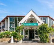
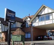
If you need a hotel, we compiled a list of available hotels close to the map centre further down the page.
While being here, you might want to pay a visit to some of the following locations: Wellington, Blenheim, Palmerston North, Nelson and Richmond. To further explore this place, just scroll down and browse the available info.
Local weather forecast
Todays Local Weather Conditions & Forecast: 15°C / 59 °F
| Morning Temperature | 16°C / 61 °F |
| Evening Temperature | 15°C / 59 °F |
| Night Temperature | 14°C / 57 °F |
| Chance of rainfall | 15% |
| Air Humidity | 99% |
| Air Pressure | 1010 hPa |
| Wind Speed | Moderate breeze with 13 km/h (8 mph) from South |
| Cloud Conditions | Overcast clouds, covering 100% of sky |
| General Conditions | Moderate rain |
Saturday, 16th of November 2024
11°C (52 °F)
8°C (47 °F)
Light rain, moderate breeze, overcast clouds.
Sunday, 17th of November 2024
15°C (59 °F)
7°C (44 °F)
Scattered clouds, gentle breeze.
Monday, 18th of November 2024
18°C (65 °F)
10°C (50 °F)
Sky is clear, light breeze, clear sky.
Hotels and Places to Stay
Kenlea Cottage
Fernhill Motor Lodge
Boulcott Lodge
Edgewater Lodge
Acorns Wellington Bed and Breakfast
ASURE 83 By the Sea Motor Lodge
Quality Inn Angus
Abbeycourt Motel
Champers Motor Inn
Motel 22
Videos from this area
These are videos related to the place based on their proximity to this place.
HIS
Brand new centre at Hutt Park, Lower Hutt, official name Hutt Indoor Sports, otherwise known as His centre.. From the 26th all sports played at Valley in Petone will be instead played at HIS.
Top Wellington Roofing Contractor | Call 04-973-0314 or 022 614 2413 New Roofs and Repairs
Hi my name's Ryan Davies and i'm the owner operator of Seaview Roofing Ltd. One of Wellington's top roofers, we specialise in roof repairs, new roofs both commercial and residential, Butynol...
Wellington Harbour Cruise GoPro Demo
Just some highlights from a weekend trip to Wellington, New Zealand. Shot entirely on a GoPro Hero 4 Silver, with a basic floating handle mount.
New Zealand Tenders: Wellington
Lowry Bay 'PARADIS SUR MER' - 234 MARINE DRIVE A unique opportunity to own this prestigious landmark property, located on the prime Lowry Bay waterfront. One of two neighbouring homes,...
Driving From Days Bay to Wellington 2013.06.22
Was driving from Days Bay to Wellington on a supposedly stormy day.
Sunset Sailing on Wellington Harbour
Sailing across Wellington Harbour from Seaview Marina over to Oriental Bay at sunset on a Raven 26.
Steppes in the Right Direction
From Butterfly Creek Theatre Troupe's October 2009 Eastbourne NZ production Eclecticity the Revue Will Clannachan, Peter Hughson, David Gledhill, Barry Mawer and 'comrade' Bill Wollerman.
Butterfly Creek Walk
http://HuttNZ.co.nz Butterfly Creek walk from the Kowhai Street entrance Eastbourne, Lower Hutt, New Zealand. This 1 hour walk to the picnic area provides great views back across Wellington...
Cruise over to our playground by the sea
Mike Mercer shows us his favourite spot in the Hutt Valley. Eastbourne and Days Bay are just 20 minutes by ferry from central Wellington. Discover a haven of popular beaches, bush walks, art...
Videos provided by Youtube are under the copyright of their owners.
Attractions and noteworthy things
Distances are based on the centre of the city/town and sightseeing location. This list contains brief abstracts about monuments, holiday activities, national parcs, museums, organisations and more from the area as well as interesting facts about the region itself. Where available, you'll find the corresponding homepage. Otherwise the related wikipedia article.
Eastbourne, New Zealand
Eastbourne is a suburb of Lower Hutt city in the southern North Island of New Zealand. Its population is about 4,600.
Hutt River (New Zealand)
The Hutt River flows through the southern North Island of New Zealand. It flows south-west from the southern Tararua Ranges for 56 km, forming a number of fertile floodplains, including Kaitoke, central Upper Hutt and Lower Hutt. The headwaters in the Kaitoke Regional Park are closed to preserve the quality of the drinking water drawn off at Kaitoke to supply the greater Wellington area. Below Kaitoke is the Kaitoke gorge, a popular destination for Rafting.
Petone
Petone is a major suburb of the city of Lower Hutt in New Zealand. It is located at the southern end of the narrow triangular plain of the Hutt River, on the northern shore of Wellington Harbour. The name, from the Māori Pito-one, means "end of the sand beach".
Muritai School
Established in 1897, Muritai School is state primary in Eastbourne, Lower Hutt, New Zealand.
Matiu / Somes Island
Matiu/Somes Island, at 24.9 ha, is the largest of three islands in the northern half of Wellington Harbour, New Zealand. It lies 3 km south of the suburb of Petone and the mouth of the Hutt River, and about 5 km northwest of the much smaller Makaro/Ward Island. Legend has it that both Matiu and Makaro Islands received their original Māori names from Kupe, the semi-legendary first navigator to reach New Zealand and get home again with reports of the new land.
Hutt Valley High School
Hutt Valley High School (also known as HVHS, Hutt High) is a state co-educational secondary school located in Lower Hutt, New Zealand. It is a uniformed school, with the uniform coming under review roughly every 5 years by the order of the Board of Trustee’s. The current principal is Ross Sinclair. Hutt Valley High School has continued to expand and now has a diverse school population from over 60 different national and cultural backgrounds.
Makaro / Ward Island
Makaro/Ward island is one of the three small islands in Wellington Harbour, at the Southern end of the North Island, New Zealand. Ward Island is on the eastern side of the harbour, about 1.7 kilometres west of the town of Eastbourne. It is about 250 metres long and 80 metres wide, with the long axis aligned north/south. The significantly larger Matiu/Somes Island lies about 5 km northwest.
Wellesley College (New Zealand)
For other articles under the same title, visit the disambiguation page. Wellesley College Location 611 Marine Drive,Days Bay,Lower Hutt 5013,New Zealand Coordinates coord}}{{#coordinates:-41.2781|174.9065|region:NZ_type:edu primary name= }} Information Type Independent, Boys, full primary (Years 1-8) Motto Amat Victoria Curam Meaning "Victory Through Care" Established 1913 Ministry of Education Institution no.
Wainuiomata High School
Wainuiomata High School is a co-educational school situated in Wainuiomata, a suburb of Lower Hutt, New Zealand. It caters for girls and boys aged 13 years and above. The school was formed on 1 January 2002 after Wainuiomata College and Parkway College were merged. The Parkway College site was expanded (budget NZ$8 million), and now has a roll of approximately 980 students. The founding principal was Rob Mill, who resigned in 2010. The current principal is Martin Isberg.
Mokopuna Island
Mokopuna (the 'grandchild') Island is a small island in Wellington Harbour, New Zealand. It is about 200 metres on its long axis and about 80 metres across. It lies immediately north of the much larger Matiu/Somes Island, from which it is separated by a channel about 50 metres wide. A number of wave-cut arches and caves line the shore. For about 3 months in 1904 one of these caves was the home of one Kim Lee, a Cantonese fruiterer who had been diagnosed (possibly mistakenly) as a leper.
Moera
Moera is a suburb of the city of Lower Hutt in New Zealand and urban district of the city of Wellington.
Hutt Workshops
The Hutt Railway Workshops is a major railway engineering facility in the Lower Hutt suburb of Gracefield in the Wellington region of New Zealand’s North Island. It is one of only two such facilities remaining, and was opened in 1930. This facility is the central motive power maintenance operation, with other rolling stock being handled by Hillside in Dunedin.
Hutt Park Railway Station, Gracefield
Hutt Park railway station was on the Gracefield Branch line in the Wellington region of New Zealand’s North Island, a terminus for passenger trains from Wellington. The station was behind the Hutt Park Raceway and opposite the Hutt Workshops. Services consisted exclusively of trains for patrons of race meetings of the Wellington Trotting Club at the Hutt Park Racecourse.
Hutt Park Railway Station, Petone
Hutt Park railway station was on the privately owned but government operated Hutt Park Railway in Petone, a suburb of the city of Lower Hutt in the Wellington region of New Zealand’s North Island. It was on the western bank of the Hutt River, adjacent to a bridge that carried pipes over the Hutt River, near present day Waione Street. The station was built for, and only ever handled, patrons for the Hutt Park Raceway who arrived on special race trains from Wellington.
Lower Hutt
Lower Hutt is a city in the Wellington Region of New Zealand. It is the tenth largest city in New Zealand in population, and covers an area of 376.74 km². Its council has adopted the name Hutt City Council, but neither the New Zealand Geographic Board nor the Local Government Act recognise the name Hutt City. This alternative name has led to confusion, as there are two cities in the Hutt Valley, Lower Hutt and Upper Hutt. The Upper Hutt City Council objects to the name of Hutt City.
Ava, New Zealand
Ava is a suburb of Lower Hutt City situated at the bottom of the North Island of New Zealand. The suburb is located in the harbour ward of the city adjacent to Petone.
Gracefield, New Zealand
Gracefield is an industrial suburb of Lower Hutt City, located at the bottom of the North Island of New Zealand. Up until the 1980s, Gracefield and neighbouring Petone were home to woollen mills, railway workshops, car assembly and meat processing plants. But when protective tariffs were lifted in the mid 1980s, many of these industries ceased.
East Harbour Regional Park
East Harbour Regional Park is a Wellington Regional park stretching from Baring Head along the east side of the Wellington Harbour along the east side of Eastbourne, New Zealand. The park covers the bush-clad hills between Eastbourne and Wainuiomata, from near sea level to up to 373m (Lowry). Several tracks, some along ridges and one into the valley of Butterfly Creek, connect the entrances on the Wellington Harbour side and the entrances on the Wainuiomata side.
Glendale, New Zealand
Glendale is a suburb of Wainuiomata, part of Lower Hutt city situated in the lower North Island of New Zealand.
Arakura
Arakura is a suburb of Wainuiomata, part of Lower Hutt city situated in the lower North Island of New Zealand.
Homedale, New Zealand
Homedale is a suburb of Wainuiomata, part of Lower Hutt city situated in the lower North Island of New Zealand.
Ava Railway Station
Ava Railway Station is an intermediate station in Lower Hutt, New Zealand served by Tranz Metro's electric multiple unit trains on the Hutt Valley Line section of the Wairarapa Line. The island platform station between double tracks serves the suburb of Ava.
Woburn Railway Station
Woburn Railway Station is an intermediate station in Lower Hutt, New Zealand served by Tranz Metro's electric multiple unit trains on the Hutt Valley Line section of the Wairarapa Line. The island platform station between double tracks serves the suburb of Woburn.
Petone Recreation Ground
Petrone Recreation Ground is a cricket ground in Lower Hutt, Wellington, New Zealand. The first recorded match held on the ground came in 1951 when Hutt Valley played Wanganui in the 1950/51 Hawke Cup. The ground later held its first first-class match during the 1991/92 Shell Trophy when Wellington played Otago, with the match ending in an 8 wicket victory for Otago.
Wainuiomata Tunnel
The Wainuiomata Tunnel was planned to improve access to the Wainuiomata Valley in the Wellington region of New Zealand’s North Island as part of a scheme to commence residential development there in the 1930s. Construction started in 1932 but was halted several years later when only partly completed due to a lack of funds brought about by economic depression.


