Safety Score: 3,0 of 5.0 based on data from 9 authorites. Meaning we advice caution when travelling to New Zealand.
Travel warnings are updated daily. Source: Travel Warning New Zealand. Last Update: 2024-08-13 08:21:03
Delve into Heidelberg
The district Heidelberg of Invercargill in Invercargill City (Southland) is a district located in New Zealand about 477 mi south-west of Wellington, the country's capital town.
In need of a room? We compiled a list of available hotels close to the map centre further down the page.
Since you are here already, you might want to pay a visit to some of the following locations: Dunedin, Greymouth, Christchurch, and . To further explore this place, just scroll down and browse the available info.
Local weather forecast
Todays Local Weather Conditions & Forecast: 12°C / 53 °F
| Morning Temperature | 9°C / 49 °F |
| Evening Temperature | 11°C / 51 °F |
| Night Temperature | 6°C / 42 °F |
| Chance of rainfall | 0% |
| Air Humidity | 50% |
| Air Pressure | 1019 hPa |
| Wind Speed | Gentle Breeze with 8 km/h (5 mph) from East |
| Cloud Conditions | Overcast clouds, covering 100% of sky |
| General Conditions | Overcast clouds |
Sunday, 24th of November 2024
15°C (58 °F)
13°C (56 °F)
Light rain, gentle breeze, overcast clouds.
Monday, 25th of November 2024
15°C (59 °F)
12°C (54 °F)
Overcast clouds, moderate breeze.
Tuesday, 26th of November 2024
16°C (61 °F)
10°C (50 °F)
Few clouds, moderate breeze.
Hotels and Places to Stay
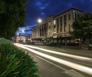
QUEST INVERCARGILL SERVICED APARTMENTS
Admiral Court Motel & Apartments
Balmoral Lodge Motel
Homestead Villa Motel
Queens Park Motels
Ascot Park Hotel Invercargill
Monarch Motel
Bavarian Motel
Tower Lodge Motel
Kelvin Hotel
Videos from this area
These are videos related to the place based on their proximity to this place.
O Week 2015 - Welcome to Invercargill - Mayor Tim Shadbolt
Invercargill City Mayor Tim Shadbolt welcomes students to Invercargill and Southern Institute of Technology for the 2015 academic year. His message to students was to "Be open to new ideas...
Invercargill City Tigers vs Eastern Knights - 12/7/92
Southland Rugby League game played 12th July 1992 at the old Sandy Point grounds beside the Oreti River near ( Invercargill )..
Invercargill - Southern Scenic Route Drmnsd's photos around Invercargill, New Zealand
Preview of Drmnsd's blog at TravelPod. Read the full blog here: http://www.travelpod.com/travel-blog-entries/drmnsd/nz_-_my_passion/1167959160/tpod.html This blog preview was made by TravelPod ...
Modern church & community centre, Invercargill, New Zealand
Quick tour of a modern church designed by Invercargill architect Neil McDowell and Queenstown designer Graham Roebeck of Structural integrity Ltd, joint venture partners in a design competition....
Southern most city in the world Alinmattrtw2005's photos around Invercargill, New Zealand
Preview of Alinmattrtw2005's blog at TravelPod. Read the full blog here: http://www.travelpod.com/travel-blog-entries/alinmattrtw2005/rtw2005/1175027820/tpod.html This blog preview was made...
Pot Pourri of Invercargill and New Zealand Life Mertonkiwis's photos around Invercargill
Preview of Mertonkiwis's blog at TravelPod. Read the full blog here: http://www.travelpod.com/travel-blog-entries/mertonkiwis/1/1229237760/tpod.html This blog preview was made by TravelPod...
Kiwirail train 926 leaves Invercargill New Zealand iphone4s
Train 926 crosses Lindisfarne Street, with a very small train for Edendale and North. New livery engine DXB 5166 (old number 2614) and old Transrail livery loco DC 4853 (rebuild of DA 1485)
Otago Rescue Helicopter, Kew Hospital, Invercargill
Otago Rescue Helicopter leaves Kew Hospital Invercargill New Zealand.
All Blacks supporters Train, Invercargill - Dunedin
All Blacks supporters leave Invercargill for Dunedin game against Springboks. (Train experts (thats me) comment, track needs packing just this side of crossing, watch the bounce..
Videos provided by Youtube are under the copyright of their owners.
Attractions and noteworthy things
Distances are based on the centre of the city/town and sightseeing location. This list contains brief abstracts about monuments, holiday activities, national parcs, museums, organisations and more from the area as well as interesting facts about the region itself. Where available, you'll find the corresponding homepage. Otherwise the related wikipedia article.
Invercargill
Invercargill is the southernmost and westernmost city in New Zealand, and one of the southernmost cities in the world. It is the commercial centre of the Southland region. It lies in the heart of the wide expanse of the Southland Plains on the Oreti or New River some 18 km north of Bluff, which is the southernmost town in the South Island.
Oreti River
The Oreti (or New) River is one of the main rivers of Southland, New Zealand, and is 170 kilometres in length. The river has been identified as an Important Bird Area by BirdLife International because, for much of its length, it supports breeding colonies of Black-billed Gulls. The Oreti has its headwaters close to the Mavora Lakes between Lake Te Anau and Lake Wakatipu, and flows south across the Southland Plains to its outflow into Foveaux Strait at the southeastern end of Oreti Beach.
James Hargest College
James Hargest College is a large school of about 1950-2000 students, in Invercargill, New Zealand. The majority of students are New Zealand European, but there are some Māori and Asians. The school caters for students from year 7-13. The school is divided into two campuses, known as James Hargest Junior Campus (Year 7-8) and James Hargest Senior Campus (Year 9-13). The campuses are at opposite ends of Layard Street and are separated by about a 15-minute walk.
Windsor North School
Windsor North School is a primary school in Invercargill, New Zealand, previously known as Invercargill North School. The school's history dates to 1878, and the school moved to its current site in the suburb of Windsor the following year. The original school buildings were destroyed by fire in 1889. The only surviving remnant of the original school building is the school bell, which hangs in the foyer of the current administration block.
Makarewa
Makarewa is a small community north of Invercargill (the southernmost city in the South Island of New Zealand). Facilities include a primary school with a roll of about 130 children, two abandoned dairies, meeting rooms for clubs, a playcentre, country club, squash courts, lawn bowling club, and an indoor swimming pool on the school grounds. Alliance Group Ltd operate a freezing works in Makarewa, originally the plant processed beef but after being downsized in the nineties is a venison plant.
Southland Boys' High School
Southland Boys' High School (SBHS) is an all-boys school in Invercargill, New Zealand, and has been the only one in the city since Marist Brothers was merged with St Catherines to form Verdon College in 1982.
Verdon College
Verdon College is a co-educational Roman Catholic high school in Invercargill, New Zealand, teaching students from year 7 to 13 (ages 11–18). The college is named after Bishop Michael Verdon (1838–1918) who was the second Catholic Bishop of Dunedin (1896–1918).
St. Mary's Basilica, Invercargill
St. Mary's Basilica is a Catholic Church in Invercargill, New Zealand. It was designed by the celebrated New Zealand architect, Francis Petre and was opened in 1905. The Basilica is located near St Josephs school and the Otepuni Gardens. The building is listed as a Category I Historic Place. Although the church is called popularly "basilica", has not been declared a minor basilica by the Vatican.
Invercargill Airport
Invercargill Airport is a controlled aerodrome located 1 NM west of the city centre of Invercargill at the south of the South Island of New Zealand, it's also the southern most controlled airport in the Commonwealth. Formed on reclaimed land from the Waihopai/New River Estuary in 1938, the airport was prone to flooding, the worst being in 1984, leaving it unused for two months.
Rugby Park Stadium
Rugby Park Stadium is a rugby union venue and home ground for ITM Cup team Southland. Rugby Park Stadium is located on the corner of Elles Road and Tweed Street in Invercargill. The gound has a regular season capacity of 18 000. It has a safe temporary seating maximum capacity of 20,000 (although in former incarnations has accommodated up to 30,000 with large grass banks and concreted standing terraces).
Southland Girls' High School
Southland Girls' High School is a girls' secondary school in Invercargill, New Zealand. The 2005 NZQA report commended the school and staff for the very good practices and consistently high standards. The school admits a small number of international students. It consists of two main school blocks, one the former Tweedsmuir Junior High School. Students of all ages are mixed around the classrooms to involve all students thoroughly in school life, and one uniform is worn by all year levels.
Stadium Southland
Stadium Southland is an international sports complex in Invercargill, New Zealand. The stadium was completed in May 2000. The main SBS Sports Arena in the stadium has a (rebuilt) capacity of 4,500, with retractable seating. The stadium also has eleven other community basketball, netball and volleyball courts, four rebound Ace tennis courts, four squash courts and several business rooms.
Queen's Park, Invercargill
Queen's Park is a tourist attraction in Invercargill, New Zealand, and was part of the original plan when Invercargill was founded in 1856. The park is 200 acres in extent. It is located just north of the city centre bounded by Queens Drive to the east, Kelvin Street to the west, Gala Street to the south and Herbert Street to the north. The park has an 18-hole Golf Course, a Botanical garden, an aviary and sports grounds.
4ZA
4ZA was a local radio station in Southland New Zealand. 4ZA began broadcasting in Southland on 820 AM in 1956 as a commercial station operated by the New Zealand Broadcasting Service. With the change in band frequency spacing in late 1978, 4ZA moved to 864 AM. Before 1989 Radio stations in New Zealand were assigned call signs, 4ZA was branded as its call sign name 4ZA until 1993 when it became Classic Hits ZAFM.
Southland Astronomical Society Observatory
Southland Astronomical Society Observatory in Invercargill is New Zealand's southernmost observatory. Operated by Southland Astronomical Society but owned by the Southland Museum and Art Gallery, it is situated on the western side of the museum building. The primary telescope in use is a fork mounted 30cm (12 inch) diameter Cassegrain design. The telescope can also be operated in the classical Newtonian configuration by removing the secondary mirror. It was built by Russell Beck.
Kennington, New Zealand
Kennington is a town located in the Southland Region of New Zealand's South Island. It is situated on the Waihopai River on the eastern outskirts of the city of Invercargill. Other nearby settlements include Longbush, Myross Bush, Rimu, and Woodlands. State Highway 1 runs through the town, as does the Main South Line portion of the South Island Main Trunk Railway.
Myross Bush
Myross Bush is a rural community on the northeastern outskirts of the city of Invercargill in the Southland region of New Zealand's South Island. Other nearby settlements include Makarewa to the northwest, Rakahouka and Roslyn Bush to the northeast, and Kennington to the southeast. The 2001 New Zealand Census of Population and Dwellings found Myross Bush to have a population of 465; 234 females and 231 males. This represents an increase of 3.3% or 15 people since the 1996 census.
Teretonga Park
Teretonga (means "Swift South" in Maori) is a motor racing circuit situated 8 kilometres south-west of Invercargill, New Zealand. It is home of the Southland Sports Car Club. The circuit was established in 1957 and said to be the southern most race track in the world. It is also the country's oldest purpose-built venue.
Anderson Park, Invercargill
Anderson Park is a park in Invercargill, New Zealand. It consists of an impressive Georgian-style residence set in 24 hectares of landscaped gardens. The house displays Invercargill's extensive collection of New Zealand art.
Southland Museum and Art Gallery
The Southland Museum and Art Gallery is located in Gala Street, Invercargill, New Zealand. It is Southland's largest cultural and heritage institution, and contains a wide variety of the region's art, history and natural history collections.
Invercargill ILT Velodrome
The Invercargill ILT Velodrome is the only indoor velodrome in New Zealand. The $11 million dollar velodrome is an indoor complex next to Stadium Southland, built on the western side of the stadium proper. The venue will also act as a home for the Southern Steel netball side and Southland Sharks basketball team for 2011, after the collapse of Stadium Southland in September 2010, following a freak Southland snow storm.
Aurora College (Invercargill)
Aurora College is a secondary school in Invercargill, New Zealand.
Lorneville, New Zealand
Lorneville is a small settlement on the northern outskirts of Invercargill, in Southland, New Zealand. It is located on New Zealand State Highway 6, at the junction with State Highways 98 and 99, and is thus also on the Southern Scenic Route.
Unwin Radar
The Unwin Radar is a scientific radar array at Awarua, near Invercargill, New Zealand {{#invoke:Coordinates|coord}}{{#coordinates:46.51|S|168.38|E||||| | |name= }}. Unwin is part of the Super Dual Auroral Radar Network (SuperDARN), an international radar network for studying the upper atmosphere and ionosphere that operates in the High Frequency (HF) bands between 8 and 22 MHz.
Southland Astronomical Society
The Southland Astronomical Society is the southern-most astronomical society in the world. Based in Invercargill at the southern tip of New Zealand's South Island, its small, active group of about 35 amateur astronomer members participate in a variety of astronomical activities including education with groups and school children, deep sky observing, astrophotography and aurora observation.


