Safety Score: 3,0 of 5.0 based on data from 9 authorites. Meaning we advice caution when travelling to New Zealand.
Travel warnings are updated daily. Source: Travel Warning New Zealand. Last Update: 2024-08-13 08:21:03
Delve into Sunnyvale
The district Sunnyvale of Fairfield in Dunedin City (Otago) is a subburb in New Zealand about 386 mi south-west of Wellington, the country's capital town.
If you need a hotel, we compiled a list of available hotels close to the map centre further down the page.
While being here, you might want to pay a visit to some of the following locations: Dunedin, Invercargill, Christchurch, Greymouth and . To further explore this place, just scroll down and browse the available info.
Local weather forecast
Todays Local Weather Conditions & Forecast: 12°C / 53 °F
| Morning Temperature | 8°C / 46 °F |
| Evening Temperature | 10°C / 50 °F |
| Night Temperature | 8°C / 47 °F |
| Chance of rainfall | 0% |
| Air Humidity | 57% |
| Air Pressure | 1018 hPa |
| Wind Speed | Moderate breeze with 11 km/h (7 mph) from East |
| Cloud Conditions | Overcast clouds, covering 100% of sky |
| General Conditions | Light rain |
Sunday, 24th of November 2024
14°C (57 °F)
15°C (58 °F)
Overcast clouds, gentle breeze.
Monday, 25th of November 2024
15°C (59 °F)
12°C (53 °F)
Scattered clouds, gentle breeze.
Tuesday, 26th of November 2024
16°C (61 °F)
12°C (54 °F)
Sky is clear, gentle breeze, clear sky.
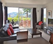
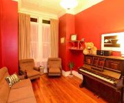
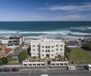
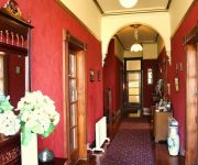
Hotels and Places to Stay
Bonnie Knights Motel
Bella Vista Motel Mosgiel
Hotel St Clair
Roslyn Apartments
Morrisons Guest House
Carisbrook Motel
Apartments at St Clair
Grandview Bed & Breakfast
Claremont House
Burns Lodge at Holy Cross Centre
Videos from this area
These are videos related to the place based on their proximity to this place.
Red Deer Hunt South Island New Zealand
Be Aware: This is a hunting video No gory bits though. A lot of look at the countryside on our journey in and out. I team up with Keith (and his hounds in case we require their help). On...
Tunnel Beach Drone Flight
Best watched 1080p. Subscribe for upcoming aerial videos. Tunnel Beach offers spectacular coast line scenery a short drive from Dunedin city. On the walk down the rolling green farm land and...
Foreign Food Test 1 - L&P, Twisties, Tim Tams
Kind of a cop out I know... More exciting foods next time :) Follow me on my travel bog: http://sheepytime.wordpress.com/
The Lord of the Posters - part I (1/2)
The Lord of the Posters - part I The ISMSC is an annual conference on Supramolecular Chemistry. This year (January 2012) was organized in Dunedin - New Zealand. This was the perfect chance...
The Steepest Street in the world
A journey up the steepest street in the world. Dunedin, NewZealand.
The Lord of the Posters - part II (2/2)
The Lord of the Posters - part II The ISMSC is an annual conference on Supramolecular Chemistry. This year (January 2012) was organized in Dunedin - New Zealand. This was the perfect chance...
Rental Property Dunedin 1 Stevenson Road 2BR/1BA by Dunedin Property Management
Call +64 3 487 8351 or visit http://www.manaproperty.co.nz/listings to view our currently available rental properties. Visit http://www.manaproperty.co.nz/ today and learn more about "Dunedin...
House to Rent Dunedin 111 Mulford Street 3BR/1BA by Dunedin Property Management
Call +64 3 487 8351 or visit http://www.manaproperty.co.nz/listings to view our currently available rental properties. Visit http://www.manaproperty.co.nz/ today and learn more about "Dunedin...
Videos provided by Youtube are under the copyright of their owners.
Attractions and noteworthy things
Distances are based on the centre of the city/town and sightseeing location. This list contains brief abstracts about monuments, holiday activities, national parcs, museums, organisations and more from the area as well as interesting facts about the region itself. Where available, you'll find the corresponding homepage. Otherwise the related wikipedia article.
Mosgiel
Mosgiel is an urban satellite of Dunedin in Otago, New Zealand, fifteen kilometres west of the city's centre. Since the re-organisation of New Zealand local government in 1989 it has been inside the Dunedin City Council area, but was physically separate from the contiguous suburbs until developments in the neighbouring suburb of Fairfield joined it to the city. Mosgiel has a population of approximately 10,000. Mosgiel stands at the north-eastern extremity of the Taieri Plains.
Cargill's Castle
The ruins of Cargill's Castle stand on a promontory overlooking the Pacific Ocean in New Zealand's southern city of Dunedin. It is one of only two castles in New Zealand, the other being nearby Larnach Castle. More a castle in name than in fact, this mansion was built for Edward Cargill, eighth child of city founder William Cargill, in the late 19th century, who called it The Cliffs.
Anglican Diocese of Dunedin
The Diocese of Dunedin is one of the thirteen dioceses and hui amorangi of the Anglican Church in Aotearoa, New Zealand and Polynesia. The diocese covers the same area as the provinces of Otago and Southland in the South Island of New Zealand. Area 65,990 km², population 272,541 (2001). Anglicans are traditionally the third largest religious group in Otago and Southland after Presbyterians and Roman Catholics.
Taieri College
Taieri College, formerly called The Taieri High School and, prior to 1956, the Mosgiel District High School, is a co-educational state school in Mosgiel, Dunedin, New Zealand. In 2003 a review of the schools on the Taieri Plains by the New Zealand Ministry of Education proposed that the high school would merge with Mosgiel Intermediate School (est. 1973) to become Taieri College from 2004.
Fairfield School (Dunedin)
Fairfield School is a Primary and Intermediate school in Dunedin, New Zealand. It was established during the late 19th century in the suburb of Fairfield by William Martin. It is situated on Sickels Street, a small cul-de-sac near the Dunedin Southern Motorway. The school has restricted enrolment to a limited geographical zone to reduce class sizes.
Wakari Hospital
Wakari Hospital is a psychiatric hospital located in Dunedin, New Zealand. It is situated in the suburb of Wakari, about three kilometres north-west of the city centre. The hospital is operated by the Southern District Health Board and is closely associated with Dunedin Public Hospital. It contains specialised psychiatric services but also cares for people with intellectual disability and people undergoing physical rehabilitation.
Tunnel Beach
Tunnel Beach is a locality 7.5 kilometres southwest of the city centre of Dunedin, New Zealand. Located just south of St Clair, Tunnel Beach has sea-carved sandstone cliffs, rock arches and caves. Beyond the beauty of the rugged sandstone cliffs, its claim to fame is the tunnel down to the beach that a local politician, John Cargill, son of Captain William Cargill, had commissioned for his family in the 1870s.
Fairfield, Otago
For the suburb of Hamilton, New Zealand, see Fairfield, Waikato Fairfield is located in New ZealandFairfieldFairfield The quiet suburb of Fairfield lies 10 kilometres to the west of Dunedin CBD, in Otago, southern New Zealand. Fairfield lies in rolling hill country between Abbotsford and the Taieri Plains, close to the slopes of Saddle Hill and Scroggs Hill.
Kaikorai Valley College
Kaikorai Valley College is a co-educational secondary school in Dunedin, New Zealand. Kaikorai Valley College is a large Year 7 to 13 school situated in a park-like setting in south west Dunedin. This year Kaikorai Valley College has celebrated 53 years. Initially starting as Kaikorai Valley High School in 1958, the school combined with Kenmure Intermediate School in 1996 to become Kaikorai Valley College, and in 2008 celebrated its 50th jubilee.
Saddle Hill, New Zealand
Saddle Hill is a prominent landmark overlooking the northeastern end of the Taieri Plains in Otago, New Zealand. Within the limits of Dunedin city, it is located 18 kilometres to the west of the city centre, between Mosgiel and Green Island, and is clearly visible from many of the city's southern hill suburbs. A lookout on the northern slopes of the hill commands a good view across the plains, with Lake Waihola visible 25 kilometres to the west in clear weather.
Caversham, New Zealand
Caversham is one of the older suburbs of the South Island New Zealand city of Dunedin. It is sited at the western edge of the city's central plain at the mouth of the steep Caversham Valley, which rises to the saddle of Lookout Point. Major road and rail routes south lie nearby; the South Island Main Trunk railway runs through the suburb, and a bypass skirts its main retail area, connecting Dunedin's one-way street system with the Dunedin Southern Motorway.
Waldronville
Waldronville is a coastal settlement on the Pacific Ocean coast of the South Island of New Zealand. Established in the 1950s as a commuter settlement, it is located 13 kilometres to the southwest of Dunedin city centre, and lies within the city's limits. Waldronville was developed by Bill Waldron, when he purchased the McCraws farm in the early 1950s, initially for 200 houses. In the mid-1970s, two other streets were added to the southwest of the settlement.
Mornington, Otago
Mornington is a suburb of the city of Dunedin, in the South Island of New Zealand. It is situated on hilly slopes 2 kilometres to the west of the city centre, the slopes forming part of a ridge which surrounds the heart of the city. At the time of the 2006 census, the permanent population was 3,393, a decrease of 15 since 2001. The use of the name Mornington for the area was first recorded in 1862.
Sunnyvale Park
Sunnyvale Park is a multi-use sports venue in Dunedin, New Zealand. It is located in Sunnyvale, near Green Island, and is currently used primarily for football (soccer), being a former home ground for Otago United in the New Zealand Football Championship, as well as local club side Green Island. Sunnyvale Park has also been a first-class cricket venue.
Corstorphine, New Zealand
Corstorphine is a suburb of southwest Dunedin in the South Island of New Zealand. It is located on the slopes of Calton Hill - a spur of Forbury Hill - between Caversham Valley and the Pacific Ocean. The suburbs of Saint Clair and Forbury lie to the east and south, and Caversham and Lookout Point lie to the north. Corstorphine is a largely residential suburb, containing a substantial amount of state housing built from the 1930s to the 1960s.
Maryhill, New Zealand
Maryhill is a residential suburb of the New Zealand city of Dunedin. It is located on a ridge to the southwest of the central city between the suburbs of Mornington, Kenmure, and Caversham. The smaller suburb of Balaclava lies immediately to its west. Maryhill takes its name from a district in the city of Glasgow in Scotland, where many of the early settlers of the suburb originated.
Brockville, New Zealand
Brockville is a residential suburb of the New Zealand city of Dunedin. It is located at the edge of the city's main urban area, 5.5 kilometres to the northwest of the city centre, but separated from it by both a ridge of hills and the Kaikorai Valley. The suburb's main street is Brockville Road, which leaves Kaikorai Valley Road close to the boundary between the suburbs of Kaikorai and Bradford, winding up the slopes which forms the northwestern boundary of Kaikorai Valley.
Burnside, Otago
Burnside is a mainly industrial suburb of the New Zealand city of Dunedin. It is located at the mouth of a long valley, the Kaikorai Valley, through which flows the Kaikorai Stream. This valley stretches to the northeast for 3.5 kilometres . Burnside is 5.5 kilometres to the southwest of the city centre, close to eastern end of the much larger suburb, Green Island. Other suburbs located nearby include Concord, immediately to the southeast and Kenmure further up Kaikorai Valley.
Kaikorai Stream
The Kaikorai Stream is a short river which runs through Otago, in New Zealand's South Island. The entirety of its length is within the city of Dunedin. The stream's headwaters are close to the city's main reservoir at Mount Grand, immediately above Fraser's Gully. The stream flows southeast through Fraser's Gully, a popular recreation reserve clad in native bush, during which part of its course it is known as Fraser's Stream.
Kaikorai Valley
Kaikorai Valley is a long broad valley which runs through the west of the New Zealand city of Dunedin, 5 kilometres to the west of the city centre. It is the valley of a small stream, the Kaikorai Stream,which runs from northeast to southwest down the length of the valley.
1979 Abbotsford landslip
On 8 August 1979, a major landslip occurred in the Dunedin, New Zealand suburb of Abbotsford. It was the largest landslide in a built-up area in New Zealand's history, resulting in the destruction of 69 houses - around one sixth of the suburb - but no fatalities.
Wingatui
Wingatui is a small settlement almost 15 kilometres west of Dunedin, and two kilometres east of Mosgiel. It has become a suburb of Mosgiel, but continues to maintain its own unique identity and heritage. Known primarily for its railway station and for Wingatui Racecourse, Wingatui is home to an increasing population of nearly 1,200 people, according to the 2006 census. Wingatui enjoys a low unemployent rate and generally high level of income compared with Dunedin generally.
Green Island, New Zealand
Green Island is a suburb of Dunedin, New Zealand. It is not on the sea — formerly a borough, it took its name from the Green Island bush, uncleared native forest extending from the valley where the town is centred over the hills towards the coast. The offshore island's name was used to identify the bush.
Green Island (Okaihe)
Green Island is a small, uninhabited island lying 2 km off the coast of the Otago Region of New Zealand, some 13 km south-west of the city of Dunedin. The island's Māori name is Okaihe.
Island Park Recreation Reserve
Island Park Recreation Reserve is a coastal reserve in Waldronville, just to the southwest of Dunedin, New Zealand. The Kaikorai Stream and Westwood Recreation Reserve lie to the west. The reserve was established in 1977, coming into effect in 1978.


