Safety Score: 3,0 of 5.0 based on data from 9 authorites. Meaning we advice caution when travelling to New Zealand.
Travel warnings are updated daily. Source: Travel Warning New Zealand. Last Update: 2024-08-13 08:21:03
Delve into Mairtown
The district Mairtown of Kamo in Whangarei (Northland) is a district located in New Zealand about 387 mi north of Wellington, the country's capital town.
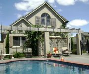
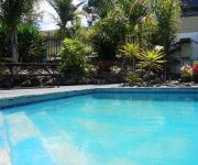
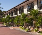
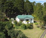
In need of a room? We compiled a list of available hotels close to the map centre further down the page.
Since you are here already, you might want to pay a visit to some of the following locations: Whangarei, Kaitaia, Auckland, Hamilton and Tauranga. To further explore this place, just scroll down and browse the available info.
Local weather forecast
Todays Local Weather Conditions & Forecast: 18°C / 64 °F
| Morning Temperature | 13°C / 55 °F |
| Evening Temperature | 16°C / 61 °F |
| Night Temperature | 12°C / 53 °F |
| Chance of rainfall | 0% |
| Air Humidity | 54% |
| Air Pressure | 1020 hPa |
| Wind Speed | Gentle Breeze with 6 km/h (4 mph) from North-East |
| Cloud Conditions | Overcast clouds, covering 100% of sky |
| General Conditions | Overcast clouds |
Sunday, 24th of November 2024
18°C (65 °F)
11°C (51 °F)
Light rain, light breeze, broken clouds.
Monday, 25th of November 2024
23°C (73 °F)
11°C (53 °F)
Sky is clear, light breeze, clear sky.
Tuesday, 26th of November 2024
23°C (74 °F)
14°C (58 °F)
Overcast clouds, light breeze.
Hotels and Places to Stay
Lodge Bordeaux
Cheviot Park Motor Lodge
Lupton Lodge
Burgundy Rose Motel
Kingswood Manor Motel
DISCOVERY SETTLERS HOTEL WHANGAREI
Motel Six
DISTINCTION WHANGAREI HOTEL AND CONFEREN
Kauri Nest
Central Court Motel
Videos from this area
These are videos related to the place based on their proximity to this place.
VINZ Rally of Whangarei. Ceremonial Start, Friday 11/4/14
VINZ International Rally of Whangarei. The start was held at Cameron Street Mall, Whangarei. Tikipunga High School did the Kapa Haka.
Too much wine? Frenchmen mooring at Town Basin, Whangarei, New Zealand
Hectic Frenchmen mooring at Town Basin, Whangarei, New Zealand.
Whangarei BMX Club - Pre North Island Champs Meeting
Whangarei BMX Club hosted the "pre North Island Championships" meeting on the 23rd September 2012. Despite the weather trying to put a damper on things, the meeting went without a hitch and...
My first skydive | New Zealand ..! (Whangarei, New Zealand)
Skydiving in Whangarei..! One of the best experiences you can ever have..! It is funny that how alive you feel when your life is at risk..! Truly a life lasting experience.
2011 APRC Rd4 International Rally of Whangarei - Photo Movie
2011 Asia Pacific Rally Championship - APRC Round 4 International Rally of Whangarei Photo Movie htt://www.yodarallying.jp/
Kiwirail DC4571 passing Whangarei's Town Hall Station.
Light engine movement past the former Town Hall Station platform (Whangarei) before crossing the Rust Ave and Water St overbridges. Feel free to hit the 'like' button. Thanks! If you want...
Ben Smith 191 Whangarei Speedway race 2 19/1/13
Helmet camera from Ben Smith 191 racing speedway at Whangarei Speedway 20/1/13 Featuring Paul Smith and Kyle Chandler.
pt1 - Parahaki Whangarei NZ, Downhill Mountain Biking (Dual Cam) - Memorial Stairs
Video from two cameras, one helmet mounted, the other mounted to MTB frame looking forward. Riding down the stairs from the Parahaki Memorial, in Whangarei. Get flat rear tyre at end :(
Charity Boxing Event Whangarei Oct 1st 2011. Kitchen vs Ivey Bout
This video is of the Bout between Karl Kitchen (Fire Service) & Andrew Ivey (Police) The fight night was on the 1st October 2011, A charity fight for the Red Cross & Salvation Army for all...
Videos provided by Youtube are under the copyright of their owners.
Attractions and noteworthy things
Distances are based on the centre of the city/town and sightseeing location. This list contains brief abstracts about monuments, holiday activities, national parcs, museums, organisations and more from the area as well as interesting facts about the region itself. Where available, you'll find the corresponding homepage. Otherwise the related wikipedia article.
Whangarei Airport
Whangarei Aerodrome is a small airport 4NM (7.4 km) to the south east of Whangarei city, in the suburb of Onerahi, on the east coast of Northland on the North Island, New Zealand.
Kamo, New Zealand
Kamo is a small township north of Whangarei, approximately five minutes drive from the Whangarei CBD. The name is a Māori word meaning "eyelash", but has also been said to mean "to bubble up", referring to hot springs in the area. Mount Parakiore is a volcanic dome rising 391 m to the northwest of the town. It is about one million years old, and part of the Harbour Fault which also includes Mount Hikurangi near Hikurangi, and Parahaki in Whangarei.
Pompallier Catholic College
Pompallier Catholic College is a Catholic co-educational Secondary college located in the suburb of Maunu in Whangarei, New Zealand.
Onerahi
Onerahi is a seaside suburb of Whangarei, New Zealand's northern most city. It is the city's only seaside suburb. It is located 9 km south-east of the centre of Whangarei, and follows the Whangarei harbour coastline until it meets the Pacific Ocean. The population was 2,100 in the 2006 Census, an increase of 96 from 2001. The suburb's main feature is Whangarei Airport, located on the large flat area at the southern end of the suburb.
Whangarei Observatory
Whangarei Observatory is associated with the Northland Astronomical Society (NAS), and situated in the Heritage Park grounds, off State Highway 14 in Maunu, Whangarei, New Zealand The observatory is open for public viewing evenings every month on the Saturday nearest to the Moon's first quarter phase. As well as the society's 14" Schmidt-Cassegrain telescope, members also bring along their own telescopes for public viewing.
Kingdom of Zion
Kingdom of Zion (formerly Zion Wildlife Gardens) is a privately owned zoo located near Kamo, Whangarei, New Zealand, currently sited at the former Zion Wildlife Gardens property. The facility houses 34 cats of varying species, mainly lions and Bengal tigers, a black leopard, and two African Cheetah. Kingdom of Zion Limited was incorporated on 9 March 2012. The park is privately run and is funded through tours and donations.
Hurupaki Mountain
Hurupaki Mountain is in Kamo, Whangarei, New Zealand. The centre of Hurupaki Mountain lies between Three Mile Bush Road and Dip Road, approximately 1.5 kilometres west of Kamo township. Hurupaki Mountain is visible from State Highway 1.
Whangarei District
The Whangarei District is located in Northland, New Zealand. Whangarei City is the principal town and the district seat. Other towns include Hukerenui, Hikurangi, Titoki, Ruakaka and Waipu. The district contains a large amount of rural land, including beaches such as Ngunguru, game fishing mecca Tutukaka, a variety of beaches along Whangarei Harbour, as well as Matakohe or Limestone Island in the Harbour, now subject to ecological restoration.
Horahora, Whangarei
Horahora is a suburb on the southwestern side of Whangarei, in Northland, New Zealand. The population was 1,026 in the 2006 Census, an increase of 45 from 2001.
Morningside, Northland
Morningside is a suburb to the south of Whangarei in Northland, New Zealand. The population was 2,148 in the 2006 Census, an increase of 81 from 2001.
Whau Valley
Whau Valley is a suburb of Whangarei, in Northland Region, New Zealand. State Highway 1 runs through it. The valley was named for the whau trees which grew there in the 1850s. The population was 2,745 in the 2006 Census, an increase of 81 from 2001. At the end of the 4 km long Whau Valley Road is the principal water reservoir for Whangarei City, created by the Whau Valley Earth Dam. The reservoir is stocked with rainbow and brown trout.
Otangarei
Otangarei is a suburb of Whangarei, in Northland Region, New Zealand. Locals also refer to this area as O. T (owe-tee). The population was 2,256 in the 2006 Census, an increase of 225 from 2001.
Okara Park
Okara Park is a multi-purpose stadium in Whangarei, New Zealand. It is currently used mostly for rugby union matches and is the home stadium of Northland Rugby Union. The stadium is able to hold 30,000 people and was built in 1965. The park has recently had a $16m redevelpoment with the new grandstand known as the Northland Events Centre being built. The new development has turned Okara Park into a multi-purpose Northland sports hub.
Hātea River
The Hātea River is a river of New Zealand. It flows from the north-east of Whangarei southwards and into the northern head of Whangarei Harbour. Its lower length forms the eastern boundary of the city. The banks along the lower reaches are parks and bushland with a series of metalled walks suitable for all weathers. At Whangarei Falls near Tikipunga, the Hātea River drops 26 metres over a basalt lava flow. The falls, originally known as Otuihau, have been a picnic spot since at least the 1890s.
Kaiikanui River
The Kaiikanui River is a river of Northland, New Zealand.
Mangapai River
The Mangapai River is a river of the Northland Region of New Zealand's North Island. It is perhaps better described as a silty arm of Whangarei Harbour, located 10 kilometres due south of Whangarei. Its average width is some four kilometres, but the silty nature of its course means that the stream itself is far narrower.
Taheke River
The Taheke River is a river of the Northland Region of New Zealand's North Island. It flows north from its origins in hills to the east of Whangarei reaching the Waitangi River close to its mouth at Ngunguru Bay.
Waiariki River
The Waiariki River is a river of the Northland Region of New Zealand's North Island. It is one of the upper tributaries of the Wairua River, which it reaches near the settlement of Waiotu, approximately halfway between Whangarei and Kawakawa.
Waiotu River
The Waiotu River is a river of the Northland Region of New Zealand's North Island. One of the headwaters of the Wairua River system, it flows generally south from its sources 15 kilometres southeast of Kawakawa. Its waters join with those of the Whakapara River to form the Wairua River.
Whakapara River
The Whakapara River is a river of the Northland Region of New Zealand's North Island. One of the headwaters of the Wairua River, it flows generally west from its sources close to the North Auckland Peninsula's east coast, and reaches the Wairua five kilometres west of Otonga.
Lake Ora
Lake Ora is a lake in the Northland Region of New Zealand.
Cobham Oval
The Cobham Oval is a cricket ground in Whangarei, New Zealand that stages daytime only first-class matches. It is one of the home grounds for the Northern Districts Knights. It is named after the former Governor General, Charles Lyttelton, 10th Viscount Cobham. A new Cobham Oval was built in 2005. A One Day International against Zimbabwe was held on Waitangi Day (6th February 2012) and a Test cricket match against Sri Lanka is to be held in January 2015.
Motu Matakohe
Motu Matakohe, also known as Matakohe or Limestone Island, is a 37 ha (100 acre) island in the upper reaches of Whangarei Harbour, just off Onerahi, a seaside suburb of the city of Whangarei, Northland, New Zealand. Used for farming and industry for many years, the island is an example of ecological island restoration by a volunteer community group.
Whangarei Harbour Marine Reserve
The Whangarei Harbour Marine Reserve is a protected area in the North Island of New Zealand. It was established in 2006 and is approximately 240 ha over two sites. The students and faculty of the nearby Kamo High School played an important role in establishing this reserve. The reserves are governed by the Marine Reserves Act 1971 and is administered by the Department of Conservation. 30px External images 16px Department of Conservation maps of the reserve


