Safety Score: 3,0 of 5.0 based on data from 9 authorites. Meaning we advice caution when travelling to New Zealand.
Travel warnings are updated daily. Source: Travel Warning New Zealand. Last Update: 2024-08-13 08:21:03
Touring Tepene
Tepene in Far North District (Northland) is a town located in New Zealand about 432 mi (or 696 km) north of Wellington, the country's capital place.
Time in Tepene is now 12:35 AM (Friday). The local timezone is named Pacific / Auckland with an UTC offset of 13 hours. We know of 8 airports nearby Tepene, of which one is a larger airport. The closest airport in New Zealand is Kerikeri Airport in a distance of 14 mi (or 22 km), South. Besides the airports, there are other travel options available (check left side).
Need some hints on where to stay? We compiled a list of available hotels close to the map centre further down the page.
Being here already, you might want to pay a visit to some of the following locations: Kaitaia, Whangarei, Auckland, Hamilton and Tauranga. To further explore this place, just scroll down and browse the available info.
Local weather forecast
Todays Local Weather Conditions & Forecast: 18°C / 65 °F
| Morning Temperature | 12°C / 53 °F |
| Evening Temperature | 15°C / 59 °F |
| Night Temperature | 12°C / 53 °F |
| Chance of rainfall | 0% |
| Air Humidity | 54% |
| Air Pressure | 1017 hPa |
| Wind Speed | Gentle Breeze with 8 km/h (5 mph) from North-East |
| Cloud Conditions | Broken clouds, covering 72% of sky |
| General Conditions | Broken clouds |
Friday, 22nd of November 2024
21°C (70 °F)
10°C (49 °F)
Sky is clear, gentle breeze, clear sky.
Saturday, 23rd of November 2024
21°C (69 °F)
11°C (52 °F)
Few clouds, gentle breeze.
Sunday, 24th of November 2024
20°C (69 °F)
12°C (53 °F)
Broken clouds, light breeze.
Hotels and Places to Stay
The Lodge at Kauri Cliffs
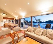
Cavalli Beach House Retreat
Videos from this area
These are videos related to the place based on their proximity to this place.
HiHi Beach. New Zealand April 2012
Hihi Beach is 5km down sealed road off State Highway 10, 7km south of Mangonui on Doubtless Bay.
AUUC Matauri Bay 2015
Auckland University Underwater Clube annual trip to Matauri Bay 2015 Footage: Igor Sammy Johnson.
Kauri Cliffs '02 Kane Wells & Daniel St George holes 4 & 5
Kauri Cliffs 2002, Kane & Dan the man chopping it ;-) 4th hole, "Cambo" 558 yd par 5, One of the great par 5's in golf. Aim tee-shot inside left hand bunkers. Longer hitters will have the option...
Magic Cottages at Takou River, Bay of Islands Accommodation
Magic Cottage Set a short distance from Kerikeri in the Bay of Islands and voted one of the Top Ten Luxury Lodges in New Zealand, Magic Cottages at Takou River are secluded and beautiful...
Barefoot And Bridleless (bitless jumping)
Riding my QHxTB horse, Tigger. I never use a bit on him and he has been barefoot all his life.
Kauri Cliffs New Zealand
www.golfholidayshop.com Looking for your next Golf Holiday? We offer amazing Golf Holidays across the globe at amazing, unbeatable prices. Why book with ...
Vlog New Zealand Matauri Bay
https://www.youtube.com/playlist?list=PL9WpYWlrkxxvY5itgF2kntKFu_-FfIKrg.
Scuba Diving Rainbow Warrior Wreck, New Zealand
Scuba Diving Rainbow Warrior Wreck Matauri Bay New Zealand January 2019.
Videos provided by Youtube are under the copyright of their owners.
Attractions and noteworthy things
Distances are based on the centre of the city/town and sightseeing location. This list contains brief abstracts about monuments, holiday activities, national parcs, museums, organisations and more from the area as well as interesting facts about the region itself. Where available, you'll find the corresponding homepage. Otherwise the related wikipedia article.
Matauri Bay
Matauri Bay is a bay in New Zealand, situated 30 km north of Kerikeri, in Whangaroa county, just north of the Bay of Islands. It has over a kilometre of beautiful white sand and crystal clear water. It is particularly popular in the summer when thousands flock there to stay in the local camping ground which can be seen at the left hand end of the beach in the photo (right). Some of the first Polynesian navigators to New Zealand landed at Matauri Bay.
Hapuawai River
The Hapuawai River is a short river in the Far North District of New Zealand. It joins the Takou River shortly before its mouth in Takou Bay in the South Pacific Ocean.
Hikurua River
The Hikurua River is a river of the far north of New Zealand's North Island. It flows southeast from rough hill country south of the Whangaroa Harbour, reaching the sea at Takou Bay, eight kilometres south of the Cavalli Islands.
Takou River
The Takou River (in its upper reaches called the Takou Stream) is a river of the Northland Region of New Zealand's North Island. It flows generally east from its sources east of Kaeo to reach the Pacific Ocean at Takou Bay, 15 kilometres north of Kerikeri.


