Safety Score: 3,0 of 5.0 based on data from 9 authorites. Meaning we advice caution when travelling to New Zealand.
Travel warnings are updated daily. Source: Travel Warning New Zealand. Last Update: 2024-08-13 08:21:03
Delve into Springlands
The district Springlands of Blenheim in Marlborough District (Marlborough) is a district located in New Zealand about 46 mi west of Wellington, the country's capital town.
In need of a room? We compiled a list of available hotels close to the map centre further down the page.
Since you are here already, you might want to pay a visit to some of the following locations: Nelson, Richmond, Wellington, Palmerston North and Christchurch. To further explore this place, just scroll down and browse the available info.
Local weather forecast
Todays Local Weather Conditions & Forecast: 12°C / 53 °F
| Morning Temperature | 10°C / 51 °F |
| Evening Temperature | 11°C / 52 °F |
| Night Temperature | 10°C / 49 °F |
| Chance of rainfall | 1% |
| Air Humidity | 78% |
| Air Pressure | 1018 hPa |
| Wind Speed | Gentle Breeze with 7 km/h (4 mph) from North-West |
| Cloud Conditions | Overcast clouds, covering 100% of sky |
| General Conditions | Light rain |
Sunday, 24th of November 2024
19°C (65 °F)
11°C (52 °F)
Broken clouds, moderate breeze.
Monday, 25th of November 2024
20°C (68 °F)
15°C (58 °F)
Broken clouds, gentle breeze.
Tuesday, 26th of November 2024
19°C (66 °F)
14°C (58 °F)
Sky is clear, gentle breeze, clear sky.
Hotels and Places to Stay
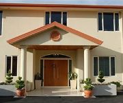
Angel Luxury Lodge
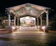
Knightsbridge Court Motor Lodge
Quality Hotel Marlborough
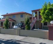
Blenheim Spa Motor Lodge
Colonial Motel
Antria Boutique Lodge
Two Tree Lodge
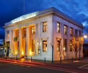
Hotel d'Urville
Bella Vista Motel Blenheim
Aston Court Motel Blenheim
Videos from this area
These are videos related to the place based on their proximity to this place.
12 Days Across New Zealand- Day 6: Blenheim
An informative video diary of a 12 day backpacking odyssey across the country of New Zealand. http://nakedbus.com/ http://www.atomictravel.co.nz/ http://www.thegrapevine.co.nz/ http://www.bub...
Blenheim Riverside Narrow Gauge Railway-Tree trimming with Murray
The Blenheim Riverside Railway (BRRS or BRR) is a 2 ft (610 mm) narrow gauge heritage railway in Blenheim, New Zealand. Plese It runs along the Taylor River, which winds its way through the...
Hi from Blenheim, New Zealand
We are having a fantastic time. Weather has been fantastic, and we are now in Blenheim with beautiful clear blue sky. Going to the vineyards on Sunday, and Monday we are catching the ferry...
Earthquake disaster in Blenheim
Earthquake disaster in Blenheim - 30 related post Earth Quake callouts for Blenheim Volunteer Fire Brigade on the 16th August 2013. Mainly unsafe or collapsed chimneys. 186 - 01022014.
heatpumps Blenheim
https://www.supercleanit.co.nz We clean heatpumps, old and new. Call us today on 0800 255 326.
Rental Properties Nelson New Zealand Blenheim Unit 3BR/1BA by Nelson Property Management
Visit http://www.rented.org.nz/ to know more about "Nelson Property Management"! For our available listings, go to http://www.rented.org.nz/region/nelson-tasman-region/ or give us a call at...
Tranz Coastal Scenic Train Journey to Christchurch Charlene.quandt's photos around Blenheim
Preview of Charlene.quandt's blog at TravelPod. Read the full blog here: http://www.travelpod.com/travel-blog-entries/charlene.quandt/1/1267825142/tpod.html This blog preview was made by...
Pollard park and Seymour Square and Talyor River Blenheim New Zealand
Pollard park and Seymour Square and Taylor river Blenheim new ZealandBlenheim's Seymour Square was, officially, named after Henry Seymour who, with his son-in-law Alfred Fell, owned the land...
Cloudy Bay - Blenheim, South Island, New Zealand
http://tripwow.tripadvisor.com/tripwow/ta-00a1-222a-e74e?ytv2=1 - Created at TripWow by TravelPod Attractions (a TripAdvisor™ company) Cloudy Bay Blenheim This winery's sauvignon blanc...
Videos provided by Youtube are under the copyright of their owners.
Attractions and noteworthy things
Distances are based on the centre of the city/town and sightseeing location. This list contains brief abstracts about monuments, holiday activities, national parcs, museums, organisations and more from the area as well as interesting facts about the region itself. Where available, you'll find the corresponding homepage. Otherwise the related wikipedia article.
Blenheim, New Zealand
Blenheim is the most populous town in the region of Marlborough, in the north east of the South Island of New Zealand, and the seat of the regional council. It has an urban population of 30,500 (June 2012 estimate). The area which surrounds the town is well known as a centre of New Zealand's wine industry. It enjoys one of New Zealand's sunniest climates, with hot, relatively dry summers and crisp winters.
Renwick, New Zealand
Renwick is a small town in Marlborough, New Zealand, close to the south bank of the Wairau River. It is located on State Highway 6, 12 kilometres west of Blenheim. Havelock is 31 km north. Highway 63 runs southwest from Renwick through the Wairau River valley. The population was 1872 in the 2006 Census, an increase of 84 from 2001. The town was initially known as "Upper Wairau", and then as "Renwicktown" after an early landowner, Dr Thomas Renwick.
RNZAF Base Woodbourne
RNZAF Base Woodbourne is a base of the Royal New Zealand Air Force, located 8 km west of Blenheim. Woodbourne was established in 1939 as the base for No. 2 Service Flying Training School (No.2 SFTS). Also located nearby during WWII were the ground training camps of the Delta. In 1942-43, Nos 16 and 18 Squadrons flying Curtiss Kittyhawks used the satellite Fairhall field.
Woodbourne Airport
Woodbourne Aerodrome is a small, controlled aerodrome located 3NM (8 km) west of Blenheim in the South Island of New Zealand, on State Highway Six, Middle Renwick Road. Marlborough Airport (Company Name) is a busy regional airport co-located with RNZAF Base Woodbourne in the sunny Wairau Valley on the north-eastern corner of the South Island of New Zealand.
Lansdowne Park, Blenheim
Lansdowne Park is one of the home grounds for Air New Zealand Cup team Tasman, the other being Trafalgar Park in Nelson. It is also home to the Marlborough Red Devils and Blenheim Clubs Harlequins and Central.
Grove Mill
Grove Mill winery was established in 1988 and is located in Marlborough, New Zealand. The winery was founded by group of local grape growers and wine enthusiasts who purchased the Malt house (The Mill), a historic landmark in Grovetown, Blenheim, and transformed it into a 150 tonne winery. By 1993, demand for their wine outgrew production capacity and Grove Mill underwent expansion.
General Service Training School
Command and Recruit Training Squadron (CRTS) of the Royal New Zealand Air Force is the principal training facility for RNZAF recruits. Located at RNZAF Base Woodbourne, it takes recruits through a thirteen-week training program designed to produce airmen and airwomen for the RNZAF.
Marlborough Boys' College
Marlborough Boys' College is a single-sex secondary school in Blenheim, New Zealand.
Rapaura
Rapaura is a village northwest of Blenheim, New Zealand. The Wairau River flows past to the north. Spring Creek lies to the east. Rapaura consists of a church and a school. It also has high quality land for growing grapes.
Tuamarina River
Tuamarina River is a river in Marlborough in the South Island of New Zealand. It flows into the Wairau River just south of Tuamarina.
Wairau Bar
The Wairau Bar, or Te Pokohiwi, is a 19 ha gravel bar formed where the Wairau River meets the sea in Cloudy Bay, Marlborough, north-eastern South Island, New Zealand. It is an important archaeological site, apparently settled within one or two generations of the arrival of Polynesians in New Zealand. It is the earliest known human settlement in New Zealand. At the time of the occupation it is believed to have been a low island 2–3 m high, 1.1 km long and 0.4 km wide.
Mayfield, Marlborough
Mayfield is a suburb to the north of Blenheim's central district. Pollard Park and Lansdowne Park are large parks to the west and north of the suburb, and a racecourse lies to the northwest. The population was 2,694 in the 2006 Census, an increase of 75 from 2001.
Springlands
Springlands is a suburb to the west of Blenheim's central district. It is located heading out of Blenheim on Nelson Street towards Renwick. It has a tavern, video shop, various takeaways, and a superstore. The population was 3,807 in the 2006 Census, an increase of 357 from 2001.
Blenheim Riverside Railway
The Blenheim Riverside Railway (BRRS or BRR) is a narrow gauge (24 inch) heritage railway in Blenheim, New Zealand. It runs along the Taylor River, which winds its way through the middle of the town. It is operated by the all-volunteer Blenheim Riverside Railway Society.
Marlborough Girls' College
Marlborough Girls' College is a single-sex secondary school in Blenheim, New Zealand. Marlborough is a province known for its thriving viticulture industry and is commonly referred to as the wine region of New Zealand. This region often has the highest number of sunshine hours in New Zealand (2,448 hours annually).
Fairhall River
The Fairhall River is a river in the Marlborough region of New Zealand. It arises near Blairich Pass and flows north-east to join the Opawa River between Renwick and Blenheim. The locality of Fairhall is east of the river. The river and locality were named in 1847 for a chainman in a survey team in the area. A vineyard, Fairhall Downs, was established in the river valley in 1982.
Okaramio River
The Okaramio River is a river of the Marlborough Region of New Zealand's South Island. It flows into the Kaituna River approximately half way between Renwick and Havelock.
Omaka River
The Omaka River is a river of the Marlborough Region of New Zealand's South Island. It flows north from the slopes of Mount Horrible 30 kilometres west of Seddon, reachin the Opawa River at the eastern end of Renwick.
Onamalutu River
The Onamalutu River is a river of the Marlborough Region of New Zealand's South Island. It initially flows northeast, turning southeast to reach the Wairau River five kilometres northwest of Renwick. The Māori language does not use the consonant l, so the name is thought to be a European corruption of Onamahutu.
Taylor River (New Zealand)
The Taylor River is one of the two rivers that flow across the Wairau Plain into Blenheim, New Zealand, where it joins the Opawa River. It arises near Taylor Pass to the south of the Wither Hills and flows north-east and north. The river and pass were named for Joseph Taylor, a New Zealand Company surveyor who worked in the area from 1842.
Waikakaho River
The Waikakaho River is a river of the Marlborough Region of New Zealand's South Island. It flows south from its sources southeast of Havelock to reach the Wairau River five kilometres west of Tuamarina.
Opawa River Bridge
The Opawa River Bridge is a bridge in Blenheim, New Zealand that crosses the Opawa River. The bridge is classified as a "Category I" ("places of special or outstanding historical or cultural heritage significance or value") historic place by the New Zealand Historic Places Trust. The bridge was first built in 1869 but collapsed in 1878. A new bridge was not completed until the end of 1917.
Horton Park, Blenheim
Horton Park is a cricket ground in Blenheim, Marlborough, New Zealand. The first recorded match held on the ground came in January 1903 when Marlborough played Lord Hawke's XI. The ground held its first first-class match in 1972 when Central Districts played Northern Districts in the 1972/73 Plunket Shield. Over the following thirty years, Central Districts played nine further first-class matches there, the last of which came against Auckland in the 2002/03 State Championship.
Marlborough Lines Limited
Marlborough Lines Limited (Marlborough Lines) is an electricity distribution company, based in Blenheim, New Zealand. Marlborough Lines is responsible for subtransmission and distribution of electricity to more than 24,000 customer network connections in the Marlborough Region over a service area of 11,330 km.
Omaka Aerodrome
Omaka Aerodrome is a New Zealand airfield owned by the Marlborough Aero Club. Located two nautical miles to the Southwest of Blenheim, New Zealand at the northern end of the South Island it is the home of the Omaka Aviation Heritage Centre and the Classic Fighters biennial airshow.


