Safety Score: 3,0 of 5.0 based on data from 9 authorites. Meaning we advice caution when travelling to New Zealand.
Travel warnings are updated daily. Source: Travel Warning New Zealand. Last Update: 2024-08-13 08:21:03
Explore Bluff Hill
The district Bluff Hill of Napier in Napier City (Hawke's Bay) is located in New Zealand about 168 mi north-east of Wellington, the country's capital.
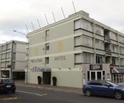
If you need a place to sleep, we compiled a list of available hotels close to the map centre further down the page.
Depending on your travel schedule, you might want to pay a visit to some of the following locations: Gisborne, Rotorua, Opotiki, Whakatane and Palmerston North. To further explore this place, just scroll down and browse the available info.
Local weather forecast
Todays Local Weather Conditions & Forecast: 23°C / 73 °F
| Morning Temperature | 19°C / 66 °F |
| Evening Temperature | 20°C / 68 °F |
| Night Temperature | 18°C / 65 °F |
| Chance of rainfall | 0% |
| Air Humidity | 61% |
| Air Pressure | 1015 hPa |
| Wind Speed | Gentle Breeze with 9 km/h (5 mph) from South-East |
| Cloud Conditions | Broken clouds, covering 52% of sky |
| General Conditions | Broken clouds |
Thursday, 5th of December 2024
27°C (81 °F)
20°C (69 °F)
Scattered clouds, moderate breeze.
Friday, 6th of December 2024
17°C (62 °F)
15°C (59 °F)
Sky is clear, moderate breeze, clear sky.
Saturday, 7th of December 2024
17°C (63 °F)
16°C (61 °F)
Broken clouds, gentle breeze.
Hotels and Places to Stay
The County Hotel
The Dome
McHardy Lodge
THE NAUTILUS
VR Napier Hotel - Tennyson St
Marineland Beachfront Accommodation
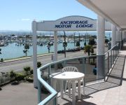
Anchorage Motor Lodge
Palm City Motor Inn
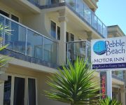
Pebble Beach Motor Inn
The Nautilus Napier
Videos from this area
These are videos related to the place based on their proximity to this place.
Timelapse of Napier Port with tilt shift effect
A time lapse of action in and outside the Port of Napier filmed mostly from the Bluff Hill lookout. Edited in Sony Vegas11 with Magic Bullet Looks 2 using the Swing Tilt pre-set that makes...
Napier Art Deco Weekend
Various scenes of the 2013 Napier Art Deco Weekend from Friday night through to Sunday afternoon.
Bladers Freestyle - Napier New Zealand
I'd like to thank Kyle Hamilton for helping organise this and making it happen. Thank you to the awesome people involved with the video: Luke Sharplin Phillip Bristow Tyla Christison Joseph...
Top Tips for Settling in Napier Hawke's Bay
Find out what Napier, Hawke's Bay has to offer and get insights for people that have settled here.
Napier to Auckland - New Zealand - (double speed & 60fps)
Napier to Auckland 16th March 2013 New Zealand Recorded at 30fps uploaded at 60fps and at double speed = change settings to half speed to view at original speed and frame rate.
Nationals Napier 2012
A short 8 minnute video of that Nationals In Napier 2012. Our Class 5 was there.
Videos provided by Youtube are under the copyright of their owners.
Attractions and noteworthy things
Distances are based on the centre of the city/town and sightseeing location. This list contains brief abstracts about monuments, holiday activities, national parcs, museums, organisations and more from the area as well as interesting facts about the region itself. Where available, you'll find the corresponding homepage. Otherwise the related wikipedia article.
Ngaruroro River
The Ngaruroro River is located in the eastern North Island of New Zealand. It runs for a total of 164 kilometers southeast from the Kaweka Range, Kaimanawa Range and Ruahine Range and then east before emptying into Hawke Bay roughly half way between the cities of Napier and Hastings, near the town of Clive (drainage area 2,000 square kilometers above Tutaekuri River confluence).
Taradale, New Zealand
Taradale is a suburb of Napier, in the Hawke's Bay region of the North Island of New Zealand, and was once a town in its own right. It is located 10 kilometres southwest of the centre of Napier, and is also known as the Taradale and Greenmeadows area. It is the home to some of Hawke's Bay's finest vineyards. The population was 16,599 in the 2006 Census, an increase of 972 from 2001.
Port of Napier
The Port of Napier is located on Hawke Bay in Napier, Hawke's Bay, New Zealand. The port is connected to the rail network via the Ahuriri Branch. On 16 February 2008 the Port was visited by the longest vessel it has ever received, the MS Queen Victoria cruise ship belonging to Cunard. Hastings District, as one of the largest apple, pear and stone fruit producing areas in New Zealand has an important relationship with the Napier Port.
Anglican Diocese of Waiapu
The Diocese of Waiapu is one of the thirteen dioceses and hui amorangi of the Anglican Church in Aotearoa, New Zealand and Polynesia. The Diocese covers the area around the East Coast of the North Island of New Zealand, including Tauranga, Taupo, Gisborne, Hastings and Napier. It is named for the Waiapu River. The diocese was established in 1858. The seat of the Bishop of Waiapu is at the Cathedral of St John the Evangelist in Napier. The incumbent Bishop of Waiapu is the Rt Rev'd David Rice.
McLean Park
McLean Park is a sports ground in Napier, New Zealand. The two main sports played at the ground are cricket and rugby union. It is one of the 10 proper cricket grounds of New Zealand. McLean Park is a sportsground of international standards which includes the main outdoor stadium and the indoor Rodney Green Centennial Events Centre. The home teams for this ground are the Hawke's Bay Rugby Union and Central Districts Cricket Association.
Hawke's Bay Airport
Hawke's Bay Airport (owned and operated by Hawke's Bay Airport Ltd) is Hawke's Bay's main commercial airport serving domestic flights to the main centres of Auckland, Wellington and Christchurch as well as smaller centres such as Gisborne, Tauranga, Hamilton and Palmerston North . The airport is permitted to allow limited international flights for aircraft with up to fourteen people on board by prior arrangement with Air Napier or Skyline Aviation.
Taradale High School
Taradale High School (THS), is a co-educational secondary school situated in the town of Taradale in Hawkes Bay, New Zealand. Taradale High School accommodates from years 9-13. The school currently has an attendance role of approximately 1060 students (ranging over the five years of age) as of February 2011.
Tamatea High School
Tamatea High School is a state secondary co-educational school located in Napier, New Zealand. The school was opened in 1975. The Senior Management Team comprises Principal Mrs Nicole Ngarewa and two Deputy Principals, Mr Nigel Groom and Mrs Merril Graham.
Marineland, Napier
Marineland of New Zealand was a marine mammal park in Napier, New Zealand. The park opened in 1965 and closed to the public in 2008. It has had several species of native marine wildlife, including the common dolphin, the New Zealand fur seal, little blue penguin and gannets. Marineland also has California sea lions, a sulphur crested cockatoo, otters and more.
Napier Boys' High School
Napier Boys High School is a state secondary school on Chambers St, in Te Awa, Napier, New Zealand. It currently has a school roll of approximately 1,200 pupils.
Tutaekuri River
The Tutaekuri River flows through the Hawke's Bay Region of the eastern North Island of New Zealand. It flows east from the Kaweka Range, reaching the Pacific Ocean just to the south of Napier and Taradale, where the Ngaruroro and Clive Rivers join it. Starting roughly 30 kilometers east of Taihape, the Tutaekuri River flows for a distance of 99.9 kilometers. Ngāti Paarau, which is the local hapū (sub-tribe) are said to have disposed of their waste food in this river.
Bay View, New Zealand
Bay View is a settlement in the Hawke's Bay region of the eastern North Island of New Zealand. It lies on State Highway 2, nine kilometres north of the city centre of Napier. It is administered by the Napier City Council. The Esk River flows into the sea just to the north. Hawke's Bay Airport and the Napier suburb of Westshore lie just to the south. The area was previously known as Petane and was seized by Maori in the early 1860s with the idea of attacking Napier.
Onekawa
Onekawa is a suburb of the city of Napier, in the Hawke's Bay Region of the eastern North Island of New Zealand. Onekawa houses a high proportion of industry trade businesses.
Maraenui
Maraenui is a suburb of the city of Napier, in the Hawke's Bay Region of the eastern North Island of New Zealand. It is a lower socio-economic neighborhood with a mix of owner occupied and state owned (Housing New Zealand) properties.
Napier Girls' High School
Napier Girls' High School is a state secondary school on Clyde Road, Napier, New Zealand. It has a current school roll of over 900.
National Aquarium of New Zealand
The National Aquarium of New Zealand, also known as Napier Aquarium is a public aquarium in Napier, New Zealand.
Sacred Heart College, Napier
Sacred Heart College, Napier (Te Kareti o Ngakau Tapu) was founded on its present site in 1867 by the Sisters of Our Lady of the Missions. For the first one hundred years of its existence, the College was staffed predominantly by the Sisters of the Missions. Sister Mary Rose who completed her term in 1998 was the last Mission Sister to hold the position of Principal. The original buildings withstood the Napier earthquake of 1931.
St Joseph's Māori Girls' College
St Joseph's Māori Girls' College or Hato Hōhepa is a Catholic, integrated, boarding and day college in Taradale, New Zealand for girls in Year 9 to Year 13. It is the largest Māori Girls' Boarding Secondary School in New Zealand.
2009 Napier shootings
The 2009 Napier shootings (also widely called the Napier siege by the New Zealand media) occurred on 7 May 2009 in Napier, New Zealand. At around 9.30 am, Jan Molenaar fired on New Zealand Police officers executing a routine cannabis search warrant at his house at 41 Chaucer Road, killing Senior Constable Len Snee and seriously injuring Senior Constables Bruce Miller and Grant Diver. A neighbour attempting to assist the police was also shot.
Nelson Park (cricket ground)
Nelson Park is a cricket ground in Napier, Hawke's Bay, New Zealand. The ground first held a first-class match when Hawke's Bay played Wellington in 1920. Hawke's Bay would play a second first-class match there in 1921 against the touring Australians. Major cricket was next played there near 65 years later when Central Districts played Wellington in the 1985/86 Shell Trophy. As of the 2010/11 season, Central Districts have played nine first-class matches there.
Park Island, Napier
Park Island (currently known as Bluewater Stadium) is a multi-purpose stadium in Napier, New Zealand. It is currently used mostly for football matches and is the home stadium of Napier City Rovers and Hawke's Bay United. The stadium has a capacity of 5,000 people and opened in 1985. It served as a training venue for teams in the 2011 Rugby World Cup.
Napier Recreation Ground
Napier Recreation Ground was a cricket ground in Napier, Hawke's Bay, New Zealand. The ground first held a first-class match when Hawke's Bay played Wellington in 1884. Hawke's Bay would play nineteen further first-class matches there, the last of which came in 1913 against Auckland. During this period the ground played host to the touring Fijians, Marylebone Cricket Club and Australians.
Westshore, New Zealand
Westshore is a northern coastal suburb of the city of Napier in Hawke's Bay, New Zealand.
Napier Prison
Napier Prison is a former prison in Napier that was New Zealand's oldest prison. It is now an historic facility which offers guided tours twice daily and self-guided audio tours all-day. It is also the only building where it is possible to see the original path of the 1931 Hawke's Bay earthquake.
Awatoto
Awatoto is a coastal suburb area located near Napier, Hawke's Bay, New Zealand. The population in the 2006 census was 354 people, an increase of 54 since 2001.


