Safety Score: 3,0 of 5.0 based on data from 9 authorites. Meaning we advice caution when travelling to New Zealand.
Travel warnings are updated daily. Source: Travel Warning New Zealand. Last Update: 2024-08-13 08:21:03
Delve into Prebbleton
Prebbleton in Selwyn District (Canterbury) with it's 3,600 habitants is a city located in New Zealand about 196 mi (or 316 km) south-west of Wellington, the country's capital town.
Current time in Prebbleton is now 11:54 PM (Thursday). The local timezone is named Pacific / Auckland with an UTC offset of 13 hours. We know of 9 airports closer to Prebbleton, of which two are larger airports. The closest airport in New Zealand is Christchurch International Airport in a distance of 7 mi (or 11 km), North. Besides the airports, there are other travel options available (check left side).
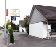
In need of a room? We compiled a list of available hotels close to the map centre further down the page.
Since you are here already, you might want to pay a visit to some of the following locations: Christchurch, Greymouth, Richmond, Nelson and Blenheim. To further explore this place, just scroll down and browse the available info.
Local weather forecast
Todays Local Weather Conditions & Forecast: 12°C / 54 °F
| Morning Temperature | 8°C / 46 °F |
| Evening Temperature | 10°C / 50 °F |
| Night Temperature | 9°C / 49 °F |
| Chance of rainfall | 3% |
| Air Humidity | 64% |
| Air Pressure | 1011 hPa |
| Wind Speed | Strong breeze with 19 km/h (12 mph) from North |
| Cloud Conditions | Overcast clouds, covering 96% of sky |
| General Conditions | Light rain |
Friday, 22nd of November 2024
17°C (62 °F)
10°C (49 °F)
Light rain, gentle breeze, scattered clouds.
Saturday, 23rd of November 2024
12°C (53 °F)
10°C (49 °F)
Light rain, moderate breeze, overcast clouds.
Sunday, 24th of November 2024
16°C (62 °F)
10°C (49 °F)
Overcast clouds, gentle breeze.
Hotels and Places to Stay
The Establishment
Tower Junction Motor Lodge
Airport Delta Motel
Airport Christchurch Motel
Airport Palms Motel
Commodore Airport Hotel
298 Westside Motor Lodge
Comfort Inn Riccarton NZ
Christchurch Motel
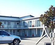
Amore Motor Lodge
Videos from this area
These are videos related to the place based on their proximity to this place.
Sockburn 257 leaving station.
Sockburn 257 leaving Sockburn station. http://111emergency.co.nz/F-I/FFF405.htm.
BOB THE BUILDER_2.MPG
BOB THE BUILDER. Year 2004, Ashita and his friends at Sockburn school, Chrischurch, New Zealand. ( year 1)
Sunday Blokarting at Wigram with a GOPRO HD
Blokarting with the Canterbury Blokart club on a Sunday afternoon in January. This is at the Airforce Museum at Wigram Christchurch New Zealand.
Air Force Museum
This museum in Christchurch, New Zealand, holds the national collection of the Royal New Zealand Airforce.
CCTV Earthquake Christchurch's coolest customer
Liquorland Tower Street during the 6.3 mag Christchurch earthquake 22 February 2010. Note the customer at the top of the screen using the fill your own beer taps. Not a the slightest reaction,...
Trains Around Hornby
Just a Couple of trains around Hornby, W8 is captured just south of the Parker Street Crossing 922M is captured just south of the Carmen Road Crossing.
Platform 9 3/4 EPIC FAIL!!!!
Umm.... this is my friend Jack running into a notice board outside of the school gym(before the video he already ran into it twice) we came up with the name after he ran into the wall.
Videos provided by Youtube are under the copyright of their owners.
Attractions and noteworthy things
Distances are based on the centre of the city/town and sightseeing location. This list contains brief abstracts about monuments, holiday activities, national parcs, museums, organisations and more from the area as well as interesting facts about the region itself. Where available, you'll find the corresponding homepage. Otherwise the related wikipedia article.
Wigram
Wigram is a suburb of Christchurch, New Zealand. Technically called Wigram Park, the second half of its name is rarely if ever heard. The suburb lies close to the industrial estates of Sockburn and the satellite retail and residential zone of Hornby. It is seven kilometres to the west of the city centre. Until 1993 Wigram was the home to one of the country's main Royal New Zealand Air Force bases, but this was closed after cutbacks in military spending.
Air Force Museum of New Zealand
The Air Force Museum of New Zealand, formerly called The Royal New Zealand Air Force Museum, is located at Wigram, the RNZAF's first operational base, in Christchurch, in the South Island of New Zealand. It opened on 1 April 1987, the 50th anniversary of the establishment of the RNZAF, and is primarily a museum of the Royal New Zealand Air Force, its predecessor, the New Zealand Permanent Air Force and New Zealand squadrons of the Royal Air Force.
Wigram Aerodrome
Wigram Aerodrome is a former Royal New Zealand Air Force base located in the Christchurch suburb of Wigram. It is named after Sir Henry Wigram. Originally home to the RNZAF Central Flying School (CFS), it was closed in 1995 following the CFS' relocation to RNZAF Ohakea two years earlier. The closing parade was held on 14 September 1995. Wigram Aerodrome maintained its aviation character, with several aviation businesses using its facilities.
Wigram Airfield Circuit
Wigram Airfield Circuit was a temporary motor racing circuit at Wigram Aerodrome, Christchurch, New Zealand. The airfield is a former base of the Royal New Zealand Air Force. It is named after Sir Henry Wigram. The temporary circuit was 3 km (2.1 mile) with a 1.3 km (0.8mile) main straight. The first summer meetings held at Wigram Aerodrome in 1949 considered as the oldest motor race in New Zealand. The track hosted the 1964-1969 Tasman Series.
Prebbleton
Prebbleton is a small town in the Selwyn District in the Canterbury Region of New Zealand. It is 11 km southwest of the centre of Christchurch and about 2 km south of the outlying industrial suburb of Hornby. Prebbleton village has been in existence for over 140 years making it one of the earliest settlements on the Canterbury Plains. Prebbleton dates back to 1855, when the brothers Prebble settled in the district.


