Safety Score: 3,0 of 5.0 based on data from 9 authorites. Meaning we advice caution when travelling to New Zealand.
Travel warnings are updated daily. Source: Travel Warning New Zealand. Last Update: 2024-08-13 08:21:03
Explore Rapaki
Rapaki in Christchurch City (Canterbury) is located in New Zealand about 193 mi (or 310 km) south-west of Wellington, the country's capital.
Local time in Rapaki is now 12:01 AM (Friday). The local timezone is named Pacific / Auckland with an UTC offset of 13 hours. We know of 9 airports in the wider vicinity of Rapaki, of which two are larger airports. The closest airport in New Zealand is Christchurch International Airport in a distance of 11 mi (or 18 km), North-West. Besides the airports, there are other travel options available (check left side).
If you need a place to sleep, we compiled a list of available hotels close to the map centre further down the page.
Depending on your travel schedule, you might want to pay a visit to some of the following locations: Christchurch, Greymouth, Richmond, Nelson and Blenheim. To further explore this place, just scroll down and browse the available info.
Local weather forecast
Todays Local Weather Conditions & Forecast: 13°C / 55 °F
| Morning Temperature | 8°C / 46 °F |
| Evening Temperature | 11°C / 51 °F |
| Night Temperature | 10°C / 49 °F |
| Chance of rainfall | 3% |
| Air Humidity | 59% |
| Air Pressure | 1010 hPa |
| Wind Speed | Fresh Breeze with 16 km/h (10 mph) from North-East |
| Cloud Conditions | Broken clouds, covering 76% of sky |
| General Conditions | Moderate rain |
Friday, 22nd of November 2024
14°C (58 °F)
10°C (50 °F)
Light rain, gentle breeze, scattered clouds.
Saturday, 23rd of November 2024
11°C (51 °F)
10°C (51 °F)
Light rain, gentle breeze, overcast clouds.
Sunday, 24th of November 2024
15°C (59 °F)
13°C (55 °F)
Broken clouds, gentle breeze.
Hotels and Places to Stay
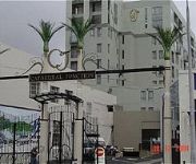
Rendezvous Christchurch
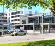
QUEST CHRISTCHURCH SERVICED APARTMENT H
RYDGES LATIMER CHRISTCHURCH
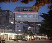
MILLENNIUM - CHRISTCHURCH
HOTEL OFF THE SQUARE
Hotel Grand Chancellor Christchurch
The George Christchurch
Christchurch City & Country Cottages
Southwark Apartments
Featherstone B&B
Videos from this area
These are videos related to the place based on their proximity to this place.
Midnight's Children
Lucy Chan Leading Midnight's Children (Grade 21) and Cirrus Tan on Belay at Cattlestop Crag, Port Hills, Christchurch, New Zealand. International Climbing Grade (Guide Only): France: 6b+...
Seventhwave Wetsuits: feedback from Rob Gray
A surfer for 20 years, Rob Gray knows what he needs in a wetsuit. Period. Having surfed in all climates and conditions, from the cold south of New Zealand, to the hot wet climate of Indonesia,...
Mountain biking trip to Christchurch
This is a clip of some of the videos I took with my go pro helmet camera, which I just go for my birthday.
Solar Powered UAV on TVNZ
A new innovation from company founder Simon Dyer, developing a design and building a prototype for the worlds smallest commercially viable Solar powered UAV, named the 2C SilverEye, after a...
Christchurch and Lyttelton Earthquake Images - Before and Afters
Images and Panoramas from around Christchurch and Lyttelton before and after the Feb 22 2011 Earthquake. A 6.3 shallow quake struck very near to the city in the lunch hour of Feb 22 2011, five...
Videos provided by Youtube are under the copyright of their owners.
Attractions and noteworthy things
Distances are based on the centre of the city/town and sightseeing location. This list contains brief abstracts about monuments, holiday activities, national parcs, museums, organisations and more from the area as well as interesting facts about the region itself. Where available, you'll find the corresponding homepage. Otherwise the related wikipedia article.
Port Hills
The Port Hills are a range of hills in Canterbury, New Zealand, so named because they lie between the city of Christchurch and its port at Lyttelton. The Port Hills run approximately east-west along the northern side of Lyttelton Harbour, including a number of summits between 300 and 500 metres above sea level. Some consider the crater rim around the western end of Lyttelton Harbour, which runs largely north-south, to also be part of the Port Hills.
Quail Island, New Zealand
Quail Island (Ōtamahua in Māori, sometimes also known as Te Kawakawa) is a small uninhabited island within Lyttelton Harbour in the South Island of New Zealand, close to Christchurch. The island was given its European name by Captain Mein Smith who saw native quail here in 1842; though they were already extinct by 1875. 'Ōtamahua' has the meaning of a 'place where children collect sea eggs'. 'Te Kawakawa' refers to the Pepper trees found on the island.
Bridle Path, New Zealand
The Bridle Path is a steep track that traverses the northern rim of the Lyttelton volcano connecting the city of Christchurch and the port of Lyttelton in the South Island of New Zealand. It was constructed in 1850 as a bridle path for leading horses, and was used by the early European settlers as a route from the port to new settlements on the northern side of the Port Hills.
Lyttelton road tunnel
The Lyttelton road tunnel links the New Zealand city of Christchurch and its seaport, Lyttelton. It opened in 1964 and carries just over 10,000 vehicles/day. While the tunnel itself was not closed for long after the February 2011 Christchurch earthquake, the Heathcote tunnel canopy has been demolished, and the Tunnel Control Building that has a Category I heritage classification by the New Zealand Historic Places Trust has suffered significant damage.
Lyttelton Rail Tunnel
The Lyttelton Rail Tunnel, initially called the Moorhouse Tunnel, links the city of Christchurch with the port of Lyttelton in the Canterbury region of New Zealand’s South Island. It is the country’s oldest operational rail tunnel, and is on one of the first railway lines in the district. On completion in 1867 it became the first tunnel in the world to be taken through the side of an extinct volcano, and at 2.7 km, the longest in the country.
Lyttelton Railway Station
Lyttelton railway station is the northern terminus of the Main South Line, a main trunk railway line from Lyttelton to Invercargill in the South Island of New Zealand. There have been three stations built at Lyttelton, with the most recent of these still being used for railway purposes. Both freight and passenger services have featured at Lyttelton since it opened in 1867.
2011 Christchurch earthquake
The February 2011 Christchurch earthquake was a powerful natural event that severely damaged New Zealand's second-largest city, killing 185 people in one of the nation's deadliest peacetime disasters. The magnitude 6.3 (ML) earthquake struck the Canterbury region in New Zealand's South Island at 12:51 pm on Tuesday, 22 February 2011 local time .
Governors Bay
Governors Bay is a small settlement in Canterbury, New Zealand.


