Safety Score: 3,0 of 5.0 based on data from 9 authorites. Meaning we advice caution when travelling to New Zealand.
Travel warnings are updated daily. Source: Travel Warning New Zealand. Last Update: 2024-08-13 08:21:03
Discover South New Brighton
The district South New Brighton of New Brighton in Christchurch City (Canterbury) is a subburb in New Zealand about 186 mi south-west of Wellington, the country's capital city.
If you need a hotel, we compiled a list of available hotels close to the map centre further down the page.
While being here, you might want to pay a visit to some of the following locations: Christchurch, Greymouth, Richmond, Nelson and Blenheim. To further explore this place, just scroll down and browse the available info.
Local weather forecast
Todays Local Weather Conditions & Forecast: 13°C / 55 °F
| Morning Temperature | 8°C / 46 °F |
| Evening Temperature | 11°C / 51 °F |
| Night Temperature | 10°C / 49 °F |
| Chance of rainfall | 3% |
| Air Humidity | 59% |
| Air Pressure | 1010 hPa |
| Wind Speed | Fresh Breeze with 16 km/h (10 mph) from North-East |
| Cloud Conditions | Broken clouds, covering 76% of sky |
| General Conditions | Moderate rain |
Friday, 22nd of November 2024
14°C (58 °F)
10°C (50 °F)
Light rain, gentle breeze, scattered clouds.
Saturday, 23rd of November 2024
11°C (51 °F)
10°C (51 °F)
Light rain, gentle breeze, overcast clouds.
Sunday, 24th of November 2024
15°C (59 °F)
13°C (55 °F)
Broken clouds, gentle breeze.
Hotels and Places to Stay
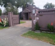
Purple-der House Accommodation
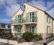
Le Petit Hotel
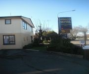
Arcadia Motel
Finlay Banks
Garden Hotel Christchurch
Adorian Motel
Avalon Court Accommodation
City Central Motel Apartments
Haka Lodge Christchurch - Hostel
Videos from this area
These are videos related to the place based on their proximity to this place.
New Brighton Water Park
http://newbrightonwaterpark.co.nz The Concept Plan by inspired supporters of New Brighton. Mission- to have this plan included in the Master Plan for the rebuild of New Brighton. An all-season...
1956-s szabadsagharc megemlékezése a chch-i magyarklubban Uj-zeland
1956-s szabadságharc 56.évfordulójának megemlékezése a christchurchi magyarklubban, Új-zéland Chch, 2012. október 21..
SBHS Mid Winter Swim and Haka 2008
Shirey Boys' High School students participate in a Haka and mid-winter swim in the frigid waters of New Brighton as a fund raiser for the Oncology Department. Filmed and produced by Peter...
Sunrise Time-lapse
This is my first attempt at time-lapse photography. This was taken at New Brighton Beach, Christchurch New Zealand.
IEI Surfing Lesson
International English Institute language school activity: Surfing lesson at New Brighton Beach, Christchurch, New Zealand. www.english.school.nz.
24 hour emergency plumbers & drainlayers Christchurch nz (03) 741 3107
Need a plumber or drain cleared now! For best 24 hour emergency plumbers in Christchurch. Guaranteed, expert plumbing and craftmanship, great service at a price that won't break your bank.
Unturned Playing Around EP 1: Leap Of Faith
Hi guys I got a new series here called Unturned playing around hope you enjoy remember to Subscribe.
Christchurch Earthquake Live CCTV Footage, 13th June 2011, 1pm. Mag 5.6
CCTV footage from inside QEII Pharmacy Ltd, North New Brighton. Amazingly, no customers were in the shop at the time,
Videos provided by Youtube are under the copyright of their owners.
Attractions and noteworthy things
Distances are based on the centre of the city/town and sightseeing location. This list contains brief abstracts about monuments, holiday activities, national parcs, museums, organisations and more from the area as well as interesting facts about the region itself. Where available, you'll find the corresponding homepage. Otherwise the related wikipedia article.
Ferrymead Railway
The Ferrymead Railway is a New Zealand heritage railway built upon the formation of New Zealand's first public railway, from Ferrymead to Christchurch, which opened in 1863. On the opening of the line to Lyttelton on 9 December 1867, the Ferrymead Railway became the Ferrymead Branch and was closed shortly thereafter. In 1964, rail enthusiasts began relaying track on the historic formation and the Ferrymead Railway officially opened in 1977.
Tamariki School
Tamariki is the oldest ‘free school’ in New Zealand and one of the oldest in the world. It was founded in 1966 by a group of parents and teachers interested in preventative mental health. It is located in the Christchurch suburb of Linwood. Its name is the Māori word for young children.
Ferrymead Heritage Park
Ferrymead Heritage Park is a museum in Christchurch, New Zealand, housing a number of groups with historical themes, the most frequent of which is transport. Formerly known as Ferrymead Historic Park, it was founded in the mid-1960s by a number of groups, local government bodies and other interested parties. It is in the Heathcote Valley, at the site of New Zealand's first public railway.
Heathcote River
The Heathcote River lies within the city boundaries of Christchurch, New Zealand, and is fed from springs near Templetons Road and also receives wet weather flows from as far west as Pound Road. It meanders around the base of the Port Hills from west to south-east.
Heathcote Valley
Heathcote Valley is a suburb of Christchurch, New Zealand.
Avonside
Avonside is an eastern suburb in Christchurch, New Zealand. It is one of the oldest suburbs of the city, with only Heathcote being older.
Queen Elizabeth II Park
For the Queen Elizabeth Park on the Kapiti Coast, see Queen Elizabeth Park, New Zealand Queen Elizabeth II Park QEii 250pxLocation Christchurch, New ZealandCoordinates {{#invoke:Coordinates|coord}}{{#coordinates:43|29|29|S|172|42|19|E| |primary |name= }}Built 1973Opened 1974Capacity 25,000Tenants Christchurch United (1974-present)1974 British Commonwealth Games Queen Elizabeth II Park was a multi-use stadium in Christchurch, New Zealand. The stadium had a capacity of 25,000 people.
Aranui High School
Aranui High School is a large secondary school for Years 9-13, in Christchurch, New Zealand. A redevelopment of the school is occurring 2009-2011.
Linwood College
Linwood College is a co-educational decile 2 secondary school in Linwood, a suburb of Christchurch, New Zealand.
Burwood, New Zealand
Burwood is a north-eastern suburb of Christchurch, New Zealand. The suburb is mostly a residential area and is centred around Burwood Hospital, Travis Wetland Nature Heritage Park and Bottle Lake Forest (a 31-acre recreation, forested area). Recently, the local iwi, Ngai Tahu, created a new subdivision in the area, naming it 'Tumara Park'. Burwood contains two schools: Burwood Primary School and Windsor School.
Burwood Primary School
Burwood Primary School is a public co-educational primary school in Christchurch, New Zealand. It is situated on the Avon river in Burwood/Shirley area.
Chisnallwood Intermediate
Chisnallwood Intermediate is the main Intermediate school in the eastern suburbs of Christchurch, New Zealand. The school has a student role of 833 students as of 2008.
Avondale, Canterbury
Avondale is a suburb of Christchurch in the South Island of New Zealand. It is located 6 kilometres northeast of the city center, and is close to the Avon River, four kilometers to the northwest of its estuary. The suburb is centered around Avondale Road and so named due to its proximity to the Avon River. Chisnallwood Intermediate is the main Intermediate school in the eastern suburbs, and is located in Avondale.
Rapanui Rock
Rapanui, better known as The Shag Rock or simply "Shag Rock" was a notable sea stack which stood at the entrance of the Avon Heathcote Estuary near Christchurch, New Zealand. The boating channel into the estuary lies on the northern side of the rock. Although not used as a shipping port, the estuary is accessible to large yachts despite the bar and difficult tidal conditions. The rock stood close to the southern shore just above the low tide level.
Dallington, New Zealand
Dallington is a suburb of Christchurch, New Zealand, on the north-east side of the city. It is bounded mainly by the Avon river, stretching in a circular area from the intersection of Gayhurst Road, Dallington Terrace and Locksley Avenue along to New Brighton Road, North Parade and Banks Avenue where it meets the intersection at the other end of Dallington Terrace and River Road. Its neighbouring suburbs are Burwood, Shirley, Richmond, and Avonside.
Mount Pleasant, New Zealand
Mount Pleasant is an outer suburb of Christchurch, New Zealand. The suburb is located on the northern flank of the mountain in the Port Hills of which it takes its name. The area originally belonged to the borough of Sumner. A petition in 1920 by the majority of its residents asked for it to be included as a riding of the Heathcote County. Whilst the mayor of Sumner, John Barr, submitted against the petition, it was granted and took effect on 1 April 1921.
Travis Wetland
Travis Wetland is an ecological restoration programme in the suburb of Burwood in Christchurch, New Zealand. It covers 116 ha of land formerly drained and used as a dairy farm. In 2009 it won the "Urban Sustainability" category in the Green Ribbon Awards awarded by the Minister for the Environment. In May 2010 the rare and endangered Canterbury mudfish were released into the wetland in the hope that they would become established.
Avon River (Canterbury)
The Avon River flows through the centre of the city of Christchurch, New Zealand, and out to an estuary, which it shares with the Heathcote River, the Avon Heathcote Estuary.
Avon Heathcote Estuary
The Avon Heathcote Estuary is the largest semi-enclosed shallow estuary in Canterbury and remains one of New Zealand’s most important coastal wetlands. It is well known as an internationally important habitat for migratory birds, and it is an important recreational playground and educational resource. It was once highly valued for mahinga kai (Māori for food gathering).
William Wilson (mayor)
William Barbour Wilson (2 April 1819 – 8 November 1897), also known as "Cabbage" Wilson, was the first Mayor of Christchurch in New Zealand in 1868.
John Thomas Peacock
John Thomas Peacock MLC JP (1827 – 20 October 1905) was a New Zealand businessman, philanthropist and politician. He came to Canterbury in 1844, several years before organised settlement started.
Village Green, Christchurch
Village Green is Christchurch's back-up first-class cricket ground in New Zealand. Located alongside the main stadium of Queen Elizabeth II Park, Village Green is often used for inter-provincial competition when the AMI Stadium is not available. The Village Green will host a test cricket match in March 2013.
Linwood Cemetery, Christchurch
Linwood Cemetery is a cemetery located in Linwood, Christchurch, New Zealand. It is the fifth oldest public cemetery in the city. Despite its age is it still open for ashes internment,Hebrew Congregational burials and if there is space in existing family plots. Opened in 1884, it has seen some 20,000 burials. The first burial, of the Sexton's wife, was held in July 1884 before the cemetery was opened.
June 2011 Christchurch earthquake
The June 2011 Christchurch earthquake was a shallow magnitude 6.3 ML earthquake that occurred on 13 June 2011 at 14:20 NZST. It was centred at a depth of 6 km (3.8 mi), about 10 km (6 mi) from Christchurch, which had previously been devastated by another magnitude 6.3 ML earthquake in February 2011. The June quake was preceded by a magnitude 5.9 ML tremor that struck the region at a slightly deeper 8.9 km (5.5 mi).
Bromley Cemetery
Bromley Cemetery is a cemetery in Christchurch, New Zealand. It occupies approximately 10 hectares to the east of the city centre, on the corner of Keighleys Road and Linwood Avenue. The Christchurch City Council maintains and administers the cemetery.


