Safety Score: 3,0 of 5.0 based on data from 9 authorites. Meaning we advice caution when travelling to New Zealand.
Travel warnings are updated daily. Source: Travel Warning New Zealand. Last Update: 2024-08-13 08:21:03
Delve into New Brighton
New Brighton in Christchurch City (Canterbury) is located in New Zealand about 186 mi (or 299 km) south-west of Wellington, the country's capital town.
Current time in New Brighton is now 11:52 PM (Thursday). The local timezone is named Pacific / Auckland with an UTC offset of 13 hours. We know of 9 airports close to New Brighton, of which two are larger airports. The closest airport in New Zealand is Christchurch International Airport in a distance of 10 mi (or 17 km), West. Besides the airports, there are other travel options available (check left side).
If you need a hotel, we compiled a list of available hotels close to the map centre further down the page.
While being here, you might want to pay a visit to some of the following locations: Christchurch, Greymouth, Richmond, Nelson and Blenheim. To further explore this place, just scroll down and browse the available info.
Local weather forecast
Todays Local Weather Conditions & Forecast: 13°C / 55 °F
| Morning Temperature | 8°C / 46 °F |
| Evening Temperature | 11°C / 51 °F |
| Night Temperature | 10°C / 49 °F |
| Chance of rainfall | 3% |
| Air Humidity | 59% |
| Air Pressure | 1010 hPa |
| Wind Speed | Fresh Breeze with 16 km/h (10 mph) from North-East |
| Cloud Conditions | Broken clouds, covering 76% of sky |
| General Conditions | Moderate rain |
Friday, 22nd of November 2024
14°C (58 °F)
10°C (50 °F)
Light rain, gentle breeze, scattered clouds.
Saturday, 23rd of November 2024
11°C (51 °F)
10°C (51 °F)
Light rain, gentle breeze, overcast clouds.
Sunday, 24th of November 2024
15°C (59 °F)
13°C (55 °F)
Broken clouds, gentle breeze.
Hotels and Places to Stay
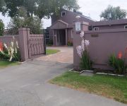
Purple-der House Accommodation
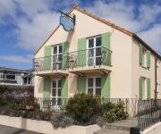
Le Petit Hotel
Arcadia Motel
Finlay Banks
Garden Hotel Christchurch
Adorian Motel
Haka Lodge Christchurch - Hostel
Videos from this area
These are videos related to the place based on their proximity to this place.
Burwood Then and Now - A Drone's Eye View
Filmed on April 3, 2015 in the remains of Burwood in Christchurch. The sheer size of the area is immense. Gathering all the shots took me more than 2 hours The map in the bottom left corner...
New Brighton Water Park
http://newbrightonwaterpark.co.nz The Concept Plan by inspired supporters of New Brighton. Mission- to have this plan included in the Master Plan for the rebuild of New Brighton. An all-season...
1956-s szabadsagharc megemlékezése a chch-i magyarklubban Uj-zeland
1956-s szabadságharc 56.évfordulójának megemlékezése a christchurchi magyarklubban, Új-zéland Chch, 2012. október 21..
SBHS Mid Winter Swim and Haka 2008
Shirey Boys' High School students participate in a Haka and mid-winter swim in the frigid waters of New Brighton as a fund raiser for the Oncology Department. Filmed and produced by Peter...
Sunrise Time-lapse
This is my first attempt at time-lapse photography. This was taken at New Brighton Beach, Christchurch New Zealand.
IEI Surfing Lesson
International English Institute language school activity: Surfing lesson at New Brighton Beach, Christchurch, New Zealand. www.english.school.nz.
24 hour emergency plumbers & drainlayers Christchurch nz (03) 741 3107
Need a plumber or drain cleared now! For best 24 hour emergency plumbers in Christchurch. Guaranteed, expert plumbing and craftmanship, great service at a price that won't break your bank.
Videos provided by Youtube are under the copyright of their owners.
Attractions and noteworthy things
Distances are based on the centre of the city/town and sightseeing location. This list contains brief abstracts about monuments, holiday activities, national parcs, museums, organisations and more from the area as well as interesting facts about the region itself. Where available, you'll find the corresponding homepage. Otherwise the related wikipedia article.
Heathcote River
The Heathcote River lies within the city boundaries of Christchurch, New Zealand, and is fed from springs near Templetons Road and also receives wet weather flows from as far west as Pound Road. It meanders around the base of the Port Hills from west to south-east.
Queen Elizabeth II Park
For the Queen Elizabeth Park on the Kapiti Coast, see Queen Elizabeth Park, New Zealand Queen Elizabeth II Park QEii 250pxLocation Christchurch, New ZealandCoordinates {{#invoke:Coordinates|coord}}{{#coordinates:43|29|29|S|172|42|19|E| |primary |name= }}Built 1973Opened 1974Capacity 25,000Tenants Christchurch United (1974-present)1974 British Commonwealth Games Queen Elizabeth II Park was a multi-use stadium in Christchurch, New Zealand. The stadium had a capacity of 25,000 people.
Aranui High School
Aranui High School is a large secondary school for Years 9-13, in Christchurch, New Zealand. A redevelopment of the school is occurring 2009-2011.
Burwood, New Zealand
Burwood is a north-eastern suburb of Christchurch, New Zealand. The suburb is mostly a residential area and is centred around Burwood Hospital, Travis Wetland Nature Heritage Park and Bottle Lake Forest (a 31-acre recreation, forested area). Recently, the local iwi, Ngai Tahu, created a new subdivision in the area, naming it 'Tumara Park'. Burwood contains two schools: Burwood Primary School and Windsor School.
Avondale, Canterbury
Avondale is a suburb of Christchurch in the South Island of New Zealand. It is located 6 kilometres northeast of the city center, and is close to the Avon River, four kilometers to the northwest of its estuary. The suburb is centered around Avondale Road and so named due to its proximity to the Avon River. Chisnallwood Intermediate is the main Intermediate school in the eastern suburbs, and is located in Avondale.
Avon River (Canterbury)
The Avon River flows through the centre of the city of Christchurch, New Zealand, and out to an estuary, which it shares with the Heathcote River, the Avon Heathcote Estuary.
Avon Heathcote Estuary
The Avon Heathcote Estuary is the largest semi-enclosed shallow estuary in Canterbury and remains one of New Zealand’s most important coastal wetlands. It is well known as an internationally important habitat for migratory birds, and it is an important recreational playground and educational resource. It was once highly valued for mahinga kai (Māori for food gathering).
Village Green, Christchurch
Village Green is Christchurch's back-up first-class cricket ground in New Zealand. Located alongside the main stadium of Queen Elizabeth II Park, Village Green is often used for inter-provincial competition when the AMI Stadium is not available. The Village Green will host a test cricket match in March 2013.


