Safety Score: 3,0 of 5.0 based on data from 9 authorites. Meaning we advice caution when travelling to New Zealand.
Travel warnings are updated daily. Source: Travel Warning New Zealand. Last Update: 2024-08-13 08:21:03
Touring Halswell
Halswell in Christchurch City (Canterbury) is a town located in New Zealand about 195 mi (or 313 km) south-west of Wellington, the country's capital place.
Time in Halswell is now 11:27 PM (Thursday). The local timezone is named Pacific / Auckland with an UTC offset of 13 hours. We know of 9 airports nearby Halswell, of which two are larger airports. The closest airport in New Zealand is Christchurch International Airport in a distance of 7 mi (or 11 km), North. Besides the airports, there are other travel options available (check left side).
Need some hints on where to stay? We compiled a list of available hotels close to the map centre further down the page.
Being here already, you might want to pay a visit to some of the following locations: Christchurch, Greymouth, Richmond, Nelson and Blenheim. To further explore this place, just scroll down and browse the available info.
Local weather forecast
Todays Local Weather Conditions & Forecast: 13°C / 55 °F
| Morning Temperature | 8°C / 46 °F |
| Evening Temperature | 11°C / 51 °F |
| Night Temperature | 10°C / 49 °F |
| Chance of rainfall | 3% |
| Air Humidity | 59% |
| Air Pressure | 1010 hPa |
| Wind Speed | Fresh Breeze with 16 km/h (10 mph) from North-East |
| Cloud Conditions | Broken clouds, covering 76% of sky |
| General Conditions | Moderate rain |
Friday, 22nd of November 2024
14°C (58 °F)
10°C (50 °F)
Light rain, gentle breeze, scattered clouds.
Saturday, 23rd of November 2024
11°C (51 °F)
10°C (51 °F)
Light rain, gentle breeze, overcast clouds.
Sunday, 24th of November 2024
15°C (59 °F)
13°C (55 °F)
Broken clouds, gentle breeze.
Hotels and Places to Stay
The Establishment
Addington Stadium Motel
Amore Motor Lodge
Tower Junction Motor Lodge
Fyffe On Riccarton
298 Westside Motor Lodge
Comfort Inn Riccarton NZ
Christchurch Motel
Featherstone B&B
Riccarton Motor Lodge
Videos from this area
These are videos related to the place based on their proximity to this place.
Outdoor Leadership: New Zealand International Adventure Trip
Find yourself half-way around the globe in the most recently discovered country on Earth on this trip lead by the Outdoor Pursuit Center of the Miami University Recreational Sports Center in...
Christchurch City - August 2012
Here is Cathederal Square, the Cashel St Mall, & Gloucester St taken in August 2012 in Christchurch New Zealand, almost 2 years after the First Major Earthquake.
Sockburn 257 leaving station.
Sockburn 257 leaving Sockburn station. http://111emergency.co.nz/F-I/FFF405.htm.
Academy of Combat: Des Smith Thai Boxing, Christchurch 1995
http://www.academyofcombat.co.nz/ Des Smith from the Academy of Combat in a Thai Boxing match in Christchurch from 1995.
Driving down Riccarton Road in a bus. (At night)
Taken out the side window of a bus while it was driving down Riccarton Road in Christchurch New Zealand. Filmed by timaruman.
2014-01-25 MTB Halswell 1 of 2
Cycling from Bowenvale to the Halswell Quarry Park on the road, through the quarry park, then up the hill...
Halswell Quarry
View from a retired quarry that's been turned into a public park. Today was the first Spring day that was bona fide T-shirt weather. It was great! Thanks to iMovie for stabilization and rolling...
2013 New Zealand Secondary Schools Cross Country Championships-Senior Girls Race
Full Coverage of the Junior Boys Race at the 2013 New Zealand Secondary Schools Cross Country Championships at Halswell Quarry Park in Christchurch, New Zealand.
2013 New Zealand Secondary Schools Cross Country Championships-Junior Boys Race
Full Coverage of the Junior Boys Race at the 2013 New Zealand Secondary Schools Cross Country Championships at Halswell Quarry Park in Christchurch, New Zealand.
Videos provided by Youtube are under the copyright of their owners.
Attractions and noteworthy things
Distances are based on the centre of the city/town and sightseeing location. This list contains brief abstracts about monuments, holiday activities, national parcs, museums, organisations and more from the area as well as interesting facts about the region itself. Where available, you'll find the corresponding homepage. Otherwise the related wikipedia article.
Wigram
Wigram is a suburb of Christchurch, New Zealand. Technically called Wigram Park, the second half of its name is rarely if ever heard. The suburb lies close to the industrial estates of Sockburn and the satellite retail and residential zone of Hornby. It is seven kilometres to the west of the city centre. Until 1993 Wigram was the home to one of the country's main Royal New Zealand Air Force bases, but this was closed after cutbacks in military spending.
Air Force Museum of New Zealand
The Air Force Museum of New Zealand, formerly called The Royal New Zealand Air Force Museum, is located at Wigram, the RNZAF's first operational base, in Christchurch, in the South Island of New Zealand. It opened on 1 April 1987, the 50th anniversary of the establishment of the RNZAF, and is primarily a museum of the Royal New Zealand Air Force, its predecessor, the New Zealand Permanent Air Force and New Zealand squadrons of the Royal Air Force.
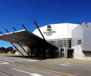
CBS Canterbury Arena
CBS Canterbury Arena is a sporting and entertainment arena located in Addington, Christchurch, New Zealand.
Wigram Aerodrome
Wigram Aerodrome is a former Royal New Zealand Air Force base located in the Christchurch suburb of Wigram. It is named after Sir Henry Wigram. Originally home to the RNZAF Central Flying School (CFS), it was closed in 1995 following the CFS' relocation to RNZAF Ohakea two years earlier. The closing parade was held on 14 September 1995. Wigram Aerodrome maintained its aviation character, with several aviation businesses using its facilities.
Sunnyside Hospital
Sunnyside Hospital (1863-1999) was the first mental asylum to be built in Christchurch, New Zealand. It was initially known as Sunnyside Lunatic Asylum, and its first patients were 17 people who had previously been kept in the Lyttelton gaol. In 2007, Hilmorton Hospital is just one of the mental health services that are based on the old Sunnyside Hospital grounds.
Wigram Airfield Circuit
Wigram Airfield Circuit was a temporary motor racing circuit at Wigram Aerodrome, Christchurch, New Zealand. The airfield is a former base of the Royal New Zealand Air Force. It is named after Sir Henry Wigram. The temporary circuit was 3 km (2.1 mile) with a 1.3 km (0.8mile) main straight. The first summer meetings held at Wigram Aerodrome in 1949 considered as the oldest motor race in New Zealand. The track hosted the 1964-1969 Tasman Series.
Addington Raceway
Addington Raceway or The Met is the home of the Metropolitan Trotting Club in Addington, Christchurch in New Zealand. The venue consists of a trotting track, a greyhound track conference centre and restaurants. It is also home to many feature harness races such as: The New Zealand Trotting Cup and the Dominion Handicap. The raceway forms part of a sporting complex that includes Rugby League Park and the CBS Canterbury Arena.
Rugby League Park
Rugby League Park (currently known as Christchurch Stadium or AMI Stadium for sponsorship reasons) is a rugby league and rugby union stadium in Christchurch, New Zealand. Formerly called the Addington Showgrounds, the ground is owned by the Canterbury Rugby League.


