Safety Score: 3,0 of 5.0 based on data from 9 authorites. Meaning we advice caution when travelling to New Zealand.
Travel warnings are updated daily. Source: Travel Warning New Zealand. Last Update: 2024-08-13 08:21:03
Delve into Saint Martins
The district Saint Martins of Christchurch in Christchurch City (Canterbury) is a district located in New Zealand about 191 mi south-west of Wellington, the country's capital town.
In need of a room? We compiled a list of available hotels close to the map centre further down the page.
Since you are here already, you might want to pay a visit to some of the following locations: Greymouth, Richmond, Nelson, Blenheim and Wellington. To further explore this place, just scroll down and browse the available info.
Local weather forecast
Todays Local Weather Conditions & Forecast: 13°C / 55 °F
| Morning Temperature | 8°C / 46 °F |
| Evening Temperature | 11°C / 51 °F |
| Night Temperature | 10°C / 49 °F |
| Chance of rainfall | 3% |
| Air Humidity | 59% |
| Air Pressure | 1010 hPa |
| Wind Speed | Fresh Breeze with 16 km/h (10 mph) from North-East |
| Cloud Conditions | Broken clouds, covering 76% of sky |
| General Conditions | Moderate rain |
Friday, 22nd of November 2024
14°C (58 °F)
10°C (50 °F)
Light rain, gentle breeze, scattered clouds.
Saturday, 23rd of November 2024
11°C (51 °F)
10°C (51 °F)
Light rain, gentle breeze, overcast clouds.
Sunday, 24th of November 2024
15°C (59 °F)
13°C (55 °F)
Broken clouds, gentle breeze.
Hotels and Places to Stay
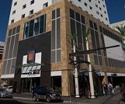
Rendezvous Christchurch
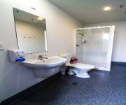
YHA Christchurch
QUEST CHRISTCHURCH SERVICED APARTMENT H
HOTEL OFF THE SQUARE
Southwark Apartments
Copthorne Hotel Central
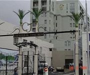
Poplars Apartment Hotel
Novotel Christchurch Cathedral Square
Hotel Grand Chancellor Christchurch
RYDGES LATIMER CHRISTCHURCH
Videos from this area
These are videos related to the place based on their proximity to this place.
Heat pumps Christchurch | Enviromaster
Website: http://www.enviromaster.co.nz/ Heat Pumps Christchurch Reveal How To Save Up To 80% On Your Heating Bill with Fujitsu Heat Pumps. Enviro Master is a Christchurch heat pump and air...
New Zealand Road Trip on a Jucy camper van through the South Island.
New Zealand, the youngest country on Earth. Amazing 9 days on the road. Route: Christchurch, Lake Tekapo, Mount Cook, Lake Pukaki, Queenstown, Wanaka, Lake Hawea, Fox Glacier, Franz Josef,...
3rd Alarm Warehouse Fire
3rd alarm warehouse fire on Welles Street central Christchurch. Attended by Christchurch 214, Christchurch 216, Christchurch 217, Christchurch 2118, Woolston 2435, Addington 221, St Albans...
Radio Network House Implosion - 2012.08.05
D-day has arrived for Radio Network House. The 14-storey building in Worcester St was imploded at 8am today. Background Story: A multi-storey office block will be blown up in quake-hit Christchu...
MVA Cnr Lichfield St and Madras St
Christchurch 217 and 211 responding to a three car Motor Vehicle Accident at the corner of Lichfield and Madras Streets central Christchurch. One car on its side. No persons trapped. One...
St John Ambulance Responding
Ambulance turning into Worcester St from Fitzgerald Ave while responding to an MVA.
Worcester St Flat Fire
Emergency services at a flat fire on Worcester Street between Fitzgerald Avenue and Barbadoes Street. Fire was out by the time I got there. Attended by: Christchurch 211 Christchurch...
Nissan Navara Features Explained by a 4x4 Professional
In this video, Pete explains the features of the Nissan Navara from an off-road perspective. We took a number of customers to a muddy hill in Christchurch and introduced them to one of New...
Videos provided by Youtube are under the copyright of their owners.
Attractions and noteworthy things
Distances are based on the centre of the city/town and sightseeing location. This list contains brief abstracts about monuments, holiday activities, national parcs, museums, organisations and more from the area as well as interesting facts about the region itself. Where available, you'll find the corresponding homepage. Otherwise the related wikipedia article.
Lancaster Park
Lancaster Park, formerly Jade Stadium and currently known as AMI Stadium through sponsorship rights, is a sports stadium situated in Waltham, a suburb of Christchurch in New Zealand. Following the February 2011 Christchurch earthquake, the stadium is closed. The Hadlee Stand has already been demolished, and the fate of the rest of the stadium is unresolved.
Canterbury Television
Canterbury Television is an independent television station broadcasting in Canterbury, New Zealand. The name is synonymous with regional television in New Zealand as it was the name of the first regional broadcaster to operate in New Zealand. CTV produces and screens more than twenty hours of locally based programming every week. It also screens overseas programming from Deutsche Welle and Al Jazeera. It broadcasts from the Sugarloaf transmitter on the Port Hills.
Anglican Diocese of Christchurch
Christchurch Polytechnic Institute of Technology
The Christchurch Polytechnic Institute of Technology (CPIT), formerly the Christchurch Technical College, is an institute of technology in Christchurch, New Zealand. It provides full- and part-time education leading to certificates, diplomas, applied bachelor's degrees and applied graduate diplomas in technologies and trades. CPIT is one of New Zealand's largest tertiary institutions and is the largest polytechnic in the South Island.
Beckenham, New Zealand
Beckenham is an inner suburb of Christchurch, New Zealand, located three kilometres south of the city centre. The Heathcote River winds through this predominantly residential suburb, a section of which is often referred to locally as the "Beckenham Loop". The suburb was named by Captain Stephen Fisher after the town in England. He eventually settled in the area in 1871 after retirement from naval duties.
Huntsbury
Huntsbury is a suburb of Christchurch, New Zealand, on the fringes of the Port Hills three kilometres south of the city centre. Huntsbury is host to one of four fountains scattered over Christchurch. Huntsbury's fountain is at the top of Conifer Place.
Linwood College
Linwood College is a co-educational decile 2 secondary school in Linwood, a suburb of Christchurch, New Zealand.
Hack Circle
The Hack Circle or Hack was a nickname given to an amphitheatre in central Christchurch, New Zealand. It was built as part of the second phase of developing a pedestrian mall in the central city in 1989 and was officially opened on 6 December of that same year by then mayor Vicki Buck. For a time it was a popular Hacky Sack venue (hence the name), later it became a popular hang out for "black-dressed emos, goths, heavy metal fans and United States style gangstas".
Roman Catholic Diocese of Christchurch
The Latin Rite Roman Catholic Diocese of Christchurch is a suffragan diocese of the Roman Catholic Archdiocese of Wellington. Its cathedral and see city are located in Christchurch, the largest city in the South Island of New Zealand. It was formed on 5 May 1887 from a portion of the territory of the Diocese of Wellington, which was elevated to archdiocese later that same month.
Murray Aynsley
Murray Aynsley is a suburb of Christchurch, New Zealand, located on the fringes of the Port Hills 5 km south-east of the city centre. Situated above the suburb is Glenelg Children's Health Camp. The suburb is named after early Christchurch settler Hugh Murray-Aynsley JP.
Ballantyne's fire
The Ballantyne's fire on 18 November 1947 remains the deadliest fire in New Zealand history. 41 people died in the blaze in the Christchurch Central City; all were employees who found themselves trapped by the fire or were overcome by smoke while evacuating the store complex without a fire alarm or evacuation plan.
Christchurch South Intermediate
Christchurch South Intermediate is a school catering for students in Years 7 and 8 in Christchurch, New Zealand. It replaced the intermediate department of the Christchurch West High School in the 1930s.
Cathedral of the Blessed Sacrament, Christchurch
The Cathedral of the Blessed Sacrament, located in the city centre of Christchurch, New Zealand, also known as the Christchurch Basilica, is the mother church of the Roman Catholic Diocese of Christchurch and seat of the Bishop of Christchurch. It was designed by architect Francis Petre. Although the church is called popularly "basilica", has not been declared a minor basilica by the Vatican. The Cathedral was closed after the 4 September 2010 Canterbury earthquake.
Music Centre of Christchurch
The Music Centre of Christchurch is a facility for music organisations in the central city of Christchurch, New Zealand. It was established in 1994 and provides office, rehearsal, tuition and performance space for a wide range of music groups.
Catholic Cathedral College
Catholic Cathedral College, Christchurch is an integrated Catholic co-educational secondary school in Christchurch, New Zealand. It was founded in 1987 but its origins go back to more than a 100 years earlier. The college is an amalgamation of two schools: Sacred Heart College for girls, and Xavier College for boys.
Christchurch East School
Christchurch East School is located in the central city of Christchurch, New Zealand.
Discovery 1 School
Discovery 1 School is a state funded primary school and offers individual, discovery based learning programmes. The experiences gained from this different way of learning is subject to research undertaken by the University of Canterbury. The school is temporarily located at 90 McMahon Drive, Aidanfield, after their building in the central city of Christchurch, New Zealand was damaged in the 22 February 2011 Christchurch earthquake.
Christchurch School of Music
The Christchurch School of Music (CSM) is a music school in Christchurch, New Zealand. The school was founded in 1955 by Robert Perks to provide musical education to primary school children. The CSM now provides lessons for people of all ages, and for a large range of orchestral instruments. The CSM features several orchestras, concert bands, and other instrumental groups, and performs a Showcase Concert each year in which all CSM students participate.
Hotel Grand Chancellor, Christchurch
The Hotel Grand Chancellor was a major five star hotel in the centre of Christchurch in New Zealand, one of eleven Hotel Grand Chancellor establishments across Australia and New Zealand. For a long time, it was the city's tallest building at 85 metres and 26 storeys, but was overtaken in 2009 by the 86 metres tall Pacific Tower. The hotel was located at 161 Cashel Street, close to the city's City Mall central shopping precinct.
Sydenham Heritage Church
Sydenham Heritage Church, originally known as the Colombo Street Methodist Church or Colombo Street Wesleyan Church or Colombo Road Wesleyan Church was a heritage-listed stone church building located in Sydenham, an inner suburb Christchurch, New Zealand. It was registered as an "Historic Place – Category II " by the New Zealand Historic Places Trust.
Church of the Good Shepherd, Christchurch
The Church of the Good Shepherd in Phillipstown, Christchurch, New Zealand is the oldest and only surviving brick church designed by architect Benjamin Mountfort (1825–1898). It is registered as a "Historic Place – Category I" by the New Zealand Historic Places Trust.
St Paul's Church, Christchurch
St Paul's Church in Cashel Street, Christchurch, was a Category I heritage building registered by the New Zealand Historic Places Trust. It was demolished after the February 2011 Christchurch earthquake.
Excelsior Hotel, Christchurch
The Excelsior Hotel in 120 Manchester Street, Christchurch, originally the Borough Hotel, in recent years known as Excelsior Backpackers or New Excelsior Backpackers, was a Category I heritage building in central Christchurch. It was designed by then most prominent architect, William Armson, and was one of the few remaining examples of his work in the city. It was heavily damaged in the February 2011 Christchurch earthquake, and all but its western facade has been demolished.
Implosion of Radio Network House
The implosion of Radio Network House on 5 August 2012 was New Zealand's first ever controlled building demolition by explosives. Like most other buildings in the Christchurch Central City, Radio Network House was damaged beyond repair in the 22 February 2011 Christchurch earthquake, and the Canterbury Earthquake Recovery Authority (CERA) added it to the demolition list in August 2011.
Darkroom (bar)
Darkroom is a bar and venue located in Christchurch, New Zealand.


