Safety Score: 3,0 of 5.0 based on data from 9 authorites. Meaning we advice caution when travelling to New Zealand.
Travel warnings are updated daily. Source: Travel Warning New Zealand. Last Update: 2024-08-13 08:21:03
Delve into Cracroft
The district Cracroft of Christchurch in Christchurch City (Canterbury) is a district located in New Zealand about 193 mi south-west of Wellington, the country's capital town.
In need of a room? We compiled a list of available hotels close to the map centre further down the page.
Since you are here already, you might want to pay a visit to some of the following locations: Greymouth, Richmond, Nelson, Blenheim and Dunedin. To further explore this place, just scroll down and browse the available info.
Local weather forecast
Todays Local Weather Conditions & Forecast: 13°C / 55 °F
| Morning Temperature | 8°C / 46 °F |
| Evening Temperature | 11°C / 51 °F |
| Night Temperature | 10°C / 49 °F |
| Chance of rainfall | 3% |
| Air Humidity | 59% |
| Air Pressure | 1010 hPa |
| Wind Speed | Fresh Breeze with 16 km/h (10 mph) from North-East |
| Cloud Conditions | Broken clouds, covering 76% of sky |
| General Conditions | Moderate rain |
Friday, 22nd of November 2024
14°C (58 °F)
10°C (50 °F)
Light rain, gentle breeze, scattered clouds.
Saturday, 23rd of November 2024
11°C (51 °F)
10°C (51 °F)
Light rain, gentle breeze, overcast clouds.
Sunday, 24th of November 2024
15°C (59 °F)
13°C (55 °F)
Broken clouds, gentle breeze.
Hotels and Places to Stay
Lorenzo Motor Lodge
Addington Stadium Motel
Christchurch City & Country Cottages
Parkview On Hagley
Tower Junction Motor Lodge
Roma on Riccarton Motel
Christchurch City Park Motel
Earnslaw Motel
Antonio's Motor Lodge
Central Park Motor Lodge
Videos from this area
These are videos related to the place based on their proximity to this place.
élan Skateboards - NZ Trip Christchurch Park
Park clip from Christchurch, the first stop on the élan NZ trip '09. Full NZ trip dvd out early 2010. Check out http://www.elanskateboards.com for a slideshow of the trip and updates...
Contra Dancing Addington 5 April 2014
51 people at the monthly dance in Christchurch, New Zealand. Band: Heather, Bridget, Margo, Paul, Oscar, Geoff and George. Jon on sound with Doug assisting. Bill called. Still images by Kath...
New Zealand Road Trip on a Jucy camper van through the South Island.
New Zealand, the youngest country on Earth. Amazing 9 days on the road. Route: Christchurch, Lake Tekapo, Mount Cook, Lake Pukaki, Queenstown, Wanaka, Lake Hawea, Fox Glacier, Franz Josef,...
Secret Lives of Ukuleles at Addington Contra
Emily, Carl, Helen, Paul and Lance sang during the break.
Jefferson Heritage at Addington Contra
The first three parts of Heritage Reel by Tony Parkes with a last part inspired by the popping through of Jefferson Revisited by Bob Dalsemer. Claire was lead on fiddle backed up by David,...
New Zealand: A Great Working Holiday & Study Destination
Visit New Zealand for your overseas experience and study English with IEI, International Education Institute, a boutique English language school in Christchurch. www.english.school.nz.
Shear Terror-48 Hours Furious Filmmaking/ City Finalist/ Christchurch Teen award winner
This is our entry into the New Zealand 48 Hour Film competition 2009. It made the Christchurch city final, and won the city teen award. I used Final cut studio 2 for the editing. Feel free...
Addington Contra - Easy Petronella
Rob Perry's calling debut. Great job Rob! Open band led by fiddler Aleks Taranov from Princeton, New Jersey with Emily, Jill (fiddles), Margo (mandolin), Paul (guitar), Geoff (bass) and George...
Addington Contra July 2014 Scotch Measure
Scotch Measure: Denise, Rosalie (Accordions); George, Natalie, Jill (Fiddles); Margo (Mandolin); Helen (Percussion); Alan, Clare (Pianos) George (Spoons) Jon on sound. Bill, Michael and...
Addington Contra March 2013
Paul (0:03), Michael (1:40) and Kathryn (4:35) are all learning to call and each called one dance. They did a great job. Roger, Heather and George (3:27) played lively tunes to dance to,...
Videos provided by Youtube are under the copyright of their owners.
Attractions and noteworthy things
Distances are based on the centre of the city/town and sightseeing location. This list contains brief abstracts about monuments, holiday activities, national parcs, museums, organisations and more from the area as well as interesting facts about the region itself. Where available, you'll find the corresponding homepage. Otherwise the related wikipedia article.
Addington, New Zealand
Addington is a major suburb of Christchurch, New Zealand. It is sited 2.5 kilometres south-west of the city centre.
Cashmere High School
Cashmere High School (Māori: Te iringa o Kahukura) is a state coeducational secondary school, located in southern Christchurch, New Zealand. It was opened in 1956 in response to population growth in southern Christchurch during the 1950s. The school is located in the suburb of Somerfield, on the northern bank of the Heathcote River overlooking the Cashmere Hills (part of the Port Hills).
Sign of the Takahe
The Sign of the Takahe is today a restaurant and function centre built in the style of an English Manor House. Designed by J. G. Collins, construction was carried out between 1918 and 1948. The Takahe also provides one of the better panoramic views of the city of Christchurch, New Zealand, the Canterbury Plains and the Southern Alps.
Princess Margaret Hospital, Christchurch
Princess Margaret Hospital is located in Christchurch, New Zealand.
CBS Canterbury Arena
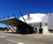
CBS Canterbury Arena is a sporting and entertainment arena located in Addington, Christchurch, New Zealand.
Christchurch Polytechnic Institute of Technology
The Christchurch Polytechnic Institute of Technology (CPIT), formerly the Christchurch Technical College, is an institute of technology in Christchurch, New Zealand. It provides full- and part-time education leading to certificates, diplomas, applied bachelor's degrees and applied graduate diplomas in technologies and trades. CPIT is one of New Zealand's largest tertiary institutions and is the largest polytechnic in the South Island.
Cracroft Caverns
Cracroft Caverns, also known as the Cashmere Caverns, are a series of large chambers in the hill of the Cashmere suburb of Christchurch, New Zealand. Constructed secretly during the Second World War in response to the Japanese threat, they were intended to house operational headquarters in the event of attack. The military commandeered the Cracroft Wilson estate, founded by Sir John Cracroft Wilson in 1854, for their Southern Group headquarters, and work on the tunnels began in 1942.
Spreydon
Spreydon is a middle-class suburb of Christchurch, New Zealand. The most central street through Spreydon is Lyttelton Street. Spreydon is flanked by the suburbs Barrington, Hoon Hay, Riccarton, and Lower Cashmere. Spreydon was constituted as a borough in 1911. In 1921, however, it was merged into the city of Christchurch.
Addington Railway Workshops
The Addington Railway Workshops was a major railway facility established in the Christchurch suburb of Addington in May 1880 by the New Zealand Railways Department. The workshops were previously in Carlyle Street and closed in 1990.
Beckenham, New Zealand
Beckenham is an inner suburb of Christchurch, New Zealand, located three kilometres south of the city centre. The Heathcote River winds through this predominantly residential suburb, a section of which is often referred to locally as the "Beckenham Loop". The suburb was named by Captain Stephen Fisher after the town in England. He eventually settled in the area in 1871 after retirement from naval duties.
Huntsbury
Huntsbury is a suburb of Christchurch, New Zealand, on the fringes of the Port Hills three kilometres south of the city centre. Huntsbury is host to one of four fountains scattered over Christchurch. Huntsbury's fountain is at the top of Conifer Place.
Christchurch West High School
Christchurch West High School existed prior to 1965 on the site of Hagley Community College in Hagley Avenue. In that year 'West' amalgamated with Technical High School to become Hagley High School. The maroon, black and white colours were lost to the 'teal' fashion-statement of the day.
Somerfield, New Zealand
Somerfield is a suburb in the south of Christchurch, New Zealand.
Middleton Grange School
Middleton Grange School (abbreviated MGS) in Christchurch, New Zealand, is a Christian co-educational partially private school for Year 1 to 13(formerly, Junior 1 to Form 7). It is currently New Zealand's largest evangelical Christian school (fee-paying).
Centennial Park, Christchurch
Centennial Park is a public park located in the suburb of Spreydon in the southwestern part of Christchurch, New Zealand. It is bordered by Lyttelton Street to the east, Rose Street to the south, Heathcote River to the west and Pioneer Recreation and Sport Centre to the north. It is used predominantly as a soccer venue during the winter months, and a cricket venue during summer months.
Roman Catholic Diocese of Christchurch
The Latin Rite Roman Catholic Diocese of Christchurch is a suffragan diocese of the Roman Catholic Archdiocese of Wellington. Its cathedral and see city are located in Christchurch, the largest city in the South Island of New Zealand. It was formed on 5 May 1887 from a portion of the territory of the Diocese of Wellington, which was elevated to archdiocese later that same month.
Sunnyside Hospital
Sunnyside Hospital (1863-1999) was the first mental asylum to be built in Christchurch, New Zealand. It was initially known as Sunnyside Lunatic Asylum, and its first patients were 17 people who had previously been kept in the Lyttelton gaol. In 2007, Hilmorton Hospital is just one of the mental health services that are based on the old Sunnyside Hospital grounds.
Christchurch South Intermediate
Christchurch South Intermediate is a school catering for students in Years 7 and 8 in Christchurch, New Zealand. It replaced the intermediate department of the Christchurch West High School in the 1930s.
Hagley Community College
Hagley Community College, is a non-integrated state secondary school in inner-city Christchurch, New Zealand. Prior to 1965 the school was Christchurch West High School, which was founded in 1858.
Cathedral of the Blessed Sacrament, Christchurch
The Cathedral of the Blessed Sacrament, located in the city centre of Christchurch, New Zealand, also known as the Christchurch Basilica, is the mother church of the Roman Catholic Diocese of Christchurch and seat of the Bishop of Christchurch. It was designed by architect Francis Petre. Although the church is called popularly "basilica", has not been declared a minor basilica by the Vatican. The Cathedral was closed after the 4 September 2010 Canterbury earthquake.
Victoria Park, Christchurch
Victoria Park is a large recreational area on the Port Hills above Christchurch, New Zealand.
Addington Raceway
Addington Raceway or The Met is the home of the Metropolitan Trotting Club in Addington, Christchurch in New Zealand. The venue consists of a trotting track, a greyhound track conference centre and restaurants. It is also home to many feature harness races such as: The New Zealand Trotting Cup and the Dominion Handicap. The raceway forms part of a sporting complex that includes Rugby League Park and the CBS Canterbury Arena.
Andrew Duncan (mayor)
Andrew Duncan (1834 – 10 December 1880) was Mayor of Christchurch 1869–1870. From a working-class background in Scotland, he emigrated to New Zealand as a young man and became a highly respected member of the Christchurch community. He is remembered for his later work as an immigration agent in Scotland on behalf of the Canterbury Province.
Rugby League Park
Rugby League Park (currently known as Christchurch Stadium or AMI Stadium for sponsorship reasons) is a rugby league and rugby union stadium in Christchurch, New Zealand. Formerly called the Addington Showgrounds, the ground is owned by the Canterbury Rugby League.
Sydenham Heritage Church
Sydenham Heritage Church, originally known as the Colombo Street Methodist Church or Colombo Street Wesleyan Church or Colombo Road Wesleyan Church was a heritage-listed stone church building located in Sydenham, an inner suburb Christchurch, New Zealand. It was registered as an "Historic Place – Category II " by the New Zealand Historic Places Trust.


