Safety Score: 3,0 of 5.0 based on data from 9 authorites. Meaning we advice caution when travelling to New Zealand.
Travel warnings are updated daily. Source: Travel Warning New Zealand. Last Update: 2024-08-13 08:21:03
Delve into Narrow Neck
Narrow Neck in Auckland (Auckland) is a town located in New Zealand about 309 mi (or 497 km) north of Wellington, the country's capital town.
Time in Narrow Neck is now 11:28 AM (Sunday). The local timezone is named Pacific / Auckland with an UTC offset of 13 hours. We know of 8 airports closer to Narrow Neck, of which one is a larger airport. The closest airport in New Zealand is Auckland International Airport in a distance of 13 mi (or 21 km), South. Besides the airports, there are other travel options available (check left side).
We saw 3 points of interest near this location. In need of a room? We compiled a list of available hotels close to the map centre further down the page.
Since you are here already, you might want to pay a visit to some of the following locations: Auckland, Hamilton, Whangarei, Tauranga and Rotorua. To further explore this place, just scroll down and browse the available info.
Local weather forecast
Todays Local Weather Conditions & Forecast: 19°C / 66 °F
| Morning Temperature | 13°C / 55 °F |
| Evening Temperature | 17°C / 62 °F |
| Night Temperature | 12°C / 53 °F |
| Chance of rainfall | 0% |
| Air Humidity | 48% |
| Air Pressure | 1019 hPa |
| Wind Speed | Moderate breeze with 9 km/h (6 mph) from North-East |
| Cloud Conditions | Broken clouds, covering 63% of sky |
| General Conditions | Light rain |
Monday, 25th of November 2024
21°C (70 °F)
14°C (57 °F)
Broken clouds, gentle breeze.
Tuesday, 26th of November 2024
21°C (70 °F)
15°C (60 °F)
Light rain, gentle breeze, overcast clouds.
Wednesday, 27th of November 2024
23°C (73 °F)
16°C (60 °F)
Light rain, gentle breeze, overcast clouds.
Hotels and Places to Stay
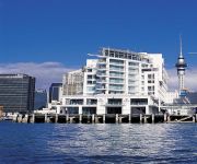
Hilton Auckland
Ascot Parnell Boutique Bed and Breakfast
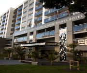
WALDORF STADIUM APARTMENT HOTEL
Peace and Plenty Inn
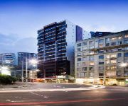
WALDORF CELESTION APARTMENT HTL
Auckland Harbour Oaks
The Esplanade Hotel
VR Takapuna
The Quadrant
PARKLANE MOTOR INN
Videos from this area
These are videos related to the place based on their proximity to this place.
Auckland City and Sea Timelapse with tilt shift effect
A time lapse of Auckland city based on the Waitemata harbour. Used a tilt shift filter in post(Magic Bullet 2) to create a tilt shift effect.
City of Sails - America's Cup Experience HD (www.bellamarsail.blogspot.com)
Viagem a Nova Zelândia, fev 2010. Um lugar fantástico, onde existe a maior quantidade de veleiros per capita no mundo. Depois dos feitos de Sir Peter Blake, que venceu a regata de volta...
North Shore Coastal Challenge
Total Sport and North Shore City present the North Shore City Coastal Challenge.
Olympus SH-1 - Ferry at Night
With night videos, the SH-1 behaves pretty much like the SH-50. The processing I used in AVS Video Converter was Gamma 10 Contrast 3, and a change in colour balance:at RED 10, GREEN 5, BLUE.
KTM 690 Enduro Adventure Gear setup timelapse
Getting ready for a 10 day Lower North Island of NZ trip.
As the Tide was Flowing - Time Lapse
Last night I recorded five 10 minute time lapse sequences, collapsed into 134 seconds after editing (with the Olympus SH-1 travel zoom). I also recorded 90 minutes of real time video with the...
Bertha and the Bee Man
Belmont Primary School Room 11 - Year 2 performs Bertha and the Bee Man at assembly.
Videos provided by Youtube are under the copyright of their owners.
Attractions and noteworthy things
Distances are based on the centre of the city/town and sightseeing location. This list contains brief abstracts about monuments, holiday activities, national parcs, museums, organisations and more from the area as well as interesting facts about the region itself. Where available, you'll find the corresponding homepage. Otherwise the related wikipedia article.
Devonport, New Zealand
Devonport is a harbourside suburb of Auckland, New Zealand. It is located on the North Shore, at the southern end of a peninsula that runs southeast from near Lake Pupuke in Takapuna, forming the northern side of the Waitemata Harbour. East of Devonport lies North Head, the northern promontory guarding the mouth of the harbour. The population of Devonport and the adjoining suburb of Cheltenham was 5,337 in the 2006 Census, an increase of 126 since 2001.
Rangitoto Channel
The Rangitoto Channel is one of several passes between the islands of the inner Hauraki Gulf, close to the mouth of the Waitemata Harbour to the east of Auckland in New Zealand. The channel is an important stretch of water as it is the only deep water approach to Auckland Port for large ships such as container cargo ships and passenger cruise liners. The channel separates the volcanic cone of Rangitoto Island from the East Coast Bays of North Shore city, to the north of the Waitemata's entrance.
Mount Victoria, Auckland
Mount Victoria (known to the Māori as Takarunga) is the highest volcano on Auckland's North Shore, rising to 87 m. Its age is currently unknown. Its lava flows now line much of Devonport's waterfront. An important pa once occupied its slopes, and some of the pa's earthworks can still be seen. A scoria mound known as Duders Hill, on Mount Victoria's southern slopes was mostly quarried away.
Belmont, Auckland
Belmont is an Auckland suburb. The name, which means "good view or hill" derives from a farm estate called "Belmont" subdivided in 1885. The population of the "Seacliffe" statistical area, which is substantially the same as Belmont, was 3,297 in the 2006 Census, an increase of 162 from 2001. The suburb is in the North Shore ward, one of the thirteen administrative divisions of Auckland City.
Narrow Neck, New Zealand
Suburb:Narrow Neck City:Auckland Island:North Island Surrounded by - to the east - to the south-east - to the south - to the west - to the north-west Hauraki Gulf Vauxhall (813 m) Devonport (1.6 km) Bayswater (2.0 km) Belmont (647 m) Narrow Neck is a suburb of Auckland, New Zealand. Until the mid-19th century, Devonport was connected with the rest of the North Shore by a causeway between Ngataringa Bay and the Hauraki Gulf. This causeway gave the appearance of a "narrow neck".
Vauxhall, Auckland
Vauxhall is a suburb of North Shore City, Auckland, New Zealand. Alison Park lies directly to the east, separating Vauxhall from Lake Road, which carries the majority of traffic between Takapuna and Devonport. It gets its name from the Vauxhall Gardens established here by pioneer settler William Colby in the 1870s. These in turn were named after the Vauxhall Gardens in London, some of the gardeners of which were brought out to New Zealand.
Stanley Bay, New Zealand
Stanley Bay on the North Shore, New Zealand is a small suburb near Devonport. It is mostly residential; the surrounding towns and shops are only a walk away. The Devonport Naval Base lies to the east of the bay on the south side of the Stanley Bay peninsula and is connected to storage facilities on the north side at Ngataringa Bay by a tunnel. The population was 2,187 in the 2006 Census, an increase of 24 from 2001.
North Head, New Zealand
North Head (or Maungauika, the Mountain of Uika in Māori) is a volcanic cone forming a headland within North Shore City, New Zealand, in the suburb of Devonport at the east end of the Waitemata Harbour. It is a public reserve (part of the Hauraki Gulf Maritime Park) known for its sweeping views over the harbour and the Hauraki Gulf.
Navy Hospital, Devonport
The Navy Hospital, historically the Royal New Zealand Navy Hospital (RNZNH) is the hospital of the New Zealand Navy. It is located in Devonport, on Devonport Naval Base in Auckland. The hospital specialises in surgery and hyperbaric treatment.
Belmont Intermediate School
Belmont Intermediate School is located in Belmont, North Shore City, Auckland, New Zealand. It was established in 1957. Contributing schools include: Devonport Primary Vauxhall Primary Stanley Bay Primary Hauraki Primary St. Leos Belmont Primary Bayswater Primary. Pupils attend for years seven and eight. As of 2007 there were just over 500 pupils enrolled. At the end of year eight the majority of students move to Takapuna Grammar School, which is located next door.
Mount Cambria
Mount Cambria (also Sheep Hill or Takararo) is one of the volcanoes in the Auckland Volcanic Field. Located north-east of Mt Victoria, it's 30m scoria cone was quarried away. The site is now Cambria Reserve. It was named Heaphy Hill after Charles Heaphy by Ferdinand von Hochstetter in 1859, but this name is not used.
Duders Hill
Duders Hill (also Takamaiiwaho) was a 20 metre high scoria mound located on the Devonport coast, on the lower south-east slopes of Mount Victoria, in the Auckland Volcanic Field. It was mostly quarried away in the early 20th century. It is thought to have been a section of Mount Victoria's upper scoria cone which was rafted downslope with lava flows.


