Safety Score: 3,3 of 5.0 based on data from 9 authorites. Meaning please reconsider your need to travel to Netherlands.
Travel warnings are updated daily. Source: Travel Warning Netherlands. Last Update: 2024-08-13 08:21:03
Delve into Waterland
The district Waterland of Spijkenisse in Nissewaard (South Holland) is a district located in Netherlands about 44 mi south-west of Amsterdam, the country's capital town.
In need of a room? We compiled a list of available hotels close to the map centre further down the page.
Since you are here already, you might want to pay a visit to some of the following locations: The Hague, Haarlem, Sint-Niklaas, Heemskerk and Amsterdam. To further explore this place, just scroll down and browse the available info.
Local weather forecast
Todays Local Weather Conditions & Forecast: 5°C / 41 °F
| Morning Temperature | 4°C / 39 °F |
| Evening Temperature | 3°C / 38 °F |
| Night Temperature | 4°C / 39 °F |
| Chance of rainfall | 1% |
| Air Humidity | 50% |
| Air Pressure | 1000 hPa |
| Wind Speed | Fresh Breeze with 13 km/h (8 mph) from South-East |
| Cloud Conditions | Overcast clouds, covering 91% of sky |
| General Conditions | Rain and snow |
Friday, 22nd of November 2024
6°C (43 °F)
6°C (42 °F)
Moderate rain, fresh breeze, overcast clouds.
Saturday, 23rd of November 2024
5°C (41 °F)
6°C (43 °F)
Light rain, fresh breeze, overcast clouds.
Sunday, 24th of November 2024
12°C (54 °F)
14°C (57 °F)
Light rain, fresh breeze, overcast clouds.
Hotels and Places to Stay
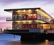
Carlton Oasis Hotel
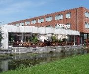
Delta Hotel
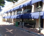
Atlas
Hotel de Sluiskop
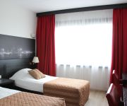
Bastion Hotel Vlaardingen
ibis Rotterdam Vlaardingen
Videos from this area
These are videos related to the place based on their proximity to this place.
Brand Spijkenisse winkelcentrum Waterland
Zeer grote brand in het winkelcentrum van Spijkenisse Waterland. Totale verwoesting.
Roofvogelshow in Hekelingen
De 'Dorpsvereniging Hekelingen' http://www.dorpsvereniginghekelingen.nl organiseerde op zondagmiddag 22 juni een Roofvogelshow.. Deze demonstratie werd verzorgd door 'Roofvogels en Uilen'...
Besneeuwde dijk en brug in Spijkenisse
door de hevige sneeuw die er gevallen is ziet deze brug en dijk zien er erg wit uit.
Sanisale.com Spijkenisse
Sanisale.com Spijkenisse. Sanitair -en tegeloutlet. Tegels kopen, badkamer kopen, douchewand kopen, toilet kopen, kraan kopen, regendouche kopen, douche kopen, grohe kopen, villeroy kopen,...
Sinterklaasfeest in Hekelingen 2013
Sinterklaas vierde op zaterdag 30 november 2013 zijn verjaardag in Hekelingen http://www.dorpsvereniginghekelingen.nl/ Hij werd op het Dorpsplein door een enthousiaste menigte kinderen ...
Besneeuwde straat met besneeuwde daken en een kerstman hangt in de mast in Spijkeisse
In deze besneeuwde staat (Anette Versluys Poelmanstraat) zijn er besneeuwde bomen, auto's en een hangende kerstman.
Te koop: Groede 38 te Hekelingen
Foto Slideshow Groede 38 te Hekelingen. Bekijk de woning op Funda: http://funda.nl/48825813/ Meer info over De Vree Makelaardij: http://www.devreemakelaardij.nl.
Besneeuwde voortuin met mooi beeld in Spijkenisse
In deze voortuinen staan besneeuwde bomen, planten, hek en een mooi beeld.
Koningsdag Hekelingen 2014 / Togido & Elementair
Het muzikale gedeelte van de Koningsdagviering werd verzorgd door T.O.G.I.D.O. en het koor ELEMENTAIR. Dat is zonder de andere activiteiten in deze video te zien en horen.
Videos provided by Youtube are under the copyright of their owners.
Attractions and noteworthy things
Distances are based on the centre of the city/town and sightseeing location. This list contains brief abstracts about monuments, holiday activities, national parcs, museums, organisations and more from the area as well as interesting facts about the region itself. Where available, you'll find the corresponding homepage. Otherwise the related wikipedia article.
Spui (river)
The Spui is a small tidal river in South Holland in the Netherlands, separating the islands of Voorne-Putten and Hoekse Waard. Historically, it forked off the Oude Maas river at the town of Oud-Beijerland to end in the Haringvliet estuary, but as a (planned) result from the Delta Works, its flow has been reversed. There are no bridges or tunnels crossing the Spui, but there is a car ferry from Hekelingen to Nieuw-Beijerland, and a pedestrian and bicycle ferry between Oud-Beijerland and Rhoon.
Pernis, Netherlands
Pernis is a neighborhood and submunicipality (since 3 March 2010) of Rotterdam, Netherlands. The district has a population of 4,789 (2011) on a total area size of 1.60 km². Pernis is thus a full submunicipality of Rotterdam, but the former independent municipality had its own district council already. Although surrounded by ports, Pernis has preserved its village-like atmosphere very well. Pernis is best known for its petrochemical industry. Refineries define its skyline.
Hoogvliet
Hoogvliet is a borough of Rotterdam, Netherlands. As of 1 January 2004, it had 36,619 inhabitants. There is also a national chain of Dutch supermarkets with the same name.
Hekelingen
Hekelingen is a village in the Dutch province of South Holland. It is located immediately to the south of Spijkenisse. From 1812 to 1817, Hekelingen was part of Spijkenisse. It was a separate municipality from 1817 until 1 January 1966, when it merged with Spijkenisse.
Langebakkersoord
Langebakkersoord is a former municipality in the Dutch province of South Holland. It was located northwest of Hoogvliet, on the confluence of the Oude Maas and Nieuwe Maas rivers. Langebakkersoord was a separate municipality between 1817 and 1826, when it merged with Pernis.
Schuddebeurs en Simonshaven
Schuddebeurs en Simonshaven is a former municipality in the Dutch province of South Holland. It was located about 4 km southwest of the town of Spijkenisse, and covered the two polders Schuddebeurs and Simonshaven, including the (still existing) village of Simonshaven. The municipality existed between 1817 and 1855, when it became part of Geervliet.
De Akkers (Rotterdam Metro)
De Akkers is the westernmost subway station of the Rotterdam Metro and is located in the Dutch city of Spijkenisse. The station, with one island platform, opened on April 25, 1985 as a terminus of the North-South Line (also formerly called Erasmus line), nowadays line D. Since the extension of the East-West Line (Caland line) opened on November 4, 2002, the station also serves as terminus of that line. The station is named for the adjacent neighborhood.
Tussenwater (Rotterdam Metro)
Tussenwater is an above-ground subway station of the Rotterdam Metro lines C and D. The station is located in the borough Hoogvliet in Rotterdam. The station is situated just before the tracks of lines C and D split. Because of this, the station has four running tracks, which are situated along three platforms. The northern two tracks (for southbound/westbound trains) share one platform, while the southern two tracks each have their own platform.
Oude Maas
The Oude Maas ("Old Meuse") is a distributary of the Rhine River, and a former distributary of the Maas River, in the Dutch province of South Holland. It begins at the city of Dordrecht where the Beneden Merwede river splits into the Noord River and the Oude Maas. It ends when it joins the Nieuwe Maas to form Het Scheur
Poortugaal (Rotterdam Metro)
Poortugaal is an above-ground subway station of Rotterdam Metro line D. The station is located in Poortugaal, a village in the municipality Albrandswaard to the southwest of Rotterdam. The station was opened on October 25, 1974. On that date, the North-South Line was extended from its former terminus, Slinge, towards Zalmplaat station. Right outside the station, passengers can get on RET-operated bus lines 62 and 79.
Pernis (Rotterdam Metro)
Pernis is an above-ground subway station of Rotterdam Metro line C. The station is located in the village of Pernis, near Rotterdam. The station was opened in November 2002, as a result of an extension of the East-West Line (also formerly called Caland line). This extension connected the former terminus Marconiplein to the North-South Line (also Erasmus line) at Tussenwater station.
Hoogvliet (Rotterdam Metro)
Hoogvliet is an above-ground subway station of the Rotterdam Metro lines C and D. The station is located in the borough Hoogvliet in Rotterdam and features two side platforms. The station was opened on October 25, 1974. On that date, the North-South Line (currently operated by line D trains) was extended from its former terminus, Slinge, towards Zalmplaat station.
Zalmplaat (Rotterdam Metro)
Zalmplaat is an above-ground subway station of the Rotterdam Metro lines C and D. The station is located in the borough Hoogvliet in Rotterdam and features two side platforms. The station was opened on October 25, 1974. On that date, the North-South Line (currently operated by line D trains) was extended from its former terminus, Slinge, towards Zalmplaat station. Until the line was extended further towards De Akkers in 1985, Zalmplaat was the southern terminus of the line.
Spijkenisse Centrum (Rotterdam Metro)
Spijkenisse Centrum is one of three (above-ground) subway stations in the Dutch city of Spijkenisse. The station is being served by trains of Rotterdam Metro lines C and D and features two side platforms. Located just outside the station is a hospital, as well as a bus station where travelers can get on local and regional buses. The station was opened on April 25, 1985.
Heemraadlaan (Rotterdam Metro)
Heemraadlaan is one of three (above-ground) subway stations in the Dutch city of Spijkenisse. The station is the penultimate stop for trains of Rotterdam Metro lines C and D and features two side platforms. The station is named for the large thoroughfare above which it is built. The station was opened on April 25, 1985.
Hartelkering
The Hartelkering is a storm surge barrier in Spijkenisse, Netherlands. The barrier is part of the Europoortkering, itself part of the Delta Works project and is designed to close the Hartelkanaal in case of a storm surge. The barrier consists of two vertical lift gates, 49.3 metres and 98 metres in length. The gates have a height of 3 metres above NAP when closed.
Boomgaardshoek
Boomgaardshoek is a neighborhood of Rotterdam, Netherlands. This part of Hoogvliet was built at the end of 70s early 80s and finished end of the 80's of the past century. When they started building this area it belonged to Poortugaal, in 1986 it became part of Rotterdam. One part of Boomgaardshoek has bird names and the other part has names of flowers. Those two are separated by a bike lane which comes from south Zalmplaat to North Tussenwater.
Meeuwenplaat
Meeuwenplaat is a neighborhood of Rotterdam, Netherlands.
Middengebied
Middengebied is a neighborhood of Rotterdam, Netherlands.
Nieuw Engeland
Nieuw Engeland is a neighborhood of Rotterdam, Netherlands.
Oudeland
Oudeland is a neighborhood of Rotterdam, Netherlands.
Westpunt (Rotterdam)
Westpunt is a neighborhood of Rotterdam, Netherlands.
Zalmplaat
Zalmplaat is a neighborhood of Rotterdam, Netherlands.
Zinkweg
Bommelkous is a hamlet in the Dutch province of South Holland and is part of the municipality Oud-Beijerland. Zinkweg lies in the middle between Oud-Beijerland and Vuurbaken.
Vuurbaken
Vuurbaken is a hamlet in the Dutch province of South Holland and is part of the municipality Oud-Beijerland. It lies to the south of Oud-Beijerland and about 1 km from Zinkweg.


