Safety Score: 3,3 of 5.0 based on data from 9 authorites. Meaning please reconsider your need to travel to Netherlands.
Travel warnings are updated daily. Source: Travel Warning Netherlands. Last Update: 2024-08-13 08:21:03
Delve into Kinderdijk
Kinderdijk in Molenwaard (South Holland) with it's 867 habitants is a town located in Netherlands about 35 mi (or 57 km) south of Amsterdam, the country's capital town.
Time in Kinderdijk is now 04:24 AM (Tuesday). The local timezone is named Europe / Amsterdam with an UTC offset of one hour. We know of 10 airports closer to Kinderdijk, of which 5 are larger airports. The closest airport in Netherlands is Rotterdam Airport in a distance of 10 mi (or 16 km), North-West. Besides the airports, there are other travel options available (check left side).
There are several Unesco world heritage sites nearby. The closest heritage site in Netherlands is Mill Network at Kinderdijk-Elshout in a distance of 1 mi (or 1 km), East. We saw 4 points of interest near this location. In need of a room? We compiled a list of available hotels close to the map centre further down the page.
Since you are here already, you might want to pay a visit to some of the following locations: The Hague, Haarlem, Utrecht, Amsterdam and Heemskerk. To further explore this place, just scroll down and browse the available info.
Local weather forecast
Todays Local Weather Conditions & Forecast: 12°C / 53 °F
| Morning Temperature | 6°C / 42 °F |
| Evening Temperature | 9°C / 48 °F |
| Night Temperature | 8°C / 46 °F |
| Chance of rainfall | 0% |
| Air Humidity | 56% |
| Air Pressure | 1023 hPa |
| Wind Speed | Light breeze with 4 km/h (3 mph) from North-West |
| Cloud Conditions | Few clouds, covering 10% of sky |
| General Conditions | Sky is clear |
Wednesday, 6th of November 2024
14°C (56 °F)
9°C (48 °F)
Few clouds, light breeze.
Thursday, 7th of November 2024
12°C (54 °F)
7°C (44 °F)
Sky is clear, light breeze, clear sky.
Friday, 8th of November 2024
12°C (53 °F)
9°C (48 °F)
Few clouds, light breeze.
Hotels and Places to Stay
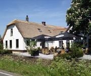
Fletcher Hotel-Restaurant De Witte Brug
Van der Valk Hotel Ridderkerk
Apollo Hotel Papendrecht
Van der Valk Hotel ARA
NH Capelle
Dordrecht
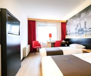
Bastion Hotel Barendrecht
Videos from this area
These are videos related to the place based on their proximity to this place.
Kinderdijk by Drone
Bekijk de windmolens van Kinderdijk zoals je ze nog nooit gezien hebt: vanuit de lucht! Op deze video is een CC-BY-NC licentie van toepassing: http://creativecommons.org/licenses/by-nc/4.0/...
Seven Sun - IHC - Kinderdijk [2014.12.19]
Launching a ship Seven Sun. Seven Sun - De lancering van een schip. Wodowanie Statku Seven Sun. IHC Kinderdijk.
Kinderdijk/HOLLAND (Windmills/Yel değirmenleri)
Kinderdijk is a village in the Netherlands, belonging to the municipality of Molenwaard, in the province South Holland, about 15 km east of Rotterdam. Kinderdijk is situated in a polder in...
Bruine kiekendieven dansen boven riet in Kinderdijk
Een schitterend mannetje bruine kiekendief (Circus aeruginosus) vliegt het beeld binnen boven een rietkraag bij de molens van Kinderdijk. Molen De Blokkerse Wip vormt het decor. Later vliegen...
Exploring Windmills in Kinderdijk, Holland
Your GypsyNesters explore how windmills work in The Netherlands! See more: http://www.gypsynester.com/tulips.htm Check out our book - Going Gypsy! http://www.GoingGypsyBook.com We'd love...
Blauwe reiger in Kinderdijk
Blauwe reiger, grey heron, héron cendré, Fischreiher, Graureiher, garza real, airone cenerino, garça real, fiskehejre, häger, gråhäger.
Videos provided by Youtube are under the copyright of their owners.
Attractions and noteworthy things
Distances are based on the centre of the city/town and sightseeing location. This list contains brief abstracts about monuments, holiday activities, national parcs, museums, organisations and more from the area as well as interesting facts about the region itself. Where available, you'll find the corresponding homepage. Otherwise the related wikipedia article.
Lek (river)
The Lek is a river in the western Netherlands of some 60 km in length. It is the continuation of the Nederrijn after the Kromme Rijn branches off at the town of Wijk bij Duurstede. The main westbound waterway is hereafter called the Lek River. The Nederrijn is, itself, a distributary branch of river Rhine. The name "Lek" is derived either from the Middle Dutch words "lake" and "leek", meaning "watercourse".
Kinderdijk
Kinderdijk is a village in the Netherlands, belonging to the municipality of Molenwaard, in the province South Holland, about 15 km east of Rotterdam. Kinderdijk is situated in a polder in the Alblasserwaard at the confluence of the Lek and Noord rivers. To drain the polder, a system of 19 windmills was built around 1740. This group of mills is the largest concentration of old windmills in the Netherlands. The windmills of Kinderdijk are one of the best known Dutch tourist sites.
Slikkerveer
Slikkerveer is a village in the municipality of Ridderkerk, South Holland, the Netherlands. In 2004, 8550 people lived in Slikkerveer. It is located about 6 km eastsoutheast of the city of
Oostendam
Oostendam is a Dutch village. It is located in the municipality of Ridderkerk, within the province of South Holland. In 2004 it had 640 residents. The Dutch word Oostendam translates to Eastern Dam. The village was founded in 1332 when Count William III had dikes built around a side-arm of the river Waal. As it is currently a dead branch of the river, the locals commonly refer to it as Het Waaltje, which means The Little Waal.
Krimpen aan de Lek
Krimpen aan de Lek is a town on the Lek River in the municipality Nederlek, province South Holland, the Netherlands. It has 6607 inhabitants in 2008. The name Krimpen comes from the archaic word "Krempener", meaning "river crossing". Therefore Krimpen aan de Lek means "Crossing on the Lek". Krimpen aan de Lek is a quiet and scenic village with 3 elementary schools.
The Gorzen
The Gorzen is a nature park in the Dutch province of South Holland, located on the eastside of Ridderkerk, between the New Veer and the New harbor. The nature- and recreational park The Gorzen is a former dumpsite with a total area of 40 acres . The park was formed in consequences of all kinds of activities and circumstances in a period of half a century shaped in a hillside nature park with a few lakes and brooks.
Noordtunnel
The Noord Tunnel is a tunnel under the Noord. It's a part of the motorway A15. The Noord Tunnel opened in 1992. The Noord Tunnel has replaced the bridge since 1992.
De Brave Hendrik
Restaurant De Brave Hendrik was a restaurant located in Hendrik-Ido-Ambacht, Netherlands. It was a fine dining restaurant that was awarded one Michelin star in the period 1990-1996. The restaurant was originally named In den Brave Hendrik and located at Kerkstraat 7, but later renamed to De Brave Hendrik and housed at Kerkstraat 30. Henk van Ark and head chef Jan Klein owned the restaurant from 1982 until 1994, when Klein left to start restaurant Hermitage in Rijsoord.


!['Seven Sun - IHC - Kinderdijk [2014.12.19]' preview picture of video 'Seven Sun - IHC - Kinderdijk [2014.12.19]'](https://img.youtube.com/vi/JEBKnssGhmE/mqdefault.jpg)


