Safety Score: 3,3 of 5.0 based on data from 9 authorites. Meaning please reconsider your need to travel to Netherlands.
Travel warnings are updated daily. Source: Travel Warning Netherlands. Last Update: 2024-08-13 08:21:03
Delve into Kortenhoeven
Kortenhoeven in Gemeente Zederik (South Holland) is a town located in Netherlands about 28 mi (or 46 km) south of Amsterdam, the country's capital town.
Time in Kortenhoeven is now 12:28 PM (Tuesday). The local timezone is named Europe / Amsterdam with an UTC offset of one hour. We know of 10 airports closer to Kortenhoeven, of which 4 are larger airports. The closest airport in Netherlands is Amsterdam Airport Schiphol in a distance of 26 mi (or 42 km), North-West. Besides the airports, there are other travel options available (check left side).
There are several Unesco world heritage sites nearby. The closest heritage site in Netherlands is Rietveld Schröderhuis (Rietveld Schröder House) in a distance of 9 mi (or 14 km), North-East. We saw 4 points of interest near this location. In need of a room? We compiled a list of available hotels close to the map centre further down the page.
Since you are here already, you might want to pay a visit to some of the following locations: Utrecht, 's-Hertogenbosch, Amsterdam, Haarlem and Heemskerk. To further explore this place, just scroll down and browse the available info.
Local weather forecast
Todays Local Weather Conditions & Forecast: 11°C / 52 °F
| Morning Temperature | 5°C / 42 °F |
| Evening Temperature | 8°C / 47 °F |
| Night Temperature | 7°C / 45 °F |
| Chance of rainfall | 0% |
| Air Humidity | 57% |
| Air Pressure | 1023 hPa |
| Wind Speed | Light breeze with 4 km/h (3 mph) from North-West |
| Cloud Conditions | Clear sky, covering 8% of sky |
| General Conditions | Sky is clear |
Wednesday, 6th of November 2024
13°C (55 °F)
8°C (47 °F)
Few clouds, calm.
Thursday, 7th of November 2024
12°C (54 °F)
7°C (44 °F)
Sky is clear, light breeze, clear sky.
Friday, 8th of November 2024
12°C (54 °F)
8°C (47 °F)
Few clouds, light breeze.
Hotels and Places to Stay
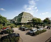
Van der Valk Hotel Vianen
Fletcher Hotel Utrecht Nieuwegein
Epping
Tulip Inn Meerkerk
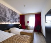
Bastion Hotel Utrecht
Videos from this area
These are videos related to the place based on their proximity to this place.
Nieuwe antenne zendmast Lopik IJsselstein (nieuwe plaatsen)
Oude antenne verwijderd en nieuwe geplaatst met behulp van een helicopter op de hoogste 'toren' van Nederland, de zendmast bij IJsselstein, de Gerbrandytoren (375m).
Nieuwe antenne zendmast Lopik IJsselstein (oude verwijderen)
Oude antenne verwijderd en nieuwe geplaatst met behulp van een helicopter op de hoogste 'toren' van Nederland, de zendmast bij IJsselstein, de Gerbrandytoren (375m).
Nieuwe antenne zendmast Lopik IJsselstein RTL reportage
Oude antenne verwijderd en nieuwe geplaatst met behulp van een helicopter op de hoogste 'toren' van Nederland, de zendmast bij IJsselstein, de Gerbrandytoren (375m).
neerhalen oude tv mast ijsselstein
Het neerhalen van de eerste oude TV-mast te IJsselstein. Dit filmpje is destijds door mijn vader op 8mm opgenomen vanaf het industriegebied in IJsselstein PE1CME.
Spektakel in IJsselstein
De analoge zenders worden van de Gerbrandytoren gehaald in IJsselstein om te worden vervangen door digitale zenders.
Nieuwe antenne zendmast Lopik IJsselstein AD/UN reportage
Oude antenne verwijderd en nieuwe geplaatst met behulp van een helicopter op de hoogste 'toren' van Nederland, de zendmast bij IJsselstein, de Gerbrandytoren (375m).
Optocht Feestweek Hei-en Boeicop 2013
Video van de optocht praalwagens Feestweek Hei-en Boeicop op 24-08-2013 Thema van de Feestweek 2013 is Reclame. Gefilmd door Tom en Patrick de Vos(Modelairplane1980)
HOLLAND: Lekbrug Vianen / Middelwaard (Utrecht) [HD]
(bridge Vianen & recreation area Middelwaard) De Middelwaard is gelegen in de uiterwaarden langs de rivier de Lek, naast de brug Vianen/Nieuwegein. Bij de recreatieplas Middelwaard kun je...
Crossley O-120 dieselmotor in gemaal de Biezen Vianen
Very nice running engine at de Biezen (Vianen near Utrecht Holland). 45/51 bhp at 260 rpm. It is pumping 60.000 liters of water per minute.
Indoorvliegen bij MVC Woerden bij sportcentrum Helsdingenin Vianen
Indoorvliegen bij MVC Woerden bij sportcentrum Helsdingenin Vianen.
Videos provided by Youtube are under the copyright of their owners.
Attractions and noteworthy things
Distances are based on the centre of the city/town and sightseeing location. This list contains brief abstracts about monuments, holiday activities, national parcs, museums, organisations and more from the area as well as interesting facts about the region itself. Where available, you'll find the corresponding homepage. Otherwise the related wikipedia article.
Mediumwave transmitter Lopik
The Mediumwave transmitter Lopik is a medium wave broadcasting facility near Lopik in the Netherlands. It works on 675 kHz and uses as aerial a 196 metre high guyed steel framework mast, which was built in 1938 and which is insulated against ground. Until April 21, 2004 there was a smaller guyed steel framework mast for the mediumwave frequency 1332 kHz. This mast should not be confused with the nearby Gerbrandy tower, which is used for FM- and TV-broadcasting.
Hei- en Boeicop
Hei- en Boeicop is a small village in the Dutch province of South Holland. It is a part of the municipality of Zederik, and lies about 9 km south of IJsselstein. The statistical area "Hei- en Boeicop", which also can include the surrounding countryside, has a population of around 940. The village consists of a long row of houses on two sides of a small canal. The canal separates the Polder Boeicop to the north from the Polder Heicop to the south.
Lexmond
Lexmond is a town in the Dutch province of South Holland. It is a part of the municipality of Zederik, and lies about 7 km south of IJsselstein. In 2001, the town of Lexmond had 1296 inhabitants. The built-up area of the town was 0.24 km², and contained 518 residences. The statistical area "Lexmond", which also can include the surrounding countryside, has a population of around 1780. Lexmond was a separate municipality until 1986, when it became part of Zederik.


!['HOLLAND: Lekbrug Vianen / Middelwaard (Utrecht) [HD]' preview picture of video 'HOLLAND: Lekbrug Vianen / Middelwaard (Utrecht) [HD]'](https://img.youtube.com/vi/0SewS6WXhH0/mqdefault.jpg)

