Safety Score: 3,3 of 5.0 based on data from 9 authorites. Meaning please reconsider your need to travel to Netherlands.
Travel warnings are updated daily. Source: Travel Warning Netherlands. Last Update: 2024-08-13 08:21:03
Discover Nieuwe Tuinen
Nieuwe Tuinen in Gemeente Westland (South Holland) is a city in Netherlands about 39 mi (or 63 km) south-west of Amsterdam, the country's capital city.
Local time in Nieuwe Tuinen is now 08:13 AM (Sunday). The local timezone is named Europe / Amsterdam with an UTC offset of one hour. We know of 8 airports in the vicinity of Nieuwe Tuinen, of which 3 are larger airports. The closest airport in Netherlands is Rotterdam Airport in a distance of 9 mi (or 14 km), East. Besides the airports, there are other travel options available (check left side).
There are several Unesco world heritage sites nearby. The closest heritage site in Netherlands is Van Nellefabriek in a distance of 9 mi (or 14 km), South-East. We discovered 2 points of interest in the vicinity of this place. Looking for a place to stay? we compiled a list of available hotels close to the map centre further down the page.
When in this area, you might want to pay a visit to some of the following locations: The Hague, Haarlem, Heemskerk, Amsterdam and Heiloo. To further explore this place, just scroll down and browse the available info.
Local weather forecast
Todays Local Weather Conditions & Forecast: 14°C / 58 °F
| Morning Temperature | 12°C / 53 °F |
| Evening Temperature | 15°C / 59 °F |
| Night Temperature | 15°C / 60 °F |
| Chance of rainfall | 4% |
| Air Humidity | 63% |
| Air Pressure | 1004 hPa |
| Wind Speed | Strong breeze with 18 km/h (11 mph) from North |
| Cloud Conditions | Overcast clouds, covering 100% of sky |
| General Conditions | Moderate rain |
Monday, 25th of November 2024
10°C (50 °F)
9°C (48 °F)
Moderate rain, fresh breeze, overcast clouds.
Tuesday, 26th of November 2024
9°C (48 °F)
7°C (45 °F)
Light rain, moderate breeze, clear sky.
Wednesday, 27th of November 2024
8°C (46 °F)
9°C (48 °F)
Moderate rain, moderate breeze, overcast clouds.
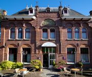
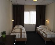
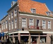
Hotels and Places to Stay
Fletcher Carlton Hotel-Restaurant
Fletcher Hotel-Restaurant Elzenduin
Hotel Saint Vincent
Rozenburg
Bastion Hotel Brielle-Europoort
Fletcher Hotel Restaurant de Zalm
Apartments Brielle
Atlas Village
Videos from this area
These are videos related to the place based on their proximity to this place.
De Lier, Carnaval 2008, Hoofdstraat
Carnalvalsoptocht in de Hoofdstraat, De Lier, gemeente Westland. Opgenomen op 2 februari 2008. Het thema was 'Alles op z'n kop'.
Aftermovie van het grootste feest van het jaar in de Lier Radio Decibel
Aftermovie van het grootste feest van het jaar in de Lier Radio Decibel.
Binnenbrand (zolder) Laan van Binnendijk De Lier
Binnebrand (Zolader) Laan van Binnendijk De Lier www.fredvanderende.nl.
power polyp onride de Lier 2010
Hallo allemaal hier een filmpje onride van de power polyp te de lier. Deze film gemaakt op woensdag 4 augustus 2010 Hello Everyone here you can see a nice movie of the power polyp onride....
Joop Stolze Collection, De Lier, The Netherlands
Joop Stolze Classic Cars is located in De Lier in the Netherlands, west of Rotterdam. Stolze's collection is often referred to as 'secret' but there's nothing secret about it, he just doesn't...
Westland Toertocht, Van De Lier naar Vlaardingen en Maassluis
Van De Lier naar Vlaardingen en Maassluis valt in de namiddag van woensdag 8 februari 2012 prima te schaatsen tot in de binnenstad. De avond voor de start van de Westland Toertocht is het ijs...
Rubberen burnout banden roken De Lier
Burnout USA car C&E Draad Bewerking B.V. Rubberen Banden roken Rubber.
19-05-2012: Middelbrand op zolder - Laan van Binnendijk, De Lier
Een uitslaande brand heeft vanavond een woning aan de Laan van Binnendijk verwoest. Bij de bestrijding van de brand is de bemanning van twee tankspuiten ingezet, waardoor opgeschaald is naar...
Fiona's eerste Jazz-wedstrijd bij SV De Lier
Fiona's eerste Jazz-wedstrijd bij SV De Lier op 17 mei 2008. Ze eindigde als DERDE!
Videos provided by Youtube are under the copyright of their owners.
Attractions and noteworthy things
Distances are based on the centre of the city/town and sightseeing location. This list contains brief abstracts about monuments, holiday activities, national parcs, museums, organisations and more from the area as well as interesting facts about the region itself. Where available, you'll find the corresponding homepage. Otherwise the related wikipedia article.
De Lier
De Lier is a village in the Dutch province of South Holland. It is a part of the municipality of Westland, and lies about 5 km north of Maassluis. It also lies about 6 feet below sea level. The village of De Lier obtained its name from the name of an old river called De Lee. De Lier used to be a separate municipality. On 26 March 1963 it was granted their coat of arms and on 14 April 1965, it adopted their modern-day flag.
Maasland
Maasland is a town in the western Netherlands, in the province of South Holland. It lies in the municipality of Midden-Delfland and covers an area of 24.42 km² (of which 0.64 km² water). Maasland was a separate municipality until 2004, when it became part of Midden-Delfland. The first signs of a community started back in 925 when the area became part of the county of Graaf Dirk II and a church was built.
Poeldijk
Poeldijk is a village in the Dutch province of South Holland. It is a part of the municipality of Westland, and lies about 8 km southwest of The Hague. In 2001, the village of Poeldijk had 5335 inhabitants. The built-up area of the village was 1.1 km², and contained 3400 residences. The statistical area "Poeldijk", which also can include the peripheral parts of the village, as well as the surrounding countryside, has a population of around 7080.
Blaker, Netherlands
Blaker is a hamlet in the Dutch province of South Holland. It is located in the municipality of Westland, about 2 km northeast of the village of De Lier. The hamlet consists of a single road, stretching between the Leê canal and the Noord Lierweg road. The area in which the hamlet is located, the "Oude Lierpolder", used to be called "Blaker" as well.
Huis Honselaarsdijk
Huis Honselaarsdijk was a palace in Honselersdijk, Holland, Dutch Republic. The palace was designed by the Dutch architects Bartholomeus van Bassen, Jacob van Campen and Pieter Post, and was built in the first half of the 17th century as a buitenplaats for stadtholder Frederick Henry, Prince of Orange.
Westland (region), Netherlands
Westland is a region of the Netherlands and lies in the western part of the Province of South Holland. It consists of the municipalities of Westland and Midden-Delfland, and also of the town of Hook of Holland (which is a part of the municipality of Rotterdam). Westland is well known for its horticulture in glasshouses.


