Safety Score: 3,3 of 5.0 based on data from 9 authorites. Meaning please reconsider your need to travel to Netherlands.
Travel warnings are updated daily. Source: Travel Warning Netherlands. Last Update: 2024-08-13 08:21:03
Explore Vergulde Hand
The district Vergulde Hand of Vlaardingen in Gemeente Vlaardingen (South Holland) is located in Netherlands about 41 mi south-west of Amsterdam, the country's capital.
If you need a place to sleep, we compiled a list of available hotels close to the map centre further down the page.
Depending on your travel schedule, you might want to pay a visit to some of the following locations: The Hague, Haarlem, Heemskerk, Amsterdam and Sint-Niklaas. To further explore this place, just scroll down and browse the available info.
Local weather forecast
Todays Local Weather Conditions & Forecast: 6°C / 43 °F
| Morning Temperature | 7°C / 44 °F |
| Evening Temperature | 7°C / 45 °F |
| Night Temperature | 6°C / 42 °F |
| Chance of rainfall | 0% |
| Air Humidity | 88% |
| Air Pressure | 1026 hPa |
| Wind Speed | Gentle Breeze with 6 km/h (4 mph) from North |
| Cloud Conditions | Overcast clouds, covering 94% of sky |
| General Conditions | Light rain |
Thursday, 5th of December 2024
7°C (44 °F)
9°C (49 °F)
Moderate rain, fresh breeze, overcast clouds.
Friday, 6th of December 2024
9°C (49 °F)
8°C (46 °F)
Moderate rain, fresh breeze, overcast clouds.
Saturday, 7th of December 2024
7°C (44 °F)
7°C (45 °F)
Moderate rain, high wind, near gale, overcast clouds.
Hotels and Places to Stay
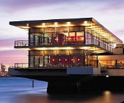
Delta Hotel
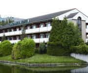
Carlton Oasis Hotel
Novotel Rotterdam Schiedam
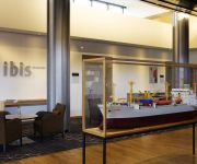
ibis Rotterdam Vlaardingen
Atlas
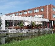
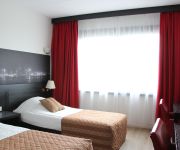
Bastion Hotel Vlaardingen
Campanile - Rotterdam Vlaardingen
Rozenburg
Hotel de Sluiskop
Videos from this area
These are videos related to the place based on their proximity to this place.
Sinterklaas intocht Vlaardingen 2011
Sinterklaas is weer in het land. Een reportage van de intocht van de Sint in Vlaardingen.
Hoogwater in Vlaardingen (5 januari 2012)
Hoogwater op de Maasboulevard en de Kon. Wilhelminahaven Nz in Vlaardingen op 5 januari 2012.
Binnenstad en parkeren ChristenUnie SGP Vlaardingen cu sgp 2014
Een goede binnenstad met aantrekkelijke winkels dat is noodzakelijk voor het centrum van Vlaardingen. Ook moet er ruimte zijn voor de kleine/plaatselijke winkelier zijn werknemer(s) en voor...
Meldkamer Vlaardingen PAC 116
Meldkamer Vlaardingen is een Particuliere Alarm- & Service Centrale PAC 116 met een 24/7 dienstverlening. Deze voldoet aan de wettelijk erkende justitiële Particuliere Alarm Centrales (PAC)...
Zeer grote brand Beelen Vlaardingen HD1080 4min28
Bij een bedrijf in afvalverwerking, Beelen, in Vlaardingen is op zaterdag 14 Mei rond 17.30 uur brand uitgebroken. Een woordvoerster van de veiligheidsregio meldde dat. Een loods van het bedrijf...
Survival Vlaardingen, 1 juni 2014
Een impressie van deze loodzware survivaltocht. Met in de hoofdrol Piko Fieggen en Joran van Kan.
Spoorwegovergang Vlaardingen Railroad/ Level Crossing; Overwegstoring
Een overwegstoring op station Vlaardingen west. Tijdens deze overwegstoring passeert de Sprinter naar Rotterdam Centraal. Ook krijgen 2 mensen een woordenwisseling/ ruzie met elkaar en lopen...
Time Lapse: Chemical tanker from Botlek to Vlaardingen.
Time lapse video made during pilotage in the Port of Rotterdam. A chemical tanker is shifting from buoy-mooring 61 in Petroleumharbour 3 (Botlek industrial area at the Port of Rotterdam) to...
Videos provided by Youtube are under the copyright of their owners.
Attractions and noteworthy things
Distances are based on the centre of the city/town and sightseeing location. This list contains brief abstracts about monuments, holiday activities, national parcs, museums, organisations and more from the area as well as interesting facts about the region itself. Where available, you'll find the corresponding homepage. Otherwise the related wikipedia article.
Vlaardingen
Vlaardingen is a city in South Holland in the Netherlands. It is located on the north bank of the Nieuwe Maas/Nieuwe Waterweg river at the confluence with the Oude Maas. The municipality administers an area of 26.71 square kilometres, of which 23.81 square kilometres is land, with 71,938 residents (in May 2006).
Maasland
Maasland is a town in the western Netherlands, in the province of South Holland. It lies in the municipality of Midden-Delfland and covers an area of 24.42 km² (of which 0.64 km² water). Maasland was a separate municipality until 2004, when it became part of Midden-Delfland. The first signs of a community started back in 925 when the area became part of the county of Graaf Dirk II and a church was built.
Botlek
The Botlek originally was the name of a stretch of the Nieuwe Maas river, part of the Rhine-Meuse delta near the Dutch cities of Vlaardingen and Spijkenisse in the province of Zuid-Holland. Specifically, it was the name of the strait that separated the island of Rozenburg from the sand bar of Welplaat.
Hoogvliet
Hoogvliet is a borough of Rotterdam, Netherlands. As of 1 January 2004, it had 36,619 inhabitants. There is also a national chain of Dutch supermarkets with the same name.
Geervliet
Geervliet is a town in the Dutch province of South Holland. It is a part of the municipality of Bernisse, and lies about 6 km northwest of Spijkenisse on the Brielse Maas. It received city rights in 1381. Geervliet was a separate municipality until 1980, when it became part of Bernisse. In 2001, the town of Geervliet had 1670 inhabitants. The built-up area of the town was 0.34 km², and contained 687 residences.
Zouteveen
Zouteveen is a neighbourhood in the municipality Midden-Delfland in the province Zuid-Holland in the Netherlands. It is located between Vlaardingen and Delft, about 3 km south of the town of Schipluiden. There are two hamlets in this area: Negenhuizen and De Kapel.
Port of Rotterdam
The Port of Rotterdam is the largest port in Europe, located in the city of Rotterdam, Netherlands. From 1962 until 2002 it was the world's busiest port, now overtaken by first Singapore and then Shanghai. In 2009, Rotterdam was the world's tenth-largest container port in terms of twenty-foot equivalent units (TEU) handled . In 2011 Rotterdam was the world's fifth-largest port in terms of annual cargo tonnage.
Battle of Vlaardingen (1351)
There was a civil war in Holland and Hainaut (which was in a personal union with Holland) in 1350 between the Hooks and the Cods. The Hooks were fighting for the Countess Margaret of Hainault, supported by England, while the Cods were fighting for Margaret's son William, who was ruling Holland in name of Margaret. William defeated the Hooks and the English in the Battle of Vlaardingen in 1351.
Langebakkersoord
Langebakkersoord is a former municipality in the Dutch province of South Holland. It was located northwest of Hoogvliet, on the confluence of the Oude Maas and Nieuwe Maas rivers. Langebakkersoord was a separate municipality between 1817 and 1826, when it merged with Pernis.
Vlaardinger-Ambacht
Vlaardinger-Ambacht is a former municipality in the Dutch province of South Holland. It covered the countryside around the city of Vlaardingen. The municipality existed between 1817 and 1941, when it became part of Vlaardingen.
De Akkers (Rotterdam Metro)
De Akkers is the westernmost subway station of the Rotterdam Metro and is located in the Dutch city of Spijkenisse. The station, with one island platform, opened on April 25, 1985 as a terminus of the North-South Line (also formerly called Erasmus line), nowadays line D. Since the extension of the East-West Line (Caland line) opened on November 4, 2002, the station also serves as terminus of that line. The station is named for the adjacent neighborhood.
Oude Maas
The Oude Maas ("Old Meuse") is a distributary of the Rhine River, and a former distributary of the Maas River, in the Dutch province of South Holland. It begins at the city of Dordrecht where the Beneden Merwede river splits into the Noord River and the Oude Maas. It ends when it joins the Nieuwe Maas to form Het Scheur
Nieuwe Maas
The Nieuwe Maas ("New Meuse") is a distributary of the Rhine River, and a former distributary of the Maas River, in the Dutch province of South Holland. It runs from the confluence of the rivers Noord and Lek, and flows west through Rotterdam. It ends west of the city where it meets the Oude Maas ("Old Meuse"), near Vlaardingen, to form Het Scheur. The total length is approximately 24 kilometres .
Hoogvliet (Rotterdam Metro)
Hoogvliet is an above-ground subway station of the Rotterdam Metro lines C and D. The station is located in the borough Hoogvliet in Rotterdam and features two side platforms. The station was opened on October 25, 1974. On that date, the North-South Line (currently operated by line D trains) was extended from its former terminus, Slinge, towards Zalmplaat station.
Zalmplaat (Rotterdam Metro)
Zalmplaat is an above-ground subway station of the Rotterdam Metro lines C and D. The station is located in the borough Hoogvliet in Rotterdam and features two side platforms. The station was opened on October 25, 1974. On that date, the North-South Line (currently operated by line D trains) was extended from its former terminus, Slinge, towards Zalmplaat station. Until the line was extended further towards De Akkers in 1985, Zalmplaat was the southern terminus of the line.
Spijkenisse Centrum (Rotterdam Metro)
Spijkenisse Centrum is one of three (above-ground) subway stations in the Dutch city of Spijkenisse. The station is being served by trains of Rotterdam Metro lines C and D and features two side platforms. Located just outside the station is a hospital, as well as a bus station where travelers can get on local and regional buses. The station was opened on April 25, 1985.
Heemraadlaan (Rotterdam Metro)
Heemraadlaan is one of three (above-ground) subway stations in the Dutch city of Spijkenisse. The station is the penultimate stop for trains of Rotterdam Metro lines C and D and features two side platforms. The station is named for the large thoroughfare above which it is built. The station was opened on April 25, 1985.
Vijfsluizen (Rotterdam Metro)
Vijfsluizen is an above-ground of Rotterdam Metro line C. The station is located in the Vlaardingen area of the City of Schiedam, adjoining Rotterdam. It was designed by Zwarts & Jansma architects and entered service with the opening of the line on November 4, 2002. Vijfsluizen station is an important transfer point between the metro and buses.
Hartelkering
The Hartelkering is a storm surge barrier in Spijkenisse, Netherlands. The barrier is part of the Europoortkering, itself part of the Delta Works project and is designed to close the Hartelkanaal in case of a storm surge. The barrier consists of two vertical lift gates, 49.3 metres and 98 metres in length. The gates have a height of 3 metres above NAP when closed.
Meeuwenplaat
Meeuwenplaat is a neighborhood of Rotterdam, Netherlands.
Middengebied
Middengebied is a neighborhood of Rotterdam, Netherlands.
Nieuw Engeland
Nieuw Engeland is a neighborhood of Rotterdam, Netherlands.
Oudeland
Oudeland is a neighborhood of Rotterdam, Netherlands.
Westpunt (Rotterdam)
Westpunt is a neighborhood of Rotterdam, Netherlands.
Sportpark Harga
Sportpark Harga is a cricket ground in Schiedam, the Netherlands. The first recorded match on the ground came in 1968 when the Netherlands Under-23s played the Marylebone Cricket Club. The ground hosted various touring international sides in the 1980s, while in 1990 it held seven matches in the ICC Trophy. In 2003, the ground held a Women's One Day International when the Netherlands Women played Japan Women in the IWCC Trophy.


